
George Andrejko, AZ Game and Fish Dept.
Overview
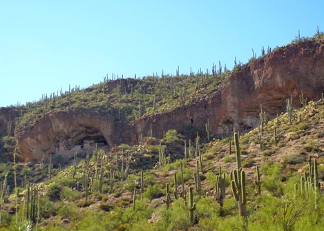
First-time visitors to Sonoran Desert Network parks are often surprised by the tremendous natural variation between, as well as within, each park. However, the very diversity of species, lifeforms, and landscapes is one of the common threads that unifies SODN parks.The Sonoran Desert is thought to have the greatest species diversity of any desert in North America, and that diversity occurs over relatively fine spatial scales. The Sonoran Desert is home to at least 60 species of mammals, more than 350 bird species, 20 amphibians, some 100 reptiles, and about 30 species of native fish. More than 2,000 species of plants have been identified in the Sonoran Desert, and each of the three physiological groupings of vascular plants (C3, C4, and CAM photosynthetic pathways) dominate one or more major biotic communities.
More striking than species diversity is the tremendous variability in Sonoran Desert lifeforms, from columnar cacti to conifers, Gila monsters to pygmy owls, cyanobacterial soil crusts to native ferns. Landscape diversity in the Sonoran Desert rivals that of any other terrestrial ecoregion on Earth, with nearly all of the planet's biomes represented, ranging from cold conifer forests to hot deserts, where frost is nearly absent and precipitation rare. This tremendous species, lifeform, and landscape biodiversity is the result of a host of factors: the subtropical climate, continental physiography, bimodal precipitation, varied geology, and wide-ranging topography.
NPS
Continental Physiography
The Sonoran Desert occupies approximately 260,000 square km (100,387 square mi) of the southwestern United States and northwestern Mexico, including the southern half of Arizona, southeastern California, and most of the states of Sonora and Baja California, Mexico. Bounded on the north by the Mogollon Rim, the Sonoran Desert grades into the Chihuahuan Desert to the east, the Mohave Desert to the west, and the tropical forests and montane forests of central Mexico to the south. Extending between 23°N and 30°N, the subtropical Sonoran Desert represents a continental-scale ecotone between the tropics and temperate zones of western North America. At a regional scale, the Sonoran Desert serves as a transition between the Sierra Madre and the Rocky Mountains, the Pacific and Gulf coasts, and the coastal lowlands of Baja and the mid-continent.
NPS
Geology and Topography
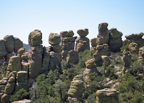
The Sonoran Desert is composed of sedimentary, igneous, and metamorphic rocks with widely varying ages, from 2 billion year-old Precambrian outcroppings in Arizona to relatively recent (ca. 700 A.D.) volcanism in the Pinacate region near the international border. Between 20 and 40 million years ago, numerous volcanoes were active in the Sonoran Desert, resulting in large calderas (basins formed by volcanic explosions), lava vents, and cinder cones. This tectonic activity, coupled with intense heat from below, placed tremendous stress on the crusts underlying the Sonoran Desert, causing the horizontal and vertical movements that produced its characteristic Basin and Range topography.
The result was roughly parallel mountain ranges, many approaching elevations of 3,048 m (10,000 ft), separated by broad valleys flanked by "bajadas" of coalesced alluvial fans. This precipitous topographic relief provides for radical differences in climate along slopes, with the relatively cool and moist (due to orographic precipitation) summits containing lifezones more characteristic of Canada than those of the valley bottoms below. These montane habitats (accentuated by north and east aspects and local topography) are termed "sky islands," which are analogous to actual marine islands from the perspective of biogeography, speciation, and landscape connectivity. In combination with the bimodal precipitation regime and mid-continental position, this tremendous variation in topography over relatively fine scales produces the amazing diversity of the Sonoran Desert.
Michelle Angel
Climate
Perhaps no feature defines the Sonoran Desert more than its bimodal precipitation regime. Interspersed between the Mohave and Chihuahuan deserts, the Sonoran Desert receives the frequent low-intensity winter (December/January) rains of the former, as well as the violent summer (July/August) "monsoon" thunderstorms of the latter. These distinct rainy seasons support a broad array of warm- and cool-season flora and fauna, and are the primary cause of the amazing species and lifeform diversity of the Sonoran Desert. Winter precipitation occurs when a low-pressure trough develops over the western United States, pushing the prevailing Pacific storm tracks south over the Sonoran Desert.
Annual precipitation in the Sonoran Desert averages from 76 to 500 mm (3–20 in) depending on location, with substantial inter- and intra-annual variability in timing and quantity. Precipitation is typically much higher with elevation due to the orographic effects of the sky islands, with a sizable proportion occurring as snowfall.
The Sonoran is a hot desert. Summer air temperatures routinely exceed 40°C (104°F), and often reach 48°C (118°F). These high near-surface temperatures interact with cool, moist air in the atmosphere to produce the violent thunderstorms of the summer monsoons. As moisture on the soil surface and near-surface air evaporate following a storm, temperatures may drop 10°C (18°F) or more, often within a matter of minutes. Winter temperatures are mild, with valley bottoms typically free of frost, while the surrounding mountains may have dense snow cover at high elevations and north and east aspects. During any season, diurnal swings of 15°C (27°F) or more are common, as the dry atmosphere and relatively low vegetation cover facilitate re-radiation of daytime heat into the atmosphere overnight.
NPS/A.W. Biel
Land Use History
Humans have shaped the ecology of the Sonoran Desert for millennia. It has been postulated that over exploitation by Stone Age Native Americans may have led to the documented extinctions of Pleistocene megafauna in North America. While this theory is controversial, Paleoindians undoubtedly influenced plant and animal populations. Archeological remains indicate that later inhabitants, the Hohokam, impacted flora and fauna by selective hunting/collecting practices and by dispersing species (particularly plants) throughout the Sonoran Desert.
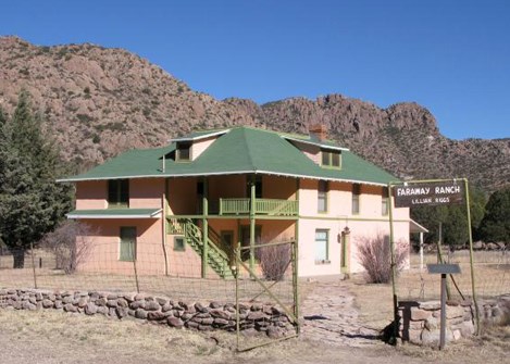
The advent of agriculture in the region some 3,000 years ago appears to have had the greatest impact in the pre-Columbian Sonoran Desert. Early practitioners employed runoff irrigation, called Ak-Chin by the Tohono O'odham, wherein seeds of crop plants were sown near washes to capture runoff during the rainy seasons. The Hohokam constructed massive systems of irrigation canals along major river valleys, such as the Gila, before abandoning them by around the 15th century.
NPS
The arrival of Europeans to the Sonoran Desert has been called an "an ecological revolution," as the introduction of Eurasian plants, animals, and microbes transformed landscapes. Livestock grazing was the most extensive Euro-American modification of the Sonoran Desert, while mining was the most intensive land-use practice introduced to the region. Both practices caused substantial degradation in the southern and central Sonoran Desert by the mid-19th century, with numerous descriptions of overgrazing and subsequent abandonment during the colonial period. These practices were not prevalent in southern Arizona, as the Apache and other hostile indigenous groups greatly limited Spanish and American settlement until the late 19th century.
Following the subjugation of the Apaches, waves of miners, ranchers, and farmers settled the area. Mining and ranching activities were economically linked in a "ranch-mine settlement complex" wherein ranches developed around mining towns to supply the meat, timber, and fuel wood required by the mining operations. During this period, the "three C's," cattle, copper, and cotton (grown in irrigated fields along river courses), dominated the economy of the region.
Pastoralism and mining peaked near the turn of the 19th and 20th centuries, then began a slow decline that accelerated after World War II. The development of modern transportation systems, the diesel pump, and the era of dam building spurred a boom in irrigated agriculture beginning in the 1930s. Groundwater overdrafts were common on both sides of the international border, and many riparian ecosystems were rapidly converted to crop and orchard production. As groundwater tables dropped and economic trends shifted, many thousands of acres of cropland were abandoned, with production continuing in areas with water developments (dams, canals), or near reliable aquifers or surface water.
In Arizona, tremendous urban growth accelerated through the 1970s, transforming former orange groves and native desert into tract homes and shopping malls. After a brief slowing in the late 1980s, this trend resumed. The 1990s saw the development of manufacturing and transportation industries on both sides of the border in response to the North American Free Trade Agreement (NAFTA).
Symbols courtesy of the Integration and Application Network, University of Maryland Center for Environmental Science (ian.umces.edu/symbols/).
Biomes and Subdivisions
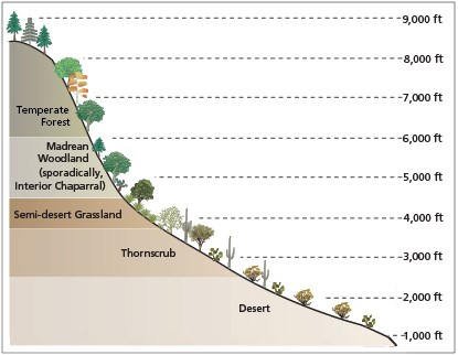
Biomes are coarse ecological units based on the phenology, lifeform, and physiognomy of the dominant vegetation. Vegetation is a useful descriptor of biotic communities as it is immobile, represents some 99% of Earth's terrestrial biomass (thus providing a useful index of productivity), and integrates abiotic site conditions (e.g., temperature, moisture, solar insolation, soil development, nutrient cycles). These globally distributed units are largely a function of climatic and topoedaphic variables and disturbance regimes. With the exception of tundra (which occurs a mere 100 km [62 mi] north), all of the major globally recognized biomes are represented in the Sonoran Desert, further emphasizing the region's amazing landscape diversity.
NPS/A.W. Biel
Desert
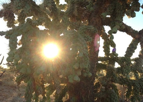
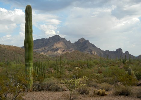
In this driest biome, aridity is the primary determinant of desert vegetation. Lifeform diversity is high, with plants from all three photosynthetic pathways (C3, C4, CAM) represented. Plants are well-spaced and typically exhibit microphyllous leaf phenologies. In the Sonoran Desert, the desert biome contains a variety of phreatophytic shrubs, such as velvet mesquite (Prosopis velutina), acacias (Acacia spp.), paloverdes (Cercidium spp.), and creosotebush (Larrea tridentata), to name but a few. Succulents are ubiquitous in the Sonoran Desert, with agave (Agave spp.), yucca (Yucca spp.), barrel cactus (Ferocactus and Echinocactus spp.), hedgehog cactus (Mammillaria spp.), and pricklypear (Opuntia spp.) and cholla (Cylindropuntia spp.) common. Warm- and cool-season annuals, both native (e.g., woolly plantain, Plantago patagonica) and introduced (e.g., red brome, Bromus rubens) are common following rainfall. The desert biome occurs at Casa Grande Ruins, Organ Pipe Cactus, and Tonto national monuments and Saguaro National Park.
NPS
Thornscrub
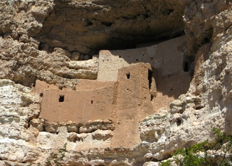
Thornscrub is composed primarily of small trees (e.g., velvet mesquite, P. velutina) and shrubs (e.g., catlaw acacia, Acacia greggii), with cacti (particularly Opuntia spp.) common in Sonoran Desert versions. Annual and perennial herbs are generally abundant in the understory. Thornscrub has well-defined wet and dry seasons, with most woody plants exhibiting drought deciduousness. Thornscrub is an intermediate biome between desert and tropical forest. Freezing temperatures are rare, with vegetation being primarily a function of the alternating wet/dry seasons. Thornscrub is found at Montezuma Castle, Organ Pipe Cactus, Tonto, and Tuzigoot national monuments, Saguaro National Park, and Tumacácori National Historical Park.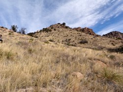
NPS
Semi-desert Grassland
In contrast to those of the Great Plains, grasslands in the Sonoran Desert are semi-desert in nature and typically composed of perennial short- and mid-grass species. Annuals and geophytes are also common, with occasional shrubs or trees. Most grasses in semi-desert grasslands use the C4 photosynthetic pathway that provides for greater water use efficiency than the C3 pathway of most other plants. Fire is a relatively common and necessary occurrence in semi-desert grassland, as it confers a competitive advantage to graminoids over most woody plants. Lehmann lovegrass (Eragrostis lehmanniana) is a common invasive exotic encroaching on semi-desert grassland. Semi-desert grasslands occur at Coronado National Memorial, Chiricahua National Monument, Fort Bowie National Historic Site, the uplands at Tonto National Monument, and at mid-elevations at Saguaro National Park.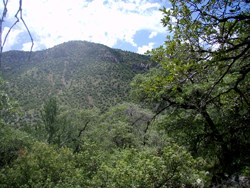
NPS
Madrean evergreen woodland
Madrean evergreen woodland is the most extensive woodland type in the Apache Highlands ecoregion and is ubiquitous at mid-elevations in SODN parks. Madrean evergreen woodland is characterized by evergreen oaks with sclerophyllous leaves, such as emory oak (Quercus emoryi), Arizona white oak (Quercus arizonica), and Mexican blue oak (Quercus oblongifolia). Mexican pinyon pine (Pinus cembroides) and alligator juniper (Juniperus deppeana) are common gymnosperms (vascular plants whose seeds are not enclosed in fruit). Understory perennial grasses are usually abundant, and woodlands may grade into tree savannas due to disturbance, local climate, or topoedaphic factors. Madrean evergreen woodland is typically bounded by semi-desert grasslands and savanna at lower-elevation, warmer and drier sites and by evergreen and broadleaf forests on more mesic and cooler sites (either by increasing elevation, aspect, or occurrence of a riparian area). Madrean evergreen woodland occurs at Chiricahua and Organ Pipe Cactus national monuments, Coronado National Memorial, Fort Bowie National Historic Site, and Saguaro National Park.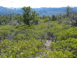
NPS
Interior chaparral
Interior chaparral is a semi-arid shrubland type that occurs on the west coast of every continent between 30 and 40°N latitude. Chaparral in the Sonoran Desert is found along the Mogollon Rim and in small patches at other locations. This interior variety of chaparral has fewer species than the coastal variety in California. Interior chaparral is composed of dense stands of manzanita (Arctostaphylos spp.) and shrub live oak (Quercus turbinella). These species have thick, sclerophyllous (hard, thick) leaves containing large quantities of volatile compounds. The natural fire regime for chaparral includes intense, fast-moving fires that are often stand-replacing. Manzanita requires charrate (burned, woody material) for sexual reproduction, and each of these species sprouts vigorously following fire. Interior chaparral is found interspersed with Madrean evergreen woodland at Chiricahua and Organ Pipe Cactus national monuments, Coronado National Memorial, Fort Bowie National Historic Site, and Saguaro National Park.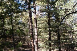
NPS
Temperate forest
Occurring at high elevations (>6,000 ft) in the American Southwest, temperate forests are dominated by conifers, such as pines (Pinus spp.), spruces (Picea spp.), and firs (Abies spp.). Cold-deciduous woody plants, such as Gambel oak (Quercus gambelii), trembling aspen (Populus tremuloides), and maples and boxelder (Acer spp.), are common in the understory of coniferous forests. At sites with particularly cool and moist microclimates (often on north or east-facing slopes), cold-deciduous trees may dominate the overstory, particularly following fire and or other disturbances that create canopy openings and permit these species to emerge from the understory.
Temperate forest represents the most cold-hardy vegetation type in the montane systems of the American Southwest. Confined to cooler sites (a function of elevation, aspect, and local geomorphology) under the current warm interglacial climate, temperate forest occurs upslope from Madrean evergreen woodland, typically at elevations greater than 6,000 feet. Most conifer forests in the Sonoran Desert are dominated by ponderosa pine (Pinus ponderosa), with a grassy understory where canopies are relatively open and subdominant trees and shrubs where canopies coalesce. Douglas-fir (Pseudotsuga menziesii) and true firs occur at higher elevations, with spruce at the highest elevations. Conifer forests are fire-adapted, with natural, low-intensity fires occurring every 9–15 years in ponderosa pine and mixed-conifer forests. Suppression of fires by humans has disrupted the natural cycles within many of these communities. Temperate forest occurs at Chiricahua and Gila Cliff Dwellings national monuments, Coronado National Memorial, and Saguaro National Park.
-
Mammals & Biomes of the Sonoran Desert
The Sonoran Desert is thought to have the greatest species diversity of any desert in North America. Take our video tour of the amazing mammals that live in its many biomes. The Sonoran Desert Network monitors these species via a series of wildlife cameras in National Park Service units.
- Duration:
- 9 minutes, 57 seconds

