NPS photo /SECN staff
Overview
Ocmulgee Mounds National Historical Park (NHP) lies in central Georgia, along the Fall Line, a biogeophysical transition zone between the Piedmont and Southeastern Plains ecoregions. Parts of the park lie within the city limits of Macon, Georgia, and the Ocmulgee River borders the park on the southern edge. A greenway corridor along the river connects the park with natural areas to the south. Landforms at the park consist primarily of a sizeable floodplain and associated herbaceous wetlands and adjacent uplands. A large, maintained utility right-of-way and railroad track crosses the park in the northeast section of the park. The natural resources of the park have been heavily impacted by human influence. Notably, interstate highway I-16 essentially disconnects the river from its floodplain and alters the natural hydrologic patterns of the area. Threats to biological resources at the park are primarily anthropogenic in origin, and include non-native species, air and water pollution, development, and other issues arising from the park’s proximity to Macon.

NPS photo / SECN staff
The Southeast Coast Network conducts monitoring for the following protocols at Ocmulgee Mounds National Historical Park:
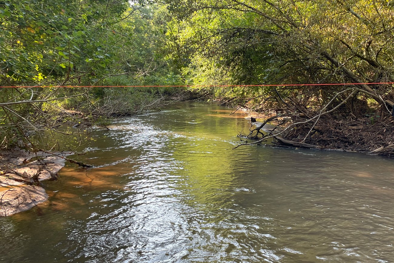
- Wadeable stream monitoring at Ocmulgee Mounds National Historical Park began in 2017 and is conducted on Walnut Creek, a fifth-Strahler order stream that flows through park grounds before meeting the Ocmulgee River. Surveys were completed in 2017, 2019, and 2023. Walnut Creek’s watershed has low slope and relief and is covered mostly by forested land and grassland, or pasture. While the majority of the watershed drains from the Appalachian Piedmont, Walnut Creek within Ocmulgee Mounds National Historical Park flows just below the fall line in the Upper Coastal Plain physiographic province resulting in a low energy, depositional environment that is subject to regular flooding and slow post-flood draining. In the park, Walnut Creek is an intermittently braided stream system with a distinct perennial channel as well as large flood chutes and side channels that spread across the Ocmulgee River’s flood plain. Methods used to monitor stream habitats at the park were primary bases on existing published methods from USGS, USFWS and EPA. Data are collected to assess both status and trends in upstream influences on stream habitat, changes to channel geomorphology, and benthic and instream habitat features.
- Landbird community monitoring and Vocal anuran community monitoring is conducted on a rotating schedule every three years. These wildlife communities play critical roles in park ecosystems and interact with several trophic levels of food webs. The network uses automated recording devices (ARDs) to collect vocalization data during mornings and evenings in the spring, which are analyzed by bioacoustics specialists. Data collected from these vital sign monitoring efforts help assess the ecological integrity and diversity of park areas and how communities and park conditions may change over time. The landbird and vocal anuran monitoring efforts in network parks began in 2012.
- Vegetation community monitoring is conducted on a rotating schedule. Monitoring vegetation is important because it’s key indicator of overall ecosystem health. Changes in vegetation reflect the effects of stressors like extreme weather, disease, invasive species, fire, and land use change. Plant communities also provide structured habitat and food resources for other species. Vegetation monitoring data provides managers with information about the degree of change in their park’s natural communities. Vegetation plots are established across the following habitats: Coastal Plain Alluvial Wetlands and Coastal Plain Upland Forests. Data reports include information about new occurrences and rare plants, species richness and abundance, tree health and regeneration, disturbance observations, soil nutrients, landform/geomorphology, and downed woody debris.
| Vital Sign | Examples of Measurements |
|---|---|
| Wadeable Stream Habitats | Stream channel morphology (heights, widths, depths), channel gradient, bed sediment particle size, large wood inventory, distribution of geomorphic channel units, canopy cover |
| Terrestrial Vegetation Communities | Plant community diversity, relative species/guild abundance, structure/age class, incidence of disease |
| Landbird and Vocal Anuran Communities | Species occurrence, distribution |
Source: NPS DataStore Collection 4019 (results presented are a subset). To search for additional information, visit the NPS DataStore.
Source: NPS DataStore Collection 4016 (results presented are a subset). To search for additional information, visit the NPS DataStore.
Source: NPS DataStore Collection 4017. To search for additional information, visit the NPS DataStore.
Source: NPS DataStore Collection 9587. To search for additional information, visit the NPS DataStore.
Source: NPS DataStore Collection 4021 (results presented are a subset). To search for additional information, visit the NPS DataStore.
Source: NPS DataStore Collection 4020 (results presented are a subset). To search for additional information, visit the NPS DataStore.
Source: NPS DataStore Collection 9568. To search for additional information, visit the NPS DataStore.
Source: NPS DataStore Collection 4018 (results presented are a subset). To search for additional information, visit the NPS DataStore.
Last updated: November 11, 2024
