
NPS Photo/Ryan Manuel
Fort Laramie National Historic Site sits at the confluence of the North Platte and Laramie rivers in southeastern Wyoming. The park is best known for its cultural resources, with the centerpiece being the surviving buildings from the major military post that existed from 1849-1890.
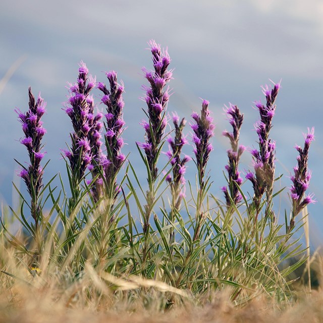
Despite its small size (833 acres), Fort Laramie has a relatively large diversity of natural resources due to the two rivers that meet in the park, the topography that ranges from riverbed to upland areas, and the location of the park near the western edge of the Great Plains and eastern edge of the Rocky Mountains.
Major natural resource concerns include the encroachment of exotic plants, altered river ecosystems due to the dams along the rivers, fire suppression, and the effect of nearby power plants on air quality.
We monitor landbirds, plant communities, water quality, and weather and climate at this park.
Featured Information
-
 Species Lists
Find species lists for this park here
-
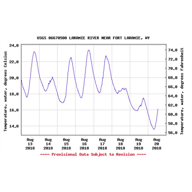 Real-time Water Quality Data
We partnered with the USGS to install and operate a continuous monitoring station on the Laramie River (2018)
-
 Rocky Mountain Region Digital Herbarium
Find plants from Fort Laramie National Historic Site in this searchable online collection of plant specimens
Reports and Publications
Read more about our work at this park in the resource briefs (short summaries), protocols (monitoring procedures), monitoring reports (detailed results), or inventories (assessments and lists of natural resources) below.
Source: NPS DataStore Saved Search 2386. To search for additional information, visit the NPS DataStore.
Source: NPS DataStore Saved Search 2387. To search for additional information, visit the NPS DataStore.
Source: NPS DataStore Saved Search 2352 (results presented are a subset). To search for additional information, visit the NPS DataStore.
Source: NPS DataStore Saved Search 3378. To search for additional information, visit the NPS DataStore.
Quick Reads
Last updated: May 17, 2022