News Release

NPS
|
Subscribe
|
Contact: Katie Lawhon, 717-338-4402
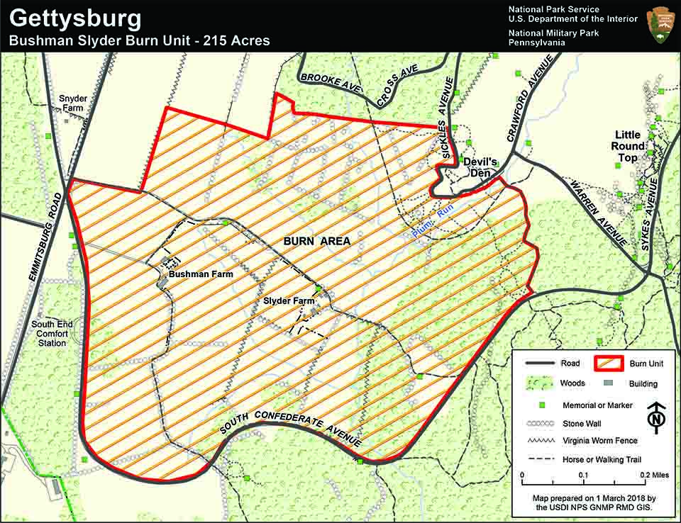
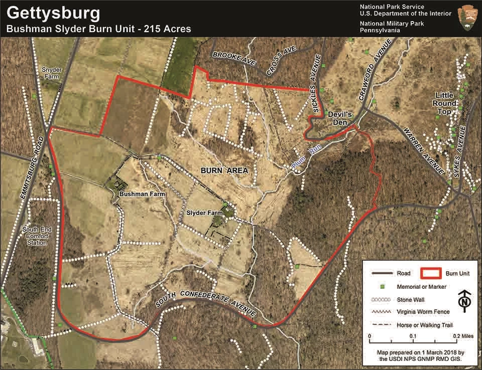
Gettysburg National Military Park fire managers are preparing for a prescribed fire on two days from late March to late April, weather permitting. The plans call for burning portions of a 215 acre burn unit between Devil’s Den and South Confederate Avenue. Fuel and weather conditions must be within certain parameters and that will determine the exact date for each of the one-day operations.
Prescribed fires allow fire managers to conduct a safe burn under optimal conditions with sufficient resources available to meet specific objectives for the management of battlefield resources. Gettysburg’s overall objectives are to maintain the conditions of the battlefield as experienced by the soldiers who fought here; perpetuate the open space character of the landscape; maintain wildlife habitat; control exotic invasive species; reduce shrub and woody species components; and reduce fuels in wooded areas to reduce fire hazard.
Temporary Road Closures Planned: During the prescribed fire, multiple roads will likely be closed for portions of the day including South Confederate Avenue, and Sickles Avenue at Devil’s Den. Closures may last two or three days. Pedestrian and equestrian trails located within the burn area will also be closed.
Additional roads, trails and areas may be closed temporarily if smoke conditions reduce visibility to a level that would cause visibility problems and public and firefighter safety concerns. Up-to-date information on this and any other closures and fire activity will be posted on the park's website, www.nps.gov/gett, and social media sites, using the hashtag, #GettysburgNPS.
The timing of the prescribed fire is dependent on conditions being within required weather parameters such as wind, temperature, and relative humidity. The prescribed fire will be conducted from approximately late morning through the afternoon, followed by patrol and monitoring to ensure the fire is completely out.
A combination of lawn-sprinklers, hoses, mowed lines, and fire engines will be used to create a buffer and fire break to protect monuments and other cultural resources in the burn area. National Park Service staff will monitor air quality and smoke impacts as well as visibility on nearby roads.
Gettysburg National Military Park preserves, protects and interprets for this and future generations the resources associated with the 1863 Battle of Gettysburg, during the American Civil War, the Soldiers' National Cemetery, and their commemorations.

NPS
Last updated: March 8, 2018
