



News Release
You are viewing ARCHIVED content
This content was published online before January 20, 2025. Please note that this content is NOT UPDATED, and links may not work. For current information, visit https://www.nps.gov/aboutus/news/index.htm.
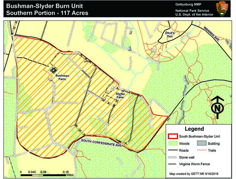
NPS map
News Release Date: March 28, 2019
Contact:
Jason Martz, 717-338-4423
Temporary Road and Trail Closures Planned
During the prescribed fire, South Confederate Avenue will be closed. Closures may last two or three days. Pedestrian and equestrian trails located within the burn area will also be closed. Additional roads, trails and areas may be closed temporarily if smoke conditions reduce visibility to a level that would cause visibility problems and public and firefighter safety concerns. Up-to-date information on this and any other closures and fire activity will be posted on the park's web and social media sites.
The timing of the prescribed fire is dependent on conditions being within required weather parameters such as wind, temperature, and relative humidity. The prescribed fire will be conducted from approximately late morning through the afternoon, followed by patrol and monitoring to ensure the fire is completely out. A combination of lawn-sprinklers, hoses, mowed lines, and fire engines will be used to create a buffer and fire break to protect monuments and other cultural resources in the burn area. National Park Service staff will monitor air quality and smoke impacts as well as visibility on nearby roads.
Visit our Planning web page for more information about our Fire Management Plan.
Last updated: March 28, 2019