

The Florissant valley is a constantly changing landscape, shaped by the power of erosion, uplift, and eruptions. Geologic activity recorded at Florissant began at least one billion years ago when magma cooled to form the Pikes Peak pluton. Volcanoes continued to influence the area until at least 34 million years ago, when eruptions covered Florissant in ash. The area is changng today as Grape Creek cuts through the valley and as rain and snow wear down the raised features of the landscape. On the Geologic Trail (map to your left) you can see the history of geologic processes that have shaped the Florissant valley. The Geologic Trail crosses Teller County Road 1 between stops 2 and 3. Please use caution and watch for traffic! Also be aware that the trail climbs 80 ft (25 m) from stop 3 to stop 5 and has a steep stretch between stops 4 and 5. 
Stop One — Eocene LakebedTo reach the Geologic Trail, exit the visitor center onto the back patio and take the trail immediately on the right (the Petrified Forest Loop trail). Walk about 1,000 feet (300 m) to a trail junction and then take the right fork (see map on back). As you walk across the open grassy meadow, you are crossing what once was the bottom of a lake. The shales that preserve many fossils were deposited in this lake 34 million years ago and now form the Florissant Formation.
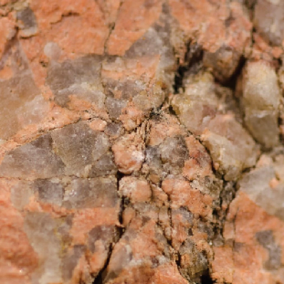
Stop Two — Ice Age GravelsAs the Geologic Trail ascends onto a low ridge, you will notice that the ground is made up of gravel. The gravel contains decomposed granite that has eroded from the slopes of surrounding hills into the Florissant valley. This material, called grus or colluvium, is a few feet deep (a meter or more) and covers much of the Florissant Formation within the Monument (see geologic map). Mammoth bones were discovered nearby in this layer in 1994 and have been radiocarbon dated as more than 43,000 years old (Quaternary). The Florissant fossil comes from one of the highest elevations (8,400 ft or 2,550 m) at which ice age mammoths have been found. Another fossil mammoth site was discovered in 2010, at Snowmass, Colorado, about 100 miles (160 km) to the northwest of the monument and 500 feet (150 m) higher in elevation. The Snowmass site has yielded more than 5,000 fossils from mammoths, mastodons, and other animals.Stop Three — Pikes Peak GraniteOn the way to stop 3 the trail crosses a bridge over Grape Creek. From the bridge, you will see large boulders made of Pikes Peak Granite. This rock unit formed more than 1.08 billion years ago, deep underground, and cooled over millions of years. It came to the surface with the uplift of the Rocky Mountains. The Pikes Peak Granite makes up a structure called a batholith, which forms when a large mass of magma is emplaced deep underground and hardens. The Pikes Peak batholith stretches about 25 miles (40 km) wide and 80 miles (130 km) long, from Castle Rock to just south of Colorado Springs. The Earth is dynamic and rocks continue to change. Today, Grape Creek is eroding Pikes Peak Granite and other rocks and is redepositing the sediment downstream. The stream deposits, called alluvium, are shown on the geologic map (above). Stop Four — Tuff OutcropAfter crossing the bridge, you will begin to ascend the trail through a section of Wall Mountain Tuff. The Wall Mountain Tuff formed 37 million years ago from an ash flow that erupted from a caldera located near modern Mt. Princeton, about 50 miles (80 km) west of Florissant. The superheated ash cloud settled to the ground, welded together, and cooled to form a volcanic rock called rhyolitic welded tuff. A layer of this tuff once covered the area, but streams have eroded most of it out of valleys like the one below you. You can recognize the Wall Mountain Tuff from its fine-grained texture and gray-beige color. It contains a few quartz crystals large enough to see with the naked eye, but it is composed mostly of matrix material called groundmass. The visible crystals, or phenocrysts, formed in the magma long before the eruption. The Story Behind Crystals 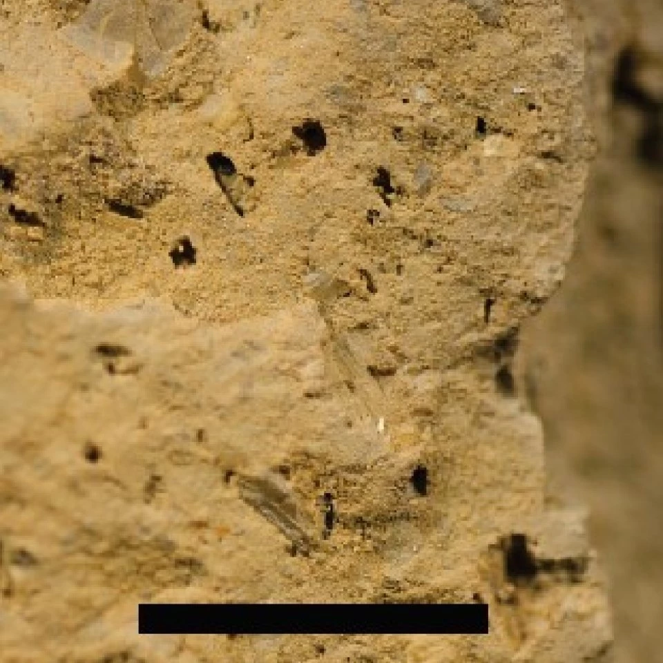
Left image
Right image
Stop Five — Geologic Trail OverlookAs you walk between stops 4 and 5, you will cross a contact between the Wall Mountain Tuff and Pikes Peak Granite. At the overlook you are standing on Pikes Peak Granite, the the oldest rock in the monument. It forms the basement rock within the monument, and it is exposed here because the overlying rocks have been eroded and weathered away. In the distance you will see the modern Florissant valley and many surrounding ridges and peaks. In the late Eocene, 34 million years ago, Lake Florissant would have dominated the foreground with the Guffey volcanic center on the horizon . Today, those features have been eroded or buried and replaced by new features, like Mt. Pisgah to the south. |
Last updated: March 20, 2021