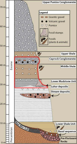
Lower Mudstone Unit The large petrified redwoods you see near the Visitor Center were once encased in the lower mudstone unit. Today they are exposed because they were excavated with dynamite when the land was commercially owned. This damaged the stumps, which is why they are held together with iron bands. Middle Shale Shortly after the lahar buried the redwood forest, another lahar flowed into the valley several kilometers to the south, creating a second natural dam and allowing the stream to flood the valley once again. The middle shale unit of the Florissant Formation is the shale that is most often seen by visitors, as it outcrops near the Visitor Center. Caprock Conglomerate Imagine ancient Lake Florissant, the waters tinged slightly yellow from abundant diatoms. Past eruptions from the Guffey volcanic center sent clouds of hot ash into the air, but for now it is relatively peaceful. In the distance, Guffey erupts again and the area begins to violently shake. A water-saturated lahar (volcanic mud and debris flow) made of pebbles, cobbles, ash, and pumice moves swiftly down the mountain towards the lake, spilling into the lake and creating large waves. The jumbled mess of fragments begins to compact at the bottom of the lake, creating water escape structures, the primary evidence that the caprock conglomerate entered waters of the lake. 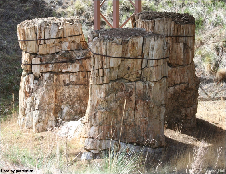
|
Last updated: February 24, 2015