|
UNIT 20

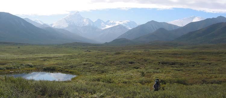
NPS Photo Tips and Special FeaturesThis unit follows the historic trail used by the pioneer climbers of Mount McKinley, including the first expeditions to reach both the North and South Summits. The end of the "trail" is McGonagall Pass with great views of Mount McKinley, the Muldrow Glacier and the Alaska Range. The best time to cross the McKinley River is very early or late in the summer season so it can be difficult to get a permit for this area during those times. If Unit 20 is full, similar terrain can be found in Units 19 and 21 and you are unlikely to run into any other parties or signs of people. Another option, if you have the proper equipment and training, is to float over the McKinley River during the summer using pack rafts.
Common Routes and Hiking CorridorsThe main route to McGonagall Pass along the informal climbers' trail is the most commonly used part of the unit. Plan on spending at least four nights in this area if you want to reach McGonagall Pass, and plan to hike strenuously for most of those days. A more pleasant trip is to plan on 5 to 7 nights to enjoy the scenery and wait out foul weather. Crossing the McKinley River should only be attempted by backpackers with previous major river crossing experience. This is a large, glacier-fed river and it is extremely difficult to cross for most of the summer, even in sections where it is heavily braided. It is best to cross the river early in the morning, meaning it is ideal to spend your first night in Unit 14 or 15 and crossing the next day. The unmaintained 'climber's trail' is very difficult to find on the north side of the McKinley River Bar and is not maintained. Hikers should travel from Wonder Lake Campground via the established McKinley Bar Trail. The start of the unmaintained 'climber's trail' is across the river and about 1 mile upstream (i.e., east) from where the McKinley Bar Trail meets the McKinley River. Many hikers find it easier to find from Turtle Hill; so if you have trouble finding it along the river, head for the summit of that small hill. 
NPS Photo Two significant river crossings are required to reach McGonagall Pass: the McKinley River and Clearwater Creek. Even under the best of conditions, a crossing of the McKinley River is typically 2 ½ to 3 feet deep through more than one channel. The Clearwater can be tricky to cross because the bottom is made up of large, slippery rocks that make footing difficult. It is best to cross the Clearwater upstream of where Cache Creek flows into it. Cache Creek is a small stream that can usually be crossed easily. Once you are across the McKinley and Clearwater, there are many options for exploring this unit that are away from the heavily-used trail corridor. The ridges on either side of Cache Creek or the headwaters of the Oastler Creek all provide amazing views and easy hiking in dry tundra.
|
Last updated: January 30, 2025
