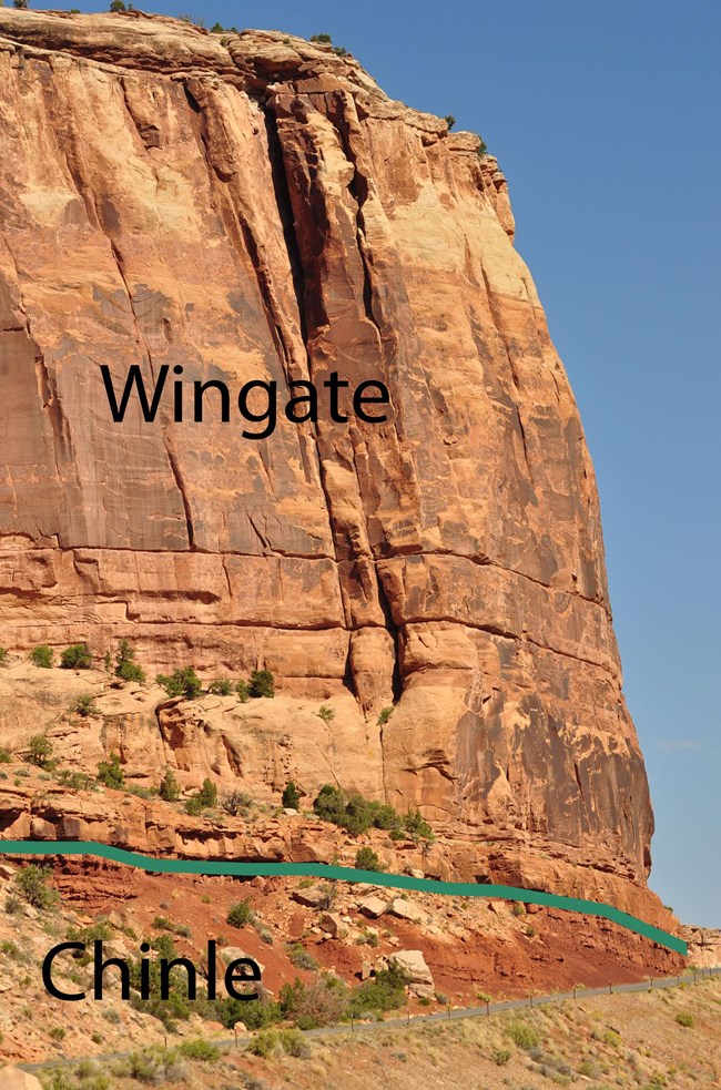
NPS Image Name: Wingate Sandstone or Wingate Formation Appearance: Reddish orange sandstone, usually appearing in sheer cliffs. The Wingate Sandstone is approximately 330 feet thick in the monument. The Wingate Sandstone is coated on most cliff faces with desert varnish, and displays a slabby to blocky weathering. Group: Is the oldest formation in the Glen Canyon Group. Origin of Name: Named for outcrops near Fort Wingate, NM, by Clarence Dutton in 1884. Age: The Wingate Sandstone was deposited in the Early Jurassic. The formation is estimated to be approximately 200 million years old. 
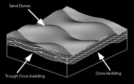
USGS Image CharacteristicsThe Wingate is a very-fine- to fine-grained sandstone that is moderately to well sorted, calcareous, and well stratified. The two important stratification features present in the Wingate that explain the origins of the formation include large cross-beds and very thin horizontal laminations. Both these features are formed from wind deposits. 
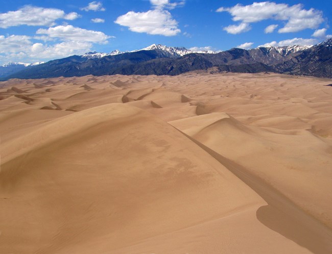
NPS Photo Depositional EnvironmentDuring the time of the Wingate Sandstone deposition, the Colorado National Monument area was located at the northeastern margin of a erg (a large sand dune area). This environment resembled the modern day Sahara Desert. This eolian setting, or an environment consisting of sand dunes whose only movement is from prevailing winds, occupied most of the Four Corners area. The dunes migrated south-southeast, and from cross-bedding measurements the sand dunes are estimated to have been 100-150 feet high. PaleogeographyColorado was located approximately 10 degrees north of the equator during deposition. The climate during deposition was dry and arid. There is also evidence in Colorado National Monument of smaller dune complexes and areas where there might have been higher water tables, creating wet sand flats. This signifies times where more humid climatic conditions might have existed. |
Last updated: April 29, 2025
