|
Like many other units, Colorado National Monument’s visitation skyrocketed after World War II. Just over 38,000 visitors came to the park in 1946. By 1956 the visitation was a whopping 204,000 people. With Mission 66 funding, a new visitor center, overlook shelter, amphitheater and trail were constructed. The CCC era Devil’s Kitchen Picnic area shelter was also rehabilitated.
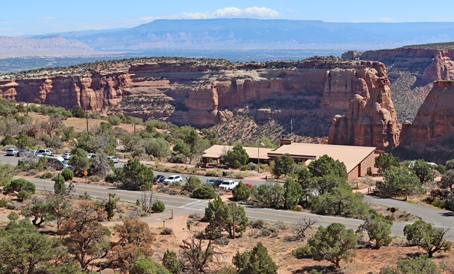
NPS Volunteer Carla DeKalb Saddlehorn Visitor CenterVisitor Centers were a relatively new concept in the 1950s. Prior to this, visitor contact stations were simple structures often no more than our entrance stations today. They were constructed of locally sourced materials, often wood and stone, blending into the landscape.Mission 66 changed this. The Saddlehorn Visitor Center is true to the modern form of Mission 66. Built large enough to encompass exhibit space, a theater, bookstore, restrooms as well as administrative office space. The design concept was one of clean lines, bold looks, use of glass, steel and concrete. Saddlehorn Visitor Center was designed by NPS architect Cecil Doty. He capitalized on the location near the rim of Wedding Canyon to provide excellent vistas of the landscape through large glass windows and on an exterior porch. The use of sandstone walls allows the building to harmonize with its environment. The flagstone flooring is continued from inside to the front and back porches. 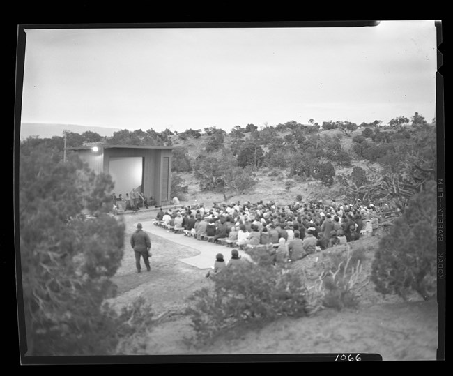
NPS Photo Saddlehorn AmphitheaterThis amphitheater was built during the Mission 66 era, part of the campground expansion effort, to provide a location for evening “campfire” talks to those camping in the campground. It consisted of a large building with a screen for the slide show and rows of wooden benches. The area was designed to seat over 300 people. There was a small concrete skirt in front of the screen which would enable one or two people to stand there to address the crowd.Over the years the use of the structure declined and thus the maintenance of the structure and the asphalt path dropped lower in priority compared to other projects. In 2019 efforts started to bring back the functionality of the amphitheater. While the number of campers interested in evening programs is lower than in the 1960s, the demand for a venue for daytime presentations, small concerts, and community events such as weddings and other presentations has increased dramatically. The small lip of a stage was not adequate for most of these uses. So, a new structure was envisioned and planned. During the spring of 2021, the old projection screen structure was dismantled with as much as possible of the materials being re-purposed into other structures. In the spring of 2022 the benches for seating were removed and will be re-finished with accessibility features. The original layout of the seating will remain the same. The original asphalt trail will be taken out and a new accessible crushed granite trail will be installed. 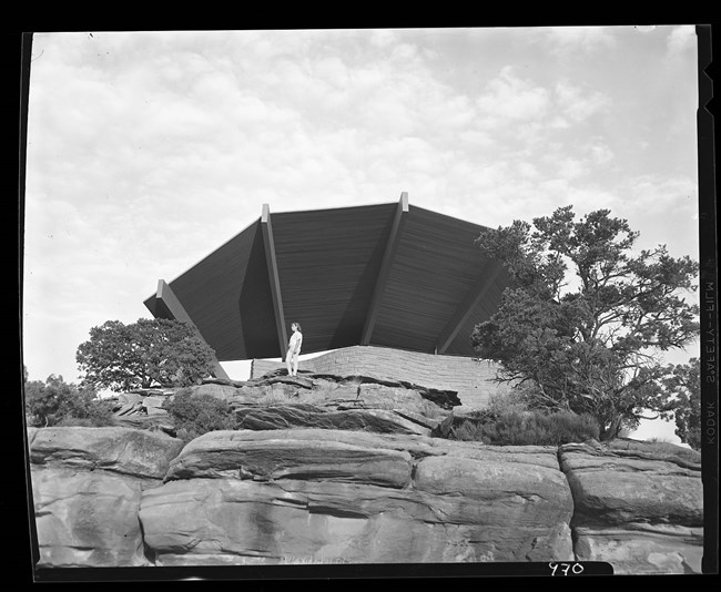
NPS Photo Bookcliff ShelterThis shelter is located on the Saddlehorn loop road and is perched on the canyon rim. The nomination language for its entry into the National Register of Historic Places stands by itself, “Bookcliff Shelter rises from the ground in the form of a large open fan, offering views of Wedding Canyon, Monument Canyon, the Bookcliff Mountains, Grand Mesa, and the Colorado River Valley. The shelter is set into the slope of the top of the canyon; its natural sandstone walls and benches designed to look as though they are part of the canyon. The shelter’s roof structure fans out over the canyon like a golden eagle soaring above the canyon below. The wood beams of the roof spread out in an array, pointing to views over the wide expansive canyon below.”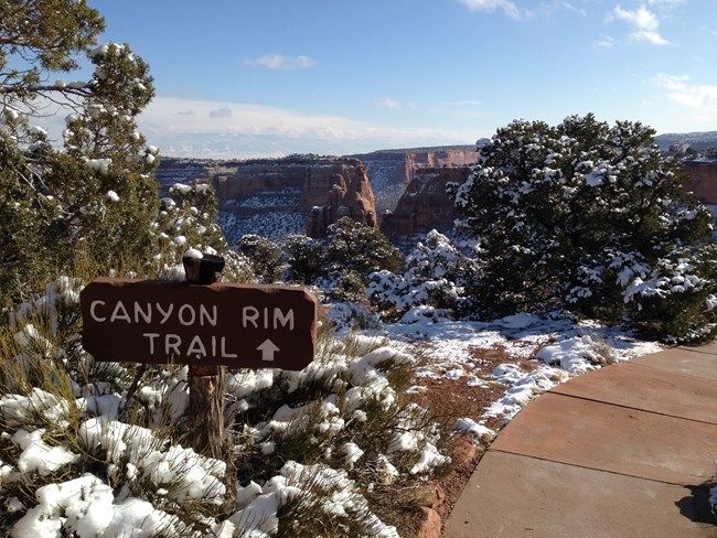
NPS Photo - AJackson Canyon Rim TrailIn 1964 Canyon Rim Trail was envisioned to connect the visitor center and the Bookcliff Shelter. Today’s trail follows the original alignment. A few portions of the trail are right along the canyon rim with railings and overlooks. The remainder of the trail meanders amongst the Pinyon-Juniper forest and along sandstone walls. The closer one gets to the Bookcliff Shelter the better the view up into Monument Canyon.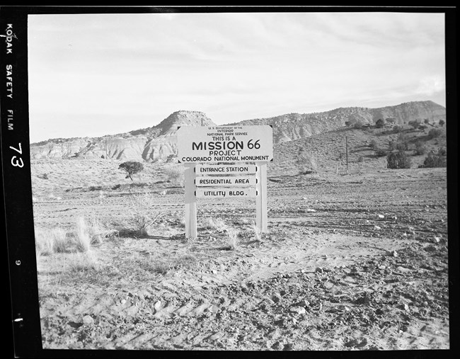
NPS Photo Visitation to the parks more than doubled from 1946 to 1955 due to pent up postwar demand for travel and recreation. Many of the buildings, roads, and utility systems dated from before World War II. These structures were previously built with hand tools in an "NPS Rustic" style using natural materials that blended with the setting. The boom of post war tourism was more than the rustic infrasturcture could handle. National Park Service Director Colin Wirth proposed an ambitious 10-year capital improvement project to modernize National Park Service sites. The program was named "Mission 66" after the proposed project completion date of 1966, which was also the 50th anniversary of the National Park Service. The U.S. Congress appropriated more than a billion dollars over this 10-year period. The National Park Service built more than 100 visitor centers, countless comfort stations and picnic shelters, headquarters buildings and over 1,000 units of much needed employee housing. These new buildings were constructed in a "Modern" style that used local materials. In addition, trails were constructed, roads were widened, utility systems were added, and hundreds of maintenance structures were built. In addition to the construction within existing parks, the system itself expanded, redefining what could and should be protected by the National Park Service. Examples include Glen Canyon National Recreation Area and Point Reyes National Seashore. Within that same 10-year period, Congress added 50 new sites to the agency. Other National Park Service Units Featuring Mission 66 Architecture |
Last updated: April 29, 2025
