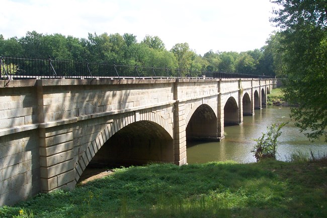
NPS Photo An Icon of American Civil EngineeringConstruction of the Chesapeake and Ohio Canal began in 1828 in Georgetown, District of Columbia, and reached its terminus in Cumberland, Maryland, in the summer of 1850. The C&O Canal system included eleven stone aqueducts designed to carry the canal across the major river tributaries that drain into the Potomac River along the canal's route. Today, the C&O Canal is the most intact canal resource of the 36 major canals constructed in the United States between 1806 and 1850. The C&O Canal's chief engineer, Benjamin Wright, is considered by many as the father of American civil engineering. He was the lead engineer on the Erie Canal prior to engineering the C&O Canal. The Monocacy Aqueduct is the largest of the eleven aqueducts erected along the C&O Canal, and is often described by many historians as one of the finest canal features in the United States. Ten of the eleven aqueducts remain as key features of the Chesapeake and Ohio Canal National Historical Park, which was designated as a national historical park in 1971. The Catoctin Aqueduct collapsed after its piers were gradually undercut and a flash flood took it down in 1972. Construction of the Monocacy AqueductConstruction on the aqueduct began in 1829 and was completed four years later. Three separate contractors labored on the immense stone structure, which was constructed for $127,900. The plan for the Monocacy Aqueduct, often referred to as C&O Canal Aqueduct No. 2, was for a stone masonry structure with a waterway of 19 feet at the bottom and 20 feet at the top. The towpath parapet wall is 8 feet wide and the upstream wall is 6 feet wide. Benjamin Wright drew the plans with 6 piers, 2 abutments and 7 arches, each with a span of 54 feet. The piers are 10 feet thick with pilaster at each end. The aqueduct is 516 feet in length. Much of the building material was large granite stone blocks quarried at the base of nearby Sugarloaf Mountain. National Park Service RestorationFollowing the 1972 Hurricane Agnes flood, the National Park Service and the Federal Highway Administration designed a steel banding system to stabilize the structure and installed a steel rod reinforcing system. The National Park Service and park supporters were concerned about the structural stability of the aqueduct and a major engineering evaluation was undertaken to determine stabilization needs and associated cost. Getting HereLatitude and LongitudeDegrees Minutes Seconds (DMS): 39° 13' 26.1" N, 77° 27' 07.3" W GPSThe Monocacy Aqueduct has no street address, search "Monocacy Aqueduct" or follow the directions below. From Frederick, MD
From Dickerson, MD
|
Last updated: February 10, 2024
