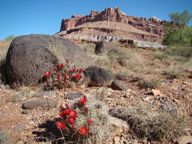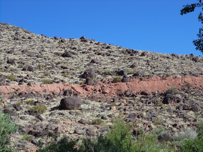
NPS Large black boulders are strewn along several valleys that cross Capitol Reef National Park. In the Fremont River Valley they cover Johnson Mesa above the campground and scatter the hillsides of Fruita. The boulders are striking among the tilted red and white bands of sandstone and shale that form the Waterpocket Fold. They originated in the high basalt and andesite cliffs that edge Boulder Mountain and the Thousand Lakes Mountain plateaus west of the park. Geologists long thought the boulders had moved from Boulder Mountain in Ice-Age glaciers and streams that carried the rocks down valley. Recent studies show that the glaciers were small and the streams lacked the power to move boulders nine feet or more in diameter such as those found around Fruita. Many of the boulders are angular in shape, whereas rocks rolled by streams become rounded. Large landslides occurred and the remains of these slides (huge chunks of basalt and andesite) mantle the slopes of Boulder and Thousand Lakes Mountains. Some of the slides flowed into the heads of the Fremont and Escalante Rivers and were liquid enough to move as debris flows for tens of miles down canyons like wet cement in a chute. Such dense flow can raft boulders without rounding them. Some debris flows incorporated enough river water to become floods that spread boulders through Capitol Reef and farther east of the park. 
NPS These enormous debris flows and floods dumped their freight of boulders across broad valley floors beyond the mountains. The Fremont and Escalante Rivers have since cut deeply into those valley floors, carving canyons. The old valley floors are now mesas that are up to 600 feet (183 m) above the present river valleys. These mesas are called strath terraces. Some debris flow material was reworked by the Fremont River and its tributaries. River processes created well-rounded boulders within the terrace deposits. The Fremont River cut through the Waterpocket Fold at a rate of approximately 30 inches (76 cm) per thousand years based on terrace dates. This rate of downcutting is considered high for the Colorado Plateau but is consistent with highly elevated areas wherein the river's headlands reach alpine glaciated areas. Thus, most of the visible canyon that we see today has been cut within the past 200,000 years. Boulder-laden debris flows descended along the Fremont River and its southern tributaries, Pleasant and Oak Creeks. Numerous terraces and mesas, perched 100 to 400 feet (30.5-122 m) above the modern valley floors, are capped by coarse black boulders. Similar boulders that originated at Thousand Lake Mountain cap benches high above the northern valleys of the park. Such benches are visible along the Hartnet Road from the Cathedral Valley Campground all the way to the Fremont River. East of the park, black boulders form flat benches where ancient floods emerged at the mouths of Pleasant and Oak Creek Canyons, i.e.: Notom Bench. These benches are the ancient floors of these streams. Since then, the creeks and the Fremont River have excavated canyons 200 feet (60.7 m) deeper into the tilted sandstone of the Waterpocket Fold. Deposits of black boulders extend into Upper Cathedral Valley. Just east of the park boundary along the Fremont River, a prominent flat terrace is mantled by several feet of river-worn black boulders, the ancient floor of Hartnet Draw. Wet landslides have also slumped off the south side of Boulder Mountain and shed huge debris flows into tributaries of the Escalante River. Large ancient flows cap ridges like the hogsback, seven miles southwest of the town of Boulder, where Utah Highway 12 balances on a boulder-strewn spine 500-600 feet (152-183 m) above the canyons. Boulder is built on the youngest large debris flow. A prehistoric ancestral Puebloan village also lies on this deposit, just north of Boulder. Established about 1050 CE, it shows that the debris flow is older than 900 years. This bulletin was written by Richard Waitt of the United States Geological Survey, in cooperation with the National Park Service, and was updated in 2008 by geologist Tom Morris of Brigham Young University. 
NPS |
Last updated: January 20, 2021
