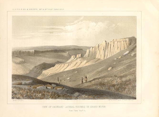
Lithograph by John Mix Stanley; Sketch by Richard H. Kern |
Early LifeJohn Williams Gunnison was born on November 11, 1812 in Goshen, New Hampshire. He attended school and shortly after became a teacher. He later entered West Point Military Academy and graduated second in his class. Gunnison began military service in 1837 on active duty under General Zachary Taylor. Battles between Seminole Indians and white settlers in Florida were ongoing. As peace talks were undertaken, Gunnison was ordered to explore unfamiliar lakes and rivers in search of provision routes south to Fort Besinger. The assignments were challenging, and the heat and humidity took a toll on Gunnison’s health. In 1838, he received a transfer to the Corps of Topographical Engineers. This was a separate branch of the military primarily focused on exploration and surveying. Going WestIn 1841, Gunnison received his first western assignment to survey land on the Wisconsin-Michigan border. Gunnison and the survey crew persisted through hardship and eventually mapped much of the border land and the shores of Lake Michigan. Gunnison’s first sight of the west came as a member of the Captain Stansbury Utah Territory Expedition of 1849. Their task was to explore the route to the Mormon community in Utah. The expedition journeyed through the Great Plains and southern Wyoming before arriving in the Great Salt Lake region. They explored and mapped the area and gathered scientific information about their surroundings. 
Near the mouth of Lake Fork with indications of the formidable Side Cañones. 1855. Drawing by F. W. Egloffstein Grand Valley and Black CanyonLieutenant Gunnison was promoted to Captain in 1853 largely due to his successes in Utah and the Great Lakes region. He was selected to lead the search for a Pacific railroad route along the Kansas-Nebraska border, assisted by Lieutenant Edward G. Beckwith. The expedition took him through the Great Plains, over the Rocky Mountains, and into the Tomichi Valley. The town, present day Gunnison, is named after him. The expedition continued to follow the Grand River (Gunnison River) until reaching the Black Canyon. 1861 Steel Engravings & Lithographed Maps. Central Pacific Railroad Photographic History Museum. http://cprr.org/Museum/USPRR-Wm_Husson-PANZOOM/index.html
De Boer, Shirley M. "John Williams Gunnison (1812-1853)." Goshen NH Historical Society, May 12, 2012. https://goshennh-historicalsociety.com/john-williams-gunnison-1812-1853/ Beckwith, E.G. "Report of Explorations for a Route for the Pacific Railroad by Capt. J. W. Gunnison, Topographical Engineers, near the 38th and 39th Parallels of North Latitude, from the Mouth of the Kansas River, MO., to the Sevier Lake in the Great Basin." War Department. 1854. O'Rourke, Paul M. "The Great Reconnaissance and the Rediscovery of the Southwest." in FRONTIER IN TRANSITION:A History of Southwestern Colorado. Bureau of Land Management - Colorado Cultural Resources Series Number Ten. 1980. |
Last updated: April 24, 2025
