News Release
You are viewing ARCHIVED content published online before January 20, 2025.
Please note that this content is NOT UPDATED, and links may not work. For current information,
visit https://www.nps.gov/aboutus/news/index.htm.

NPS Photo
|
Subscribe
|
Contact: Christopher Derman, (423) 569-9778
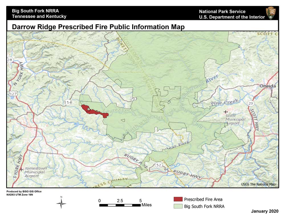
During the spring months of 2020, fire crews will conduct prescribed fire operations, located along Darrow Ridge Road, in the Tennessee district of the park. Prescribed fire, as defined in the approved Fire Management Plan, will be located within the boundaries of the park.Approximately 800 acres are scheduled to be burned, on the west side to Proctor Ridge Horse Trail on the east side down to the creek. During the burns, some park roads and trails may be closed temporarily for visitor safety.
As priority, fire crews are now working on prepping these units to burn safely and effectively. The expectation is and will be to initiate the prescribed fire as soon as possible. Local communities can expect minimal smoke and visibility impacts.
Implementation of burn operations is dependent upon a variety of conditions. Prescribed fires are conducted within specific parameters including temperature, relative humidity, fuel moisture, and wind speed to name a few.
Fire is an essential, natural process, having shaped the landscape for thousands of years, releasing, and recycling nutrients tied up in vegetation, duff, and organic soil layers, improving the overall health of plants and animals. During the planning of these prescribed burn units, areas of historical, cultural, and ecological importance are protected.
Last updated: February 3, 2020
