News Release
You are viewing ARCHIVED content published online before January 20, 2025.
Please note that this content is NOT UPDATED, and links may not work. For current information,
visit https://www.nps.gov/aboutus/news/index.htm.

NPS Map
|
Subscribe
|
Contact: Big Cypress Duty Officer, 239-719-0241
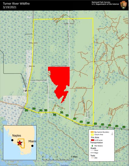
OCHOPEE, FL – Beginning today, March 18, 2021, the Turner River Wildfire will transition from a Type 3 incident down to a Type 4.Fire behavior has diminished significantly as crews continue to secure and monitor the lines. Some low to moderate fire activity remains in interior pockets of pines, prairie and cypress. No significant fire growth was observed over the last few days. The Turner River Wildfire is now 6,245 acres and 50% contained. Aviation and ground resources will continue to monitor the fire in the coming days.
Personnel from Florida Forest Service, US Forest Service, US Fish and Wildlife Service, Great Smokey Mountains National Park and the Buffalo River Wildland Fire Module are assisting South Florida National Parks and Preserve.
Visitors and travelers may still see and smell smoke in the area. Please use caution as there is potential for smoke impacts along US Highway 41, State Road 29, and other roadways in the vicinity of the fire.
Last updated: March 19, 2021
