News Release
You are viewing ARCHIVED content published online before January 20, 2025.
Please note that this content is NOT UPDATED, and links may not work. For current information,
visit https://www.nps.gov/aboutus/news/index.htm.

NPS Map
|
Subscribe
|
Contact: Riki Hoopes, 786-886-9342
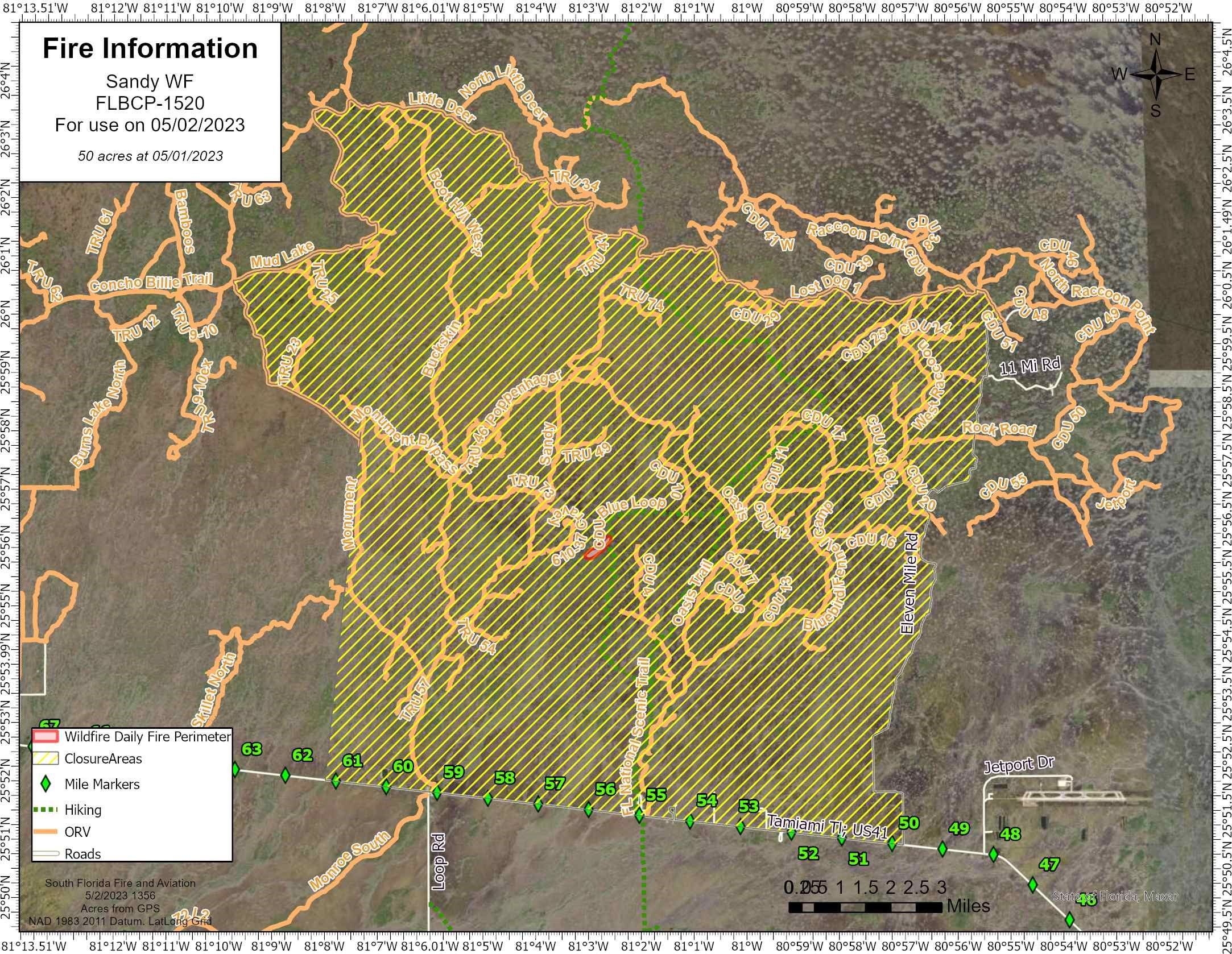
OCHOPEE, FL – Yesterday, May 1st, at approximately 3:30 PM, a wildfire was discovered in Big Cypress National Preserve, located just west of the Blue Loop portion of Florida Trail. The Sandy Wildfire is currently estimated to be about 50 acres, burning in a mixture of grass, brush and pine. South Florida Fire & Aviation resources are on scene, and additional resources have been ordered.Big Cypress National Preserve has issued a temporary trail closure to promote visitor safety during current wildfire activity effective immediately, May 2, 2023. During the closure all recreational use including off-road vehicles, hiking, camping, hunting and commercial activities are prohibited in the designated areas.
Please refer to the provided map and area description below, temporary closures include the following areas:
Closures Include All Trails and Roadways
- West of 11 Mile Road
- North of US41
- East of Monument Trail
- South of Mud Lake, Little Deer, Oasis Trail, and Lost Dog
- Florida Trail from Oasis Visitor Center to I75 (MM63) including all campsites
- Private lands in the designated area; residents should use caution and notify the Fire Duty Officer of entry by calling 561-923-5228.
Last updated: May 3, 2023
