



News Release
You are viewing ARCHIVED content
This content was published online before January 20, 2025. Please note that this content is NOT UPDATED, and links may not work. For current information, visit https://www.nps.gov/aboutus/news/index.htm.
NPS Maps
News Release Date: March 6, 2024
Contact:
Riki Hoopes
Prescribed fire is a carefully planned fire that uses fire science and specific environmental conditions to meet management goals for the preserve. A prescribed fire is one of Big Cypress’s best tools to help create a mosaic of diverse habitats, manage for our endangered species, and reduce the threat of a destructive wildfire.
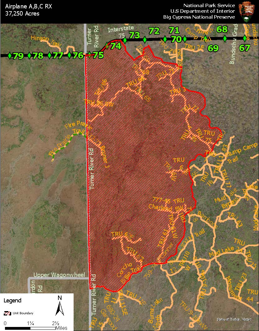
Please refer to the provided map and area description below, temporary closures include the following areas:
• All areas within the perimeter of the unit
• Concho Billie Trail North Entrance (see map)
• Concho Billie Trail (all areas within treatment unit-see map)
• TRU 62
• TRU 62E
• TRU 61
• TRU 61 W
• TRU 8
• TRU 8W
• TRU 6
• TRU 6W
• TRU 65
• TRU 66
• TRU 68
• TRU 1
• TRU 67
• TRU 70
• TRU 69
• TRU 71
• TRU 2 (all areas within the treatment unit-see map)
• TRU 3
• TRU 72
• TRU 4
• TRU 4S
• TRU 5
• TRU 75
• TRU 86 SW
• TRU 86 NW
• TRU 86
• TRU 69
• A32-77 Bruner J
• A32-75 Hill
The following adjacent areas will remain open:
- Private lands in the designated area; residents should use caution and notify the Fire Duty Officer of entry by calling 561-923-5228.
Last updated: March 6, 2024