Falls Trail

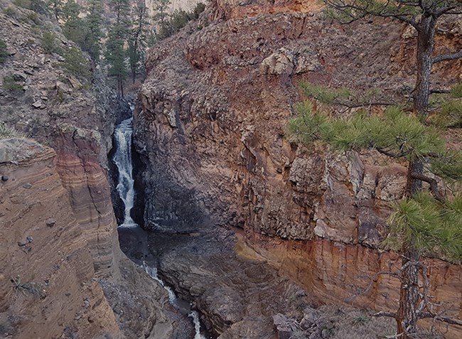
upper falls 31719
Upper Falls

Photo by Sally King

Find out what the trail is like before you hike. Do a virtual tour here.
Also a virtual trail guide for the Falls Trail can be found
here.

The Falls Trail starts at the end of the Backpacker's Parking Lot near the visitor center. The trail descends 400 vertical feet in its 1.5 mile length to the Upper Falls. A beautiful trail in any season, this trail is not cleared of snow in the winter and can be extremely icy. There are steep dropoffs along the trail and plank bridges across the creek. Keep children close at all times and watch for wildlife. Take plenty of water. Water from the creek should not be drunk without first treating it.

THIS TRAIL IS NOT ACCESSIBLE TO WHEELCHAIRS OR STROLLERS.

 
Visit our keyboard shortcuts docs for details
Duration:
26 seconds

The Upper Falls is an excellent hike right now. Snow and ice are gone from the trail but large runoff from snow melt is making the falls spectacular.

 
rock fall on the falls trail
Flooding in 2011 and 2013 lead to massive erosion in this canyon.  The Falls Trail used to lead to the Rio Grande but now stops at the Upper Falls.

Photo by Sally King

 
tent rocks
Tent rocks can be found in several locations along the Falls Trail.  Tent rocks form when more resistant rock is left after softer rock is eroded to form a tent-like structure.

Photo by Sally King

 
basalt tuff boundary
Hiking down this trail you will pass through an area that was once the main channel of the Rio Grande.  The large explosions of ash from the Jemez Mountains moved the Rio to its current location over a 1/2 mile down creek.

Photo by Sally King

 
cu upper falls
Upper Falls (in the background) is just one of many falls on Frijoles Creek.  Falls form wherever more resistant rock like basalt slows the erosional process.

Photo by Sally King

 
maar volcano deposits
The Falls Trail is a good place to look at geology, especially volcanology.  Just across the creek from the Upper Falls you will see maar volcano deposits.  Maar deposits occur when molten rock is erupted through water at or near the earth's surface.

Photo by Sally King

 
below upper falls
When hiking in the canyon look for trees like these in the upper right hand corner of this image.  These are cottonwoods that stand over 30 feet tall.  Notice the damage to their upper limbs.  These trees survived several major floods in 2011 and 2013.  Imagine how high the water and debris was to incite this type of destruction.

Photo by Sally King

Last updated: March 21, 2022

Park footer

Contact Info

Mailing Address:

Bandelier National Monument
15 Entrance RD

Los Alamos, NM 87544

Phone:

505 672-3861 x0

Contact Us