Part of a series of articles titled Coastal Geomorphology—Storms of Record.
Previous: Great Storm of ‘88
Next: Hurricane Andrew (1992)
Article

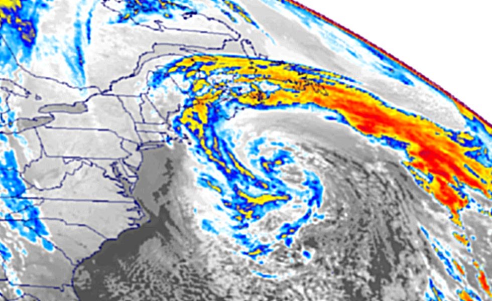
NOAA image.
Also known as the Halloween Storm, “The Perfect Storm” of literary and Hollywood fame wracked the Atlantic seaboard in late October 1991 and sunk the Andrea Gail. On 30 October 1991, this nor’easter reached peak intensity when it was 340 miles (547 km) south of Halifax, Nova Scotia, but the storm had been building since 28 October 1991 when it killed the six crew members of the Andrea Gail. Oddly, this storm was neither one of the worst in terms of wind severity or precipitation nor in overall impact to people and property. Rather, it was “an extraordinary confluence of atmospheric ingredients” and “unique in its evolution” (Ostro 2006).
In late October and November the eastern United States experiences rapid changes in weather. To the west, cold Canadian air masses regularly envelope the Midwest. To the east, the Atlantic Ocean loses its stored summer heat more slowly than the continent, and hurricanes sometimes form over the warm waters. The contrast between two very dissimilar air masses (i.e., cold to the west and warm to the east) often results in massive storms just offshore North America. These tempests, called “nor’easters” in the Atlantic states, have sunk many ocean vessels (Mcgahee 2008), and indeed, The Perfect Storm lived up to this reputation with the Andrea Gail. In addition to this storm’s legacy in popular culture, however, the storm’s evolution is noteworthy. The Perfect Storm began as an extratropical system, absorbed a tropical system (i.e., Hurricane Grace), and ended somewhat uneventfully as an unnamed hurricane. According to The Weather Channel’s senior meteorologist Stu Ostro, “a non-tropical system absorbing a tropical one is not unprecedented, nor is a tropical cyclone developing from a non-tropical system. But for both processes to occur with the same system, not to mention one of this magnitude, is what made the cyclone so amazing. To me, this was the ultimate ‘hybrid’ storm” (Ostro 2006).
A state by state damage summary reveals the widespread impacts caused by the storm. Most memorably in the public psyche may be the damage suffered to then-President George H. W. Bush’s house in Kennebunkport, Maine, where windows were blown out, water flooded the building, and some structural damage occurred. Yet, coastal areas from Massachusetts to Puerto Rico experienced flooding and high winds, and beach erosion was severe and widespread. Hundreds of homes and businesses were knocked from their foundations. Sea walls, boardwalks, bulkheads, and piers were reduced to rubble. Numerous small boats were sunk at their berths, and thousands of lobster traps were destroyed. The Hudson, Hackensack, and Passaic rivers all experienced tidal flooding, and high winds brought down utility poles, power lines, tree limbs, and signs. The most extensive damage occurred in New England where federal disaster areas were declared for seven counties in Massachusetts, five in Maine, and one in New Hampshire. The National Park Service’s weather and climate inventory for the Northeast Coastal and Barrier Network recognizes The Perfect Storm as an example of an extreme storm event that introduced large-scale disturbances into National Park System units such as Assateague (Maryland), Cape Cod (Massachusetts), Fire Island (New York) national seashores, and Gateway National Recreation Area (New York) (Davey et al. 2006).
Part of a series of articles titled Coastal Geomorphology—Storms of Record.
Previous: Great Storm of ‘88
Next: Hurricane Andrew (1992)
Last updated: May 30, 2019