Part of a series of articles titled Coastal Geomorphology—Tropical Storms.
Previous: Anatomy of a Hurricane
Article

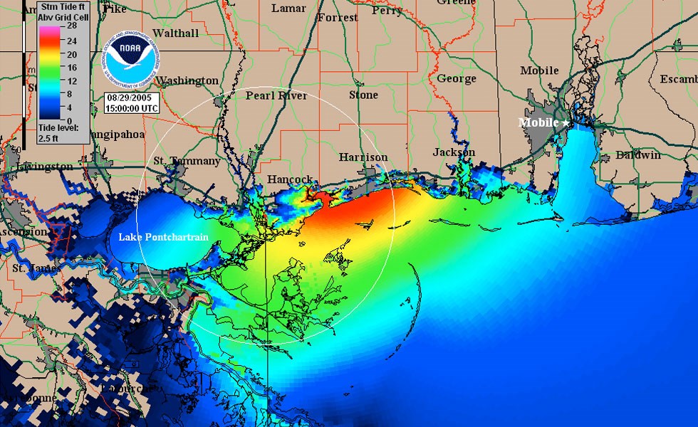
NOAA image.
Storm surge is the water that advances toward the shore by the force of the winds swirling around a storm. Most (>85%) of the storm surge is caused by winds pushing the ocean surface ahead of the storm. This advancing surge combines with the tide, and the sudden rise in water level can cause severe flooding in coastal areas, particularly when the storm surge coincides with periods of high tides. In areas where there is a significant difference between low tide and high tide, storm surges can be particularly damaging when they occur at the time of a high tide (National Hurricane Center 2009).
In addition to the storm’s meteorology (e.g., wind speed and size), the level of surge in a particular area is determined by the slope of the continental shelf and the shape of the coast. A shallow slope off the coast will allow a greater surge to inundate coastal areas. Areas with a steeper continental shelf will not have as much surge inundation, although large breaking waves can still present major problems (National Hurricane Center 2009).
During Hurricane Katrina (2005), storm surge along the Mississippi coast reached 30 feet (9.1 m) in height. Pilkey and Young (2009) describe the effect of storm surge during this 2005 hurricane: “Imagine having a high tide that is 30 feet (9.1 m) higher than normal. Now, imagine there are hurricane-driven waves on top of that extra-high tide. That is the impact of the storm surge.”
Part of a series of articles titled Coastal Geomorphology—Tropical Storms.
Previous: Anatomy of a Hurricane
Last updated: June 4, 2019