Last updated: April 9, 2020
Article
Site Unseen: Remote Sensing at Fort Frederica
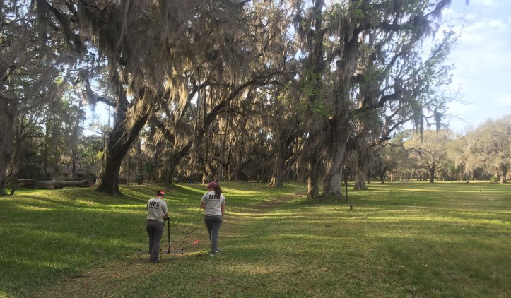
Five archeologists from the Southeast Archeological Center (SEAC) spent twelve days in March conducting a remote sensing survey at Fort Frederica National Monument (FOFR) as part of a project to identify and document subsurface cultural features at the park. Remote sensing allows SEAC to conduct non-invasive mapping of archeological sites to determine where cultural deposits may exist. Once the survey data has been completely analyzed, it will provide new insights into portions of the site that are not as well documented archeologically as other portions of the site.
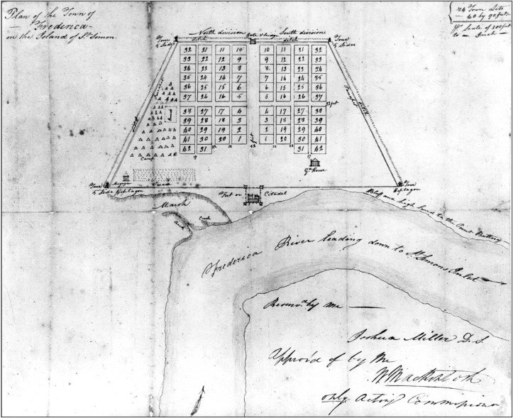
If you are unfamiliar with Fort Frederica, it was established in 1736 along the southeast coast of present-day Georgia. The fort was built on St. Simons Island, along the Frederica River, by General James Oglethorpe to help defend the British colony of Georgia from attack by the Spanish in Florida. The town of Frederica was established next to the fort and both were surrounded by an outer defensive wall. As military needs changed, the fort was abandoned in the mid-18th century and the town would follow suit in the late 18th century.

NPS, SEAC
You can learn more about the history of Fort Frederica here.
Although the fort itself is the reason for the park’s existence, it is important to note that the cultural history of the area where Fort Frederica and the town once stood goes back long before the British colonists arrived. Evidence suggests people have lived on St. Simons Island at least since the Late Archaic period (3-5,000 years ago). While it is expected that data from the survey will reflect the colonial occupation of the site, it is also possible that evidence of earlier occupations will come to light in ways not previously identified.
In order to conduct the survey, SEAC brought several remote sensing instruments (including a Ground Penetrating Radar (GPR) unit, a magnetometer unit, an electrical conductivity unit, and a resistivity unit) to survey the northern half of the historic town.

NPS, SEAC

NPS, SEAC

NPS, SEAC

NPS, SEAC
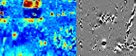
The survey consisted of a grid of 85 blocks, each 20 x 20 meters, covering an area 34,000 square meters in size, making this SEAC’s largest remote sensing survey to date using this equipment! Various types of instruments were used because each one has a different technique to “see” beneath the surface. Because certain types of equipment are better at locating certain kinds of cultural features than others, a more complete subsurface picture is created by combining the data from each unit.
Learn more about the specific remote sensing equipment SEAC has and how the machines operate by visiting this page.
Currently, SEAC archeologists are in the process of analyzing the data collected by the remote sensing units.

NPS, SEAC
Once all of the data has been analyzed and compared, plans will be made to return to FOFR and ground truth select anomalies discovered during the survey. Excavation will help determine what these anomalies are and how they fit within the history of the site. The resulting work will add to our knowledge of the site and provide more information that can direct how the site is interpreted to the general public.
SEAC also visited FOFR earlier in the year to help girl scouts earn their Girl Scout Ranger Program certificates and patches. You can read more about it here.
