Last updated: November 28, 2018
Article
River Connections: 50 Years of Wild and Scenic Rivers
"In spite of the durability of rock-walled canyons and the surging power of cataracting water, the wild river is a fragile thing—the most fragile portion of the wilderness country."
- John Craighead, biologist and one of the architects of the Wild and Scenic Rivers Act
Rivers, Land, and People
NPS Photo
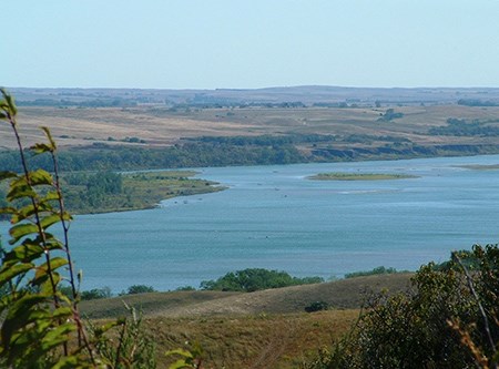
In the United States, American Indian communities settled in river valleys and floodplains, realizing the importance of water and its ability to sustain life. These biologically diverse areas provided opportunities to hunt and gather. Rivers supported a reliable source of drinking water, plants and animals for sustenance, fertile land for agriculture, and a system for transportation. As importantly, rivers were interconnected with the cultural traditions and spiritual beliefs of native peoples.
Rivers have also played a key role in the economic development of our nation. They provided efficient routes for transportation and helped facilitate migration of people, food, and trade goods. The introduction of steamboats in the early 1800s brought the construction of man-made canals and shipping channels. Americans found innovative ways to utilize free-flowing rivers to their advantage, converting these natural waterways into hubs of commerce and travel.
NPS Photo / Janis Burger
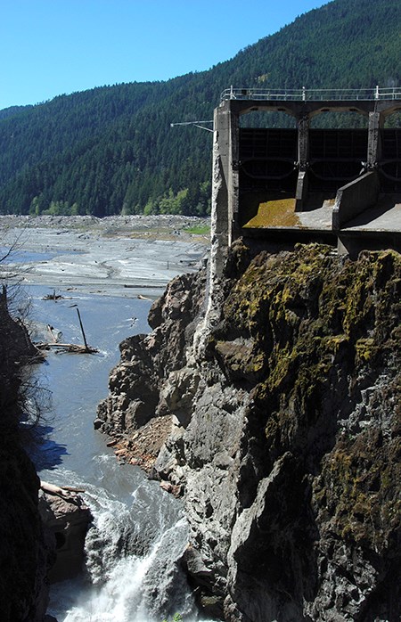
Hydroelectric dams helped power the nation's economy in the early 1900s, increasing the power supply for communities and mitigating the risk of seasonal flooding. Water districts built massive dams to store water for irrigation and to meet the demands of a growing urban population. The 1950s and 60s saw the peak of dam construction in America. However, the era of dams plugged rivers, submerging scenic and culturally significant valleys and halting important natural processes, such as downstream sediment movement and upstream fish migration. As the public became aware of the negative impacts caused by obstructing the natural free-flow of our rivers, a movement was afoot to defend the nation’s remaining pristine waterways.
Two prominent figures played a particularly major part in the establishment of the National Wild and Scenic Rivers System. In 1957, renowned wildlife biologists Frank and John Craighead, known for their work on the restoration of Yellowstone Grizzlies, got involved in the fight against the construction of the Spruce Park dam along the Flathead River. Concerned about the future of America’s most pristine rivers, the Craighead brothers started a campaign to educate the public on the value of unaltered rivers and streams.
The Craighead brothers rallied community and national support for legislation to protect our wild rivers. Their dedication to preserving the last of our free-flowing rivers resulted in the passage by Congress of the Wild and Scenic Rivers Act, signed into law by President Lyndon B. Johnson on October 2, 1968.
For the past half century, the Act has served to protect and enhance our nation’s most spectacular rivers, serving as a valuable tool to balance development and preservation. Initially created to offset the increase in dam construction that came in the mid 1900s, this forward-looking piece of legislation continues to preserve the special character and outstanding values of our Wild and Scenic Rivers.
Cultural Landscape Preservation
The NPS Park Cultural Landscapes Program uses a system of individual and collective characteristics to describe the tangible and intangible elements that give a historically-significant landscape its character. These 13 landscape characteristics, which include natural systems and features, spatial organization, and topography, are applied to both the naturally-occurring processes and the built forms that influenced or reflect the landscape history.
The histories of many cultural landscapes in the national parks intersect with rivers. Rivers are often the "point of beginning" of landscapes, giving rise to landforms, supporting vegetation and animals, and serving as the alighting point for humans arriving by vessel. Rivers are recognized as significant historic systems within cultural landscapes, and their protection is vital to the continued health and preservation of the landscape.
Landscape Lines 3: Landscape Characteristics - A guide to the development and application of the classification system used to describe the character and condition of cultural landscapes.
Landscape Characteristics 101 - A visual summary of the characteristics used by the NPS to evaluate historic significance and integrity of landscapes.
Wild and Scenic Rivers
NPS Photo / Shari Quinn
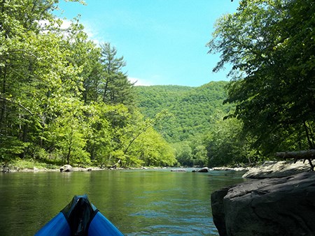
The Wild and Scenic Rivers System preserves selected rivers in their free-flowing conditions for the benefit and enjoyment of present and future generations. Rivers designated in this system must be free flowing and have at least one Outstandingly Remarkable Value (ORV) that is unique, rare, or exemplary to the region or nation.
History, Culture, and Recreation are ORVs that represent our human connection to rivers. Historic values symbolize important historic events or past land use, which may take the form of structures, artifacts, or petroglyphs. Cultural values signify the importance of the river to a people’s identity, such as the Noatak River to the Noatak Village in the Northwest Arctic Borough of Alaska. Recreation refers to pure enjoyment of rivers, from whitewater boating to fishing, canoeing to hiking, and nature viewing to camping.
Of the 60 specially designated rivers the National Park Service manages, nearly every one has at least one historic, cultural, or recreational ORV!
Outstandingly Remarkable Values (ORVs) are river-related resources that are unique, rare, or exemplary in a regional or national context. An ORV must be directly river-related, such that it is located in the river or on its immediate shorelands and meets at least one of the following criteria:
-
Contributes substantially to the function of the river ecosystem, or
-
Owes its location or existence to the presence of the river.
Types of ORVs include, but are not limited to:
- Scenery
- Geology
- Fish
- Wildlife
- History
- Culture
- Recreation
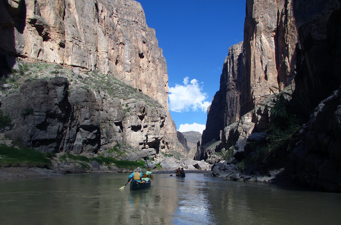
Though the NPS and other federal agencies administer Wild and Scenic Rivers, state and local governments, non-profit organizations, and local communities provide key assistance to managing these waterways. Local governments determine appropriate forms of land use along the rivers, set zoning requirements, and ensure compliance with regulations associated with the Act. Communities that live and recreate along Wild and Scenic Rivers play a major role in their protection through volunteer stewardship and participation in the development of river management plans.
Because of this strong partnership, over 12,700 miles of America’s most outstanding rivers are protected for the enjoyment of present and future generations.
NPS Photo
50th Anniversary of the Wild and Scenic Rivers Act
October 2, 2018 marks the 50th Anniversary of the Wild and Scenic Rivers Act. Communities, non-profit organizations, federal and state agencies, and river-enthusiasts across the country are celebrating half a century of river protection.
To celebrate, check out these videos about two very different rivers, protected from coast-to-coast under this Act.
Mississquoi and Trout Wild and Scenic Rivers, Vermont
The Mississquoi and Trout Wild and Scenic Rivers are two partnership rivers that flow through a patchwork of different lands in rural Vermont. This part of New England is layered with cultural history; including settlement by indigenous peoples, early British colonial and Revolutionary War history, and 19th century development. Local communities collectively manage these rivers with assistance from the National Park Service.
The designated rivers include the greatest concentration of covered bridges in any town in the country. All built by the Jewett brothers in the 1800s and listed to the National Register of Historic Places, these bridges are popular destinations for sightseers along the river and add to the local character of the region.
The protection of these rivers is connected to the preservation of the cultural and historic resources along their shores. National and state protections help to maintain and preserve historic bridges, downtown historic districts with their accompanying zoning laws, and pre-contact archeological sites.
Watch River Connections to learn about rivers in the Northeast that are managed collaboratively through the NPS in partnership with local governments, councils, watershed groups, and non-governmental organizations:
Noatak Wild and Scenic River, Alaska
Situated north of the Arctic Circle in Noatak National Preserve and Gates of the Arctic National Park & Preserve, the Noatak River is the longest free-flowing river in the Wild and Scenic Rivers System. Thousands of years ago, people that crossed into North America from Asia utilized the resources of the river valley, leaving impressive arrowheads, tools, and carvings throughout the region.
Today, Native Alaskan tribes still rely on the Noatak River for a subsistence lifestyle. People in the Noatak Village still use salmon from the river and berries from the land as primary food sources. For these communities, preserving the river so that future generations can carry on their traditions is essential.
Watch Noatak - Wild & Scenic to experience the Noatak River “through the eyes of the people whose lives and livelihoods have long depended on its waters and wildlife.”
NPS Photo / Jason Burton
Into the Next 50 Years
The Wild and Scenic Rivers Act arose from efforts to balance the use of rivers for economic activity, power, and water supply with their preservation, conservation, and recreation. Fifty years ago, the Craighead Brothers’ vision of a wild rivers system set aside for future generations came to life, amassing into a system of 209 rivers as of 2018.
Now as one reflects on the past 50 years of protecting Wild and Scenic Rivers, one can look forward to the next 50 knowing the power of this Act to protect the natural and cultural significance of rivers and their surroundings.


