Last updated: July 17, 2024
Article
NPS Geodiversity Atlas—Weir Farm National Historic Site, Connecticut
Geodiversity refers to the full variety of natural geologic (rocks, minerals, sediments, fossils, landforms, and physical processes) and soil resources and processes that occur in the park. A product of the Geologic Resources Inventory, the NPS Geodiversity Atlas delivers information in support of education, Geoconservation, and integrated management of living (biotic) and non-living (abiotic) components of the ecosystem.

Introduction
Weir Farm National Historical Park (WEFA) in located in the towns of Ridgefield and Wilton in Fairfield County, southern Connecticut. Authorized on October 31, 1990, WEFA contains approximately 30 hectares (74 acres) and preserves the home, studio, farm, and agricultural setting that inspired artist Julian Alden Weir’s transition into American Impressionism. The farm was home to three generations of American artists, Julian Weir (painter); his daughter Dorothy Weir Young (painter) and husband Mahonri M. Young (sculptor); followed by Sperry and Doris Andrews (painters). The landscape surrounding WEFA includes successional old fields, mesic successional hardwood forests, vernal wetland areas, streams, a pond, and exposed bedrock ridges. The park unit contains 15 historic structures as well as gardens, orchards, terraces, fields, stone walls, 5 km (3 mi) of hiking trails, and hundreds of historic painting sites. Additionally, the museum collection at WEFA contains more than 200,000 archives and objects including original paintings, prints, sculptures, decorative arts, and furnishings associated with the Weir, Young, and Andrews families (National Park Service 2017e). Representing the only national park unit dedicated to American painting, WEFA was intentionally designed by artists to capture the power of light and color associated with the style of Impressionism.
Geologic Setting
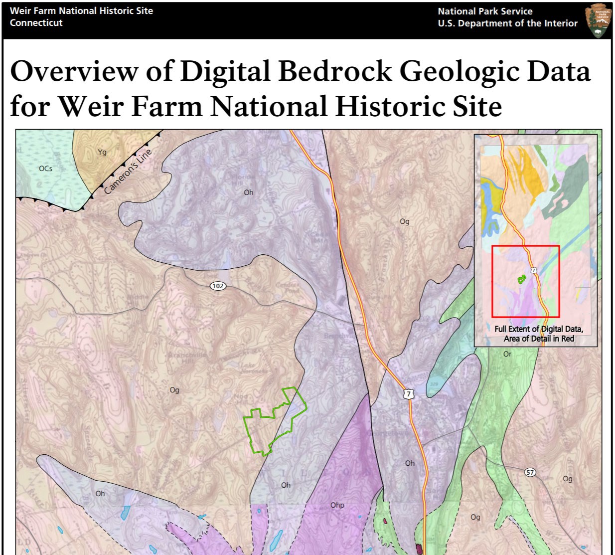
Weir Farm National Historical Park is situated in the Western Uplands physiographic province of Connecticut, a region characterized by north–south trending bands of rock reflecting a long history of orogenesis (mountain building) associated with the Appalachian Mountains. The landscape of WEFA features hills, shallow stream valleys, meadows, bedrock exposures, and glacial erratics that inspired Julian Alden Weir’s paintings (Thornberry-Ehrlich 2012). The bedrock underlying WEFA consists entirely of Ordovician-age metamorphic and meta-igneous rocks. Most of the bedrock pertains to unnamed granitic gneiss. The Harrison Gneiss is mapped in the eastern area of WEFA. During the Pleistocene ice ages, glaciers scoured and reworked the pre-existing landscape of New England, leaving behind erratics and young, unconsolidated till deposits that form a veneer above the older bedrock of the park (London 1984a, 1984b).
Regional Geology
Weir Farm National Historic Site is a part of the New England Physiographic Province and shares its geologic history and some characteristic geologic formations with a region that extends well beyond park boundaries.
- Scoping summaries are records of scoping meetings where NPS staff and local geologists determined the park’s geologic mapping plan and what content should be included in the report.
- Digital geologic maps include files for viewing in GIS software, a guide to using the data, and a document with ancillary map information. Newer products also include data viewable in Google Earth and online map services.
- Reports use the maps to discuss the park’s setting and significance, notable geologic features and processes, geologic resource management issues, and geologic history.
- Posters are a static view of the GIS data in PDF format. Newer posters include aerial imagery or shaded relief and other park information. They are also included with the reports.
- Projects list basic information about the program and all products available for a park.
Source: NPS DataStore Saved Search 3195. To search for additional information, visit the NPS DataStore.
A NPS Soil Resources Inventory project has been completed for Weir Farm National Historic Site and can be found on the NPS Data Store.
Source: NPS DataStore Saved Search 3220. To search for additional information, visit the NPS DataStore.
Related Articles
Weir Farm National Historic Site
National Park Service Geodiversity Atlas
The servicewide Geodiversity Atlas provides information on geoheritage and geodiversity resources and values within the National Park System. This information supports science-based geoconservation and interpretation in the NPS, as well as STEM education in schools, museums, and field camps. The NPS Geologic Resources Division and many parks work with National and International geoconservation communities to ensure that NPS abiotic resources are managed using the highest standards and best practices available.


