Last updated: July 11, 2024
Article
NPS Geodiversity Atlas—Oregon Caves National Monument & Preserve, Oregon
Geodiversity refers to the full variety of natural geologic (rocks, minerals, sediments, fossils, landforms, and physical processes) and soil resources and processes that occur in the park. A product of the Geologic Resources Inventory, the NPS Geodiversity Atlas delivers information in support of education, Geoconservation, and integrated management of living (biotic) and non-living (abiotic) components of the ecosystem.

Introduction
Oregon Caves National Monument and Preserve (ORCA) is located in the northern Klamath Mountains approximately 10 km (6 mi) north of the California–Oregon border in Josephine County, southwestern Oregon. The monument was proclaimed on July 12, 1909 and originally administered by the U.S. Forest Service. Stewardship of ORCA was transferred to the NPS on August 10, 1933. Encompassing approximately 1,843 hectares (4,554 acres), ORCA protects remnant old-growth Douglas fir forest, numerous glacial features, and the longest marble solution cave in the Siskiyou Mountains (Anderson 2017). Although its name is confusingly pluralized, Oregon Caves is a single cave with 4.8 km (3 mi) of interconnected passages (KellerLynn 2011). The entrance to the cave is located on the side of Mt. Elijah, named after the 24-year-old hunter Elijah Davidson who accidentally made the first recorded discovery of the cave in 1874.
Geologic Setting
The geologic history of Oregon Caves National Monument and Preserve spans millions of years and involved the slow dissolution of rock by acidic waters to create a long, continuous marble cave nestled within an unusually diverse array of rock types. The bedrock at ORCA consists of the Triassic–Jurassic Rattlesnake Creek terrane (207– 193 million years old; Wright and Wyld 1994) and Jurassic Josephine ophiolite (157 million years old; Harper 1984), rocks that originated elsewhere and were transported to their current location by plate tectonic processes. The assemblage of rocks consists of complete ophiolite (seafloor) sequences, broken formations (rock units disrupted by faults but retaining continuous strata), and mélange (units of fragmented rock) that were added to the western margin of North America and welded in place by igneous intrusions of the Jurassic-age Grayback pluton (160 million years old; Johnson and Barnes 2006) (KellerLynn 2011). A diverse suite of rock types and minerals is present in ORCA and includes rocks derived from the upper mantle, submarine lavas, terrestrial sediments, plutons, and marble metamorphosed from marine limestone (KellerLynn 2011).
Cave and Karst
The primary feature at Oregon Caves National Monument is Oregon Caves, which is a solution(al) cave developed in marble. The cave has multiple water inputs converging in a stream-like pattern, and a plethora of speleothems produced mainly by dripping water. Protection, preservation, restoration, and interpretation of the cave and karst resources are of primary importance to the national monument.
There are 12 known caves at the Monument, including Oregon Caves which is the largest known cave in the Siskiyou Mountains. There are about 10 endemic cave species including a fly, beetle, millipede, grylloblatid, springtail, and water mite. There are ten species of bats that utilize the Monument.
All NPS cave resources are protected under the the Federal Cave Resources Protection Act of 1988 (FCRPA)(16 U.S.C. § 4301 et seq.).
Geology
The geology of the Monument includes marble of the Applegate Group which is a complex sequence that occurs within the Late Triassic (210 million years ago) Rattlesnake Creek terrane. This unit is gray to white, mostly bedded marble composed of calcite crystals. The marble originated as limestone within a seamount setting. The limestone was metamorphosed to marble as a result of accretion (~170 million years ago) and igneous intrusion (~160 million years ago). The marble is largely surrounded by argillite and metabasalt, and to a lesser extent by the quartz diorite of the Grayback Pluton.
Accreted terranes
Situated on the continental margin of the North American plate, the Klamath Mountains physiographic province has repeatedly been the site of collision and accretion (gradual addition) of fragments of tectonic plates called “terranes.” The accretion of terranes expanded North American towards the west. The terrane underlying most of Oregon Caves National Monument is the Rattlesnake Creek terrane.
Ophiolites
The Josephine ophiolite underlies the Cave Junction part of the national monument. It is one of the largest and most complete ophiolite sequences in the world. The Josephine ophiolite is famous for its massive sulfide deposits, which yield gold, silver, copper, zinc, and cobalt.
Grayback pluton
In addition to the rocks of the Rattlesnake Creek terrane and Josephine ophiolite, Oregon Caves National Monument hosts plutonic rocks. The molten material of the Grayback pluton was intruded into the rocks of the Rattlesnake Creek terrane about 160 million years ago. Dikes of the Grayback pluton are repeatedly exposed within the marble block of Oregon Caves. Plutonic intrusions metamorphosed much of the limestone (to marble) in the contiguous area.
Mining and mineral resources
Mining began in southern Oregon in 1850, with the discovery of gold, in what is now Josephine County, the county in which Oregon Caves National Monument is situated. The presence of precious metals in southwestern Oregon relates to plate tectonics, primarily mineralization as part of past seafloor spreading, but also the formation of mineral ores as a result of intrusion of plutons. Gold, silver, copper, nickel, and chromium have been important commodities to the economy of Josephine County. In addition, marble used as building stone has been a significant industrial product.
Paleontological Resources
The cave preserves vertebrate fossils of scientific importance. To date, investigators have documented more than 50 paleontological localities within the cave passages of Oregon Caves, and the potential is high for additional localities and collection sites (Santucci and Kenworthy 2009).
By contrast to the mostly unfossiliferous bedrock at the national monument, the cave sediments within Oregon Caves preserve an impressive collection of fossils. These fossiliferous cave sediments range in age from less than 10,000 years old to at least 120,000 years old; some may be as old as 1.5 million years (Santucci et al. 2001).
In 1995, NPS paleontologist Greg McDonald identified the remains of a jaguar (Panthera onca), black bear (Ursus americanus), and grizzly bear (Ursus arctos) from Oregon Caves. The limb bone from the grizzly bear yielded a radiocarbon date greater than 50,000 years old, which at the time represented the oldest known grizzly bear remains from North America (Santucci et al. 2009). The jaguar remains, which are 38,600 years old (National Park Service 2006), represent the most complete North American jaguar outside of Appalachia (Santucci et al. 2009) and the northernmost jaguar remains ever found (John Roth, chief of Resources Management, Oregon Caves NM, written communication, June 15, 2011).
Quaternary vertebrate remains also include trace fossils. For example, an exceptionally well-preserved claw print, likely from a bear or cat, shows five claw points pushed into the mud. Moreover, at least 20 distinct claw scratch marks are preserved in the cave sediments (National Park Service 2006; Santucci et al. 2006).
Between 1997 and 2000, investigators from Northern Arizona University conducted an inventory of paleontological resources within Oregon Caves. Field crews sieved, cleaned, and dried approximately 270 kg (600 lbs.) of sediments from several localities within the cave (Santucci and Kenworthy 2009). The inventory yielded numerous faunal remains, with salamanders being the most common fossil. The majority of the salamander remains belonged to a large and complex group of plethodontids (lungless salamanders), including the genera Aneides and Dicamptodon (Mead et al. 2000). Investigators identified the following remains to the genus level: western alligator lizard (Elgaria), western skink (Plestiodon), fence lizard (possibly Sceloporus), rubber boa (Charina), shrew (Sorex), shrew-like mole (Neurotrichus), jumping mice (Zapus), deer mice (Peromyscus), harvest mice (Reithrodontomys), packrat (Neotoma), mountain beaver (Aplodontia), smoothtoothed pocket gophers (Thomomys), vole (Cleithrionomys, Microtus, and Phenacomys/Arborimus), rabbit (Lepus and Sylvilagus), bear (Ursus), skunk (Spilogale), and deer (Cervus and Odocoileus) (Mead et al. 2000). The inventory also uncovered sciurids (rodents), colubrids (nonvenomous snakes), bats, snails, birds, and a rare anuran (frogs/toads) (Santucci et al. 2001; National Park Service 2006).
All NPS fossil resources are protected under the Paleontological Resources Preservation Act of 2009 (Public Law 111-11, Title VI, Subtitle D; 16 U.S.C. §§ 470aaa - 470aaa-11).
Regional Geology
Oregon Caves is a part of the Pacific Border Physiographic Province and shares its geologic history and some characteristic geologic formations with a region that extends well beyond park boundaries.
- Scoping summaries are records of scoping meetings where NPS staff and local geologists determined the park’s geologic mapping plan and what content should be included in the report.
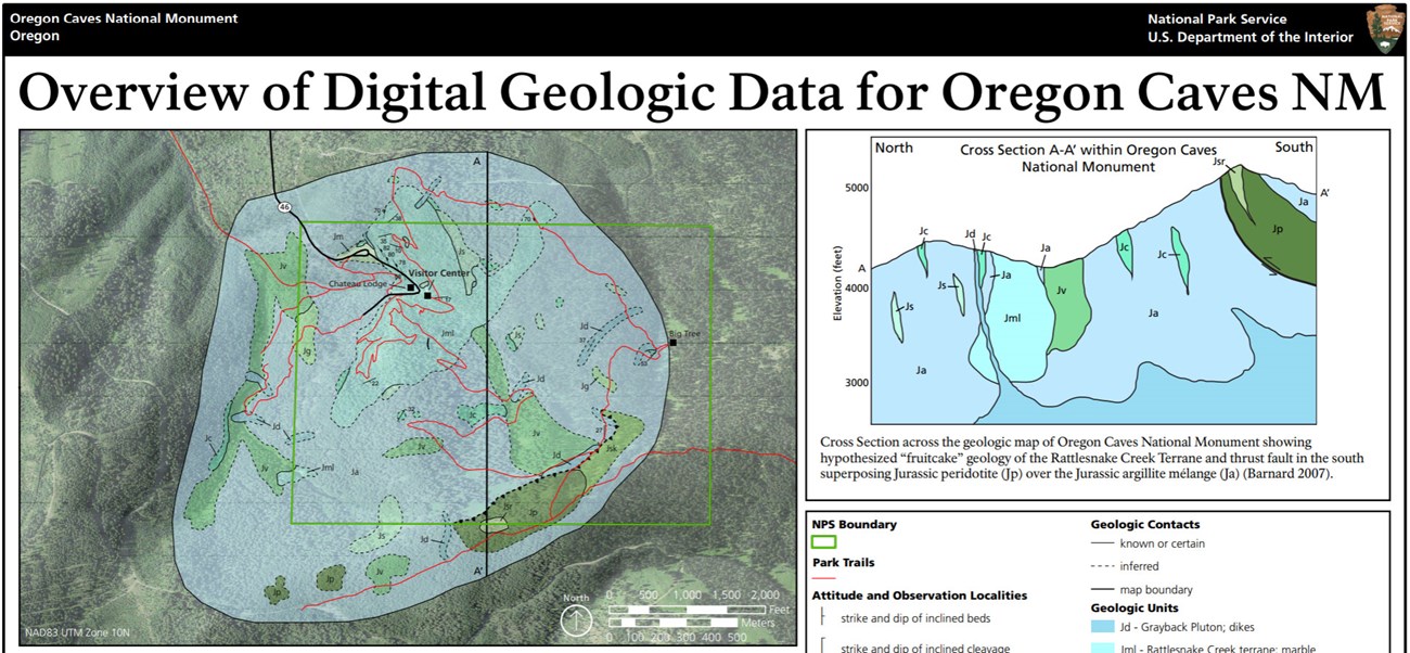
- Digital geologic maps include files for viewing in GIS software, a guide to using the data, and a document with ancillary map information. Newer products also include data viewable in Google Earth and online map services.
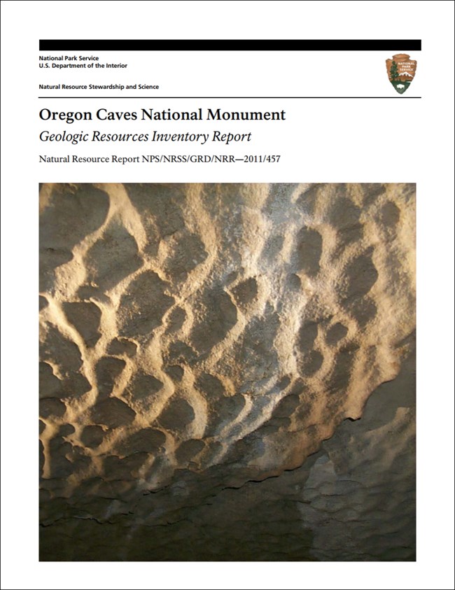
- Reports use the maps to discuss the park’s setting and significance, notable geologic features and processes, geologic resource management issues, and geologic history.
- Posters are a static view of the GIS data in PDF format. Newer posters include aerial imagery or shaded relief and other park information. They are also included with the reports.
- Projects list basic information about the program and all products available for a park.
Source: NPS DataStore Saved Search 3039. To search for additional information, visit the NPS DataStore.
A NPS Soil Resources Inventory project has been completed for Oregon Caves National Monument & Preserve and can be found on the NPS Data Store.
Source: NPS DataStore Saved Search 3086. To search for additional information, visit the NPS DataStore.
Related Articles
Oregon Caves National Monument & Preserve
National Park Service Geodiversity Atlas
The servicewide Geodiversity Atlas provides information on geoheritage and geodiversity resources and values within the National Park System. This information supports science-based geoconservation and interpretation in the NPS, as well as STEM education in schools, museums, and field camps. The NPS Geologic Resources Division and many parks work with National and International geoconservation communities to ensure that NPS abiotic resources are managed using the highest standards and best practices available.


