Last updated: March 16, 2026
Article
Siege of Boston Map
Following the battles at Lexington and Concord on April 19, 1775, Boston became the center of a quickly developing war between rebelling colonists and the forces of the British government. Colonial militia from Massachusetts, Connecticut, New Hampshire, and Rhode Island formed an Army of New England to surround and contain the British forces occupying Boston. Over the course of the next 11 months, both sides engaged in what became known as the Siege of Boston.
This period included the devastating Battle of Bunker Hill on June 17, 1775, countless skirmishes and small engagements, regular periods artillery fire, and a constant buildup of defensive lines on both sides. In early March, 1776, the Continental Army under command of George Washington successfully fortified Dorchester Heights to the south of Boston. The control of these heights ultimately forced the British troops out of town. The final evacuation of the British by sea on March 17, 1776 marked the end of the Siege of Boston.
Explore the sites of fortifications, confrontations, and conflicts on this map. Select the points or lines on the map to learn more. You can manipulate the transparency of the 1775/6 Siege of Boston map layer to locate the approximate place in modern metro Boston.
During the Siege, many of those loyal to the British government remained confined inside Boston. This included the artist Henry Pelham. With a pass from British authorities, Pelham surveyed and observed the defensive lines inside Boston and throughout Boston Harbor. When mapping the areas outside of British control, Pelham relied on careful observations and personal memory to map the roads, houses, and terrain of the communities of Roxbury, Dorchester, Brookline, Cambridge, and Medford. In the end he created a map that depicted, with great detail, what the siege lines looked like surrounding Boston.
Like many loyalists, Pelham evacuated Boston after the siege. He ultimately settled in London and published his map "A Plan of Boston in New England with its Environs..." in 1777. Using other primary sources, secondary accounts, as well as the surviving terrain and landmarks in the area, we used Photoshop and GIS resources to manipulate and correct Henry Pelhams’ work so that it fit accurately on a modern digital map.
Featured Stories of the Siege
-
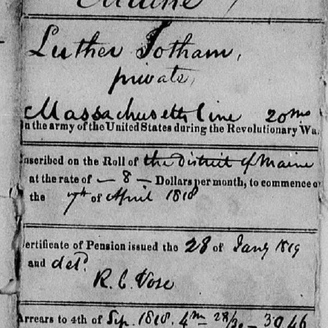 Journey for Country and CommunityLuther Jotham
On paper, Luther Jotham's Revolutionary War service record reads like a typical service record of a Minute Man from rural Massachusetts.
-
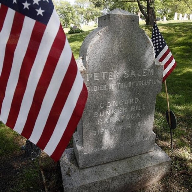 Peter Salem
Peter Salem most notably fought in the Battle of Bunker Hill, and some observers attributed the death of Major John Pitcairn to him
-
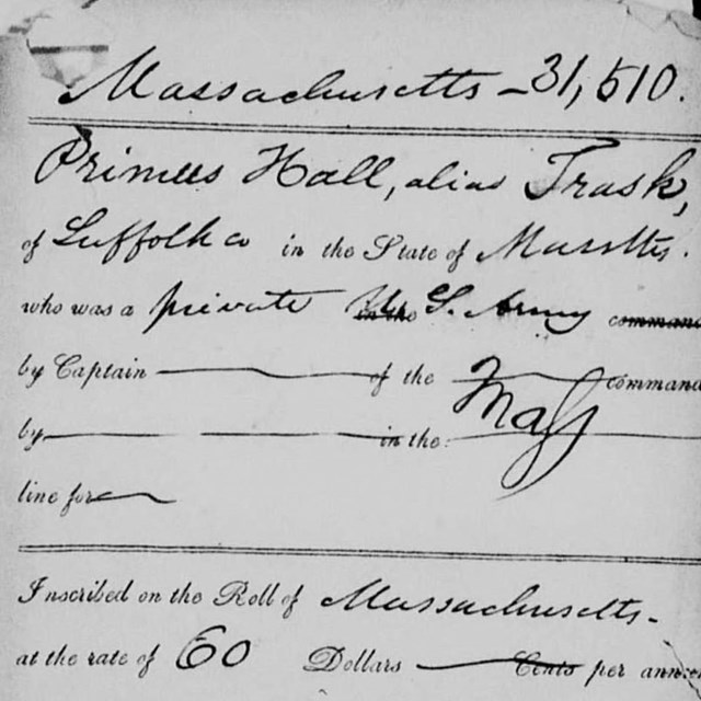 A Revolutionary Life of ServicePrimus Hall
Follow Primus Hall's journey from Revolutionary War soldier to respected community leader on Black Beacon Hill.