Last updated: June 13, 2023
Article
A Zone of Its Own - Adventures in Rocky Intertidal Monitoring
By Mosaics in Science Intern Jailyn Hoskins, San Francisco Bay Area Network Science Communication Team

NPS / Environment for the Americas / Jailyn Hoskins
June 2022 - After my experience hiking in Pinnacles to monitor falcons, I was hesitant about going off-trail. Hearing that the hike down to our first rocky intertidal destination in Golden Gate National Recreation Area was “mostly downhill” and “short” –music to my ears. Before this internship I had never seen the intertidal zone but was already anticipating being on the shore in the early morning and seeing new creatures for the first time. The intertidal zone is the area between the highest and lowest tides. The San Francisco Bay Area Monitoring Network monitors five intertidal zone sites along the coast.
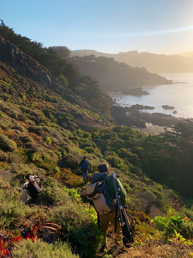
Though the hike was relatively short, it was very steep! It was impressive to see the team slowly ease their way down the slope carrying the necessary items to conduct rocky intertidal habitat surveys at six in the morning. We were there that early to survey areas exposed by some of the lowest tides of the year. These extreme high and low tides are caused largely by the gravitational pull of the full moon, and vary in their timing.
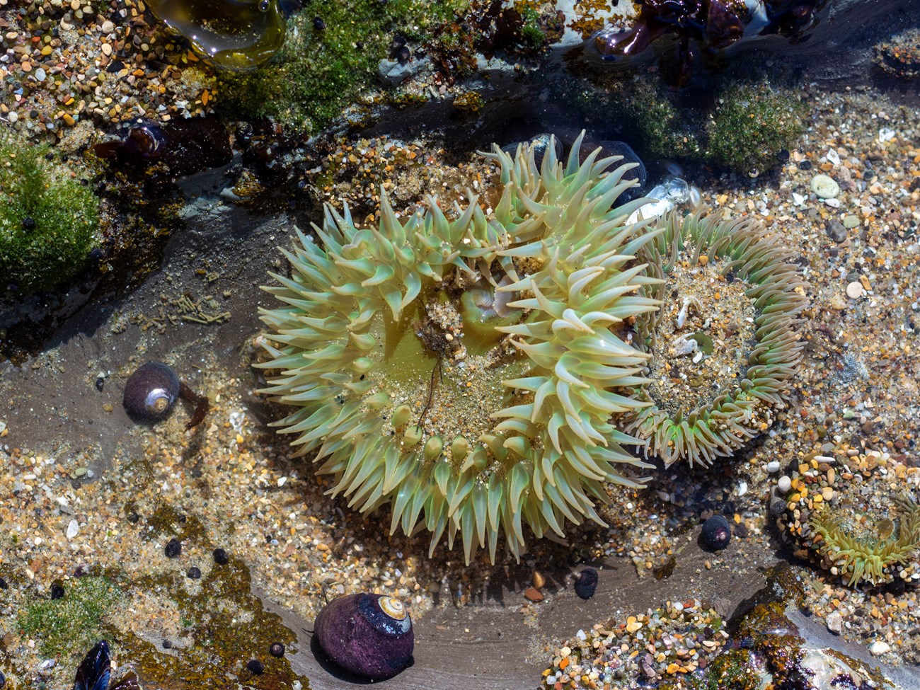
I was very thankful to end the descent and finally put my feet on the rocky shore. Standing on what would soon be the ocean floor again, it felt like I’d stumbled upon a secret no one had ever told me. Across rocky intertidal sites at Golden Gate and Point Reyes National Seashore, I saw colorful claws from a few crabs, who seemed to be happy to be getting some sun. I knew the intertidal stole my heart when I saw a baby ochre star suctioned in a crevice. There were also anemones smaller than quarters, and some larger than my hand. Someone even mentioned that some of the larger anemones we saw were over 60 years old!

NPS / Environment for the Americas / Jailyn Hoskins
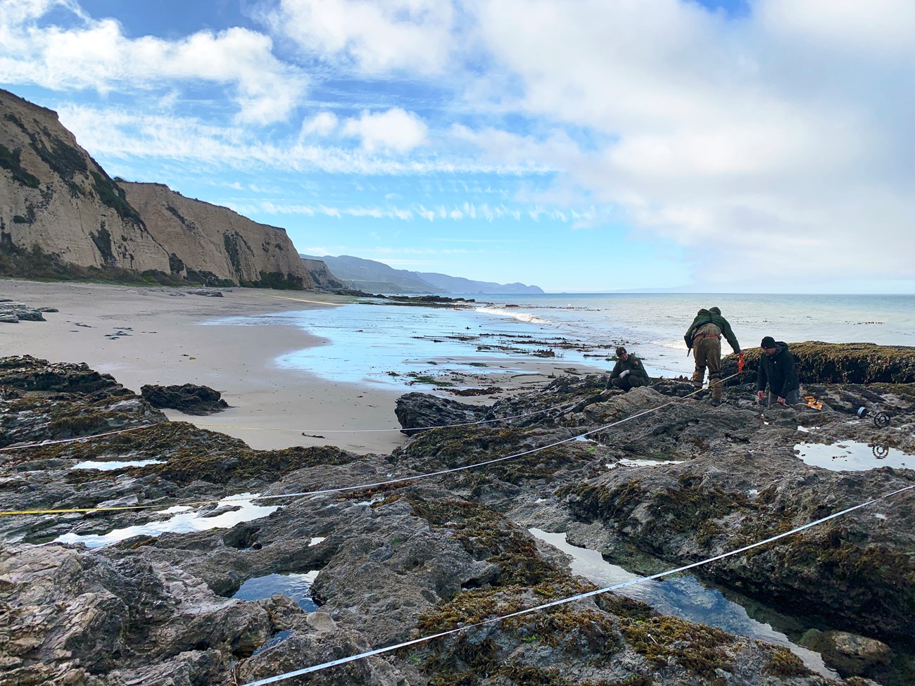
Despite having woken up at four am, the monitoring team seemed as happy to be here as I was.They worked seamlessly together. Everyone knew their role and were moving around like ants trying to conduct all of the surveys before the tide came in. There were sea star counts, line transects to monitor different organisms along designated area, and even photoplots being taken. I was even able to assist with data collection for the biodiversity surveys. Members of this specific team had actually helped develop the protocol used for monitoring and explained the specifics of how they had decided to monitor that way. For example, they use bolts to relocate specific areas to be photographed to record changes in species like mussels, barnacles, and algae.

NPS / Environment for the Americas / Jailyn Hoskins
The intertidal zone is an intense area to be, whether you are a barnacle stuck to a rock, or a human trying to look for a purple ochre sea star. The unique species that live along in the intertidal zone deal with the daily challenges of harsh waves, the beating sun, and more. Monitoring year after year allows us to track changes in species diversity, distribution, and abundance.Monitoring also helps researchers to better understand the impacts of things like disease, oil spills, climate change, and ocean acidification.
Four hours had passed and I could see the area where I was standing before. The water level seemed to be up above where my head was! No wonder we had to get such an early start! To witness the elusive intertidal zone was an amazing experience. I look forward to the next series of extreme low tides and the opportunity to explore again.
For More Information
- Learn more about rocky intertidal ecosystems and monitoring:
- How/where/when to go tidepooling:
- Contact Golden Gate National Recreation Area Aquatic Ecologist Darren Fong or Marine Ecologist Ben Becker
See more from the Bay Area Nature & Science Blog
