Last updated: July 9, 2021
Article
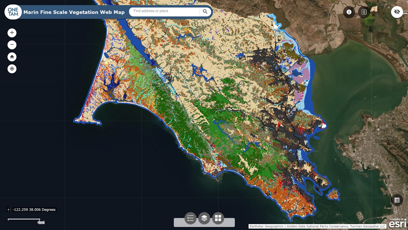
Marin County Fine Scale Vegetation Map Complete

June 2021 - Since 2018, a broad partnership* co-led by the Golden Gate National Parks Conservancy has been working towards creating a fine scale vegetation map of Marin County. After collecting high resolution aerial imagery, LiDAR, and on-the-ground data, they released a draft “Lifeform Map” last year with 22 vegetation classes. This June, they finalized that map and completed it’s fine scale counterpart!
The new Marin Countywide Fine Scale Vegetation Map details the state of the landscape in 2018. It features 96,636 polygons representing 82 vegetation classes from the standardized National Vegetation Classification. The map is the first of its kind for Marin, and will serve as a valuable new tool for scientists, land managers, and plant nerds. For example, it can help scientists track changes in plant communities after a wildfire. It can also help inform plans for maintaining resilient landscapes in the face of interrelated challenges like climate change, wildfire, invasive species, and disease.
The One Tam Regional Forest Health Strategy for Public Lands is one such planning effort that intends to put the new map to good use. The strategy authors aim to offer a variety of proven options for managing forests to improve biodiversity and reduce fire fuels. The fine-scale map will help them figure out which areas could benefit from which management strategies.
With the fine scale vegetation map now complete, the Conservancy-led team will work on a formal accuracy assessment, a final mapping report, and couple related maps. They are finalizing an impervious surfaces map (of where the ground cannot absorb water, e.g., roads, buildings, and parking areas) and hydrological systems mapping. As part of the latter, you can now explore updated stream features for Marin via the National Hydrography Dataset. Updates to the Watershed Boundaries Dataset are coming soon.
In the meantime, many of the same mapping team members are also busy completing a similar fine-scale vegetation map for San Mateo County. They hope to have that one ready in January 2022.
*Project partners include: Golden Gate National Recreation Area, Point Reyes National Seashore, California State Parks (Bay Area Districts), Marin County Parks, Marin Municipal Water District, Marin Resource Conservation District, Marin Agricultural Land Trust, US Geological Survey, California Native Plant Society, County of Marin, ...and many more!!
For more information
-
Refer to this datasheet for more information and to download/access the map
-
Contact Project Manager Danny Franco with any questions
Tags
- golden gate national recreation area
- muir woods national monument
- point reyes national seashore
- sfan
- pcslc
- blog
- san francisco bay area
- marin county
- vegetation map
- vegetation mapping
- plant communities
- national vegetation classification
- collaboration
- partner-led
- golden gate national parks conservancy
- map
- plants
- vegetation
