Part of a series of articles titled Cultural Landscapes of Katmai National Park and Preserve.
Article
Cultural Landscapes of Katmai National Park and Preserve
Historically Significant Places
The Brooks River area is currently renowned for its bear viewing and recreational fishing opportunities, but people have been living in the area for 4500 years and their experiences have been written in the landscape. There are four documented cultural landscapes in the vicinity of Brooks River where culturally and historically significant modifications to the land have resulted in the place we recognize today. The National Park Service is committed to protecting the historic character of each cultural landscape by identifying and managing the character defining features that allow visitors to better understand our past.

NPS / Alaska Regional Office
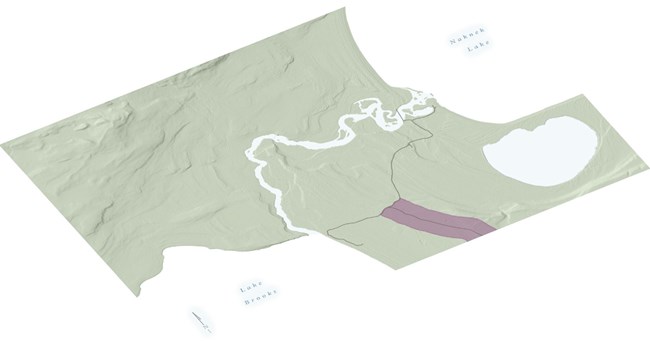
Valley of Ten Thousand Smokes Road
Period of Significance: 1962-1964
Landscape Type: Historic Designed Landscape
Located in the Katmai National Park and Preserve on the northern Alaska Peninsula, the Valley of Ten Thousand Smokes (VTTS) Road extends 22.5 miles from the Brooks River developed area southeasterly to the Three Forks Overlook. The road was planned in the summer of 1961 and constructed in the summer of 1962 as part of the Mission 66 National Park Service development program and has been used to provide concessionaire led day tours during the summer since 1963.
Originally developed as a ten-foot wide jeep road, the gravel alignment adheres to the National Park Service's aesthetic road design principles, incorporating views, vistas, and rest stops that showcase the unique natural landscape and the geological wonder of the Valley of Ten Thousand Smokes, a defining geological feature of the park. The road's development was debated by nationally significant individuals including Senator Ernest Gruening and organizations such as the Sierra Club.
The Valley of Ten Thousand Smokes Road remains a unique feature of the park because it is unconnected to the larger road systems and is only used by the park, concessionaire, and contractor vehicles.
Explore This Landscape
Valley of 10,000 Smokes Road HD
NPS / Alaska Regional Office
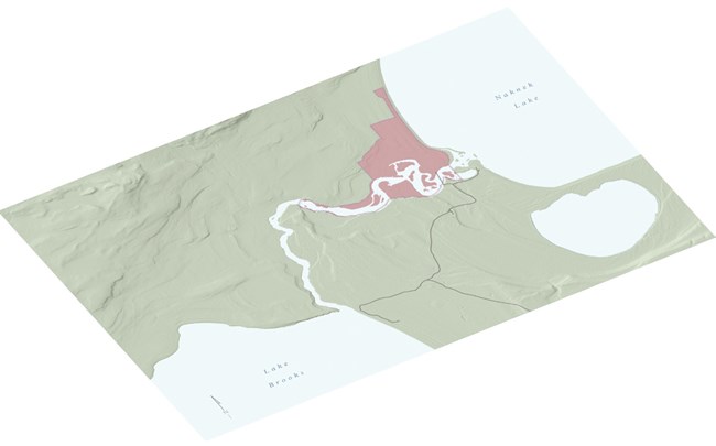
Brooks Camp Historic District
Period of Significance: 1950-1968
Landscape Type: Historic Vernacular Landscape
Brooks Camp Historic District is located on the west shore of Naknek Lake in Katmai National Park and Preserve. The NPS signed a contract with Petersen's Northern Consolidated Airlines (NCA) in 1950 marking the first NPS concession lease issued to an airline and the first use of an airline to provide primary access to an NPS site.
In the 1960s, seeking to increase the breadth of visitation, both the NPS and NCA developed the camp with the construction of a series of milled cedar log cabins, referred to as Pan Abodes, a name derived from the company that produced them. Pan Abode became the most identifiable architectural style in the park, critical to the rustic ambiance of the northern frontier. Both NPS and concessioner buildings retain their original northern frontierism tradition.
Brooks Camp serves as a destination for park and concessioner visitors to enjoy camping, fishing, bear watching, wilderness sightseeing, and to explore the cultural history of Alaska.
Explore this Landscape
Brooks River Historic District
NPS / Alaska Regional Office
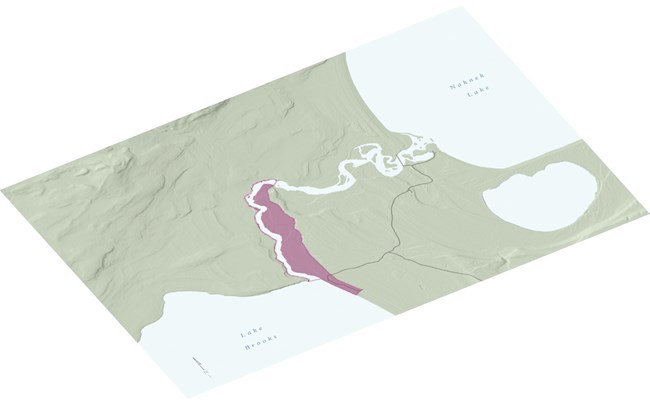
Lake Brooks Fisheries Research District
Period of Significance 1940-1972
Landscape Type: Historic Vernacular Landscape
The Lake Brooks Fisheries Research District, located on the shores of Lake Brooks and the adjacent Brooks River in Katmai National Park and Preserve, served as headquarters for the US Bureau of Fisheries (later known as the Fish and Wildlife Service) fisheries investigations in the Naknek Region. Beginning in 1940, fisheries scientists established a research camp which expanded to include a laboratory, residences, outbuildings, roads, an airplane ramp, a fish counting weir, and a fish ladder. The facilities were utilized for research purposes to investigate primarily sockeye salmon through 1972 and were officially transferred to the National Park Service in 1978.
In the mid-20th century, fisheries research became the foundation of salmon management practices and thus played a large role in the sustained economic development for coastal communities.
Explore this Landscape
Fisheries Research District
NPS / Alaska Regional Office
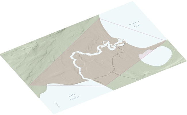
Brooks River Archeological District NHL
Period of Significance: 2500 BCE-1912 CE
Landscape Type: Historic Site
The Brooks River Archeological District National Historic Landmark (NHL) incorporates a series of ancient beach ridges and river terraces near the 2.5 mile long Brooks River. The 22 well-preserved sites which make up the district date from 2,500 BCE to recent historic times.
People have fished Brooks River for nearly 4,000 years, and the remains of their homes and villages and the camps of earlier hunters are clustered along the river.
The district has major scientific importance. Included in the district is the greatest concentration of Arctic Small Tool Tradition houses and camps known in Alaska and possibly in Arctic North America. It is estimated that over 90% of all the archeological properties remain intact.
Explore this landscape
Brooks River Archeological DistrictLandscape Poster
Overview of the historically significant cultural landscapes of the Brooks River area
at Katmai National Park and Preserve.
Last updated: November 21, 2023

