Part of a series of articles titled Cultural Landscapes of Katmai National Park and Preserve.
Article
Lake Brooks Fisheries Research District Cultural Landscape
A Brief History

NPS / Alaska Regional Office
Scientifically Informed Fisheries Management
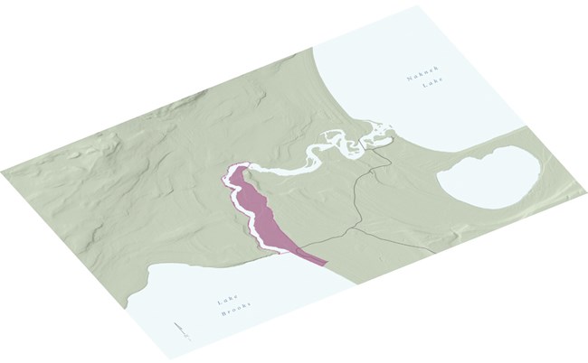
The Lake Brooks Fisheries Research District is located on the shore of Lake Brooks in Katmai National Park and Preserve. The district represents the Fish and Wildlife Service’s development and use of the site from 1940 until 1972, when it was used for research and management of the sockeye salmon fishery of Bristol Bay. the foundation of fisheries research in Alaska
The Fish and Wildlife Service (FWS) research at the site was initiated in 1940, when a temporary fish-counting weir was constructed across the outlet of Lake Brooks. Through 1955, the site served as headquarters for the Fish and Wildlife Service’s research on sockeye salmon in the lakes and rivers of Bristol Bay, becoming the foundation of fisheries research in Alaska. In 1956, the research at the site began to focus only on the upper Naknek drainage, including the majority of lakes and rivers of Katmai National Monument. Over the years, the facility expanded with the construction of a field laboratory, several outbuildings, two residences, and a concrete fish ladder circumventing Brooks Falls.
This study of the region's salmon and the impacts of international fishing, called the Bristol Bay Investigation, established the scientific basis for current management practices that rely on strict escapement quotas. It contributed to an international treaty on fishing in the North Pacific. The district played a significant role in developing sustainable management practices for a natural resource that is the economic backbone of coastal communities in the region. From 1950 to 2008, the sockeye salmon fishery was the most valuable fishery in the United States. The biological success was due, at least in part, to the management practices that were based on scientific research.
Significance and Condition
-
Period of Significance: 1940 to 1972
-
Significance Level: Local
-
National Register Significance Criteria:
-
Criterion A - in areas of Science and Conservation
-
-
Landscape Type: Historic Vernacular Landscape
-
Condition: Fair— Additional buildings, non-historic repairs to BL3, loss of contributing structures, neglect and underutilization of contributing structures, modern circulation patterns, and failing utilities will impair district integrity in the absence of proactive management.
Character Defining Features

NPS / Katmai National Park and Preserve Archives
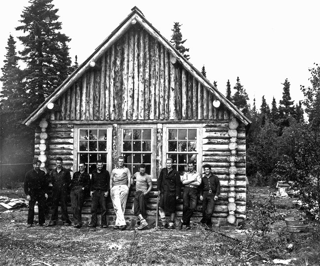
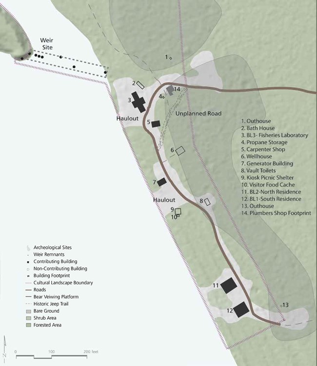
The overall layout of the facility remains intact, as are all the major buildings from the fisheries period. Since the period of significance, the laboratory has been converted to a residence and the roof was replaced.
The fish ladder and the weir remnants serve as the strongest physical reminders of the story of fisheries research conducted at the site. The fish ladder was blocked off in 1973, but this barrier has since deteriorated. A few remnants of the weir remain in the form of metal bars protruding from the base of the river and a concrete footing on the eastern bank of the outlet.
Buildings and Structures
Field Laboratory, Brooks Lake (BL-3)
-
Oldest federally constructed building in the park.
-
Built over a period of 15 years.
- Designed to meet the Rustic Architecture standards of the NPS.
Pan Abode Buildings
-
Residences accommodated families during fieldwork, increasing retention of fisheries expertise.
-
Architectural style conforms with the nearby Brooks Lodge complex.
- Residences (BL1 and BL2) and Generator Building.

NPS / Alaska Regional Office
Spatial Organization
-
The district is sited in three clearings in a dense spruce-dominated forest.
-
NPS landscape architect recommended retaining a pattern of trees within the research area to maintain the forest character.
Natural Systems
-
Lake Brooks was selected to be representative of the five major sockeye drainages—Nushagak, Kvichack, Naknek, Ugashik, and Egegik.
-
Situated in an ecosystem that acts as a natural laboratory where fish stocks have not been modified by hatcheries.
Circulation
-
Direct access to Lake Brooks fish weir
-
Airplane haulout
-
Jeep trail to Naknek Lake
-
Jeep trail to fish ladder site
Last updated: February 12, 2024


