Last updated: April 29, 2021
Article
Guilford Courthouse National Military Park Cultural Landscape

NPS
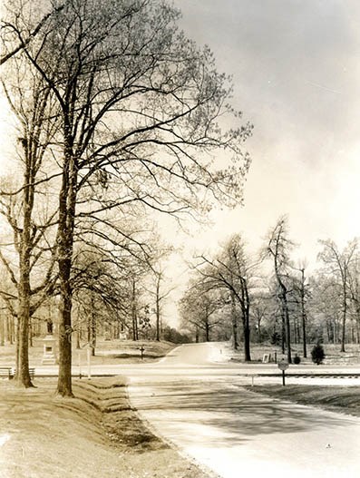
The Guilford Courthouse Historic Landscape is important for its association with the consequential battle and also for enhancing the understanding of the strategies employed by American forces at the time. Much of the landscape retains integrity, or the ability to convey its historical significance, through extant features. The topographic features, battle sites, and the historic Salisbury Road (New Garden Road) remain intact, contributing to the setting, feeling, association, materials, location, workmanship, and design associated with the period of significance

NPS

NPS
Landscape Description
The Guilford Courthouse Historic Landscape occupies approximately 250 acres in Greensboro, North Carolina. Typical of the Piedmont Region, the landscape contains numerous hills and a range of elevations. The historic Salisbury Road (New Garden Road) bisects the site from east to west. It is crossed by Hunting Creek in the eastern part of the landscape. A hardwood forest covers most of the area with several species of oak including white, southern red, black, chestnut, and scarlet. Approximately ten percent of the park area is unforested. To the southeast, Greensboro Country Park, managed locally by The Greensboro Parks & Recreation Department, also exemplifies the area’s historic character with woodlands and hilly terrain.
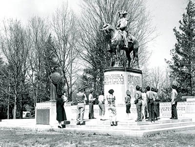
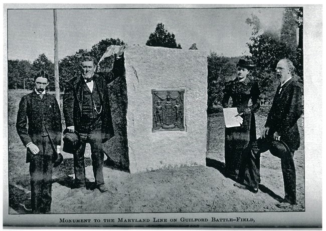
Commemorative elements add another layer of history to the landscape fabric. These include 29 monuments and gravesites mostly added between the late 1800s and early 1900s by the Guilford Battleground Company (GBC). A loss of integrity from the GBC era of park development (1887 to 1917) prevents this layer’s designation as a designed landscape under the criteria for National Register of Historic Places.
Historic Use
Available evidence indicates nomadic groups of hunter-foragers appeared in the Piedmont region by 8,000 BC. Although no cultural artifacts have been revealed within the Guilford Courthouse landscape, two Siouan cultural groups’ villages existed within 40 miles of the site in the 1600s and early 1700s. These groups included the Keyauwee and Saura (Cheraw) tribes. The Saura likely practiced controlled burning to enhance hunting grounds around the area.European immigration fluctuated in the North Carolina interior or “backcountry” during the 1730s with the promise of affordable and arable land. Many immigrants arrived from the "Great Wagon Road'' that ran from Philadelphia, Pennsylvania to Augusta, Georgia. The now non-extant Guilford Courthouse followed the establishment of Guilford County in 1771.
The American Revolution began in 1775. The British embarked on the Southern Campaign in 1780 whereas previously most of the fighting occurred in the north. After defeat at the Battle of Cowpens in 1781, the British army of approximately 2,500 soldiers, led by General Cornwallis, pursued the American forces north from South Carolina to the Dan River in Virginia. The American Major-General Nathanael Greene and his forces continued into Virginia and recruited additional soldiers. They reversed course back southward and camped near Guilford Courthouse in March 1781.
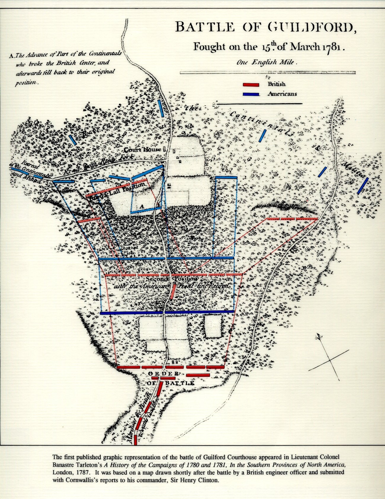
Rolling terrain and interspersed patches of dense woods and clear fields made the area around Guilford Courthouse ideal for a defensive operation. Major-General Greene divided his 4,400-man army into three lines that occupied strategic positions. The militia, or citizen soldiers, composed the majority of first two lines, the first of which stood to the rear of a clearing and the second in a woodland. Continental troops made up the third line, which also stood to the rear of a clearing at higher ground.

Banastre Tarleton, "A History of the Campaigns of 1780 and 1781," from NPS/Guilford Courthouse National Military Park.
Preservation and Park Development

NPS
During the late 1800s, efforts to preserve historic sites were often led by individuals and small groups. In the case of Guilford Courthouse, Greensboro resident Judge David Schenck had a strong desire “to redeem the battlefield from oblivion," in his words from a December 1886 diary entry. By that time, the area was an unindustrialized rural landscape. The location of the battlefield, about an hour’s ride from the small town of Greensboro, was largely forgotten to area residents. After purchasing part of the battlefield, Schenck convinced local businessmen to join his cause and established the Guilford Battleground Company (GBC). The GBC prioritized the beautification and ornamentation of the battlefield, a common practice at the time, and the effort succeeded in generating public support for its preservation.
An Act by the United States Senate and House of Representatives on March 2, 1917 provided for the establishment of Guilford Courthouse National Military Park under the stewardship of the War Department. In the summer of 1933, President Franklin Delano Roosevelt signed Executive Order 6166, thereby transferring all national military parks, including Guilford Courthouse, to the National Park Service.
Today, the National Park Service preserves part of the center section of the American first and second line positions, as well as the left portion of the third line. The courthouse itself was demolished sometime in the mid-1800s. The principle axis and historic Salisbury Road (now New Garden Road) are still in existence. Visitors may travel along the interpretive tour road to see the significant features of the Guilford Courthouse battlefield. Additionally, the park and adjacent landscapes contain numerous walking trails.
Quick Facts
- Cultural Landscape Type: Historic Site
- National Register Significance Level: National
- National Register Significance Criteria: A, D
- National Historic Landmark
- Periods of Significance
1933-1942: Park Development Era

