Last updated: May 16, 2025
Article
The Capture of Mount Alifan
US Marine Corps Collection of Still Photos #87239
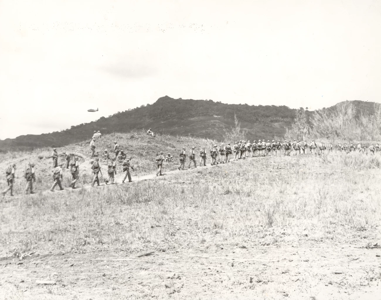
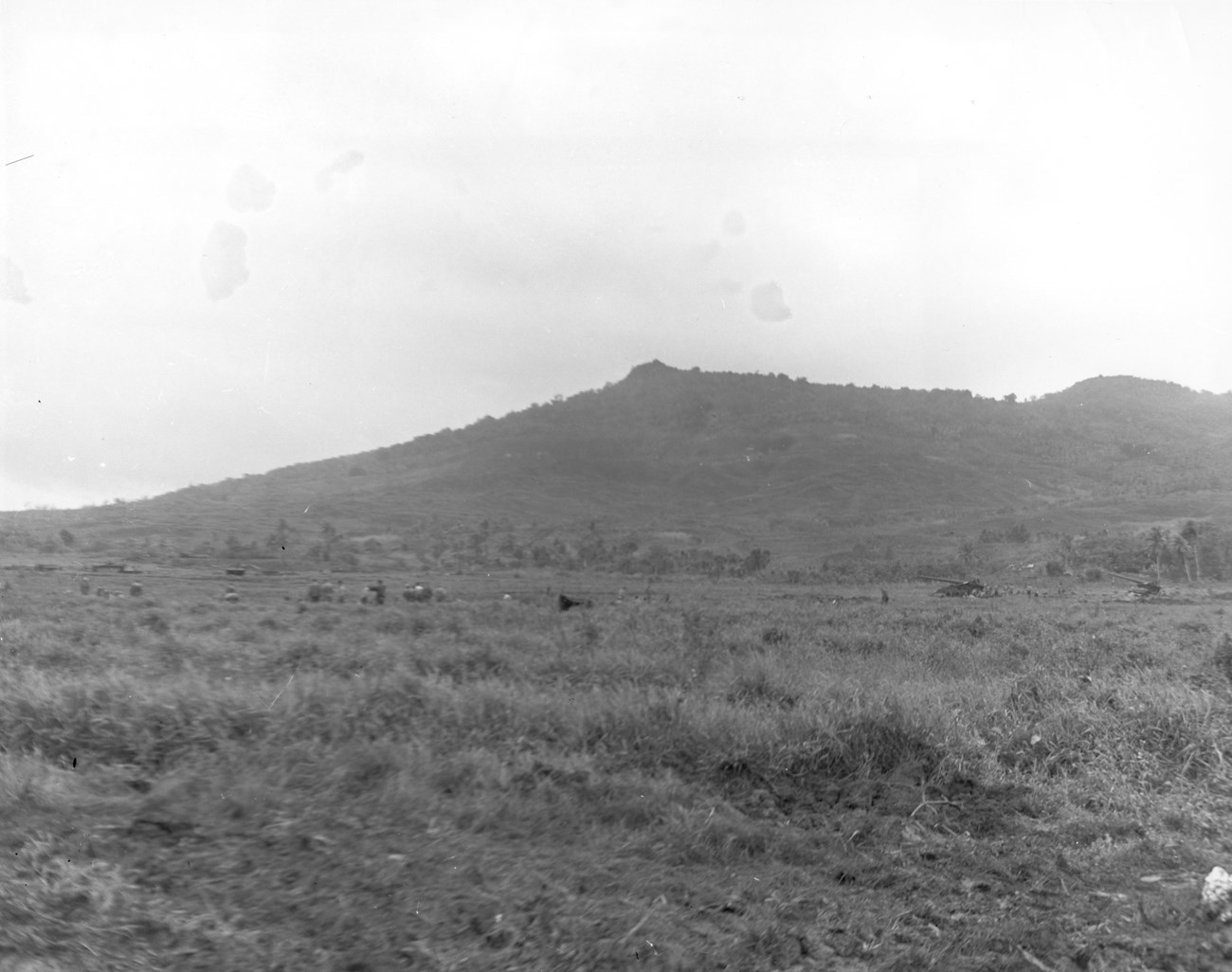
On July 21, 1944, a soldier standing atop one of the freshly-captured Imperial Japanese strongholds at Ga'an Point would have seen a green hill with a distinct, almost square-shaped peak rising above the beach. This was Mount Alifan, and it was the Marines next target.
A Heavily Fortified Stronghold
Both of the landing beaches on Guam were shallow enclaves encircled first by foothills, and then a line of mountain peaks stretching from north to south. While it was less steep than the ridges overlooking Assan Beach, at 871 feet tall, Mount Alifan still loomed over the Hågat Beachhead. In order to secure the landing beaches and consolidate their foothold on the island, the U.S. needed to secure that line of mountains, including Mount Alifan. [1]
US Marine Corps Collection of Still Photos #92657
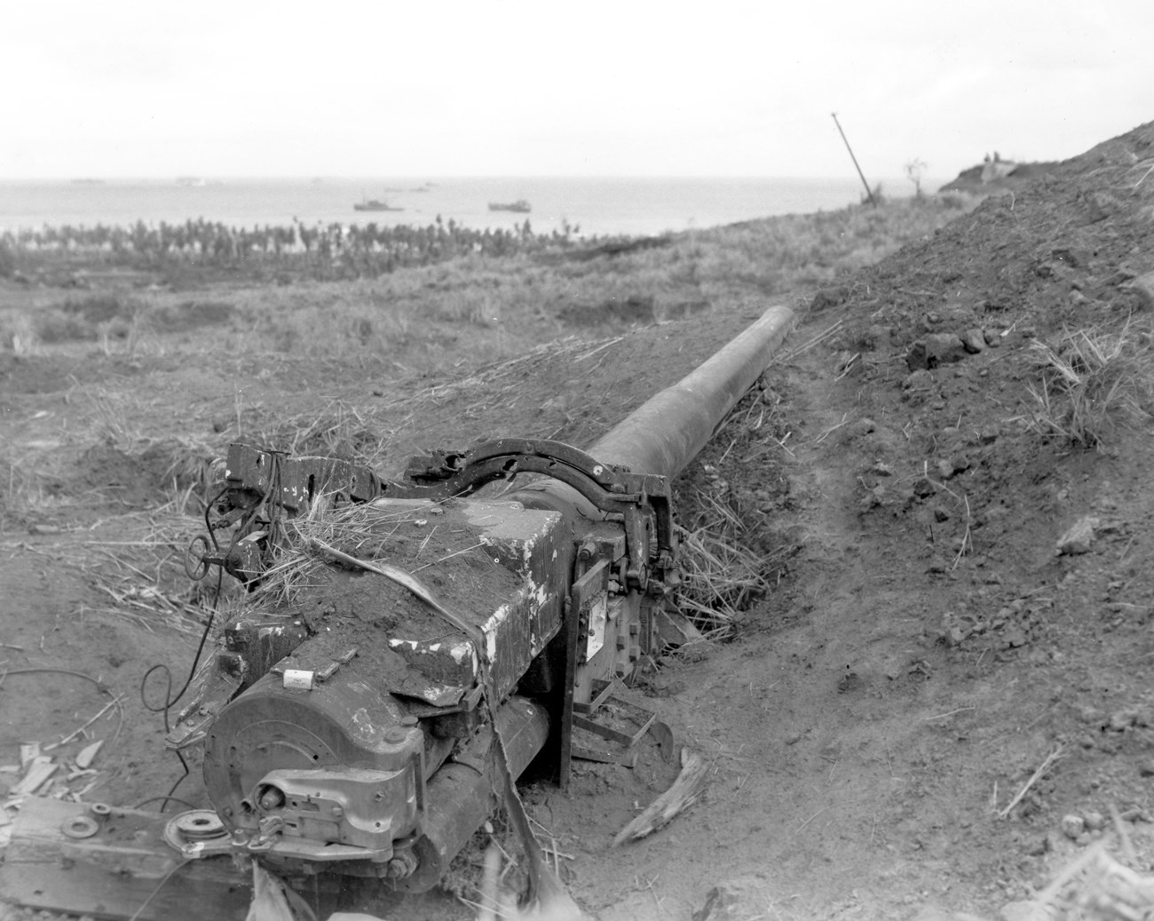
Alifan's slopes bristled with defenses. Colonel Tsunetaro Suenaga, who was in charge of defending the southern beachhead, had built his command post on the side of the mountain. It was one of the best fortified areas on Guam, with three coastal defense guns overlooking the beach; trenches, foxholes and a series of linked pillboxes; a fire control center; and an observation post. Before the American invasion, CHamoru and Korean laborers were forced to enlarge natural caves; dig tunnels; and build earthworks, anti-tank traps, gun emplacements, and bunkers on the lower slopes. [2]
Capturing the Mountain's Peak
The 4th Marines, part of the 1st Provisional Marine Brigade, were tasked with capturing Mount Alifan. Once Alifan was in American hands, the Marines would push south along the ridge line towards Mount Tanae and Magpo Point (near where Nimitz Beach Park is now located), securing the southern portion of the Forced Beachhead Line (FBL), a perimeter circling the Hågat Beachhead. By the end of W-Day, the 2nd Battalion had reached the base of the mountain, roughly 1000 yards from the peak. At 9:00 the following morning, the 1st and 3rd Battalions, 4th Marines started up the slopes towards the mountain's peak. [3]
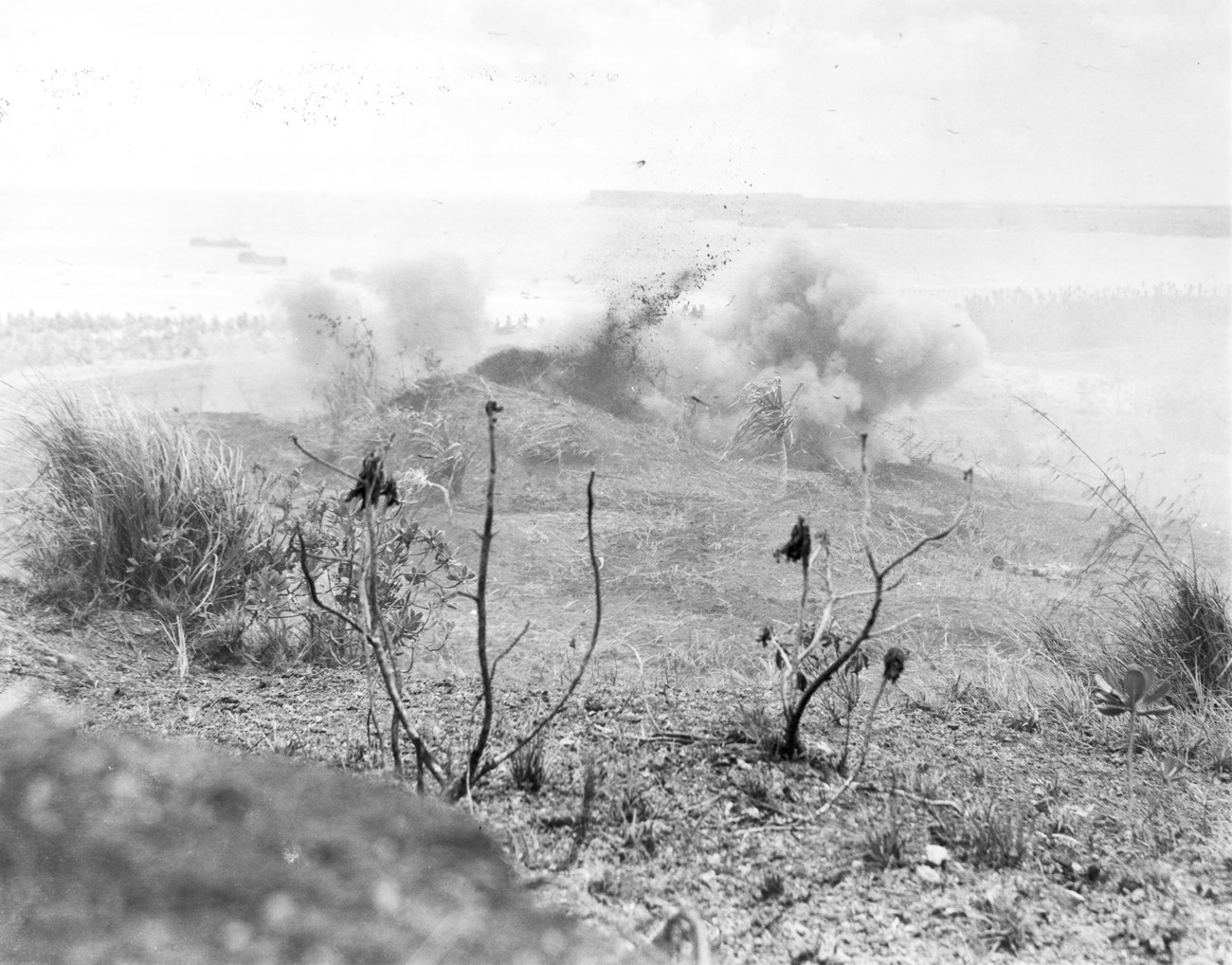
The Marines faced fierce opposition from the remains of the Imperial Japanese 38th Infantry. While the previous night's counterattack had been a disaster and the regiment had taken heavy losses, the surviving soldiers were able to take advantage of established defensive positions, especially the caves on Mount Alifan's northern slope. Throughout the morning, they rained fire down on the advancing Marines until engineers and demolition teams armed with flamethrowers and hand grenades were able to neutralize their positions. [4]
US Marine Corps Collection of Still Photos #87240
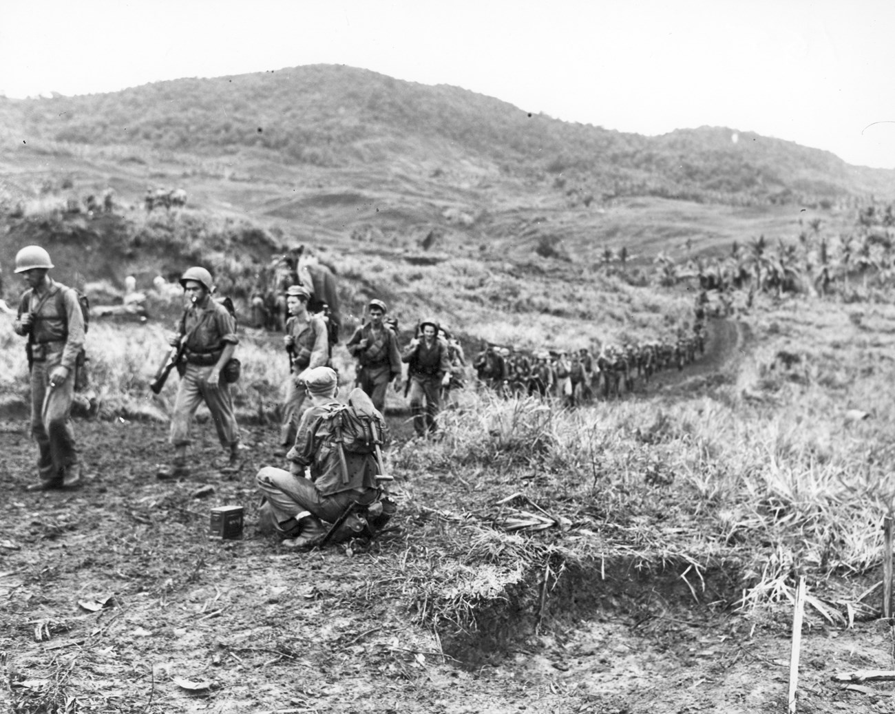
Mount Alifan threw more than just enemy soldiers at the Marines. Once they had passed through the belt of fortifications on the mountain's lower slopes, the troops faced only scattered Imperial Japanese resistance, but the mountain's rough terrain continued to present a serious challenge. The higher up the mountain they climbed, the steeper it became. Only a handful of rough trails wound through the dense underbrush and they were frequently blocked by the thick roots of pandanus trees. Soldiers' gear caught on tangled, thorny vines, and the sweating and tired men soon began to drop their packs and any extra equipment as they continued to push on. [5]
At 3:30 p.m., their hard work paid off when the 2nd Platoon, Company G, 1st Battalion, led by Lieutenant William Kerr, reached the summit of Mount Alifan. From the top, they could see clear to the far side of the island. Despite the commanding view, the Marines quickly determined that the rugged peak was indefensible. The Japanese must have thought the same thing; there was no sign that they had occupied the area. [6]
While Kerr and his men climbed to the top of Mount Alifan, the rest of the 4th Marines moved south along the ridgeline and captured Mount Tanae and Magpo Point. By the end of July 22, the second day of battle, the southern perimeter stretched 3000 yards from Magpo Point in the south to the old village of Hågat in the north. [7]
US Marine Corps Collection of Still Photos #93098
The Forced Beachhead Line Secured
With the southern portion of the FBL established, attention turned to the 1st Brigade's next objective: capturing Orote Peninsula, home to a strategically important airfield and the entrance to Apra Harbor. Both the 4th and 22nd Marines would be needed to take the heavily defended peninsula, so the 306th Regiment, 77th U.S. Army Infantry Division was tapped to take over command of the perimeter. The 306th Regiment landed at Hågat Beach on July 23, and by that afternoon, the 3rd Battalion had started to relieve the 4th Marines. The remaining battalions replaced the rest of the 4th Marines the following morning. [8]
The 306th and 305th Regiments spent the rest of the first phase of the Battle of Guam guarding the perimeter, mopping up any remaining Imperial Japanese forces within the FBL, and running reconnaissance missions into the southern part of the island. [9]
Today, Mount Alifan is one of seven units that make up War in the Pacific National Historical Park. While there are still remains of the fight to capture the island on the mountain's slopes, the unit is undeveloped. The best way to experience Mount Alifan is to stand at Ga'an Point, look up at the peak above, and imagine how the Marines must have felt climbing to the top in the heat of battle.
US Marine Corps Collection of Still Photos #92921
[1] Vida Germano and James Oelke Farley, "War in the Pacific National Historical Park: Cultural Landscapes Inventory, National Park Service" (NPS Pacific West Regional Office, 2013), 62–63; Peggy Nelson, Lisa Duwall, and Laila Tamimi, "Asan and Agat Invasion Beaches: Cultural Landscape Inventory, War in the Pacific National Historical Park, National Park Service" (National Park Service, November 26, 2003), 34; Henry I. Shaw, Bernard C. Nalty, and Edwin T. Turnbladh, Central Pacific Drive, vol. III, History of U.S. Marine Corps Operations in World War II (Headquarters: Historical Branch, G-3 Division, U.S. Marine Corps, 1966), 494; Erwin N. Thompson, "War in the Pacific National Historical Park Historic Resource Study," Historic Resource Study (National Park Service, July 1985).
[2] Philip A. Cowl, Campaign in the Marianas, United States Army in World War II (Washington, D.C.: Center of Military History United States Army, 1960), 332; Evans-Hatch & Associates, Inc, "War in the Pacific National Historic Park: An Administrative History," Park Administrative Histories (National Park Service, 2004), 38, 97; Germano and Oelke Farley, "War in the Pacific National Historical Park: Cultural Landscapes Inventory," 30, 80, 100–101.
[3] Center of Military History, United States Army, Guam: Operations of the 77th Division, 21 July-10 August 1944, American Forces in Action (Washington, DC: Center of Military History, US Army, 1990), 37; Kenneth W. Condit and Edwin T. Turnbladh, Hold High the Torch: A History of the 4th Marines (Washington, D.C.: Historical Branch, G-3 Division Headquarters, 1960), 264; Cowl, Campaign in the Marianas, 348–49; Maj O. R. Lodge, The Recapture of Guam (Headquarters: Historical Branch, G-3 Division, U.S. Marine Corps, 1954), 65; James S. Santelli, A Brief History of the 4th Marines (Washington D.C.: Historical Division Headquarters, U.S. Marine Corps, 1970), 28; Shaw, et al, Central Pacific Drive, 476, 494.
[4] Condit and Turnbladh, Hold High the Torch, 264; Harry A. Gailey, The Liberation of Guam, 21 July-10 August 1944 (Novato, CA : Presidio, 1988), 115–17; Lodge, The Recapture of Guam, 65; Santelli, A Brief History of the 4th Marines, 28; Shaw, et al, Central Pacific Drive, 494.
[5] Condit and Turnbladh, Hold High the Torch, 264; Cowl, Campaign in the Marianas, 349; Gailey, The Liberation of Guam, 115–17; Lodge, The Recapture of Guam, 66; Shaw, et al, Central Pacific Drive, 494–95.
[6] Condit and Turnbladh, Hold High the Torch, 264; Cowl, Campaign in the Marianas, 494; Gailey, The Liberation of Guam, 115–17; Lodge, The Recapture of Guam, 66; Santelli, A Brief History of the 4th Marines, 28; Shaw, et al, Central Pacific Drive, 495.
[7] Condit and Turnbladh, Hold High the Torch, 264; Cowl, Campaign in the Marianas, 350–51; Gailey, The Liberation of Guam, 117; Shaw, et al, Central Pacific Drive, 495.
[8] Center of Military History, United States Army, Guam: Operations of the 77th Division, 39–40; Cowl, Campaign in the Marianas, 351–52; Lodge, The Recapture of Guam, 72–73.
[9] Cowl, Campaign in the Marianas, 361–62; Lodge, The Recapture of Guam, 103–5.
Learn More
-
 Hågat Beach During the Battle of Guam
On W-Day, the 1st Provisional Marine Brigade landed at Hågat Beach, establishing the southern beachhead.
-
 Landing of the 77th Infantry Division
On W-Day, the 77th U.S. Army Infantry Division served as the reserve troops. Over the next four days, they landed on Hågat Beach.
-
 Battle of Guam
On July 21, 1944, American forces landed at Guam, kicking off a 21-day fight to retake the island.
