Ice Caves Status: ClosedUpdated: 02/18/2026, 10:30am The ice shelf near Meyers Beach at Apostle Islands National Lakeshore was broken up during a winter storm that began on 2/17. 
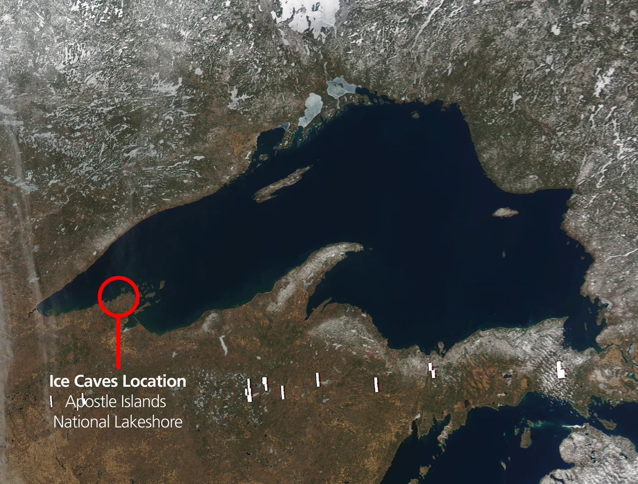
From https://wavesatseacaves.cee.wisc.edu. About the Ice CavesThe ice caves are rare winter formations along the cliffs and sea caves of Apostle Islands National Lakeshore near Meyers Beach. As Lake Superior freezes, waves splashing against the rock and water seeping between sandstone layers form sculptures of ice. When Will the Ice Caves Open?The short answer is very rarely. 
NPS How Rare is Rare?The last time stable lake ice allowed access to the ice caves was for one day in 2026, and a brief nine-day period in 2015. What Are the Right Conditions?To safely walk across the miles of Lake Superior's frozen surface to reach the ice caves, several conditions must align.

NPS / Billy Flynn Location ChallengesWind and waves rippling across the largest lake in the world can quickly break up seemingly stable ice.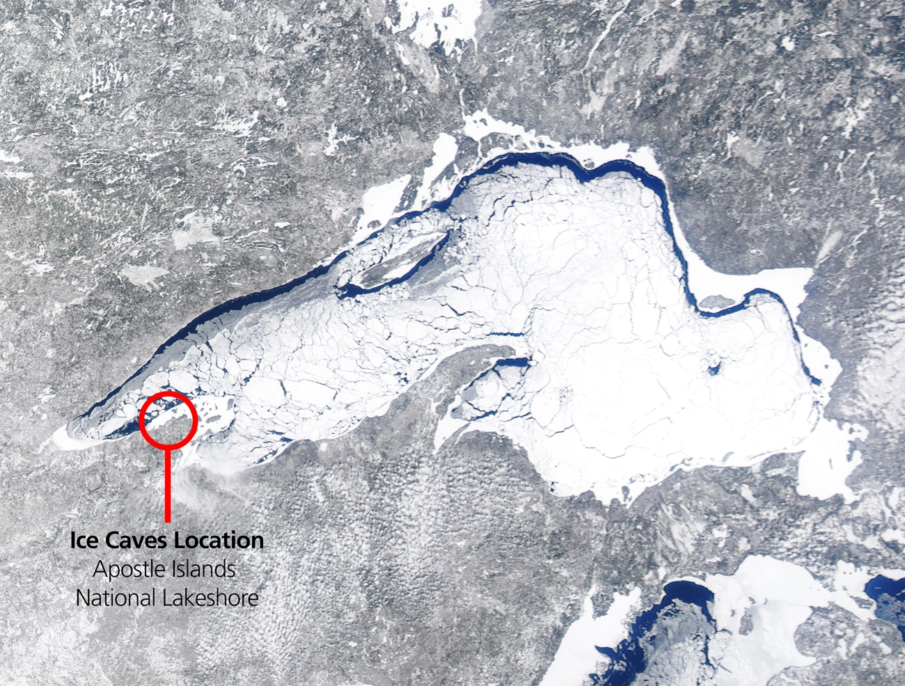
Left image
Right image
Left image
Right image
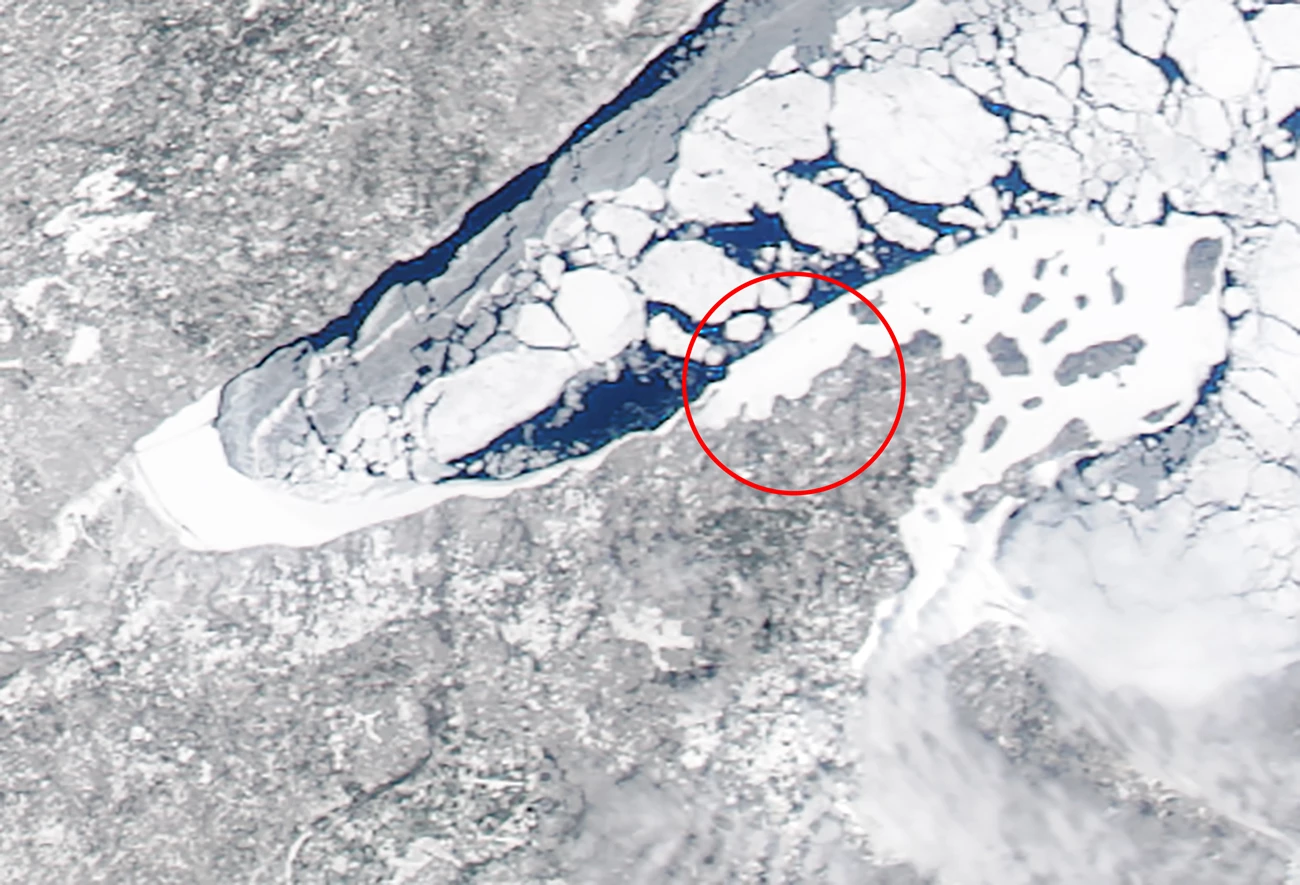
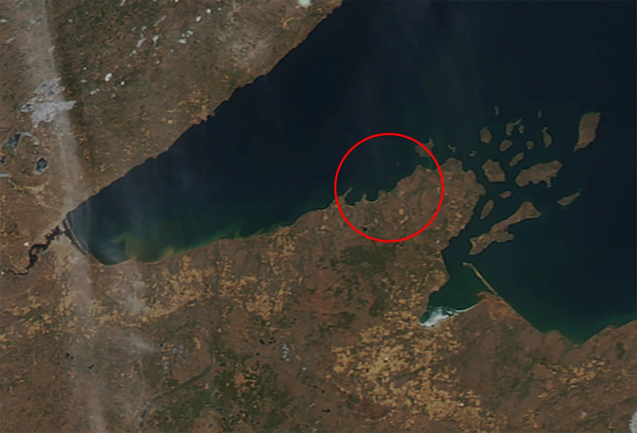
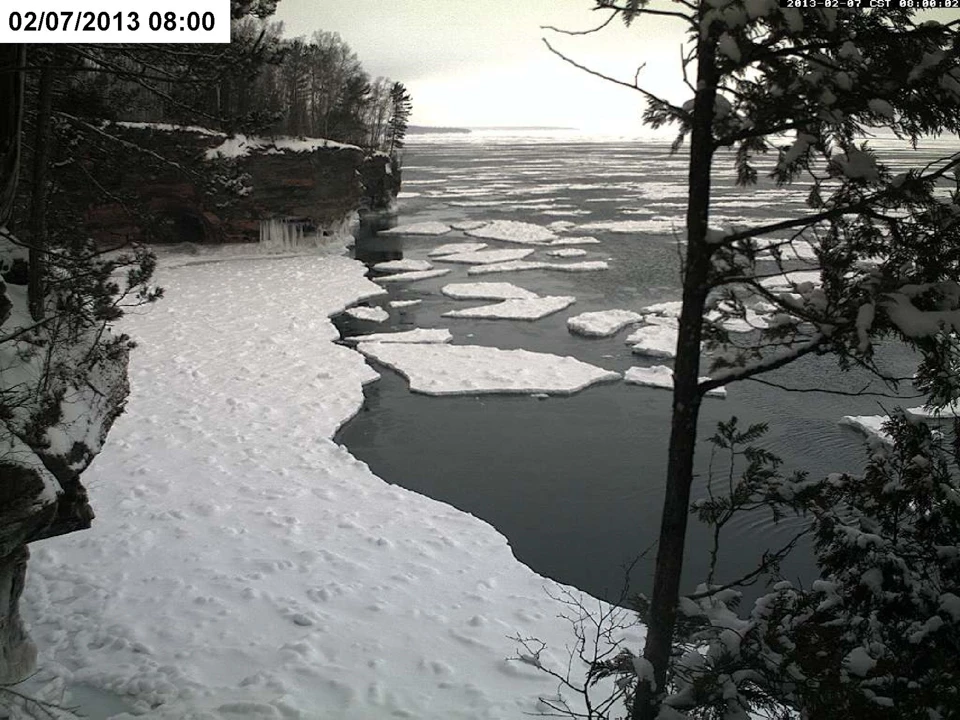
Lake Ice is UnpredictableThe webcam can be misleading. Webcam Comparison Showing Ice Shelf Breakup in Less Than 12 Hours 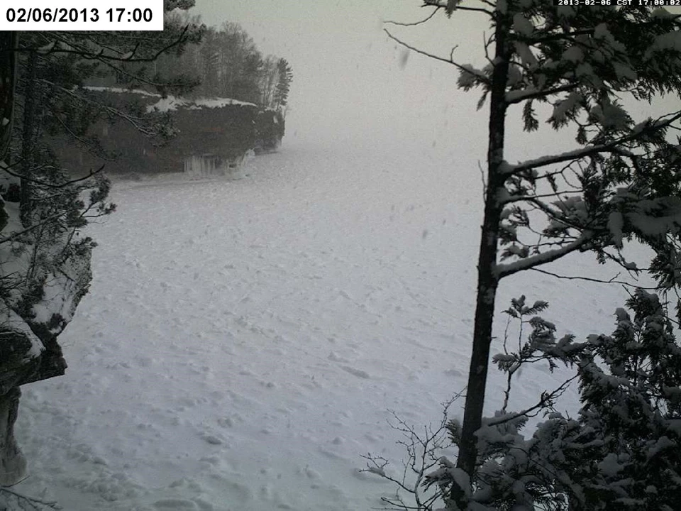
Top image
Bottom image
How Will I Know if the Ice Caves are Accessible?Park staff will update this page, our Facebook page, and the ice line in the rare event that the ice caves are accessible to visitors.
NPS staff monitor ice conditions on an ongoing basis. Note that NPS staff only provide updates when lake conditions allow safe access. If conditions haven’t been updated recently, it’s an indication that conditions haven’t changed and remain unfavorable for ice cave access. 
NPS Photo Winter Activities When Ice Caves Are InaccessibleEven when the Ice Caves are inaccessible, there are many winter activities to enjoy in the Apostle Islands National Lakeshore and surrounding communities.
Visit the Winter Activities page on the Bayfield Chamber & Visitor Bureau for activities in the area. |
Last updated: March 16, 2026