![]()
Cover Page
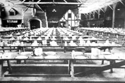
MENU
|
| |
Confinement and Ethnicity: An Overview of World War II Japanese American Relocation Sites by J. Burton, M. Farrell, F. Lord, and R. Lord |

|
|
| |
List of Figures
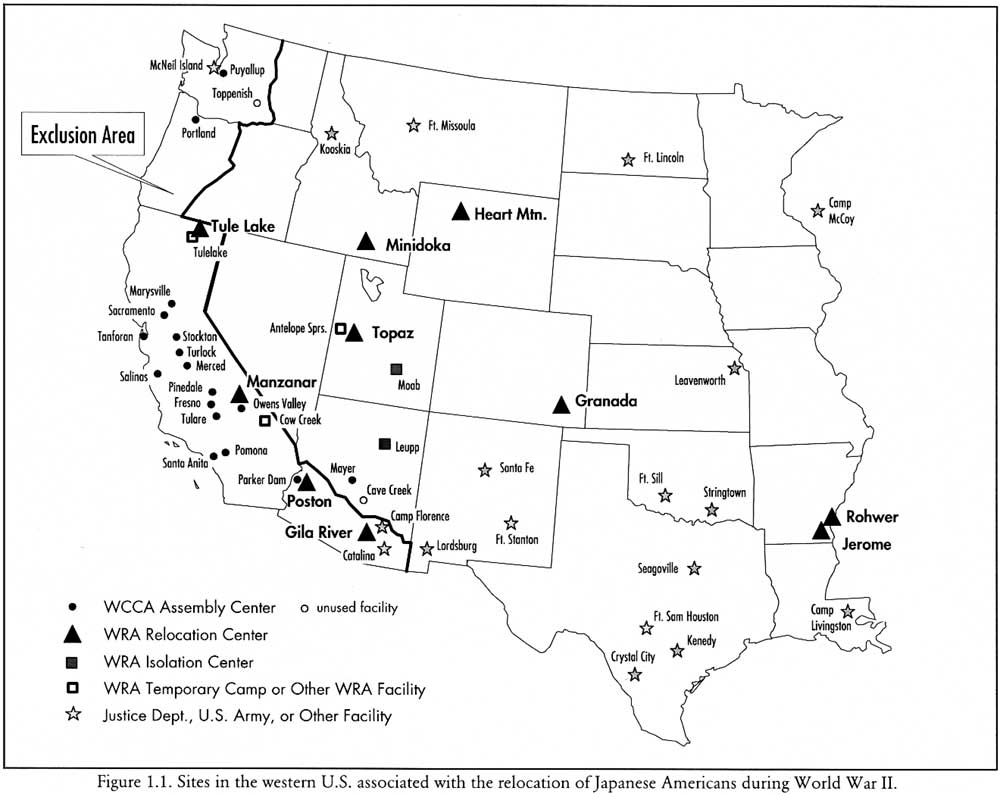
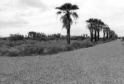
Figure 1.1. Sites in the western U.S. associated with the relocation of Japanese Americans during World War II.
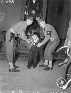
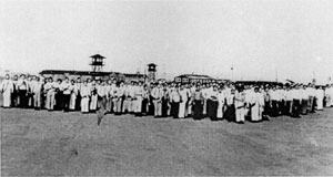
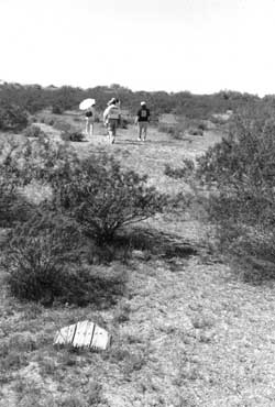
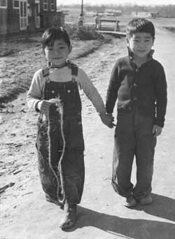
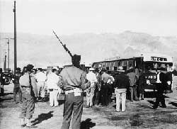
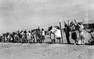
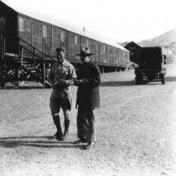
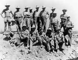
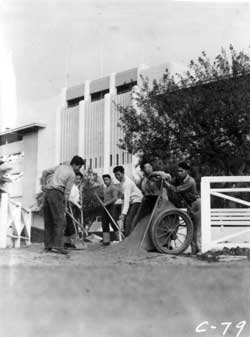
Figure 1.2. Armed military police lend a helping hand, Manzanar 1942.
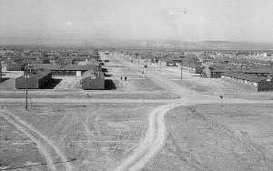
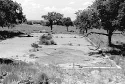
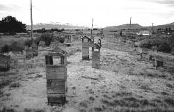
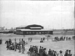
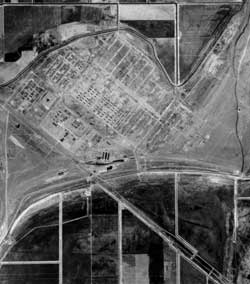
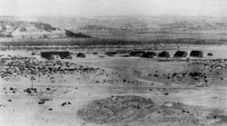
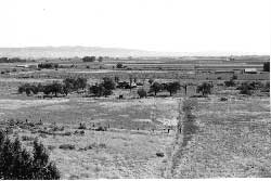
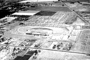
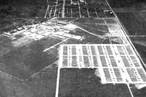
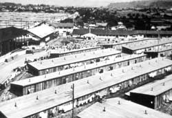
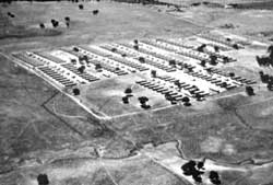
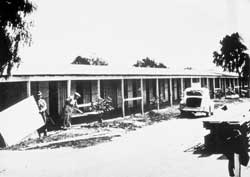
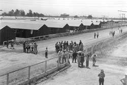
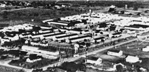
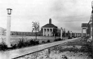
Figure 1.3. Topaz Relocation Center in 1943.
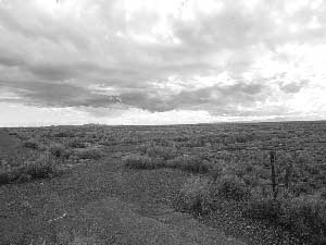
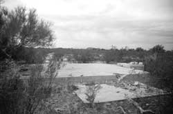
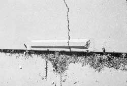
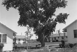
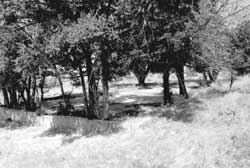
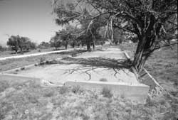
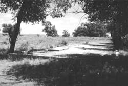
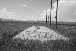
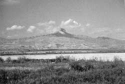
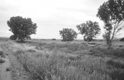
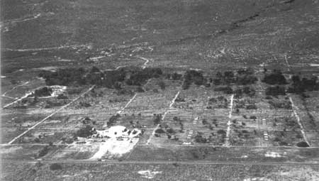
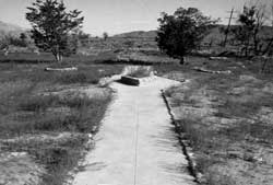
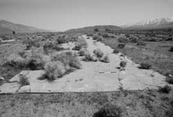
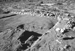
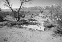
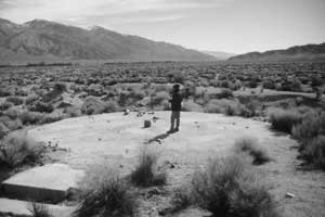
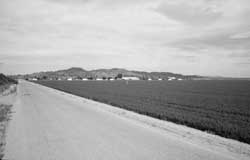
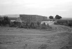
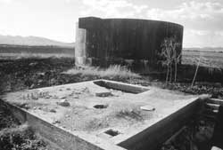
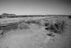
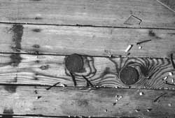
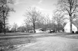
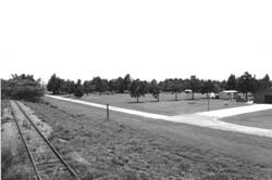
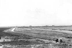
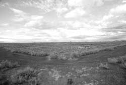
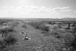
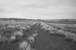
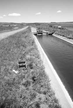
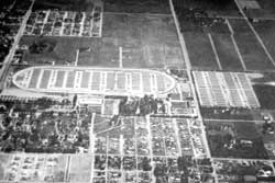
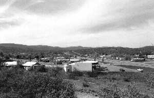
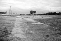
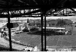
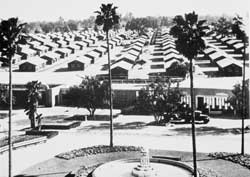
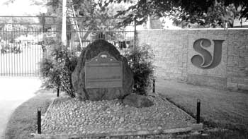
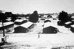
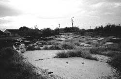
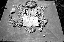
Figure 1.4. Site of the Topaz Relocation Center today.
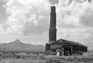
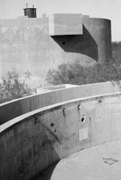
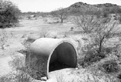
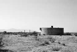
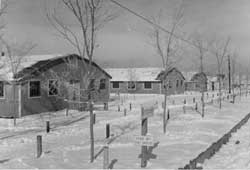
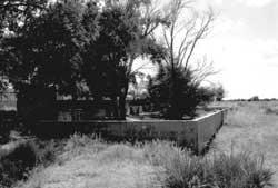
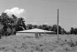
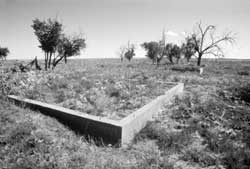
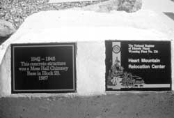
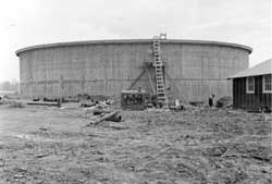
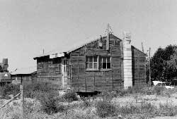
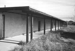
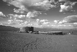
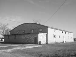
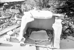
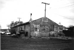
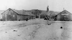
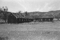
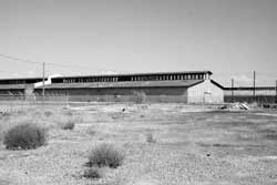
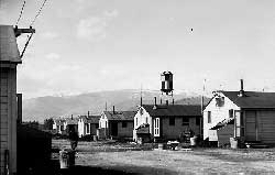
Figure 1.5. Hospital heating plant at the Heart Mountain Relocation Center.
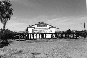
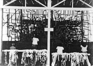
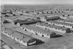
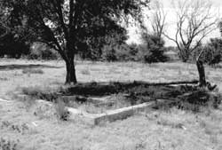
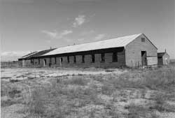
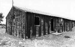
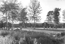
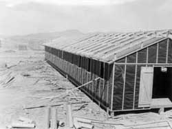
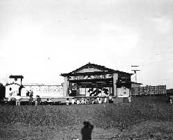
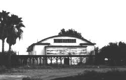
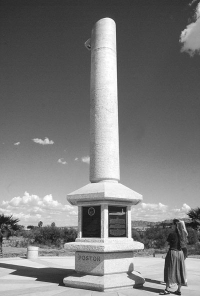
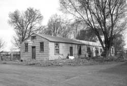
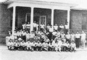
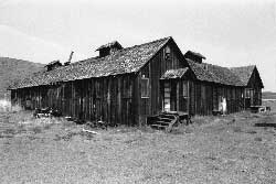
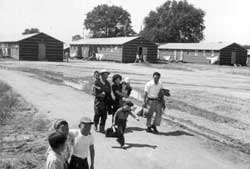
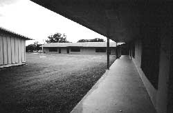
Figure 1.6. Elementary school auditorium at the Poston Relocation Center.
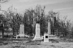
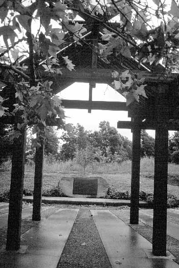
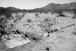
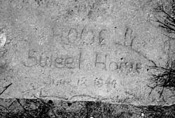
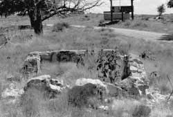
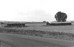
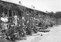
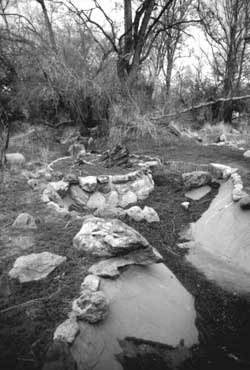
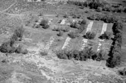
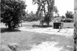
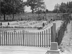
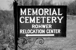
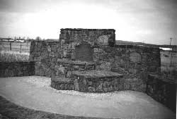
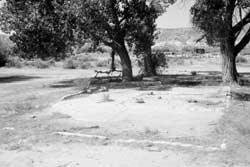
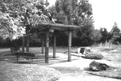
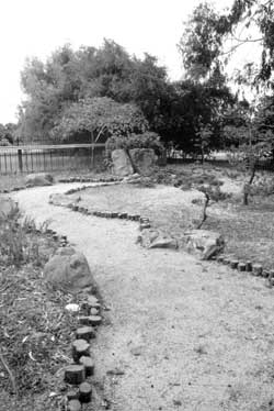
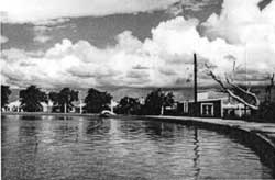
Figure 1.7. Memorial park at the Rohwer Relocation Center.
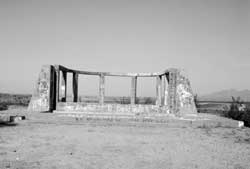
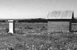
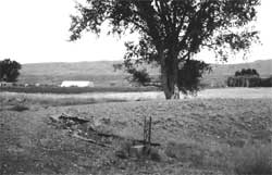
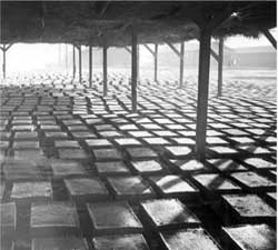
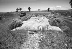
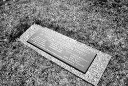
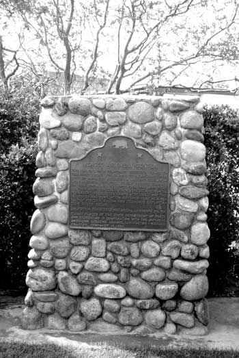
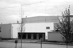
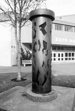
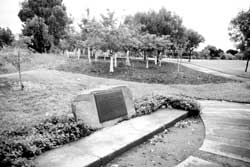
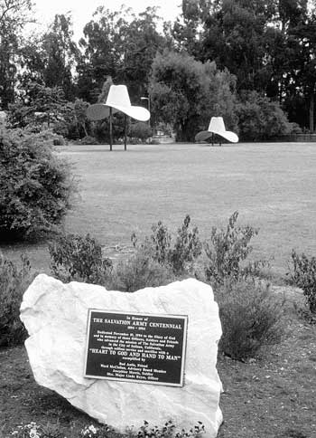
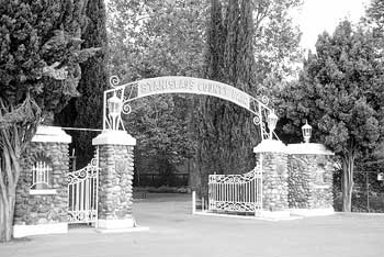
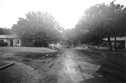
Figure 1.8. Historical marker and ramada at the site of the Sacramento Assembly Center.
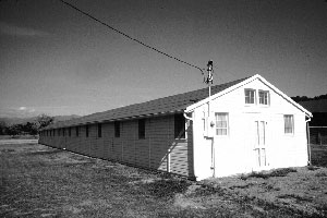
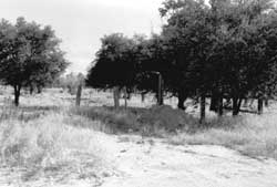
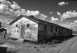
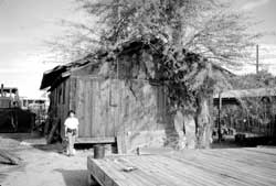
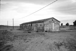
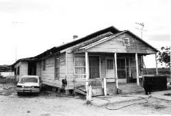
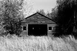
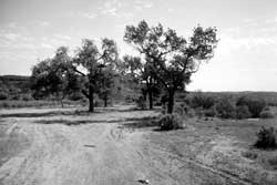
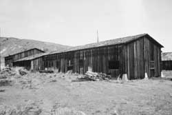
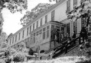
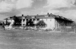
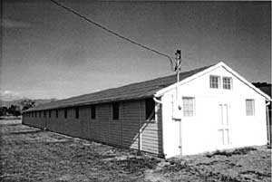
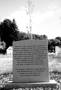
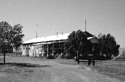
Figure 1.9. Reconstructed barracks on the grounds of the Fort Missoula History Museum.
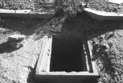
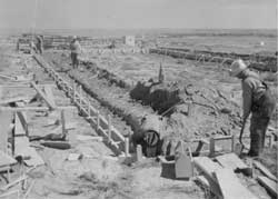
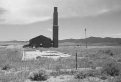
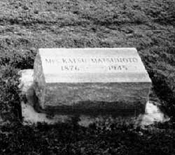
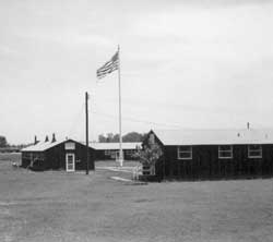
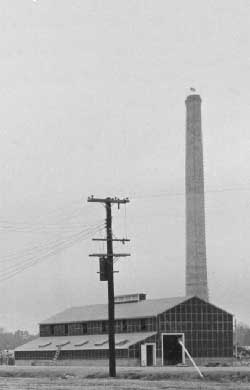
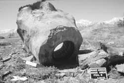
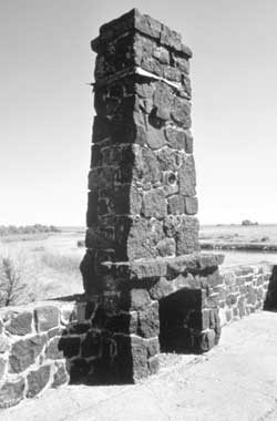
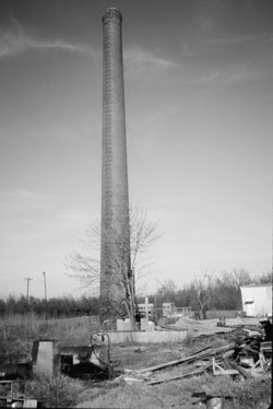
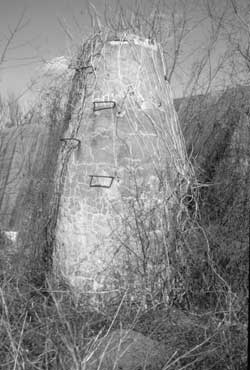
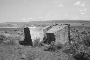
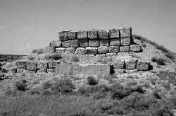
Figure 1.10. Hospital smokestack at the Jerome Relocation Center.
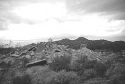
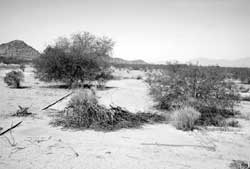
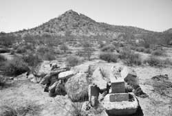
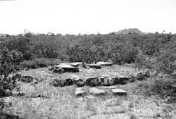
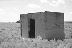
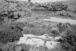
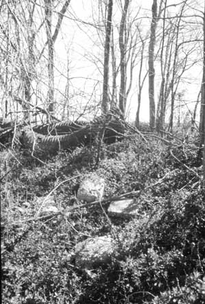
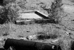
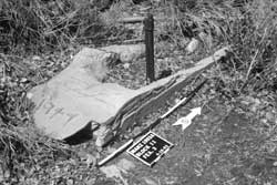
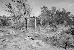
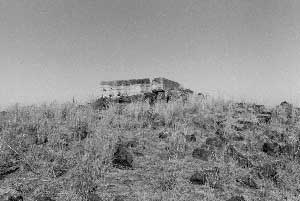
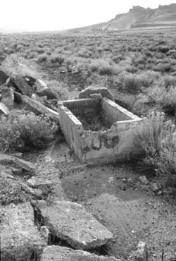
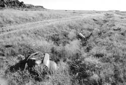
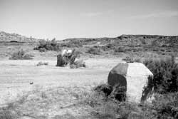
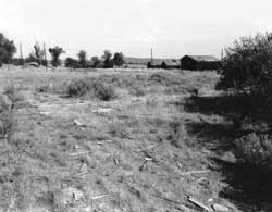
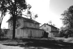
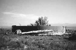
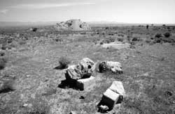
Figure 1.11. Remains at the site of the Lordsburg Internment Camp.
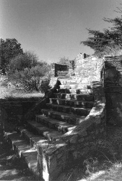
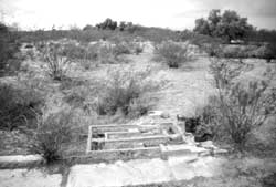
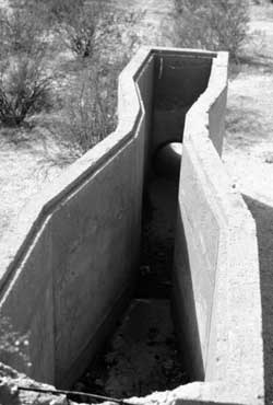
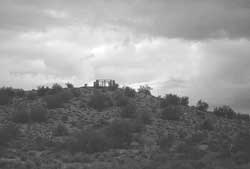
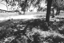
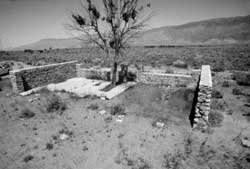
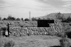
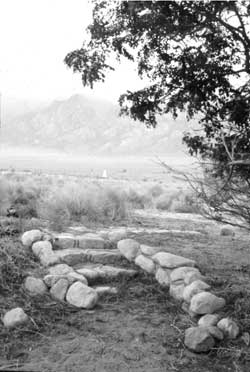
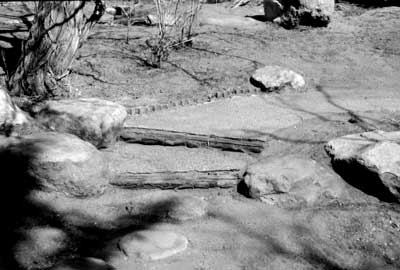
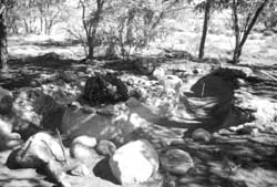
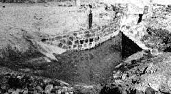
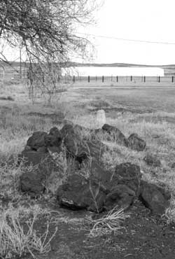
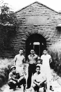
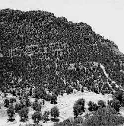
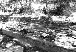
Figure 1.12. Rock and concrete steps in the staff housing area at the Catalina Federal Honor Camp.
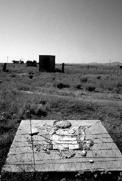
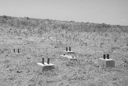
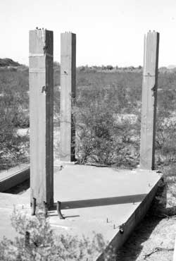
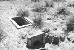
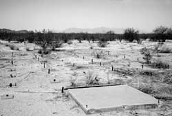
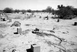
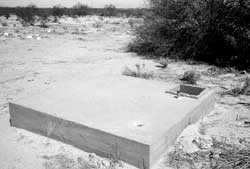
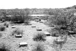
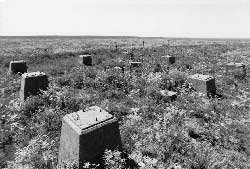
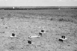
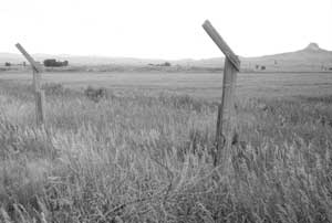
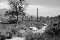
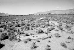
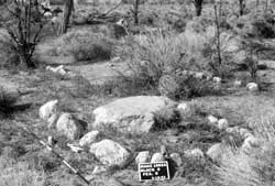
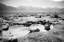
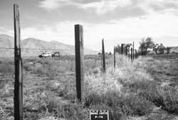
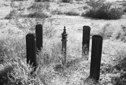
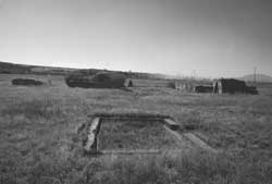
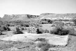
Figure 1.13. Watch tower foundation blocks at the Granada Relocation Center.
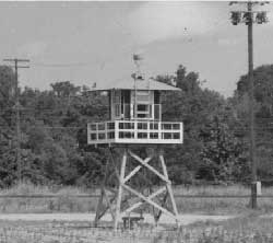
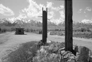
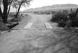
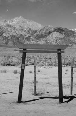
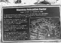
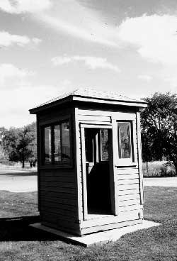
Figure 1.14. Sentry post and waiting room at the entrance to the Minidoka Relocation Center.
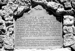
Figure 1.15. Jail at the Tule Lake Relocation Center.
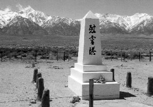
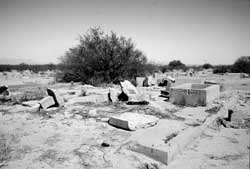
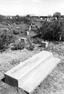
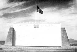
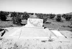
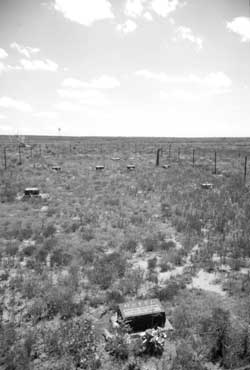
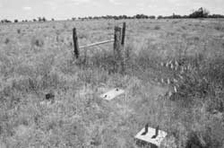
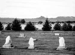
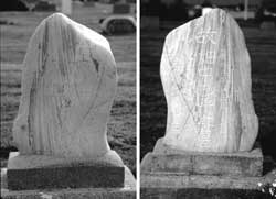
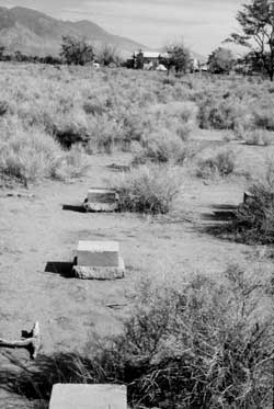
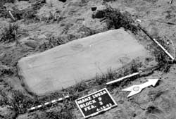
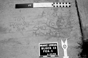
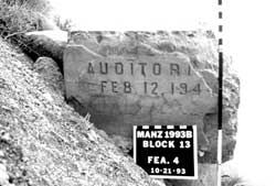
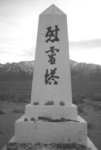
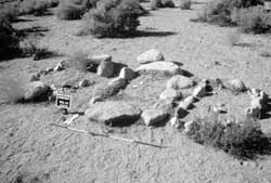
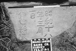
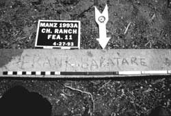
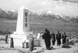
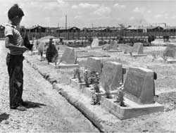
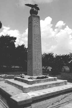
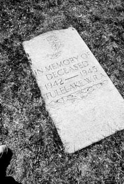
Figure 1.16. Cemetery monument at the Manzanar Relocation Center.
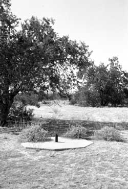
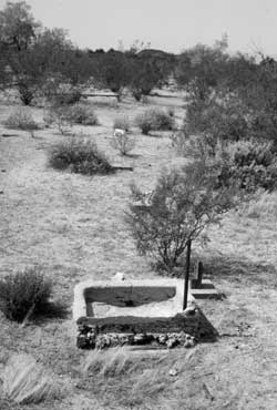
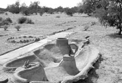
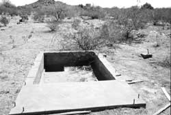
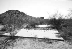
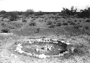
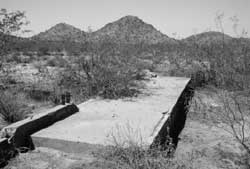
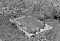
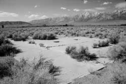
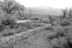
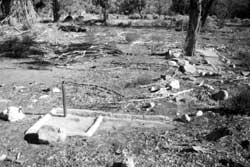
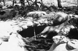
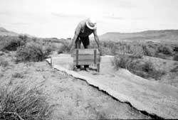
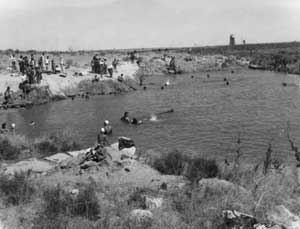
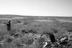
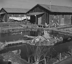
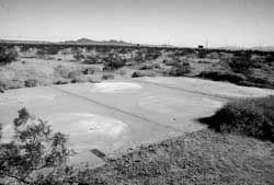
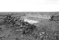
Figure 1.17. Small concrete pond at the Gila River Relocation Center.
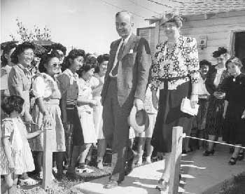
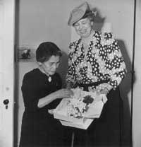
Figure 2.1. Mrs. Eleanor Roosevelt, accompanied by WRA National Director Dillon S. Myer, visits the Gila River Relocation Center.
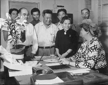
Figure 2.2. Representatives of Councils greet Mrs. Roosevelt, Gila River Relocation Center.
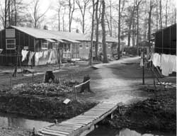
Figure 2.3. Residential area at the Gila River Relocation Center.
Figure 2.4. Buddhist Church at the Gila River Relocation Center.
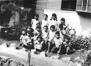
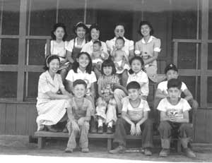
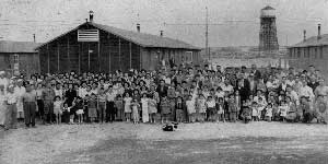
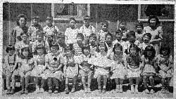
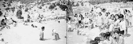
Figure 2.5. Group of Japanese American children at the Gila River Relocation Center, August 1943.
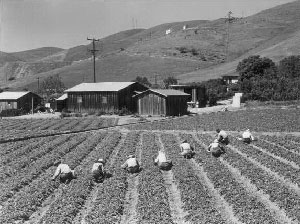
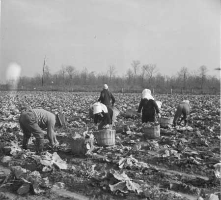
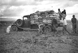
Figure 3.1. Japanese American family harvesting their strawberry field near San Jose, April 5, 1942.
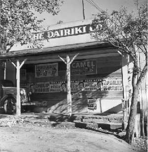
Figure 3.2. Japanese store, Penryn, California.
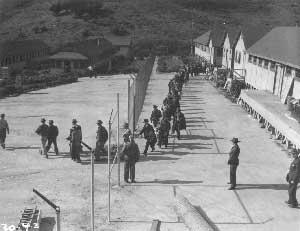
Figure 3.3. Aliens at the Camp Sharp Detention Station prior to transfer to interment camps.
Figure 3.4. The Shibuya family at their Mountain View, California, home.
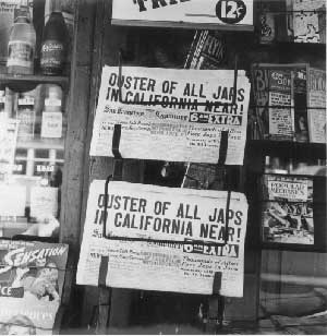
Figure 3.5. Newspaper headline.
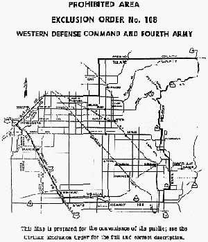
Figure 3.6. Map included with Civilian Exclusion Order 108.
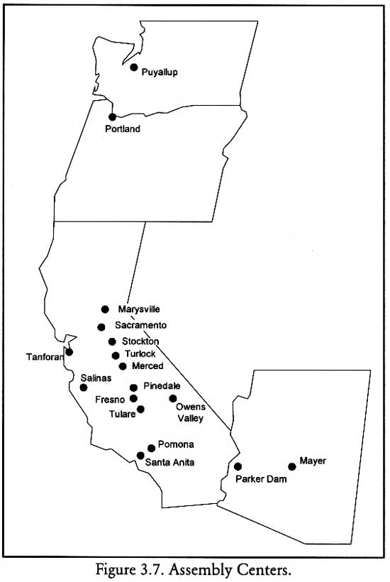
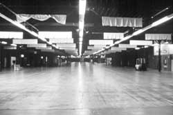
Figure 3.7. Assembly Centers.
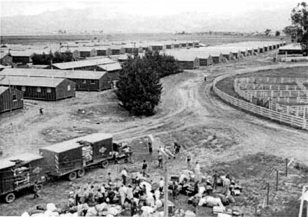
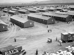
Figure 3.8. Arrival at Salinas Assembly Center, April 29, 1942.
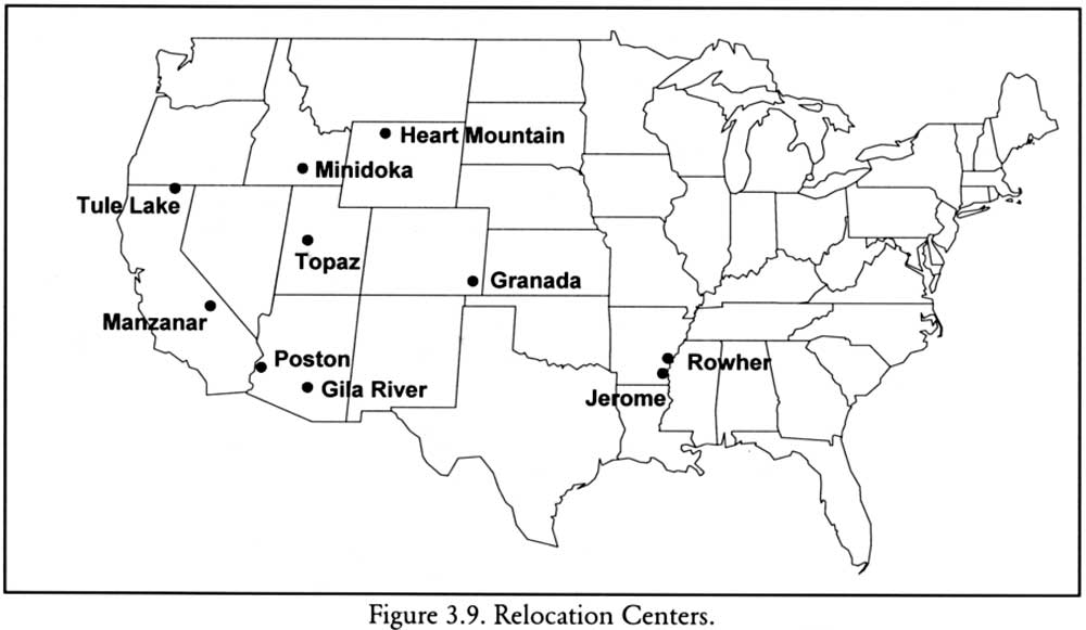
Figure 3.9. Relocation Centers.
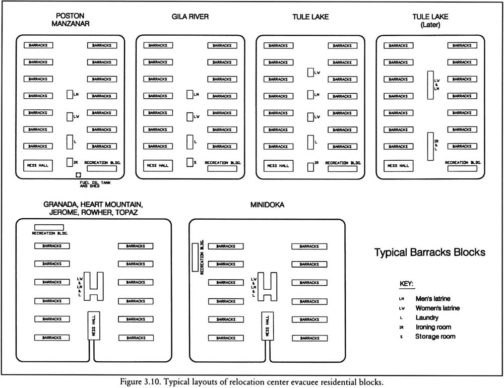
Figure 3.10. Typical layouts of relocation center evacuee residential blocks.
Figure 3.11. Camouflage net factory at the Manzanar Relocation Center.
Figure 3.12. Evacuee barracks at the Manzanar Relocation Center.
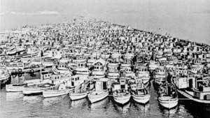
Figure 3.13. Seized fishing boats impounded on the Fraser River.
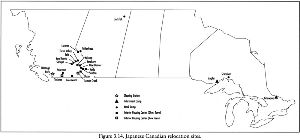
Figure 3.14. Japanese Canadian relocation sites.
Figure 3.15. Residents of the Tule Lake Center post signs to welcome the arrival of transferees from other centers.
Figure 3.16. Demonstration at Tule Lake.
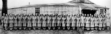
Figure 3.17. Japanese American women in the armed forces.
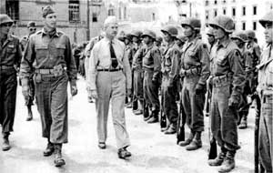
Figure 3.18. Japanese American soldiers in Italy.
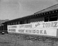
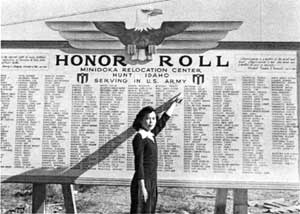
Figure 3.19. Honor roll at the Minidoka Relocation Center.
Figure 3.20. Abandoned evacuee barracks at the Tule Lake Center.
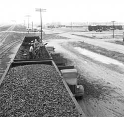
Figure 3.21. Transporting building materials from the Manzanar Relocation Center.
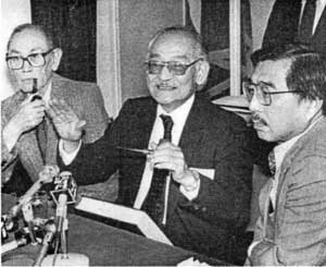
Figure 3.22. Fred Korematsu, Minoru Yasui, and Gordon Hirabayashi.
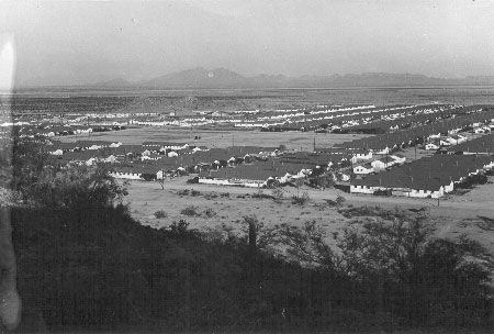
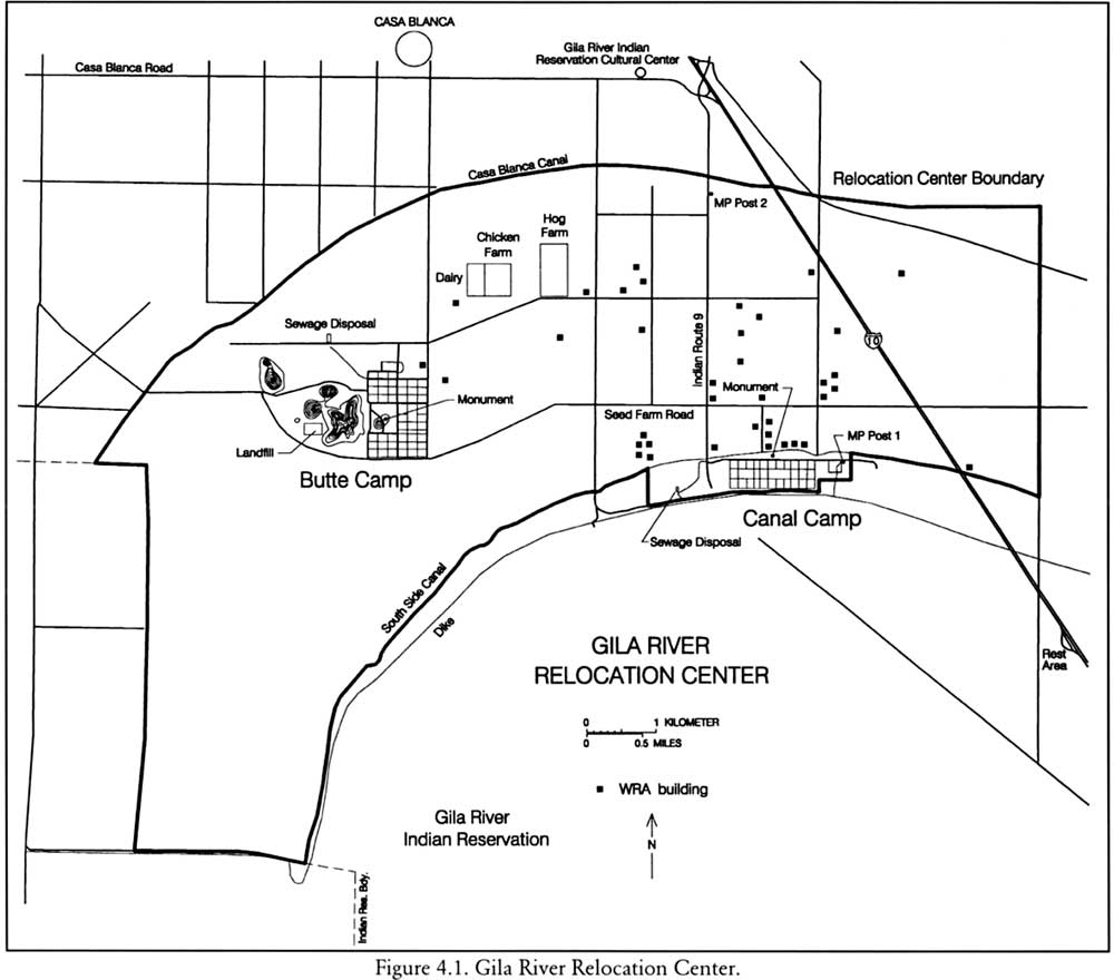
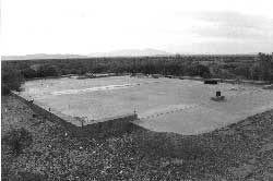
Figure 4.1. Gila River Relocation Center.
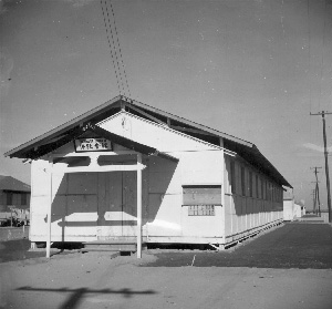
Figure 4.2. Typical Barracks at the Gila River Relocation Center.
Figure 4.3. Eleanor Roosevelt at the Gila River Relocation Center, April 23, 1943.
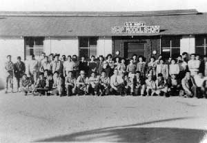
Figure 4.4. Model ship building shop.
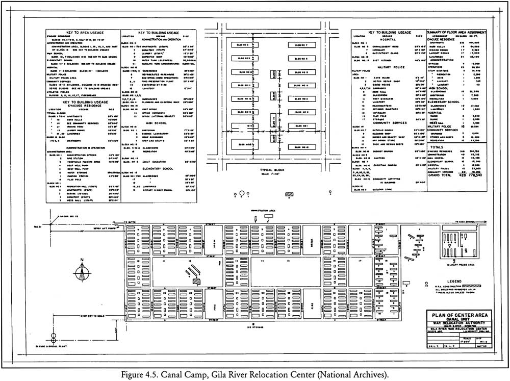
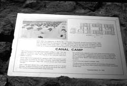
Figure 4.5. Canal Camp, Gila River Relocation Center.
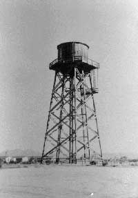
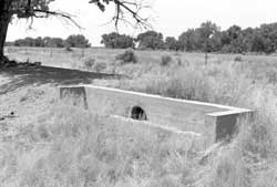
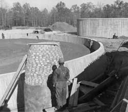
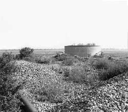
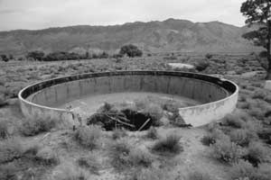
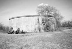
Figure 4.6. Water tank at Canal Camp.
Figure 4.7. Administration building at Canal Camp.
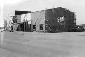
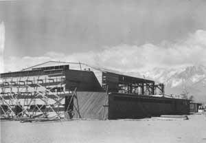
Figure 4.8. Auditorium under construction at Canal Camp.
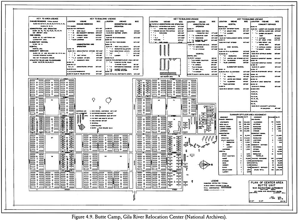
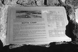
Figure 4.9. Butte Camp, Gila River Relocation Center.
Figure 4.10. Staff housing at Butte Camp.
Figure 4.11. Camouflage net factory at Butte Camp.
Figure 4.12. Water tank and outdoor stage at Butte Camp.
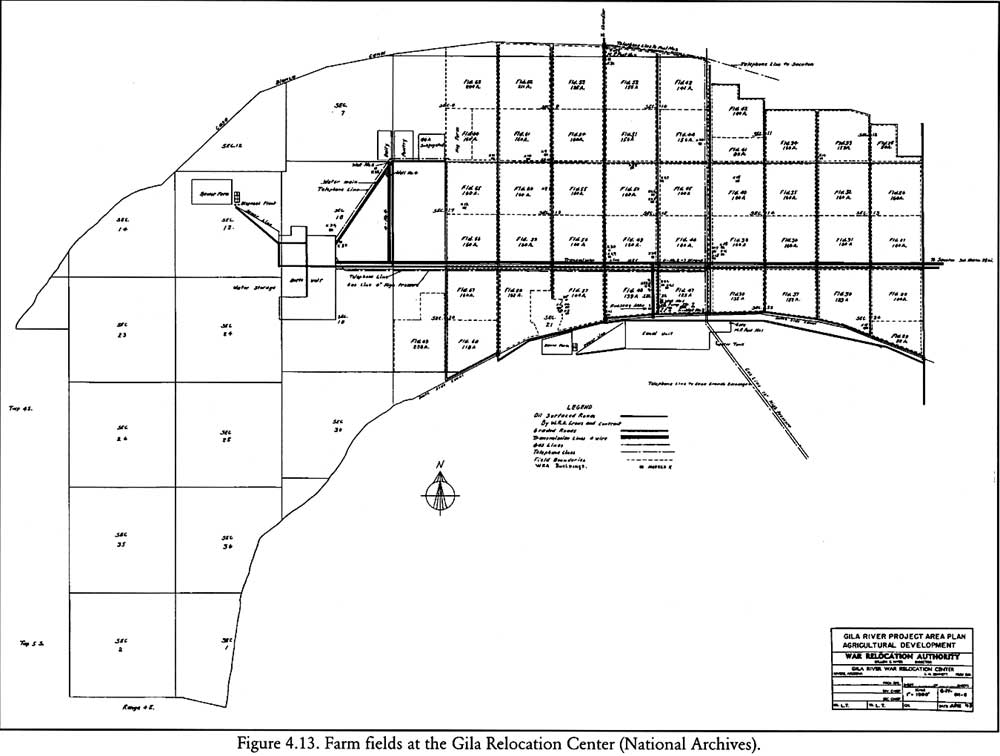
Figure 4.13. Farm fields at the Gila Relocation Center.
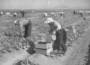
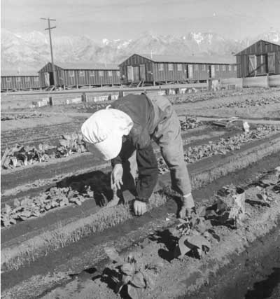
Figure 4.14. Harvesting cucumbers at the Gila River Relocation Center.
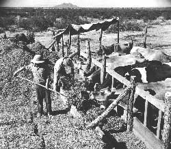
Figure 4.15. Growing experimental plants at the Gila River Relocation Center.
Figure 4.16. Growing carrot seeds at the Gila River Relocation Center.
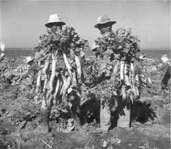
Figure 4.17. Harvesting daikon at the Gila River Relocation Center.
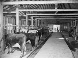
Figure 4.18. Feeding dairy cows at the Gila River Relocation Center dairy farm.
Figure 4.19. Feeding calves at the Gila River Relocation Center dairy farm.
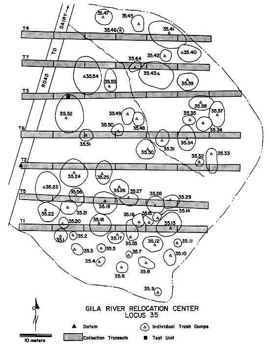
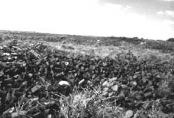
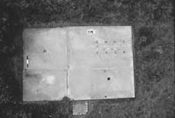
Figure 4.20. Trash concentration (Locus 35) near Butte Camp.
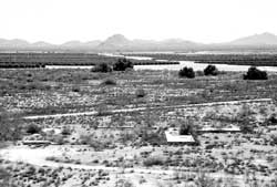
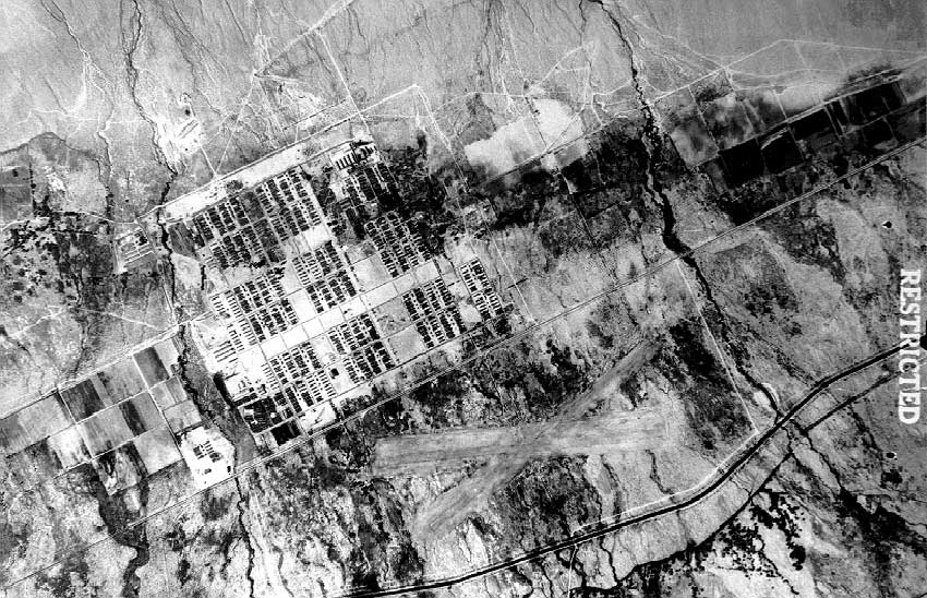
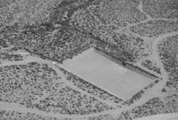
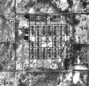
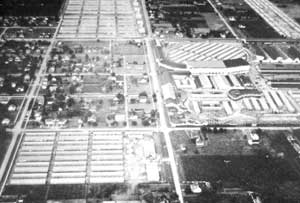
Figure 4.21. Oblique aerial view of the Gila River Relocation Center area today.
Figure 4.22. Old highway bridge over the South Side Canal.
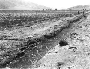
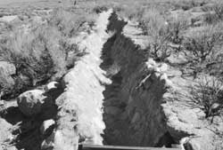
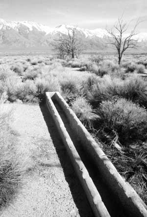
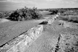
Figure 4.23. Remains of irrigation ditch at Canal Camp.
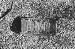
Figure 4.24. Vehicle licence plate at Canal Camp.
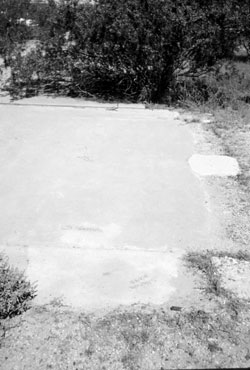
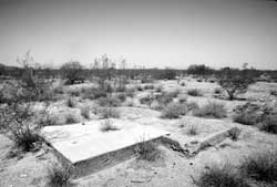
Figure 4.25. Concrete slab of the Canal Camp fire station.
Figure 4.26. Flagpole base in administration area at Canal Camp.
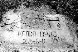
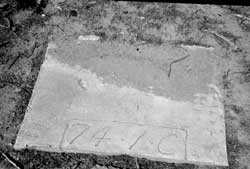
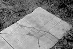
Figure 4.27. Inscription in administration area at Canal Camp.
Figure 4.28. Inscription in administration area at Canal Camp.
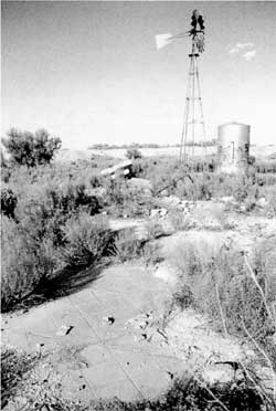
Figure 4.29. Concrete slab of warehouse at Canal Camp.
Figure 4.30. Concrete slab of latrine and shower building at Canal Camp.
Figure 4.31. Laundry room slab.
Figure 4.32. Latrine grease trap.
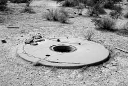
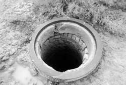
Figure 4.33. Cistern manhole.
Figure 4.34. Barracks footings at Canal Camp, protective dike in background.
Figure 4.35. Barracks basement depression.
Figure 4.36. Barracks basement.
Figure 4.37. Exterior faucet in evacuee residential area.
Figure 4.38. Posts remaining from shade canopy at Block 10 mess hall, Canal Camp.
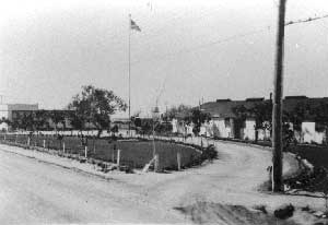
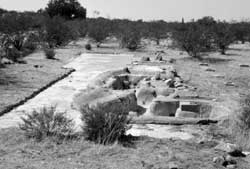
Figure 4.39. Landscaping at Canal Camp.
Figure 4.40. Sidewalk and landscaping at Canal Camp.
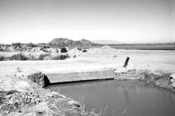
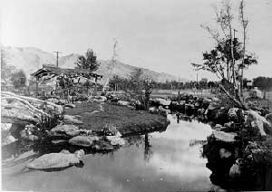
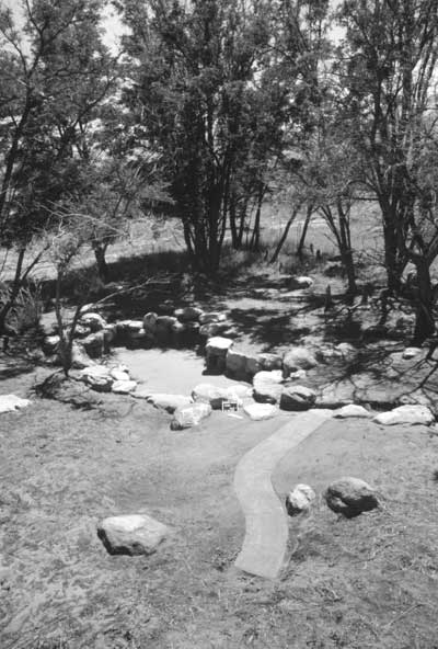
Figure 4.41. Evacuee-built pond at Canal Camp.
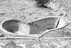
Figure 4.42. Evacuee-built pond and landscaping at Canal Camp; note barracks footing block within pond.
Figure 4.43. Evacuee-built pond at Canal Camp.
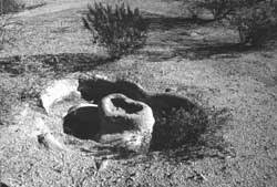
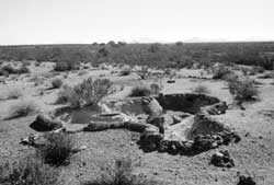
Figure 4.44. Evacuee-built pond at Canal Camp.
Figure 4.45. Evacuee-built pond at Canal Camp.
Figure 4.46. Evacuee-built pond at Canal Camp.
Figure 4.47. Evacuee-built pond at Canal Camp.
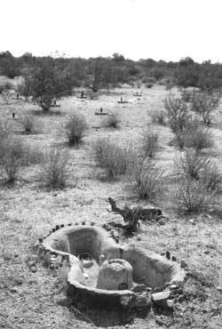
Figure 4.48. Evacuee-built pond at Block 23 mess hall, Canal Camp, note footing block within pond.
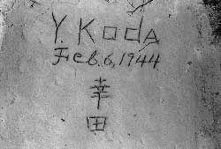
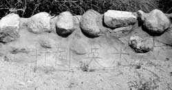
Figure 4.49. Japanese inscription on pond edge at Canal Camp.
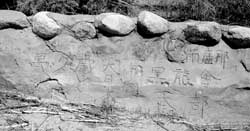
Figure 4.50. Inscription at Canal Camp.
Figure 4.51. Inscription at Canal Camp.
Figure 4.52. Inscription at Canal Camp.
Figure 4.53. Inscription at Canal Camp.
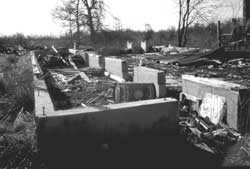
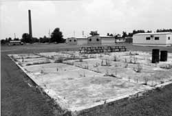
Figure 4.54. Foundation at Canal Camp high school.
Figure 4.55. Wooden home plate at Canal Camp.
Figure 4.56. Foundation of ice house at Canal Camp.
Figure 4.57. Clarifier and digester at the Canal Camp sewage treatment plant.
Figure 4.58. Control room at the Canal Camp sewage treatment plant.
Figure 4.59. Headworks at the Canal Camp sewage treatment plant.
Figure 4.60. Piled concrete rubble at Butte Camp.
Figure 4.61. Irrigation ditch at Butte Camp.
Figure 4.62. Foundation of administration building at Butte Camp.
Figure 4.63. Upturned cistern at Butte Camp.
Figure 4.64. Entry and footing blocks at the Butte Camp hospital.
Figure 4.65. Footing blocks at the Butte Camp hospital.
Figure 4.66. Foundation remains at the Butte Camp hospital.
Figure 4.67. Foundation of heating plant at the Butte Camp hospital.
Figure 4.68. Foundation of laundry building at the Butte Camp hospital.
Figure 4.69. Cistern at the Butte Camp hospital.
Figure 4.70. Incinerators northwest of the Butte Camp hospital.
Figure 4.71. Foundation of staff apartment building at Butte Camp.
Figure 4.72. Foundation of staff laundry room at Butte Camp.
Figure 4.73. Foundation of warehouse at Butte Camp.
Figure 4.74. Foundation of refrigerated warehouse at Butte Camp.
Figure 4.75. Foundation of ice house at Butte Camp.
Figure 4.76. Foundation of mess hall at Butte Camp.
Figure 4.77. Concrete threshold at Butte Camp mess hall.
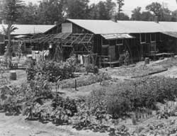
Figure 4.78. Landscaping in the evacuee residential area at Butte Camp.
Figure 4.79. Landscaping in the evacuee residential area at Butte Camp.
Figure 4.80. Saguaro cactus and scattered rock work in the evacuee residential area at Butte Camp.
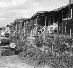
Figure 4.81. Evacuee landscaping at Butte Camp.
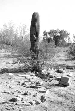
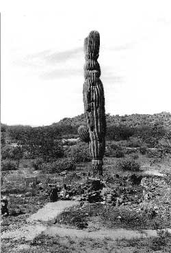
Figure 4.82. Saguaro cactus and rock work in the evacuee residential area.
Figure 4.83. Detail of garden in the evacuee residential area.
Figure 4.84. Concrete entry at the front of an evacuee barracks.
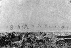
Figure 4.85. Inscription at Butte Camp.
Figure 4.86. Inscription at Butte Camp.
Figure 4.87. Evacuee-built pond at Butte Camp.
Figure 4.88. Evacuee-built pond at Butte Camp.
Figure 4.89. Evacuee-built pond at Butte Camp.
Figure 4.90. Evacuee-built pond at Butte Camp.
Figure 4.91. Sumo wresting arena, November 1942.
Figure 4.92. Area of the sumo arena today.
Figure 4.93. Remains at Butte Camp high school auditorium.
Figure 4.94. Footing blocks at the Butte Camp high school.
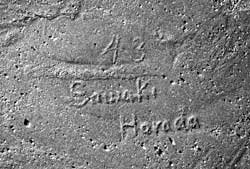
Figure 4.95. Inscription at the Butte Camp high school.
Figure 4.96. Foundation of the Butte Camp fire station.
Figure 4.97. Concrete slab at the camouflage net factory.
Figure 4.98. Concrete rubble at the camouflage net factory.
Figure 4.99. Butte Camp sewage treatment plant today.
Figure 4.100. Monument on knoll at Butte Camp.
Figure 4.101. Servicemen's monument at Butte Camp in 1944.
Figure 4.102. Detail of Butte Camp monument.
Figure 4.103. Monument at Butte Camp prior to repainting.
Figure 4.104. View towards Butte Camp high school from the water tank foundation.
Figure 4.105. Foundation of the military police vehicle repair shop.
Figure 4.106. Flagpole base at the military police compound.
Figure 4.107. Sidewalk at the military police compound.
Figure 4.108. Abandoned ditch in the evacuee farm area.
Figure 4.109. Gila Relocation Center Dairy farm.
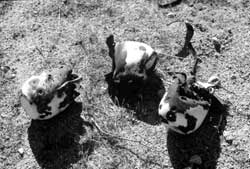
Figure 4.110. Pet grave southeast of Butte Camp in 1994.
Figure 4.111. Foundation of water tank north of the Canal Camp administration area.
Figure 4.112. Landfill at the Gila River Relocation Center.
Figure 4.113. Landfill at the Gila River Relocation Center.
Figure 4.114. Artifacts at the Gila River Relocation Center landfill.
Figure 4.115. Artifacts at the Gila River Relocation Center landfill.
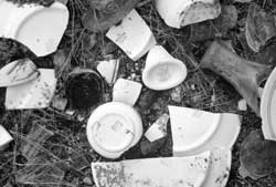
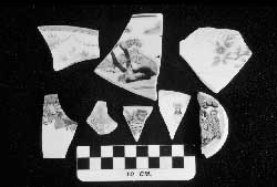
Figure 4.116. Typical glass artifacts from the Gila River Relocation Center landfill.
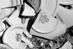
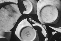
Figure 4.117. Typical ceramics from the Gila River Relocation Center landfill.
Figure 4.118. Flattened cans at the Gila River Relocation Center landfill.
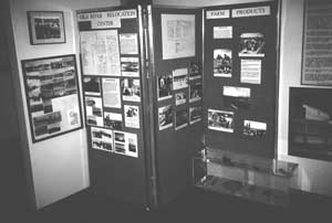
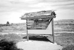
Figure 4.119. Relocation center display at the Gila River Indian Reservation Cultural Center.
Figure 4.120. Relocation center display outside the Gila River Indian Reservation Cultural Center.
Figure 4.121. Memorial marker at Canal Camp.
Figure 4.122. Memorial marker at Butte Camp.
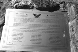
Figure 4.123. Memorial marker at Butte Camp listing the names of Japanese Americans from the Gila River Relocation Center killed in World War II.
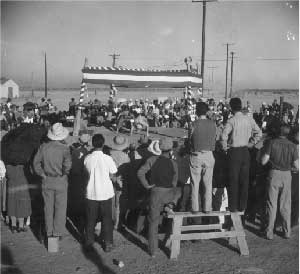
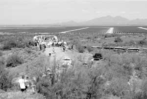
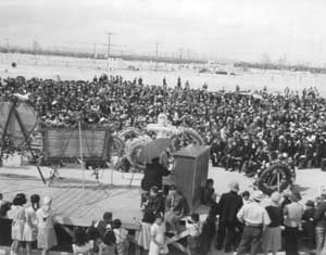
Figure 4.124. Dedication ceremony at Butte Camp (1995).
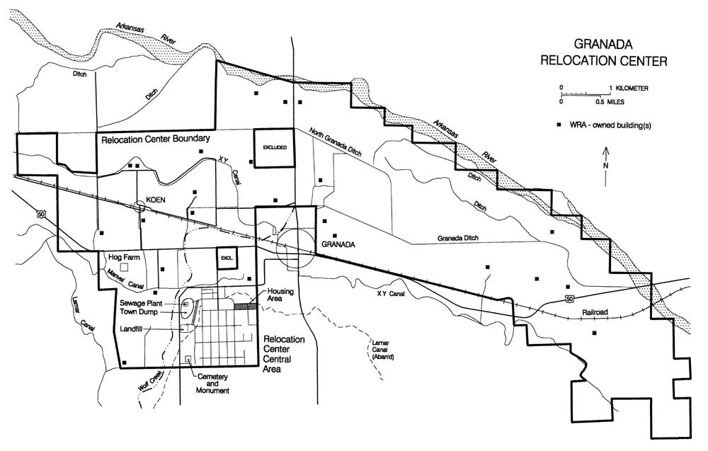
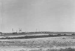
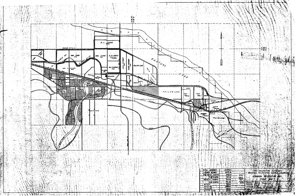
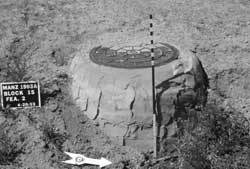
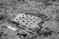
Figure 5.1. Granada Relocation Center.
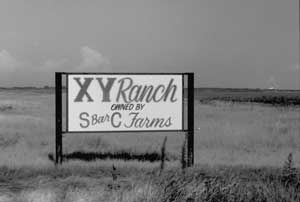
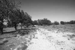
Figure 5.2. XY Ranch lands today.
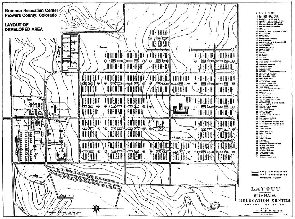
Figure 5.3. Granada Relocation Center central area.
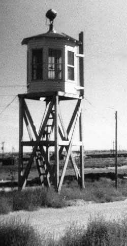
Figure 5.4. Watch tower at Granada.
Figure 5.5. Staff housing area at Granada.
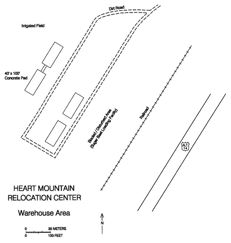
Figure 5.6. Warehouse area at Granada.
Figure 5.7. Evacuee residential area at Granada.
Figure 5.8. Preparing barracks foundation at Granada.
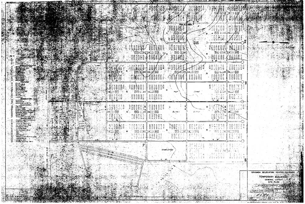
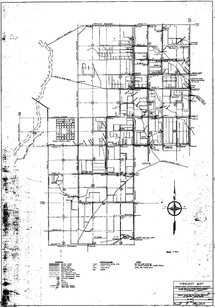
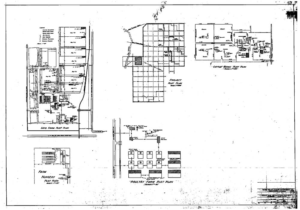
Figure 5.9. 1942 layout plan of the central area at the Granada Relocation Center.
Figure 5.10. Recreation hall in Block 10H at Granada used as a church.
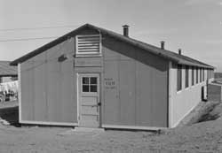
Figure 5.11. Boy Scout headquarters at Granada.
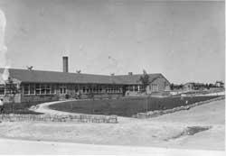
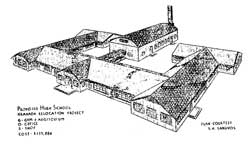
Figure 5.12. South entrance to Granada High School.
Figure 5.13. Proposed Granada High School.
Figure 5.14. Evacuee barracks at Granada, view from water tower.
Figure 5.15. Evacuee barracks at Granada.
Figure 5.16. Evacuee barracks and outhouses at Granada.
Figure 5.17. Coal storage area at Granada.
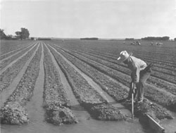
Figure 5.18. Irrigating lettuce field at Granada.
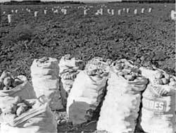
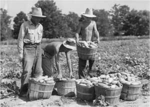
Figure 5.19. Potato harvest at Granada.
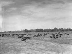
Figure 5.20. Cattle herd at Granada.
Figure 5.21. Milking shed at dairy farm at Granada.
Figure 5.22. Chicken farm at Granada.
Figure 5.23. Hog farm at Granada.
Figure 5.24. Evacuee-run blacksmith shop at Koen.
Figure 5.25. Constructing a trench silo at Granada.
Figure 5.26. Farm fields at the Granada Relocation Center (National Archives).
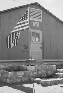
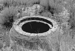
Figure 5.27. Manhole in Block 10E at Granada.
Figure 5.28. Relocation center road at Granada today.
Figure 5.29. Housing complex within the former hospital area at Granada.
Figure 5.30. Foundation of hospital laundry building at Granada.
Figure 5.31. Foundation of hospital boiler house at Granada.
Figure 5.32. Foundation in the administration area at Granada.
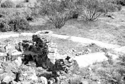
Figure 5.33. Remnants of a rock and concrete feature in the staff housing area at Granada.
Figure 5.34. Water reservoir at Granada today.
Figure 5.35. Well house used by the town of Granada.
Figure 5.36. Ruins of pump house at Granada.
Figure 5.37. Foundation blocks of water tower at Granada.
Figure 5.38. Concrete slab foundation of a warehouse at Granada.
Figure 5.39. Concrete slab foundation of mess hall in Block 9L at Granada.
Figure 5.40. Concrete slab foundation of bathroom/ laundry building in Block 11K at Granada.
Figure 5.41. Detail of concrete bathroom slab in Block 10E at Granada.
Figure 5.42. Concrete perimeter barracks foundation in Block 12F.
Figure 5.43. Concrete slab barracks foundation in Block 11H.
Figure 5.44. Brick and concrete pad for coal heater in Block 7E.
Figure 5.45. Concrete entries at the high school location.
Figure 4.46. Concrete patio at the high school location.
Figure 5.47. Concrete building at the co-op location.
Figure 4.48. Foundation at the co-op location.
Figure 5.49. Decorative landscaping at the Block 12F mess hall location.
Figure 5.50. Granada Relocation Center landfill.
Figure 5.51. Ceramics at the Granada Relocation Center landfill.
Figure 5.52. Can and ceramic dump at the Granada Relocation Center.
Figure 5.53. Remains at the Granada Relocation Center sewage treatment plant.
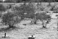
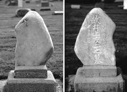
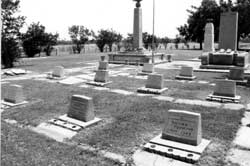
Figure 5.54. Graves at the Granada Relocation Center cemetery.
Figure 5.55. Monument and brick building at the Granada Relocation Center cemetery.
Figure 5.56. 1945 monument inside small building at the Granada Relocation Center cemetery.
Figure 5.57. Southwest corner watch tower foundation blocks.
Figure 5.58. Southeast corner watch tower foundation blocks.
Figure 5.59. Original relocation center entrance today.
Figure 5.60. Foundation remains in the military police compound at Granada.
Figure 5.61. Farm at the location of formerly-owned WRA buildings.
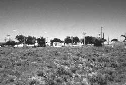
Figure 5.62. Relocated barracks east of the town of Granada.
Figure 5.63. Sign along U.S. Highway 50 in 1994.
Figure 5.64. Monument placed at the Granada Relocation Center Cemetery in 1983.
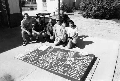
Figure 5.65. Scale model of the Granada Relocation Center.
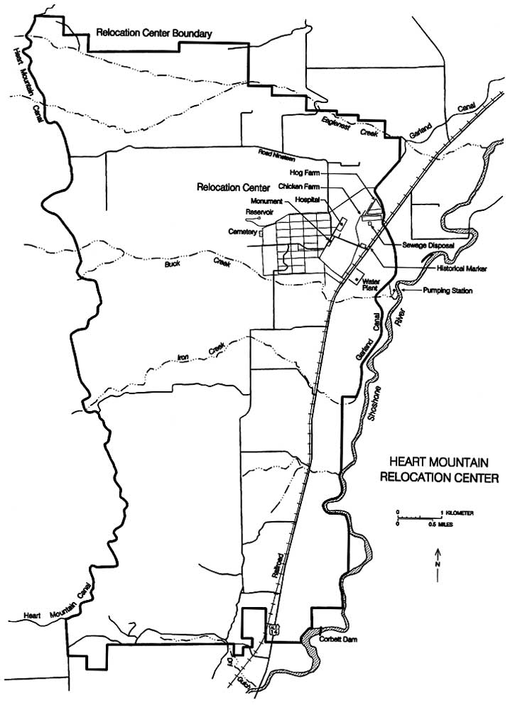
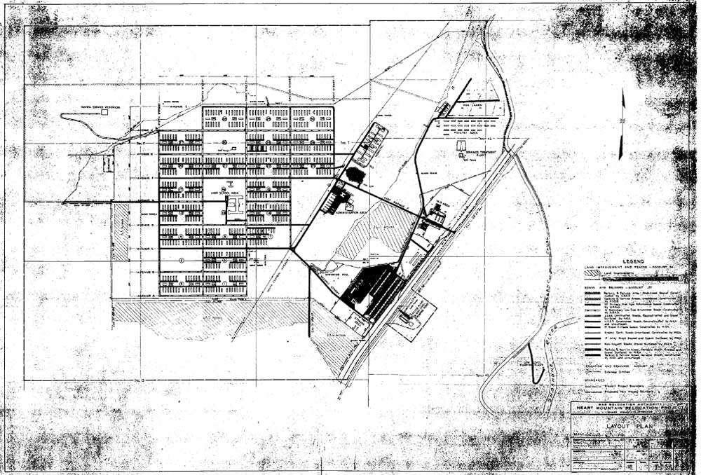
Figure 6.1. Heart Mountain Relocation Center.
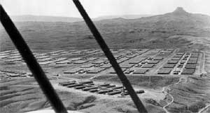
Figure 6.2. Oblique aerial view of the Heart Mountain Relocation Center.
Figure 6.3. Heart Mountain Relocation Center.
Figure 6.4. Heart Mountain Hospital.
Figure 6.5. Reassembling a CCC building for use as a school building.
Figure 6.6. Evacuees arriving through the warehouse area.
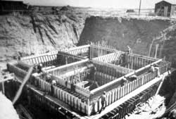
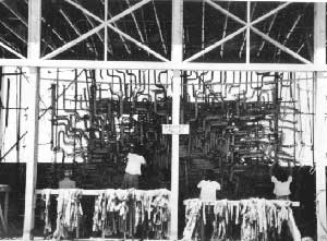
Figure 6.7. Imhoff tank under construction at the sewage disposal plant; note size of structure in relation to workers.
Figure 6.8. Farm fields at the Heart Mountain Relocation Center.
Figure 6.9. Farm field at Heart Mountain.
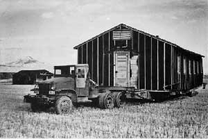
Figure 6.10. Transporting barracks from Heart Mountain.
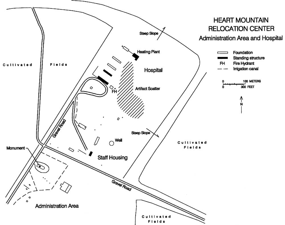
Figure 6.11. Hospital, staff housing, and administration area.
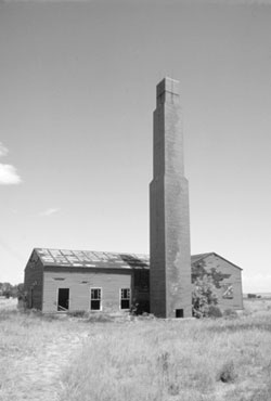
Figure 6.12. Hospital boiler house at Heart Mountain.
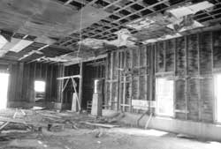
Figure 6.13. Interior of hospital boiler house.
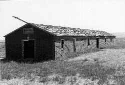
Figure 6.14. Hospital warehouse at Heart Mountain.
Figure 6.15. Hospital mess hall at Heart Mountain.
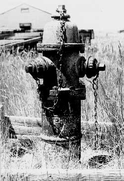
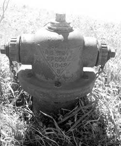
Figure 6.16. Fire hydrant in hospital area.
Figure 6.17. Concrete slab in hospital area.
Figure 6.18. Concrete slab of hospital laundry building.
Figure 6.19. Gasoline pump island in hospital area.
Figure 6.20. Building in staff housing area.
Figure 6.21. Basement in staff housing area.
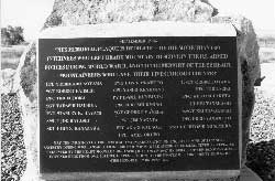
Figure 6.22. Honor Roll in administration area.
Figure 6.23. Warehouse area at Heart Mountain.
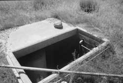
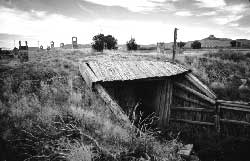
Figure 6.24. Root cellar at Heart Mountain.
Figure 6.25. Detail of root cellar vents.
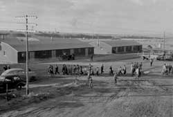
Figure 6.26. Residential area, Heart Mountain Relocation Center.
Figure 6.27. Residential area at Heart Mountain today.
Figure 6.28. Concrete structure at the location of the Heart Mountain Relocation Center high school.
Figure 6.29. Swimming pool at Heart Mountain today.
Figure 6.30. Remains of swimming pool diving board.
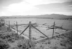
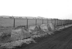
Figure 6.31. Remnants of the perimeter security fence southeast of the warehouse area.
Figure 6.32. Remains of the low-level pumping plant.
Figure 6.33. Concrete reservoir at Heart Mountain.
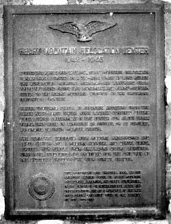
Figure 6.34. Historical marker placed along highway by the American Legion.
Figure 6.35. Detail of marker placed by the American Legion.
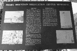
Figure 6.36. Detail of Historical marker at Memorial Park.
Figure 6.37. Detail of Historical marker at Memorial Park.
Figure 6.38. Detail of Historical marker at Memorial Park.
Figure 6.39. Detail of Historical marker at Memorial Park.
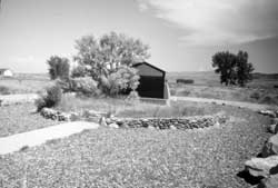
Figure 6.40. Heart Mountain Memorial Park.
Figure 6.41. Barracks building later moved to the Japanese American National Museum in Los Angeles.
Figure 6.42. Recycled barracks along State Highway 120 north of Cody, Wyoming.1
Figure 6.43. Crown Hill Cemetery, Powell, Wyoming.
Figure 6.44. Headstone at Crown Hill Cemetery.
Figure 6.45. Headstone at Crown Hill Cemetery.
Figure 6.46. Headstone at Crown Hill Cemetery.
Figure 6.47. Headstone at Crown Hill Cemetery.
Figure 6.48. Headstone at Crown Hill Cemetery.
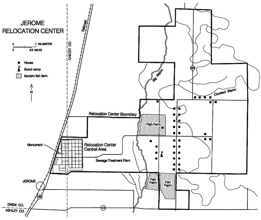
Figure 7.1. Jerome Relocation Center.
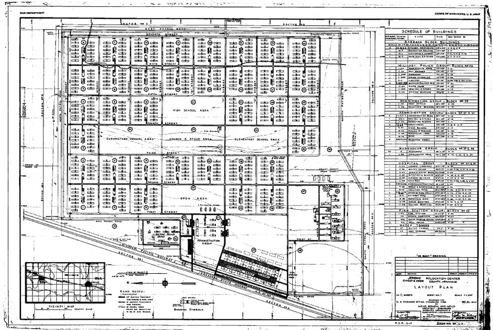
Figure 7.2. Jerome Relocation Center central area.
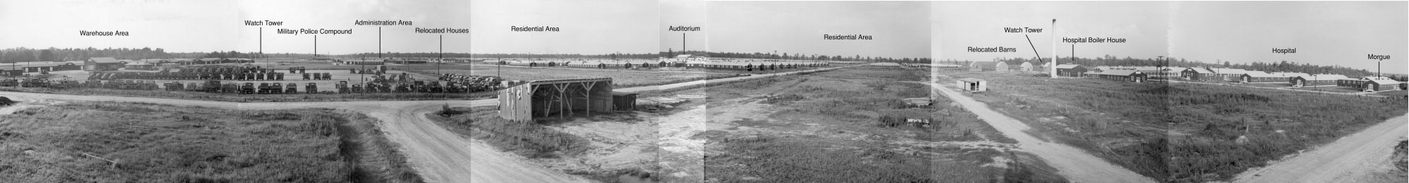
Figure 7.3. Panorama view of the Jerome Relocation Center from the southwest.
Figure 7.4. Jerome watch tower.
Figure 7.5. Military police compound at Jerome.
Figure 7.6. Typical Jerome street scene.
Figure 7.7. Barracks, Block 44, Jerome Relocation Center.
Figure 7.8. Young children at Jerome.
Figure 7.9. Multi-purpose auditorium at Jerome.
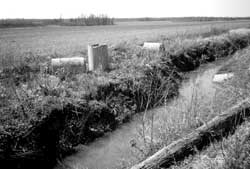
Figure 7.10. Evacuee-constructed ditches at the Jerome Relocation Center.
Figure 7.11. Drainage Ditch No. 1 at Jerome.
Figure 7.12. Sawmill at the Jerome Relocation Center.
Figure 7.13. Cabbage harvest at Jerome.
Figure 7.14. Site of the Jerome Relocation Center today.
Figure 7.15. "Relocated House" at Jerome today.
Figure 7.16. 1942 fire hydrant at Jerome.
Figure 7.17. Hospital boiler house and smokestack.
Figure 7.18. Smokestack at Jerome today.
Figure 7.19. Water reservoir under construction.
Figure 7.20. Water reservoir at Jerome today.
Figure 7.21. Deep water well at Jerome today.
Figure 7.22. Warehouse area at Jerome today.
Figure 7.23. Residential area at Jerome today.
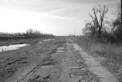
Figure 7.24. Relocation center road today.
Figure 7.25. Watch tower foundation blocks.
Figure 7.26. Sewage treatment plant under construction.
Figure 7.27. Sewage treatment plant at Jerome today.
Figure 7.28. Equipment at the Jerome sewage treatment plant today.
Figure 7.29. Old highway west of Jerome.
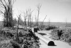
Figure 7.30. Typical ditch at Jerome.
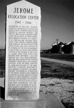
Figure 7.31. Historical Monument at Jerome.
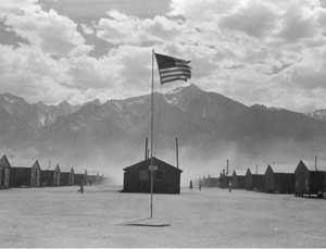
Figure 8.1. Manzanar with Mount Williamson in the background.
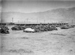
Figure 8.2. Confiscated evacuee automobiles.
Figure 8.3. Evacuees arriving at Manzanar.
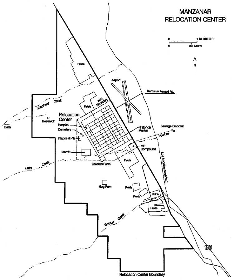
Figure 8.4. Manzanar Relocation Center.
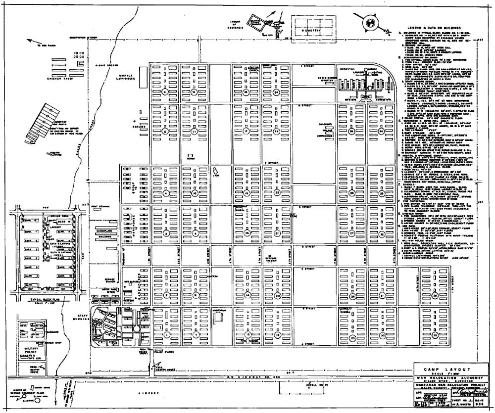
Figure 8.5. Manzanar Relocation Center central area.
Figure 8.6. Auditorium under construction.
Figure 8.7. Camouflage net factory at Manzanar.
Figure 8.8. Manzanar Children's Village.
Figure 8.9. Barracks landscaping.
Figure 8.10. Pleasure Park.
Figure 8.11. Victory gardens in a firebreak at Manzanar.
Figure 8.12. Lath house with seedling guayule plants.
Figure 8.13. Farm fields and irrigation ditches at the Manzanar Relocation Center.
Figure 8.14. 1944 aerial photograph showing relocation center farm fields north and south of the developed area at Manzanar.
Figure 8.15. Relocation center farm field.
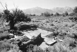
Figure 8.16. 1993 oblique areal view of the central area of the Manzanar Relocation Center.
Figure 8.17. Entrance to the Manzanar Relocation Center today.
Figure 8.18. Military police sentry post at the Manzanar Relocation Center today.
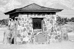
Figure 8.19. Internal police post at the Manzanar Relocation Center today.
Figure 8.20. Concrete slab foundation of the Manzanar police station.
Figure 8.21. Sidewalk at the location of the Mananzar administration building.
Figure 8.22. Traffic circle in the administration area a Mananzar.
Figure 8.23. Inscription in the concrete top of the traffic circle.
Figure 8.24. Small concrete slab in the administration area at Manzanar.
Figure 8.25. Patio and walls at the Manzanar Relocation Center director's residence.
Figure 8.26. Concrete steps to building in the administration and staff area.
Figure 8.27. Concrete slab for water heater at a staff apartment.
Figure 8.28. Rock and concrete pedestal for a sign in the administration and staff area.
Figure 8.29. Rock and concrete wall at staff apartment.
Figure 8.30. Concrete island from gasoline pump.
Figure 8.31. Concrete slab foundation of automotive service garage.
Figure 8.32. Concrete slab foundation of building at the camouflage net factory.
Figure 8.33. Barrel hoops near the camouflage net factory.
Figure 8.34. Concrete slab foundation of the hospital laundry.
Figure 8.35. Foundation of the hospital heating plant.
Figure 8.36. Foundation of the morgue.
Figure 8.37. Foundation of the garbage can washing rack.
Figure 8.38. Pulled manhole at hospital.
Figure 8.39. Concrete bench incorporated into retaining wall at the hospital.
Figure 8.40. Steps at hospital ward.
Figure 8.41. Rock and concrete retaining wall at the hospital laundry.
Figure 8.42. Remains of pond and garden complex at the Manzanar hospital.
Figure 8.43. Stepping stones, wood steps, and concrete path at the hospital pond and garden complex.
Figure 8.44. Barracks footing blocks at Manzanar.
Figure 8.45. Exterior faucet in the evacuee barracks area at Manzanar.
Figure 8.46. Exterior faucet in the evacuee barracks area at Manzanar.
Figure 8.47. Overhead view of a concrete slab foundation of a men's latrine.
Figure 8.48. Manhole and cover.
Figure 8.49. Fire hydrant.
Figure 8.50. Concrete stoop with embedded pipe fragments.
Figure 8.51. Simulated wood concrete stoop.
Figure 8.52. Concrete stoop with address formed by embedded stones.
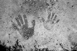
Figure 8.53. Handprints in concrete.
Figure 8.54. Rock alignments at barracks entry.
Figure 8.55. Partially exposed concrete-lined wading pool.
Figure 8.56. Wood arbor.
Figure 8.57. Wood clothesline pole.
Figure 8.58. Rock work at Block 9 pond and garden complex.
Figure 8.59. Block 22 pond and garden complex.
Figure 8.60. Concrete bridge at Block 22 pond and garden complex.
Figure 8.61. Block 34 pond.
Figure 8.62. Block 12 pond and garden complex.
Figure 8.63. Concrete slab foundation of the Manzanar fire station.
Figure 8.64. Inscriptions at the Manzanar fire station.
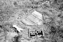
Figure 8.65. Manzanar auditorium in 1994.
Figure 8.66. Auditorium cornerstone.
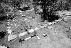
Figure 8.67. Remains of the Manzanar judo house.
Figure 8.68. Baseball home plate in firebreak at Manzanar.
Figure 8.69. Rock work at Merritt (Pleasure) Park.
Figure 8.70. Teahouse location at Merritt (Pleasure) Park.
Figure 8.71. Barbeque grills at Manzanar North Park.
Figure 8.72. Concrete and rock irrigation ditch for victory gardens.
Figure 8.73. Inscription in a diversion box of the staff victory garden irrigation system.
Figure 8.74. Pear trees near the Manzanar Children's Village.
Figure 8.75. Watch tower foundation blocks.
Figure 8.76. Inscription near the southwest watch tower.
Figure 8.77. Original section of the perimeter security fence along U.S. Highway 395.
Figure 8.78. Concrete slab foundation in the Manzanar military police compound.
Figure 8.79. Monument at the Manzanar Relocation Center cemetery.
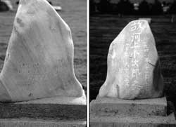
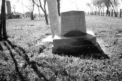
Figure 8.80. Grave at the Manzanar Relocation Center cemetery.
Figure 8.81. Grave at the Manzanar Relocation Center cemetery.
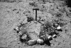
Figure 8.82. Pet cemetery at Manzanar.
Figure 8.83. Concrete-lined irrigation ditch near Shepherd Creek.
Figure 8.84. Inscription in the Manzanar North Fields irrigation ditch.
Figure 8.85. Inscription at well north of the Manzanar North Fields.
Figure 8.86. Wood control gate on one of the South Fields irrigation ditches.
Figure 8.87. Irrigation ditch for the Manzanar South Fields.
Figure 8.88. Irrigation ditch for the Manzanar South Fields.
Figure 8.89. Japanese poem inscribed on pipeline support.
Figure 8.90. Inscription on South Fields irrigation ditch.
Figure 8.91. Inscription on South Fields irrigation ditch.
Figure 8.92. Dam and retaining walls on George Creek.
Figure 8.93. Bridge over George Creek.
Figure 8.94. Oblique aerial view of the Manzanar chicken farm today.
Figure 8.95. Foundation of the slaughterhouse/ office at the Manzanar chicken farm.
Figure 8.96. Incinerator at the Manzanar chicken farm.
Figure 8.97. Inscription at the Manzanar chicken farm.
Figure 8.98. Manzanar hog farm today.
Figure 8.99. Oblique aerial view of the Manzanar water reservoir today.
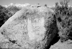
Figure 8.100. Boulder inscribed with Japanese characters for "peace".
Figure 8.101. Setting basin at the Manzanar water reservoir.
Figure 8.102. Japanese inscription at the setting basin translated as "beat Great Britain and the USA".
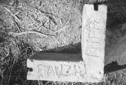
Figure 8.103. Japanese inscriptions at the setting basin translated as "banzai, the Great Japanese Empire, and Manzanar Black Dragon Group headquarters".
Figure 8.104. Inscription at the sand trap.
Figure 8.105. Inscription at the sand trap.
Figure 8.106. Inscription at the sand trap.
Figure 8.107. Concrete slab foundation of the chlorination tank.
Figure 8.108. Control room and digester at the Manzanar sewage treatment plant.
Figure 8.109. Clarifier at the Manzanar sewage treatment plant.
Figure 8.110. Manzanar Relocation Center landfill in 1994.
Figure 8.111. Typical artifacts at the Manzanar Relocation Center landfill.
Figure 8.112. Ceramic disposal pit at the Manzanar Relocation Center.
Figure 8.113. Partially-buried evacuee automobile west of the Manzanar cemetery.
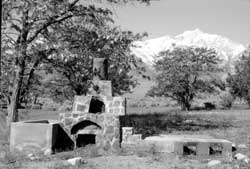
Figure 8.114. Evacuee-built oven 1/4 mile south of the central area.
Figure 8.115. Inscription in the clapboard of the Lone Pine train station.
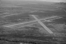
Figure 8.116. Oblique aerial view of the Manzanar airport today.
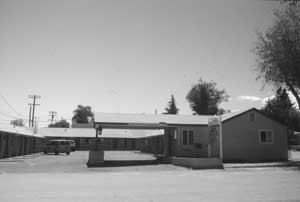
Figure 8.117. Barracks buildings at the Willow Motel in Lone Pine.
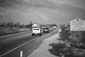
Figure 8.118. Sign along U.S. Highway 395.
Figure 8.119. Historical marker at the military police sentry post.
Figure 8.120. Detail of the historical marker at the sentry post.
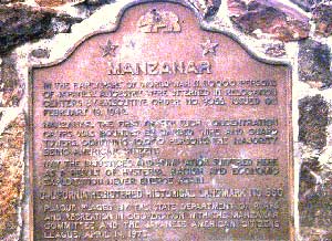
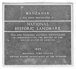
Figure 8.121. National Historic Landmark plaque at Manzanar.
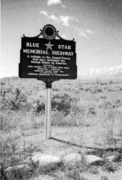
Figure 8.122. Blue Star Memorial Highway marker.
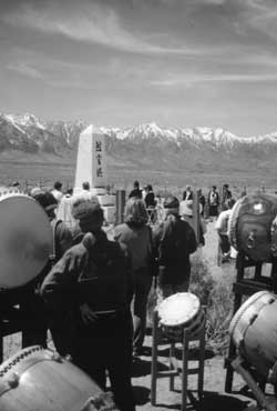
Figure 8.123. Manzanar pilgrimage.
Figure 8.124. Manzanar pilgrimage.
Figure 8.125. Framework for information board the Manzanar cemetery.
Figure 8.126. Manzanar display at the Eastern California Museum in Independence.
Figure 9.1. North Side Canal.
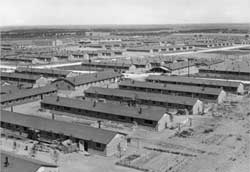
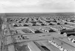
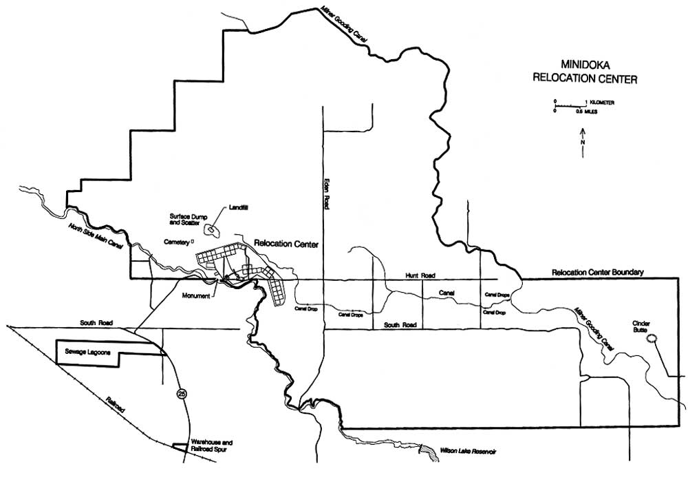
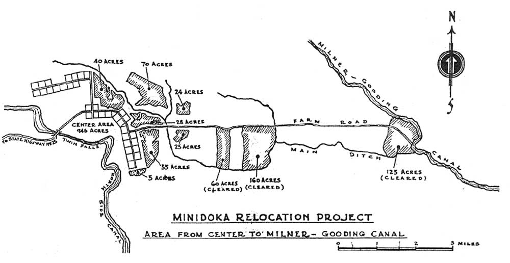
Figure 9.2. Minidoka Relocation Center.
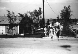
Figure 9.3. Residents of one barracks block.
Figure 9.4. Minidoka Relocation Center.
Figure 9.5. Administration area, Minidoka Relocation Center.
Figure 9.6. Oblique aerial view of the Minidoka Relocation Center.
Figure 9.7. Swimming pool located south of warehouses.
Figure 9.8. Farm fields at Minidoka.
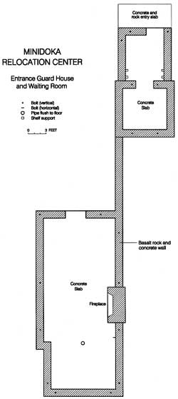
Figure 9.9. Plan map of guard house and waiting room at Minidoka.
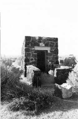
Figure 9.10. Guard house today.
Figure 9.11. Chimney in waiting room.
Figure 9.12. Guard house and waiting room.
Figure 9.13. Residential area at the Minidoka Relocation Center today.
Figure 9.14. Root cellar under construction.
Figure 9.15. Root cellar at Minidoka today.
Figure 9.16. Concrete slab in warehouse area.
Figure 9.17. Manhole in staff housing area.
Figure 9.18. Typical reused barracks.
Figure 9.19. Concrete slab reportedly for a searchlight.
Figure 9.20. Minidoka Relocation Center landfill.
Figure 9.21. Japanese ceramics at the Minidoka Relocation Center landfill.
Figure 9.22. Canal drop under construction.
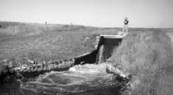
Figure 9.23. One of seven canal drops at the Minidoka Relocation Center today.
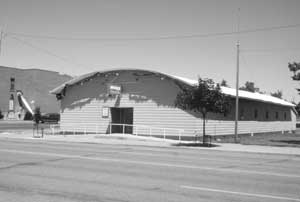
Figure 9.24. VFW hall in Jerome, Idaho.
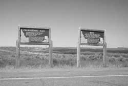
Figure 9.25. Historical markers at intersection of Hunt Road and State Highway 25.
Figure 9.26. Historical markers at the guard house and waiting room.
Figure 9.27. Detail of historical marker at guard house and waiting room.
Figure 9.28. Detail of historical marker at guard house and waiting room.
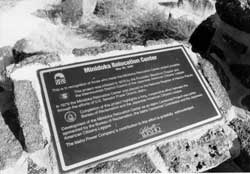
Figure 9.29. Detail of National Register plaque at guard house and waiting room.
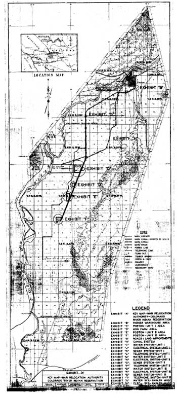
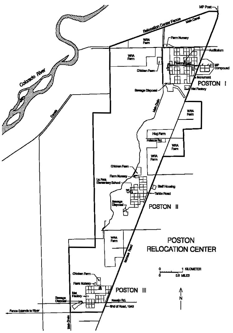
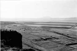
Figure 10.1. Colorado River Indian Reservation.
Figure 10.2. Poston site partially cleared.
Figure 10.3. Rolls of roofing paper at the Poston site.
Figure 10.4. Unloading lumber at the Poston site.
Figure 10.5. Construction underway at Poston I.
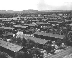
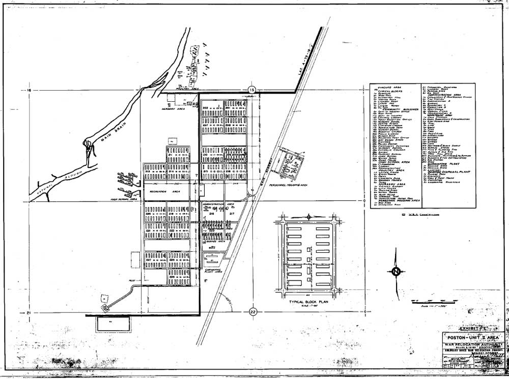
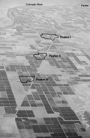
Figure 10.6. Poston Relocation Center.
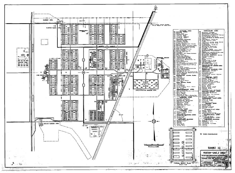
Figure 10.7. Poston I central area.
Figure 10.8. Poston I.
Figure 10.9. Pond at Poston I.
Figure 10.10. Kabuki theater at Poston I.
Figure 10.11. Evacuee making adobe bricks.
Figure 10.12. Drying adobe bricks.
Figure 10.13. Adobe brick factory.
Figure 10.14. Mixing mud for adobe bricks.
Figure 10.15. Pouring foundation for school.
Figure 10.16. Machine shop at Poston I.
Figure 10.17. Poston II central area.
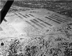
Figure 10.18. Aerial view of Poston II under construction.
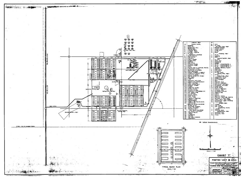
Figure 10.19. Poston III central area.
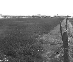
Figure 10.20. Farms at the Poston Relocation Center.
Figure 10.21. Alfalfa field north of Poston.
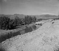
Figure 10.22. Main irrigation ditch at Poston.
Figure 10.23. Poston Relocation Center hog farm.
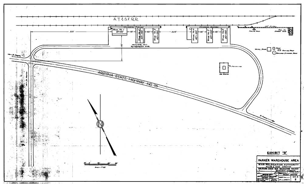
Figure 10.24. Parker warehouse area, Poston Relocation Center.
Figure 10.25. Oblique aerial view of the Poston area today.
Figure 10.26. Barracks area at Poston I today.
Figure 10.27. Poston I elementary school auditorium today.
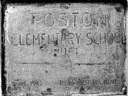
Figure 10.28. Plaque at the Poston I elementary school auditorium.
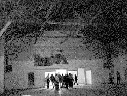
Figure 10.29. Interior of the Poston I elementary school auditorium.
Figure 10.30. Classroom building at the Poston I elementary school.
Figure 10.31. Collapsed porch at the Poston I elementary school.
Figure 10.32. Poston I machine shop today.
Figure 10.33. Poston I garage area today.
Figure 10.34. Poston I staff housing area today.
Figure 10.35. Clarifier at the Poston I sewage treatment plant.
Figure 10.36. Top of digester at the Poston I sewage treatment plant.
Figure 10.37. Barracks area at Poston II today.
Figure 10.38. School auditorium at the site of the Poston II elementary school.
Figure 10.39. Ditch through the center of Poston II.
Figure 10.40. Inscription in concrete block in ditch bank at Poston II.
Figure 10.41. Concrete slab foundation at the site of the Poston II camouflage net factory.
Figure 10.42. Poston II sewage treatment plant today.
Figure 10.43. Clarifier and overturned manholes at the Poston II sewage treatment plant.
Figure 10.44. Relocation center hospital building at the site of the Poston II staff housing area.
Figure 10.45. Poston III sewage treatment plant today.
Figure 10.46. Barracks area at Poston III today.
Figure 10.47. Concrete slab foundation at the site of the Poston Relocation Center military police compound.
Figure 10.48. Site of the Poston Relocation Center hog farm today.
Figure 10.49. Concrete slab foundation at the site of the Poston Relocation Center hog farm.
Figure 10.50. Inscription at the Poston Relocation Center hog farm.
Figure 10.51. Site of the Poston Relocation Center Parker warehouse area today.
Figure 10.52. Hydrant at the site of the Parker warehouses.
Figure 10.53. Concrete slab foundation for the fuel oil storage tanks at the Parker warehouse area.
Figure 10.54. Barracks moved to the town of Parker.
Figure 10.55. Can lids used to patch knot holes in barracks floor.
Figure 10.56. Relocated barracks formerly used as Head Start School.
Figure 10.57. Hospital building north of Poston I.
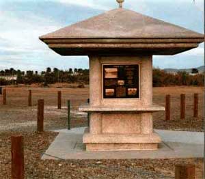
Figure 10.58. Monument and kiosk at Poston I.
Figure 10.59. Monument at Poston I.
Figure 10.60. Kiosk at Poston I.
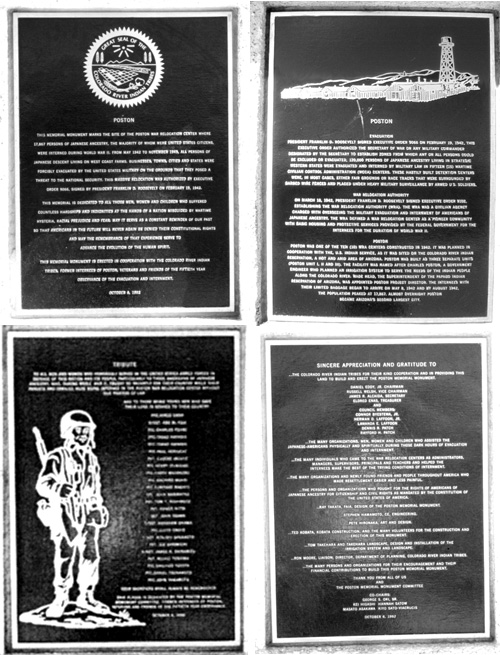
Figure 10.61. Plaques at the Poston monument.
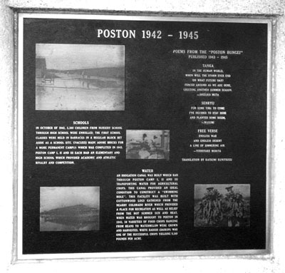
Figure 10.62. One of four interpretative signs at the Poston I kiosk.
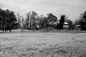
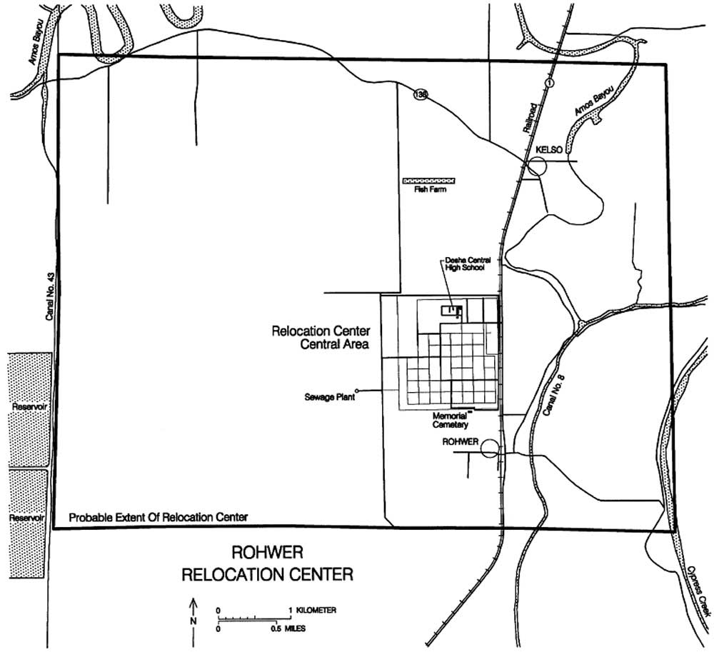
Figure 11.1. Residence south of Rohwer on top of a suspected Indian mound.
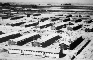
Figure 11.2. Rohwer Relocation Center.
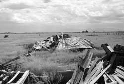
Figure 11.3. Construction underway at the Rohwer Relocation Center.
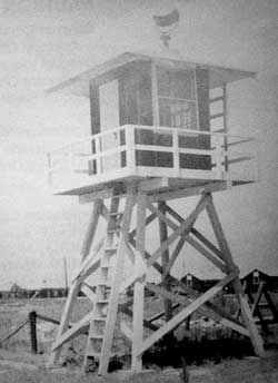
Figure 11.4. Watch tower at Rohwer.
Figure 11.5. Rohwer Relocation Center central area.
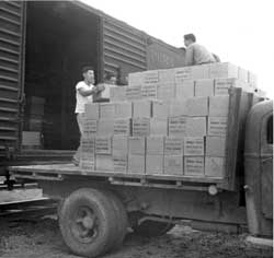
Figure 11.6. Evacuees unloading boxcar at Rohwer.
Figure 11.7. Evacuees unloading coal at Rohwer.
Figure 11.8. Evacuees building staff apartment at Rohwer.
Figure 11.9. Wooden sidewalk at Rohwer.
Figure 11.10. Drainage ditch in residential block at Rohwer.
Figure 11.11. Evacuee garden at Rohwer.
Figure 11.12. Barracks residence at Rohwer.
Figure 11.13. Farm mules at Rohwer.
Figure 11.14. Harvesting cucumbers at Rohwer.
Figure 11.15. Hospital boiler house foundation at Rohwer.
Figure 11.16. Hospital boiler house smokestack.
Figure 11.17. Concrete slab of the hospital mess hall at Rohwer.
Figure 11.18. Desha Central High School auditorium.
Figure 11.19. High school auditorium at the Rohwer Relocation Center.
Figure 11.20. Residences within the former administration area at Rohwer.
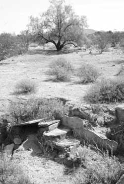
Figure 11.21. Remains of the relocation center post office at Rohwer.
Figure 11.22. Railroad and warehouse area at Rohwer today.
Figure 11.23. Former residential area at Rohwer, now a rice field.
Figure 11.24. Concrete debris on concrete slab in rice field at Rohwer.
Figure 11.25. Concrete water reservoir at Rohwer today.
Figure 11.26. Modern well house at the site of a relocation center well.
Figure 11.27. Exposed and displace sewer pipe at Rohwer.
Figure 11.28. Digester at the sewage treatment plant today.
Figure 11.29. Manhole at the Rohwer sewage treatment plant.
Figure 11.30. Rohwer Relocation Center cemetery in July 1943.
Figure 11.31. Rohwer Relocation Center cemetery in June 1944.
Figure 11.32. Rohwer Relocation Center cemetery today.
Figure 11.33. Rohwer Relocation Center cemetery today.
Figure 11.34. Road to the Rohwer Memorial cemetery.
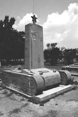
Figure 11.35. Monument to the 100th Battalion and 442nd Regimental Combat Team, erected by evacuees during the war.
Figure 11.36. Monument to those who died at the Rohwer Relocation Center, erected by the evacuees in 1944.
Figure 11.37. Sign along State Highway 1.
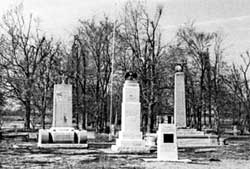
Figure 11.38. Monuments at the Rohwer Cemetery.
Figure 11.39. Recent monument to Japanese American soldiers from Rohwer killed during World War II.
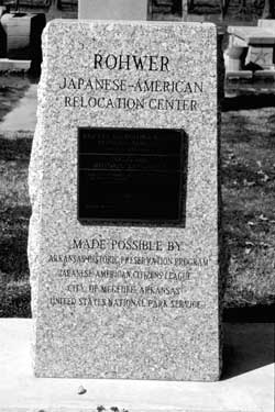
Figure 11.40. National Historic Landmark monument.
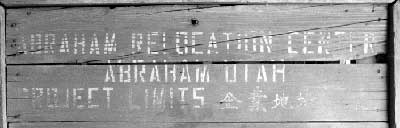
Figure 12.1. Sign at the Great Basin Museum in Delta, Utah.
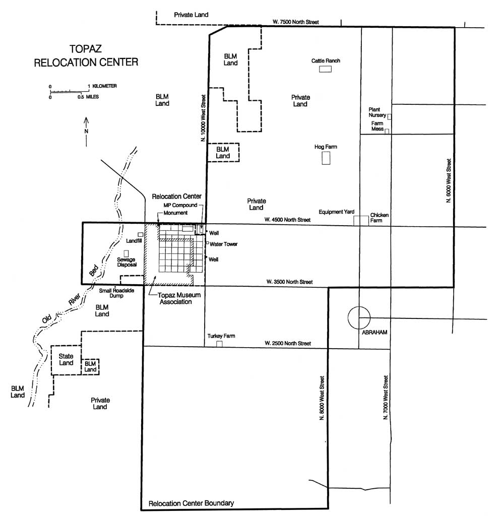
Figure 12.2. Topaz Relocation Center.
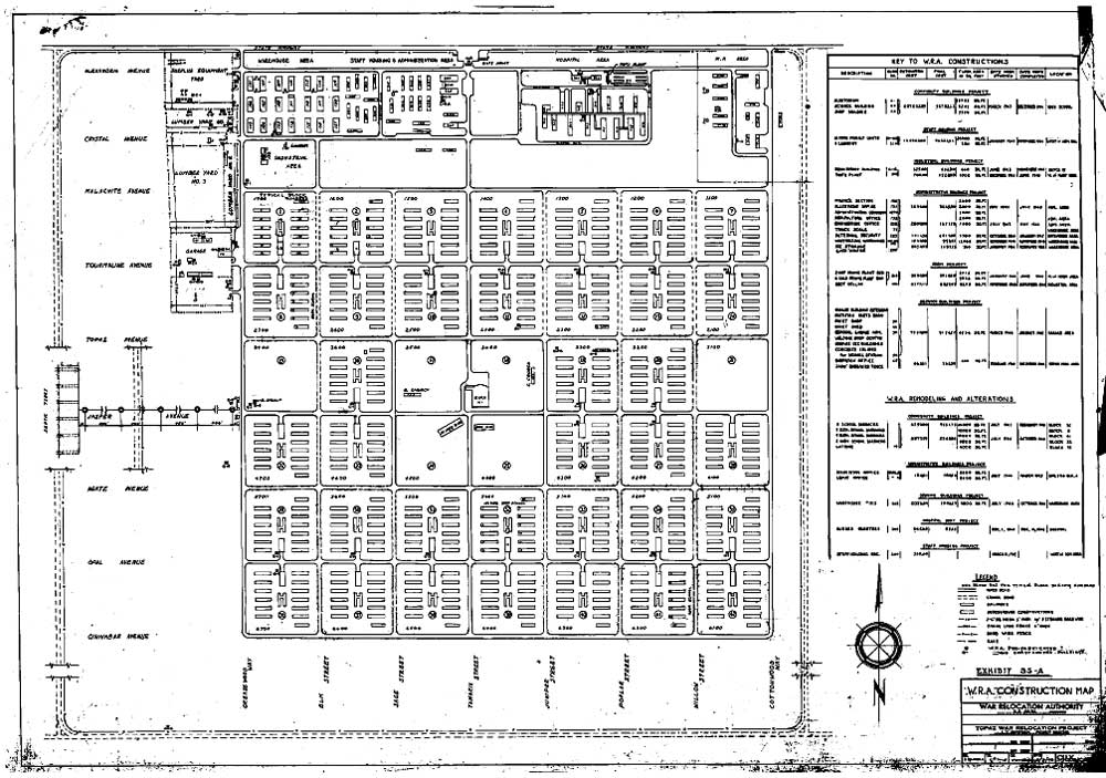
Figure 12.3. Residential and administration area, Topaz Relocation Center.
Figure 12.4. Administration area, hospital, and military police compound, Topaz Relocation Center.
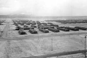
Figure 12.5. Panorama view of the Topaz Relocation Center.
Figure 12.6. Irrigation ditch constructed by evacuees.
Figure 12.7. Corral at the relocation center hog farm.
Figure 12.8. Irrigation ditches at the Topaz Relocation Center.
Figure 12.9. James Wakasa funeral.
Figure 12.10. Aerial view of the Topaz Relocation Center site, 1993.
Figure 12.11. Overview of the Topaz site.
Figure 12.12. Manhole in Block 4 at the Topaz Relocation Center.
Figure 12.13. Rock wall in the administration area.
Figure 12.14. Topaz fire station.
Figure 12.15. Topaz fire station today.
Figure 12.16. Concrete hopper north of the hospital area.
Figure 12.17. Stove pipes near the hospital location.
Figure 12.18. Latrine and laundry room slab.
Figure 12.19. Stoves on mess hall slab.
Figure 12.20. Concrete sink on latrine and laundry room slab.
Figure 12.21. Rock work at the location of Barracks 1, Block 14.
Figure 12.22. Rock-lined ditch and culvert.
Figure 12.23. Remnants of baseball backstop in Block 15.
Figure 12.24. Rock and concrete wall at the military police compound.
Figure 12.25. Watch tower foundation and intact portion of the western perimeter fence.
Figure 12.26. Topaz Relocation Center landfill.
Figure 12.27. Government-issued ceramics at the Topaz Relocation Center landfill.
Figure 12.28. Outlying farm buildings, Topaz Relocation Center.
Figure 12.29. Farm house at the Topaz Chicken Farm.
Figure 12.30. Collapsed laying houses at the Topaz Chicken Farm.
Figure 12.31. Laying house at the Topaz Chicken Farm.
Figure 12.32. Adobe wall at the Topaz Chicken Farm.
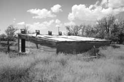
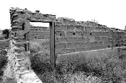
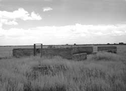
Figure 12.33. Building remains at the Topaz Turkey Farm.
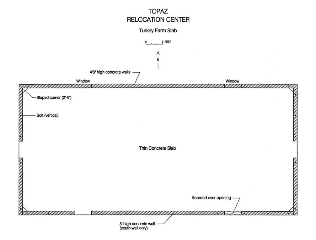
Figure 12.34. Plan map of building remains at the site of the Topaz Turkey Farm.
Figure 12.35. Farm house at the Topaz Cattle Ranch.
Figure 12.36. Barn at the Topaz Cattle Ranch.
Figure 12.37. Garage at the Topaz Farm Kitchen.
Figure 12.38. Barn at the Topaz Farm Kitchen.
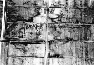
Figure 12.39. Graffiti at the Topaz Farm Kitchen.
Figure 12.40. Graffiti at the Topaz Farm Kitchen.
Figure 12.41. Graffiti at the Topaz Farm Kitchen.
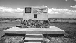
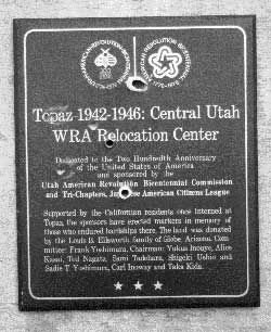
Figure 12.42. Monument at the site of the Topaz Relocation Center.
Figure 12.43. Detail of vandalized plaque.
Figure 12.44. Detail of vandalized monument at the site of the Topaz Relocation Center.
Figure 12.45. Historical marker in Delta city park.
Figure 12.46. Restored partial barracks at the Great Basin Museum in Delta, Utah.
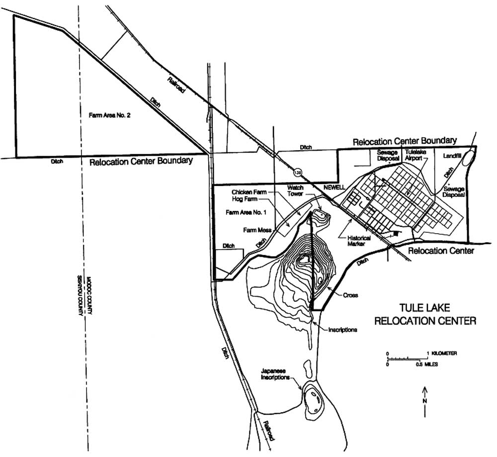
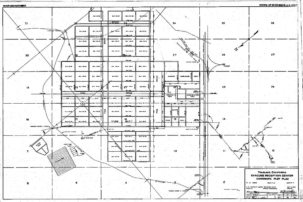
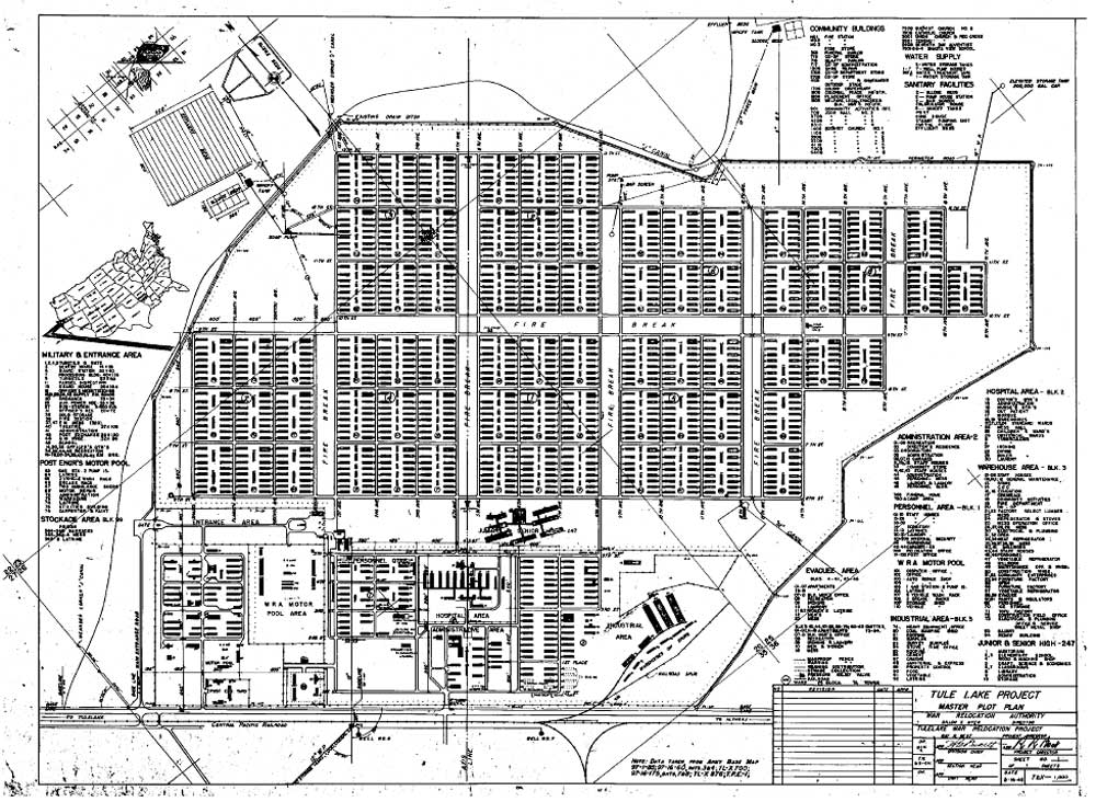
Figure 13.1. Land status, Tule Lake Relocation Center and vicinity.
Figure 13.2. Tule Lake Relocation Center.
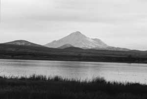
Figure 13.3. Tule Lake and Mt. Shasta.
Figure 13.4. Tule Lake Relocation Center, June 1946.
Figure 13.5. Demonstration at Tule Lake.
Figure 13.6. Fence between the administration and evacuee residential area.
Figure 13.7. 1949 aerial photograph of the Tule Lake Relocation Center, north to top.
Figure 13.8. Abandoned staff building in the staff area, 1946.
Figure 13.9. Abandoned evacuee barracks, 1946.
Figure 13.10. 1955 aerial photograph of the Tule Lake Relocation Center, north to top.
Figure 13.11. Tule Lake Relocation Center central area in 1942.
Figure 13.12. Tule Lake Relocation Center central area in 1944.
Figure 13.13. Administration building at Tule Lake.
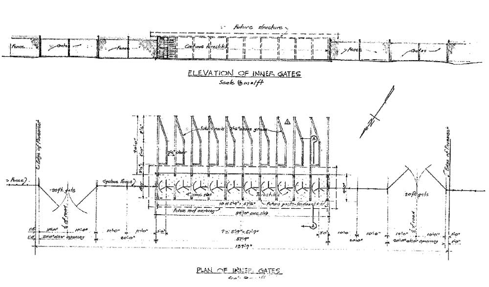
Figure 13.14. Detail of inner gate at Tule Lake.
Figure 13.15. Watch tower design at Tule Lake, left 1942, middle and right 1943.
Figure 13.16. Details of the perimeter road and security fences at Tule Lake.
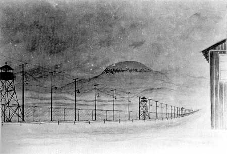
Figure 13.17. Evacuee painting of the lighted perimeter security fence at Tule Lake.
Figure 13.18. Evacuee barracks at Tule Lake.
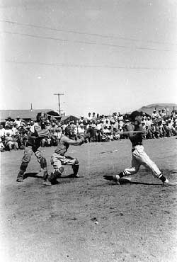
Figure 13.19. Baseball game at Tule Lake.
Figure 13.20. Outlying farm areas at Tule Lake.
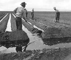
Figure 13.21. Irrigating crops at Tule Lake.
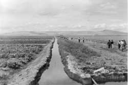
Figure 13.22. Irrigation ditch at Tule Lake farm.
Figure 13.23. Loading potatoes.
Figure 13.24. Field of Chinese cabbage.
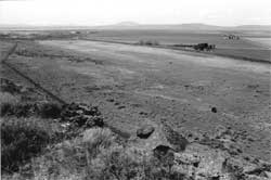
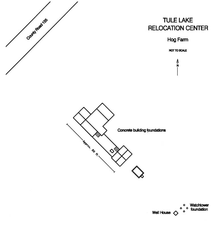
Figure 13.25. Hog farm at Tule Lake.
Figure 13.26. Chicken farm at Tule Lake.
Figure 13.27. Hog and chicken farms at Tule Lake.
Figure 13.28. Unloading coal at Tule Lake.
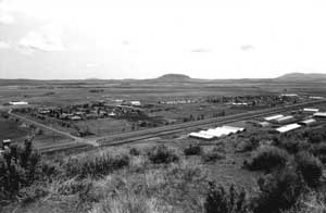
Figure 13.29. Overview of the central area at the Tule Lake Relocation Center today.
Figure 13.30. Central area at the Tule Lake Relocation Center today.
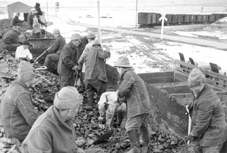
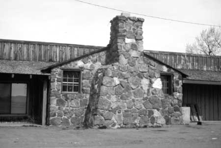
Figure 13.31. Basalt rock chimney at the Newell store.
Figure 13.32. Portion of pencilled Japanese text on the of a former relocation center warehouse.
Figure 13.33. Former industrial warehouses at the Tule Lake Relocation Center.
Figure 13.34. Concrete foundation slab of combination men's and women's latrine and shower building in Ward 7.
Figure 13.35. Concrete foundation slab of combination men's and women's latrine and shower building in Ward 7.
Figure 13.36. Metal trough urinal discarded next to men's latrine foundation.
Figure 13.37. Sketch map of combination men's and women's latrine and shower building in Ward 7.
Figure 13.38. Heating coal storage bin in Ward 7.
Figure 13.39. Rock and concrete culvert near the present-day Tule Lake Airport.
Figure 13.40. Concrete footing blocks at the site of the Tule Lake Relocation Center high school.
Figure 13.41. Typical relocation center road in Ward 8.
Figure 13.42. Concrete slab and rubble in Ward 8.
Figure 13.43. Clothesline pole in Ward 8.
Figure 13.44. Manhole in Ward 8.
Figure 13.45. Watch tower foundation blocks at Tule Lake.
Figure 13.46. Watch tower foundation blocks and perimeter fence at Tule Lake.
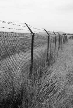
Figure 13.47. Perimeter fence at Tule Lake.
Figure 13.48. Perimeter fence at Tule Lake.
Figure 13.49. Outer sentry post foundation.
Figure 13.50. Rock work near outer sentry post.
Figure 13.51. Inner sentry post foundation.
Figure 13.52. Overview of military police compound, 1946.
Figure 13.53. Overview of the military police compound today.
Figure 13.54. Wold War II-era buildings remaining in the military police compound.
Figure 13.55. Building in MP compound.
Figure 13.56. Building in MP compound.
Figure 13.57. Building in MP compound.
Figure 13.58. Former MP fire station.
Figure 13.59. Building in MP compound.
Figure 13.60. Building in MP compound.
Figure 13.61. Stockade jail at Tule Lake.
Figure 13.62. Stockade jail at Tule Lake.
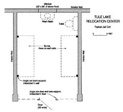
Figure 13.63. Typical jail cell.
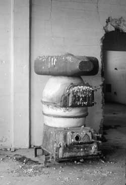
Figure 13.64. Heating stove in the stockade jail.
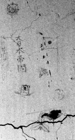
Figure 13.65. Japanese graffiti on the wall of the stockade jail.
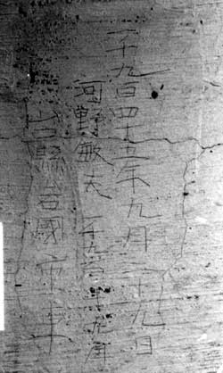
Figure 13.66. Japanese graffiti on the wall of the stockade jail.
Figure 13.67. "M" Canal today.
Figure 13.68. Tule Lake Relocation Center farm kitchen today.
Figure 13.69. Detail of interior door at the Tule Lake Relocation Center farm kitchen.
Figure 13.70. Hog and chicken Farms in 1943.
Figure 13.71. Overview of the hog and chicken farm areas today.
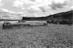
Figure 13.72. Foundation remains at the southern end of the Tule Lake Relocation Center hog farm.
Figure 13.73. Foundation remains at the southern end of the Tule Lake Relocation Center hog farm.
Figure 13.74. Foundation remains at the southern end of the Tule Lake Relocation Center hog farm.
Figure 13.75. Foundation remains at the southern end of the Tule Lake Relocation Center hog farm.
Figure 13.76. Watch tower foundation at the Tule Lake Relocation Center hog farm.
Figure 13.77. Watch tower foundation at the Tule Lake Relocation Center hog farm.
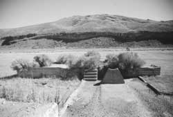
Figure 13.78. Well house at the Tule Lake Relocation Center hog farm.
Figure 13.79. Inscription at well house.
Figure 13.80. Inscriptions in the concrete slab floor of the hog farm well house.
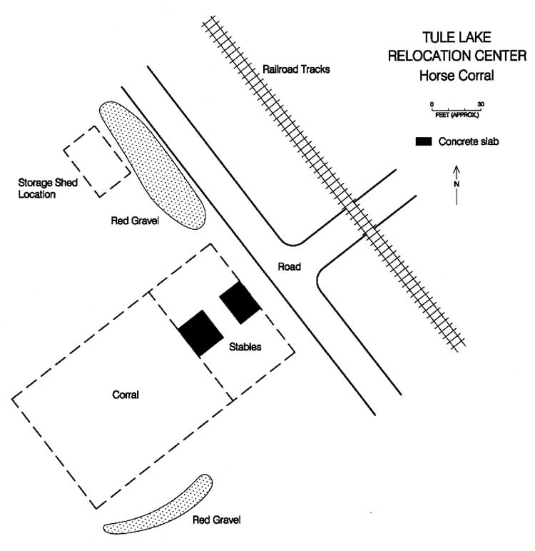
Figure 13.81. Concrete slabs at the horse corral location.
Figure 13.82. Sketch map of the Tule Lake Relocation Center horse corral.
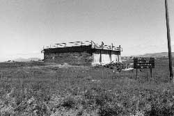
Figure 13.83. Imhoff tank at Sewage Treatment Plant No. 1.
Figure 13.84. Imhoff tank at Sewage Treatment Plant No. 2.
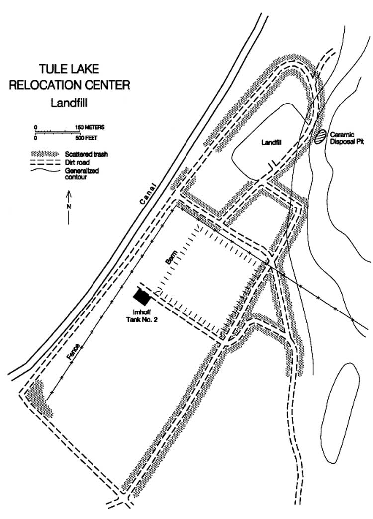
Figure 13.85. Sketch map of the relocation landfill vicinity.
Figure 13.86. Trash-filled trench at the Tule Lake Relocation Center landfill.
Figure 13.87. Trash-filled trench at the Tule Lake Relocation Center landfill.
Figure 13.88. Typical artifacts at the Tule Lake Relocation Center landfill.
Figure 13.89. Typical artifacts at the Tule Lake Relocation Center landfill.
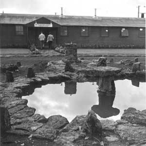
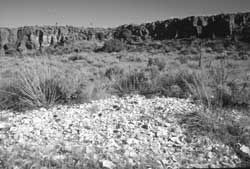
Figure 13.90. Ceramic disposal area at the Tule Lake Relocation Center landfill.
Figure 13.91. Detail of the ceramic disposal area.
Figure 13.92. Overview of CA-MOD-22.
Figure 13.93. Inscription at CA-MOD-22.
Figure 13.94. World War II-era inscriptions at CA-MOD-22.
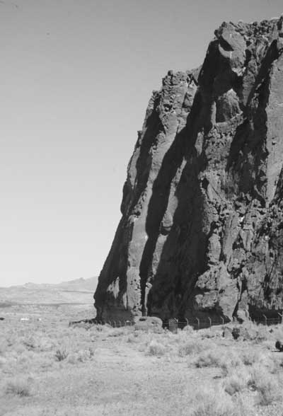
Figure 13.95. Petroglyph Point, Lava Beds National Monument.
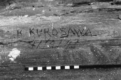
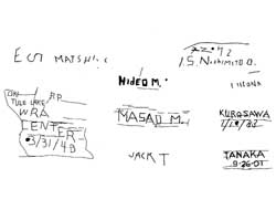
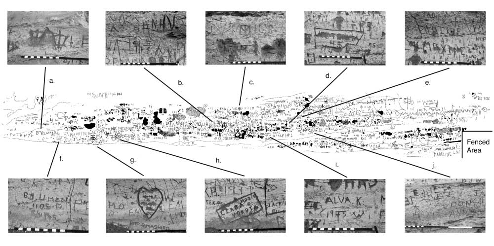
Figure 13.96. Selected World War II-era inscriptions on the cliff face at Petroglyph Point.
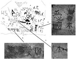
Figure 13.97. Japanese inscriptions on a detached boulder at Petroglyph Point.
Figure 13.98. Detached boulder at Petroglyph Point with Japanese inscriptions.
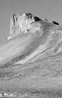
Figure 13.99. Cross on promontory southeast of Newell.
Figure 13.100. Linkville Cemetery, Klamath Falls, Oregon.
Figure 13.101. Memorial plaque at the Linkville Cemetery.
Figure 13.102. Memorial at the Linkville Cemetery.
Figure 13.103. Grave marker at the Linkville Cemetery.
Figure 13.104. Grave marker at the Linkville Cemetery.
Figure 13.105. Monument along State Highway 139.
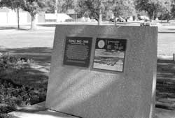
Figure 13.106. Detail of state historic marker.
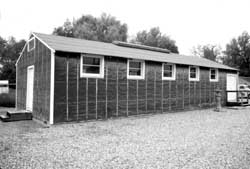
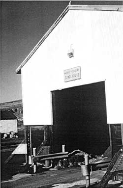
Figure 13.107. The Harvey Yoshizuka Sand House at the Caltrans maintenance yard in Newell.
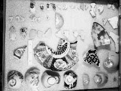
Figure 13.108. Japanese ceramics from the Tule Lake Relocation Center in the Lava Beds National Monument collections.
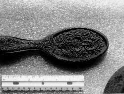
Figure 13.109. Ornate hair brush from the Tule Lake Relocation Center in the Lava Beds National Monument collections.
Figure 14.1. Dalton Wells CCC Camp in 1937.
Figure 14.2. Administration buildings at the Dalton Wells CCC Camp.
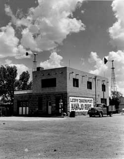
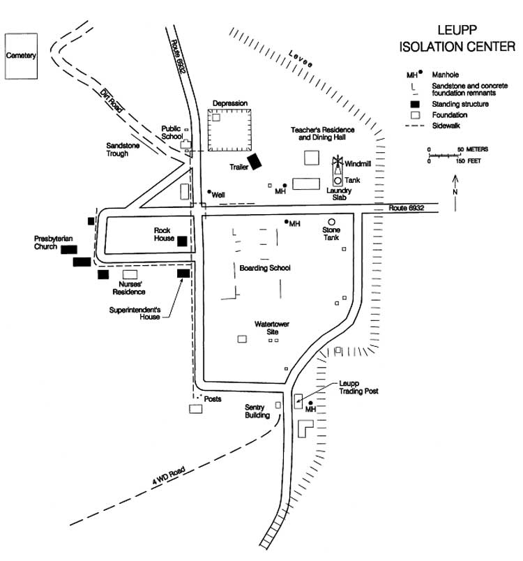
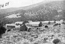
Figure 14.3. Leupp Isolation Center.
Figure 14.4. Mess hall at the Leupp Isolation Center.
Figure 14.5. Concrete entrance pillars, Moab Isolation Center.
Figure 14.6. Administration area, Moab Isolation Center.
Figure 14.7. Concrete Slab in support area, Moab Isolation Center.
Figure 14.8. Concrete slab in support area, Moab Isolation Center.
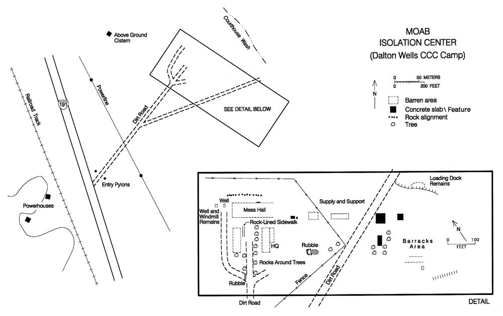
Figure 14.9. Moab Isolation Center.
Figure 14.10. Leupp Boarding School.
Figure 14.11. Leupp Trading Post.
Figure 14.12. Old highway south of Old Leupp.
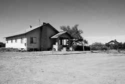
Figure 14.13. Former superintendent's residence at Old Leupp.
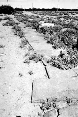
Figure 14.14. Sidewalk remnants at the Leupp Isolation Center.
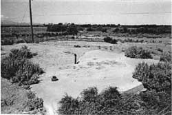
Figure 14.15. Concrete slab at the Leupp Isolation Center.
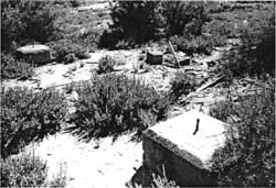
Figure 14.16. Water tower foundation blocks at the Leupp Isolation Center.
Figure 14.17. Leupp Isolation Center.
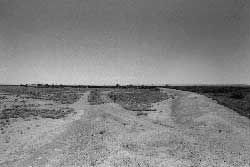
Figure 14.18. Site of the Leupp Isolation Center.
Figure 14.19. Foundation of the dining hall at the Leupp Isolation Center.
Figure 14.20. Leupp Trading Post today.
Figure 15.1. Composite photograph of Japanese American children at Antelope Springs.
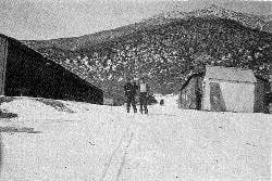
Figure 15.2. Barracks area at the Antelope Springs CCC camp.
Figure 15.3. Truck shed and motor pool at the Antelope Springs CCC camp.
Figure 15.4. Antelope Springs CCC camp.
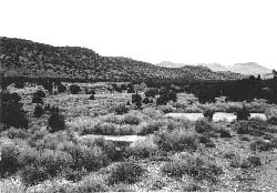
Figure 15.5. Overview of the Antelope Springs CCC camp today.
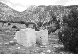
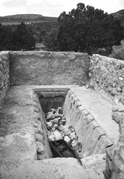
Figure 15.6. Remains of adobe building at the Antelope Springs CCC camp.
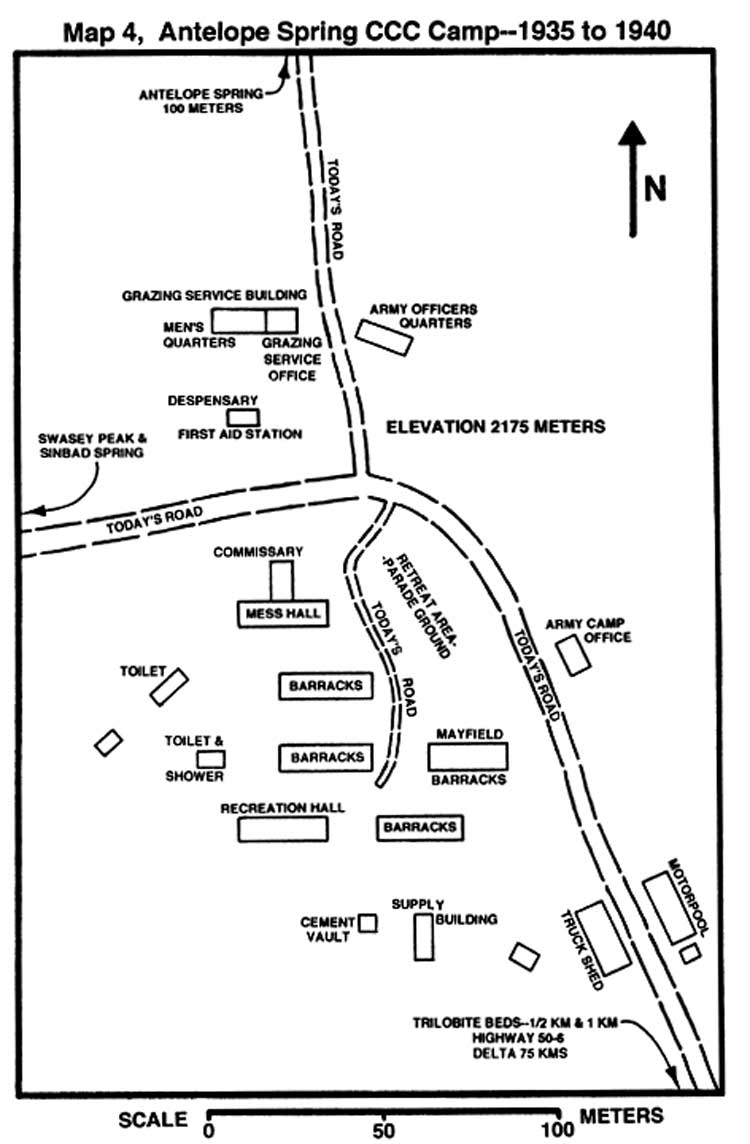
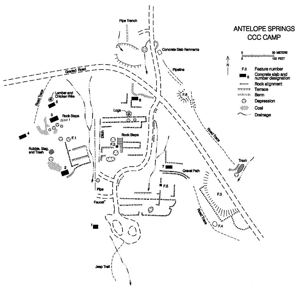
Figure 15.7. Sketch map of the Antelope Springs CCC camp.
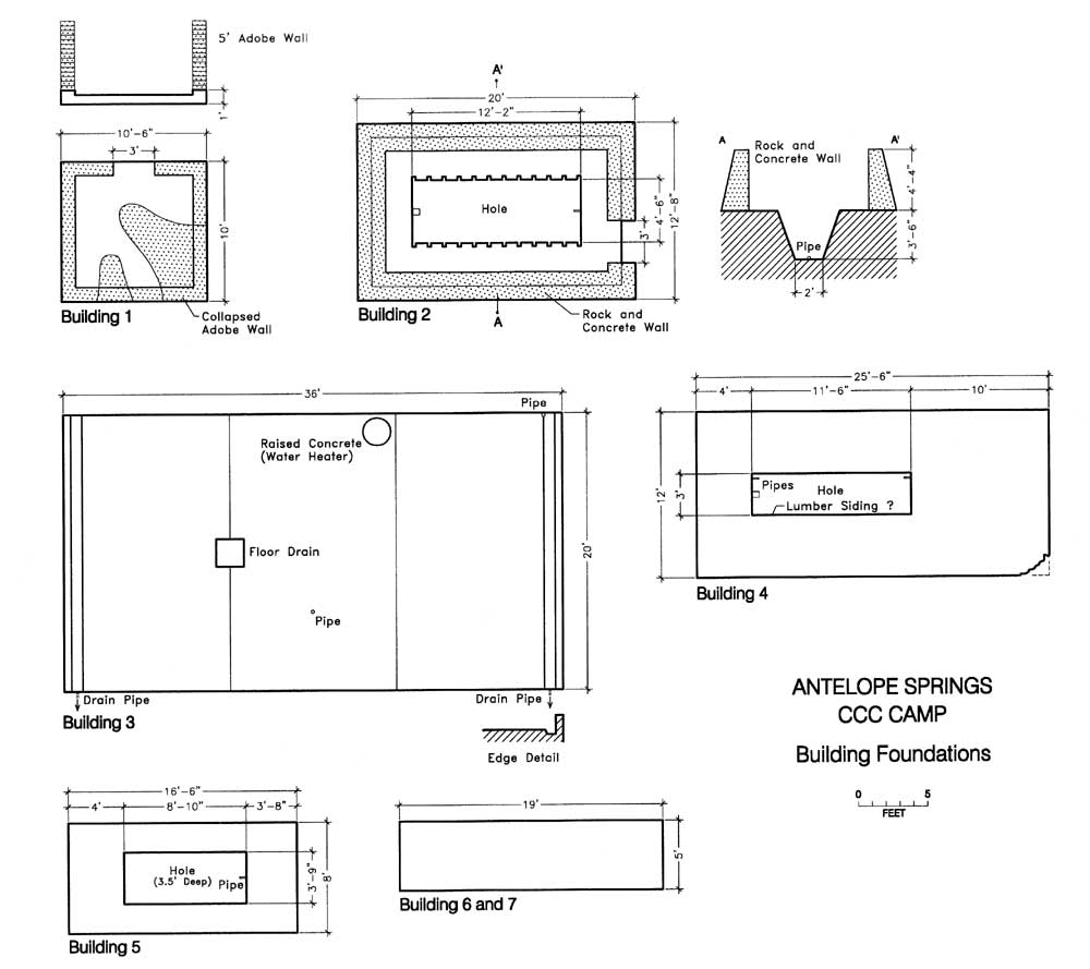
Figure 15.8. Building foundations at the Antelope Springs CCC camp.
Figure 15.9. Remains of Building 2 at the Antelope Springs CCC camp.
Figure 15.10. Historic inscription at the Antelope Springs CCC camp.
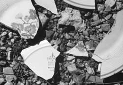
Figure 15.11. White ware ceramic fragments at the Antelope Springs CCC camp.
Figure 15.12. Headquarters area at Death Valley National Monument in 1935.
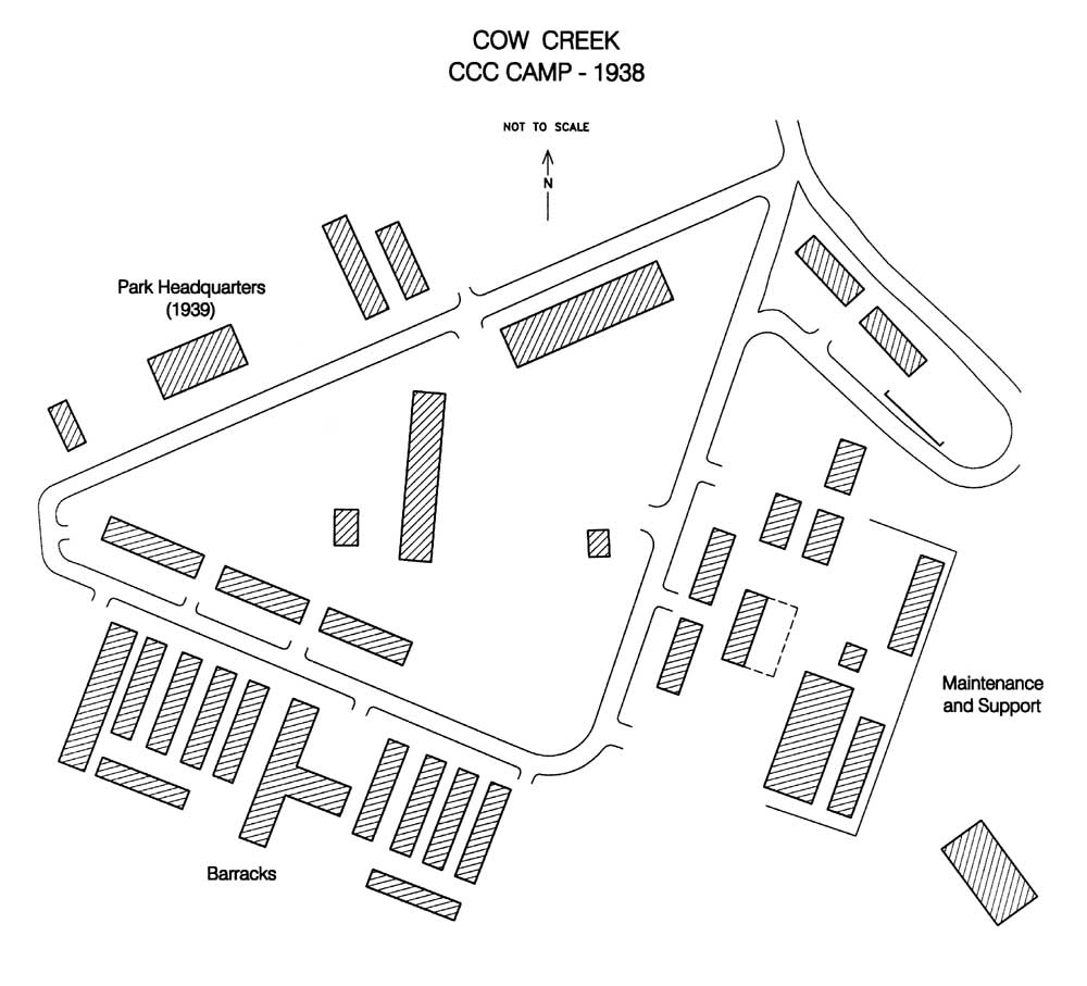
Figure 15.13. Cow Creek CCC Camp, 1939.
Figure 15.14. Unloading supplies at Cow Creek.
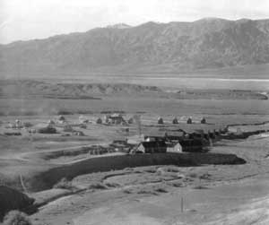
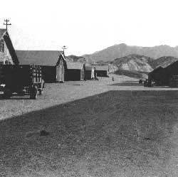
Figure 15.15. Cow Creek during the Japanese American internment.
Figure 15.16. Military police officer and T.R. Goodwin, superintendent of Death Valley National Monument.
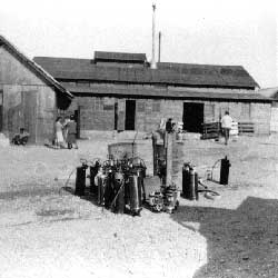
Figure 15.17. Fire-fighting equipment brought to Cow Creek from Manzanar.
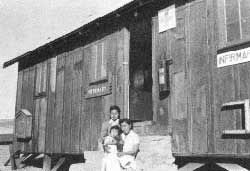
Figure 15.18. Infirmary at Cow Creek.
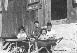
Figure 15.19. Japanese American children at Cow Creek.
Figure 15.20. Departure for Chicago.
Figure 15.21. Overview of the Cow Creek area today.
Figure 15.22. The old park headquarters today.
Figure 15.23. Recreation building and infirmary at Cow Creek today.
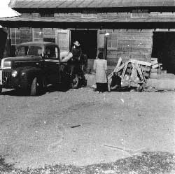
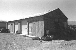
Figure 15.24. Garage in the utility area at Cow Creek today.
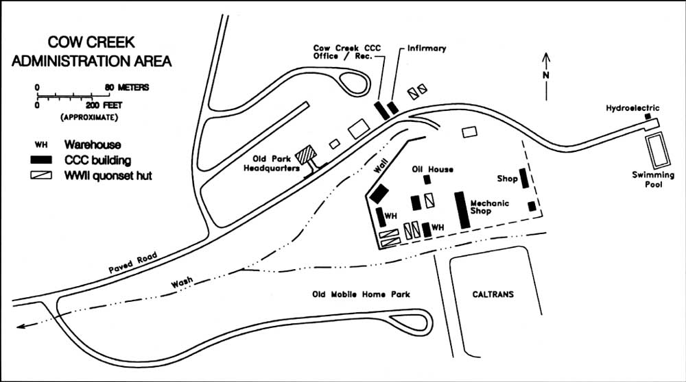
Figure 15.25. Cow Creek Administration Area, Death Valley National Park.
Figure 15.26. Tulelake CCC camp in 1940.
Figure 15.27. Tulelake CCC camp.
Figure 15.28. Tulelake POW camp.
Figure 15.29. German POWs held at Tulelake.
Figure 15.30. Overview of the Tulelake CCC camp today.
Figure 15.31. Mess hall at the Tulelake CCC camp today.
Figure 15.32. Barracks building at the Tulelake CCC camp today.
Figure 15.33. Garage at the Tulelake CCC camp today.
Figure 15.34. Scattered lumber at the Tulelake CCC camp.
Figure 16.1. Oblique aerial view of the Fresno Assembly Center.
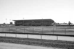
Figure 16.2. Grandstand at the Fresno County Fairgrounds today.
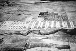
Figure 16.3. Oblique aerial view of the Marysville Assembly Center.
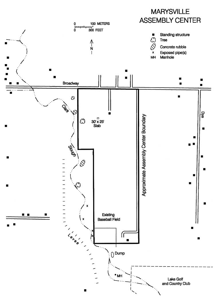
Figure 16.4. Map of the Marysville Assembly Center site today.
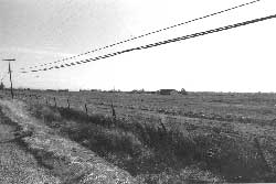
Figure 16.5. Site of the Marysville Assembly Center today.
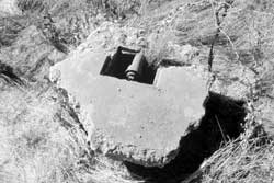
Figure 16.6. Concrete rubble at the site of the Marysville Assembly Center.
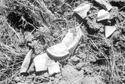
Figure 16.7. Hotel ware ceramics at the site of the Marysville Assembly Center.
Figure 16.8. Hotel ware ceramics at the site of the Marysville Assembly Center.
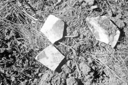
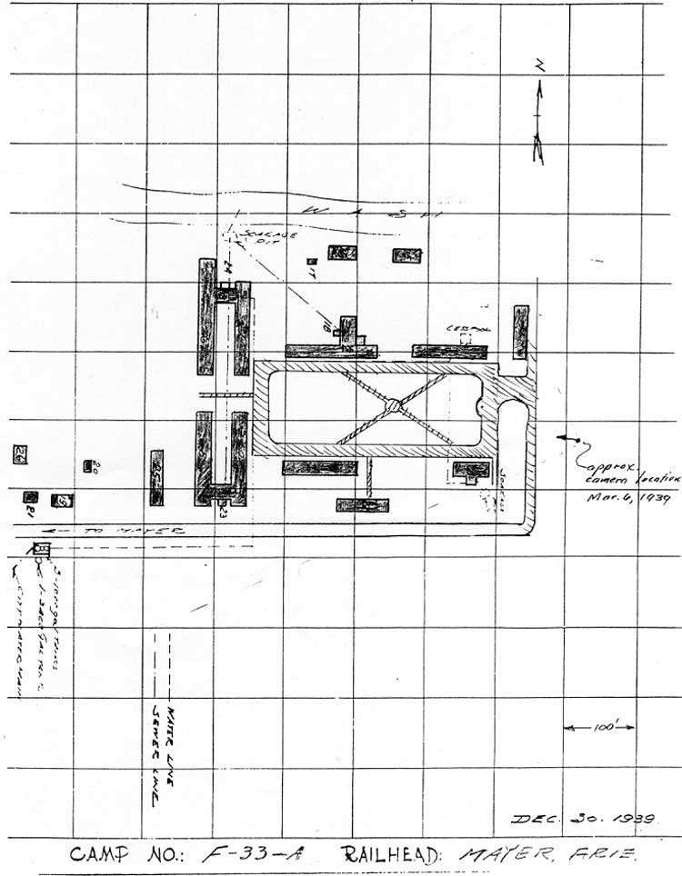
Figure 16.9. Map of CCC Camp No. F-33-A, Mayer, Arizona, 1939.
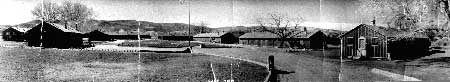
Figure 16.10. CCC Camp No. F-33-A, Mayer, Arizona, 1939.
Figure 16.11. Site of the Mayer Assembly Center today.
Figure 16.12. Oblique aerial view of the Merced Assembly Center.
Figure 16.13. Monument at the Merced County Fairgrounds.
Figure 16.14. Concrete slabs at the Merced County Fairgrounds.
Figure 16.15. Concrete slab at the Merced County Fairgrounds.
Figure 16.16. Oblique aerial view of the Pinedale Assembly Center.
Figure 16.17. Warehouses near the site of the Pinedale Assembly Center.
Figure 16.18. Site of the Pinedale Assembly Center today.
Figure 16.19. 1942 aerial photograph of the Pomona Assembly Center.
Figure 16.20. Pomona Assembly Center.
Figure 16.21. Grandstand at the Los Angeles County Fairgrounds.
Figure 16.22. Barracks building at the Los Angeles County Fairgrounds.
Figure 16.23. Racetrack media tower at the Los Angeles County Fairgrounds.
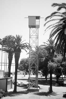
Figure 16.24. Oblique aerial view of the Portland Assembly Center.
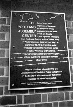
Figure 16.25. Historical marker inside the Portland Exposition Center.
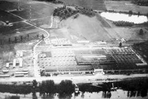
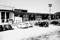
Figure 16.26. Portland Assembly Center.
Figure 16.27. Portland Exposition Center today.
Figure 16.28. Portland Assembly Center.
Figure 16.29. Interior of the Portland Exposition Center.
Figure 16.30. Oblique aerial view of the Puyallup Assembly.
Figure 16.31. Sculpture at the Puyallup Fairgrounds.
Figure 16.32. Commemorative plaque at the Puyallup Fairgrounds.
Figure 16.33. View from the grandstand of barracks at the Puyallup Assembly Center.
Figure 16.34. View from the grandstand at the Puyallup Fairgrounds today.
Figure 16.35. Cover of the Souvenir Edition of Camp Harmony Newsletter.
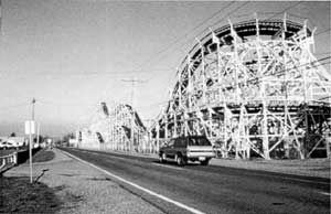
Figure 16.36. Wooden frame roller coaster at the Puyallup Fairgrounds.
Figure 16.37. Oblique aerial view of the Sacramento Assembly Center.
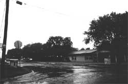
Figure 16.38. Sacramento Assembly Center.
Figure 16.39. Ramada and historical marker at Walerga Park.
Figure 16.40. Historical marker and cherry trees at Walerga Park.
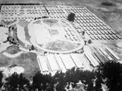
Figure 16.41. Oblique aerial view of the Salinas Assembly Center.
Figure 16.42. Salinas Assembly Center.
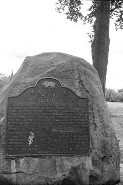
Figure 16.43. Historical marker at the site of the Salinas Assembly Center.
Figure 16.44. Japanese garden in the courtyard of the Salinas Community Center.
Figure 16.45. Two of the "Three Hats" in the courtyard of the Salinas Community Center.
Figure 16.46. Santa Anita Assembly Center.
Figure 16.47. Construction underway at the Santa Anita Assembly Center.
Figure 16.48. Newly-constructed barracks at the Santa Anita Assembly Center.
Figure 16.49. Converting horse stalls into housing at the Santa Anita Assembly Center.
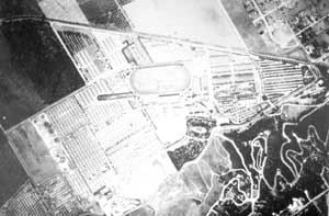
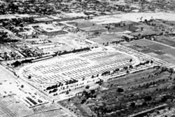
Figure 16.50. 1942 aerial photograph of the Santa Anita Assembly Center.
Figure 16.51. Santa Anita Assembly Center.
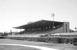
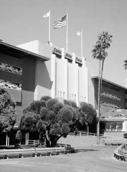
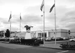
Figure 16.52. Grandstand building at the Santa Anita Racetrack today.
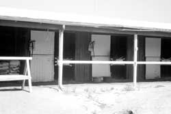
Figure 16.53. Stables at the Santa Anita Racetrack today.
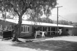
Figure 16.54. Stable residence at the Santa Anita Racetrack today.
Figure 16.55. Oblique aerial view of the Stockton Assembly Center.
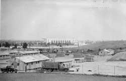
Figure 16.56. Stockton Assembly Center.
Figure 16.57. Historical marker at the entrance to the San Joaquin County Fairgrounds.
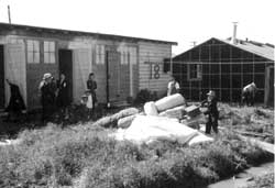
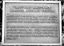
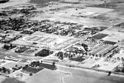
Figure 16.58. Oblique aerial view of the Tanforan Assembly Center.
Figure 16.59. Guard tower at the Tanforan Assembly Center.
Figure 16.60. Concerted horse stalls and barracks at the Tanforan Assembly Center.
Figure 16.61. Tanforan Mall.
Figure 16.62. Historical marker at the Tanforan Mall.
Figure 16.63. Oblique aerial view of the Tulare Assembly Center.
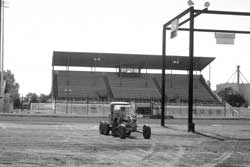
Figure 16.64. Grandstand at the Tulare Fairgrounds today.
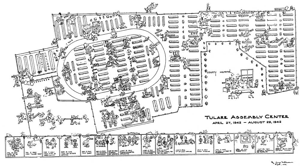
Figure 16.65. Map of the Tulare Assembly Center.
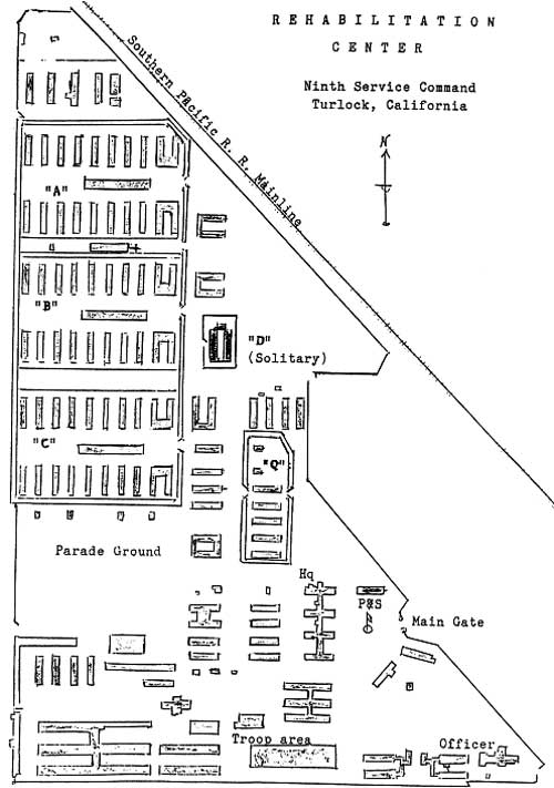
Figure 16.66. Map of the U.S. Army Turlock Rehabilitation Center.
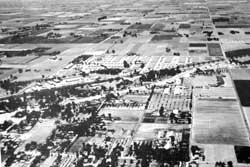
Figure 16.67. Oblique aerial view of the Turlock Assembly Center.
Figure 16.68. Turlock Assembly Center.
Figure 16.69. Entrance of the Stanislaus County Fairgrounds in Turlock.
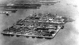
Figure 17.1. Air view of Ellis Island, 1933.
Figure 17.2. Detainee barracks at the Angel Island Immigration Station.
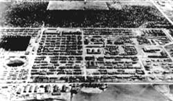
Figure 17.3. Crystal City Internment Camp.
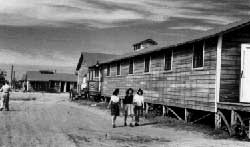
Figure 17.4. Housing at Crystal City.
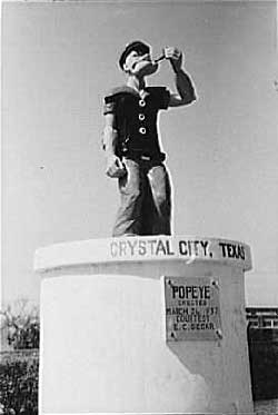
Figure 17.5. Popeye monument in 1939.
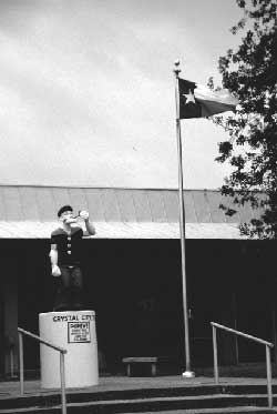
Figure 17.6. Popeye monument today.
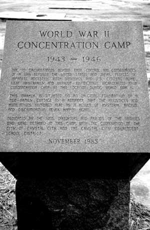
Figure 17.7. Monument at the site of the Crystal City Internment Camp.
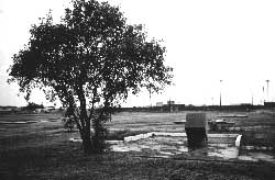
Figure 17.8. Overview of monument and slab foundations at the Crystal City Internment Camp.
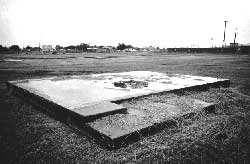
Figure 17.9. Foundation of three-room cottage at the Crystal City Internment Camp.
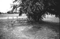
Figure 17.10. Concrete slab at the site of the Crystal City Internment Camp.
Figure 17.11. Well and concrete slab at the site of the Crystal City Internment Camp.
Figure 17.12. Elementary school at the former location of the Crystal City Internment Camp German School.
Figure 17.13. Swimming pool at the Crystal City Internment Camp.
Figure 17.14. Remains of the concrete swimming pool at the Crystal City Internment Camp today.
Figure 17.15. Kenedy Alien Internment Camp.
Figure 17.16. Residential neighborhood at the site of the Kenedy Internment Camp.
Figure 17.17. Concrete pillars at the site of the Kenedy Internment Camp.
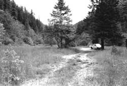
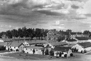
Figure 17.18. Caucasian staff and Japanese American internees take a break at the Kooskia Work Camp.
Figure 17.19. Site of the Kooskia Work Camp today.
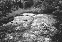
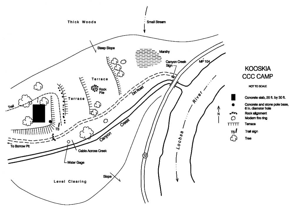
Figure 17.20. Concrete slab at the site of the Kooskia Work Camp.
Figure 17.21. Sketch map of the Kooskia Work Camp.
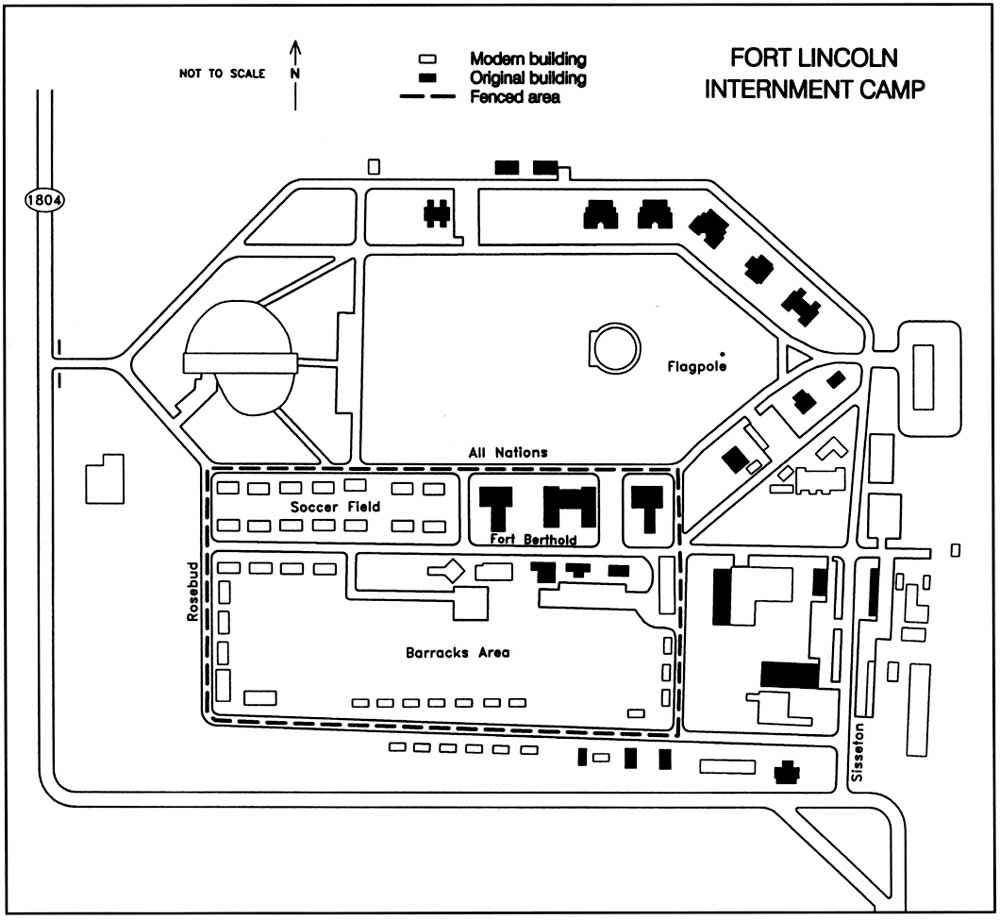
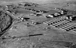
Figure 17.22. Fort Lincoln Internment Camp.
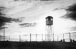
Figure 17.23. Guard tower at the Fort Lincoln Internment Camp.
Figure 17.24. Army barracks at Fort Lincoln today.
Figure 17.25. Fort Lincoln Internment Camp.
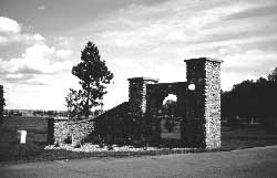
Figure 17.26. North half of stone entry gate at Fort Lincoln.
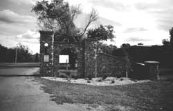
Figure 17.27. South half of stone entry gate at Fort Lincoln.
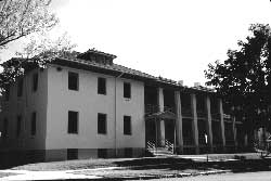
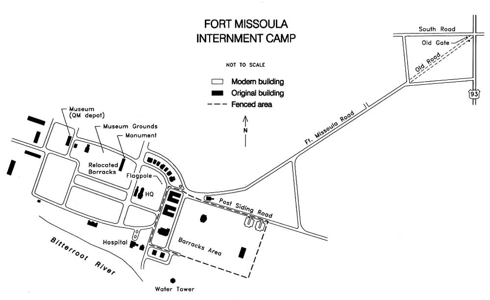
Figure 17.28. Fort Missoula Internment Camp.
Figure 17.29. CCC barracks at Fort Missoula.
Figure 17.30. Fenced army barracks at Fort Missoula.
Figure 17.31. Internees at Fort Missoula.
Figure 17.32. Abandoned buildings at Fort Missoula.
Figure 17.33. Former army barracks at Fort Missoula.
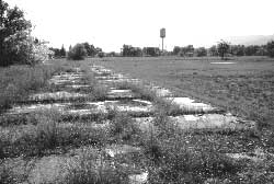
Figure 17.34. Slab foundation at Fort Missoula.
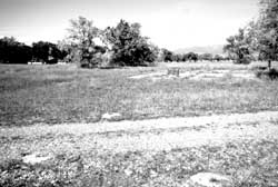
Figure 17.35. Concrete post supports and slab at Fort Missoula..
Figure 17.36. Fort Missoula Internment Camp.
Figure 17.37. Relocated CCC barracks on Fort Missoula Museum grounds.
Figure 17.38. Guard tower at Fort Missoula.
Figure 17.39. Guard tower cabin at Fort Missoula today.
Figure 17.40. Internment monument at Fort Missoula.
Figure 17.41. Segoville Internment Camp.
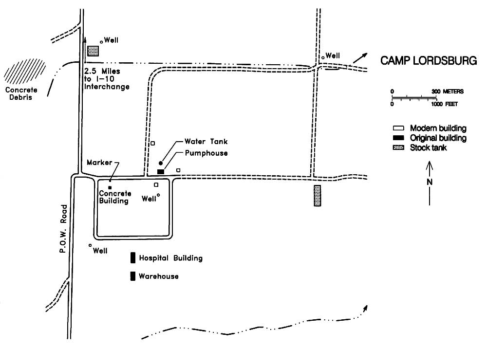
Figure 17.42. Lordsburg Internment Camp.
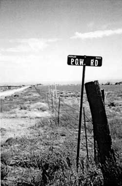
Figure 17.43. P.O.W. Road, Lordsburg, New Mexico.
Figure 17.44. Sign at the Lordsburg Internment Camp.
Figure 17.45. Water tank and water treatment building at the site of the Lordsburg Internment Camp.
Figure 17.46. Detail of the water tank at the site of the Lordsburg Internment Camp.
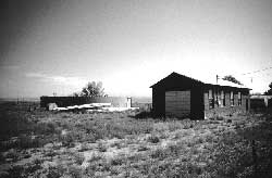
Figure 17.47. Hospital building at the site of the Lordsburg Internment Camp.
Figure 17.48. Building south of hospital building at the Lordsburg Internment Camp.
Figure 17.49. Small concrete building at the Lordsburg Internment Camp.
Figure 17.50. Detail of decorative seal at the Lordsburg Internment Camp.
Figure 17.51. Concrete blocks used for retaining wall northwest of the Lordsburg Internment Camp.
Figure 17.52. Concrete debris northwest of the Lordsburg Internment Camp.
Figure 17.53. Area 2400, Fort Sill, Oklahoma.
Figure 17.54. Inmate housing at the Stringtown Internment Camp today.
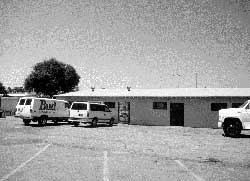
Figure 17.55. Administration building at the Stringtown Internment Camp today.
Figure 17.56. Guard tower at the Mack Alford Correction Center.
Figure 17.57. Sand Island Internment Camp.
Figure 17.58. Camp McCoy today.
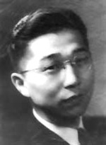
Figure 18.1. Gordon Hirabayashi in 1942.
Figure 18.2. Trail of 63 Japanese American draft resisters from the Heart Mountain Relocation Center.
Figure 18.3. Draft resisters just released from McNeil Island wearing government-issued suits.
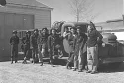
Figure 18.4. Japanese Americans imprisoned at the Catalina Federal Honor Camp at their first reunion in 1946.
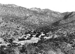
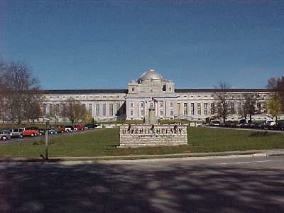
Figure 18.5. Catalina Federal Honor Camp, 1945.
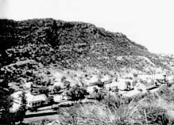
Figure 18.6. Catalina Federal Honor Camp, 1945.
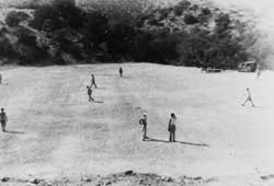
Figure 18.7. Baseball field at the Catalina Federal Honor Camp.
Figure 18.8. Catalina Federal Honor Camp in 1954.
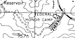
Figure 18.9. Site of the Catalina Federal Honor Camp today.
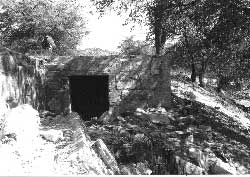
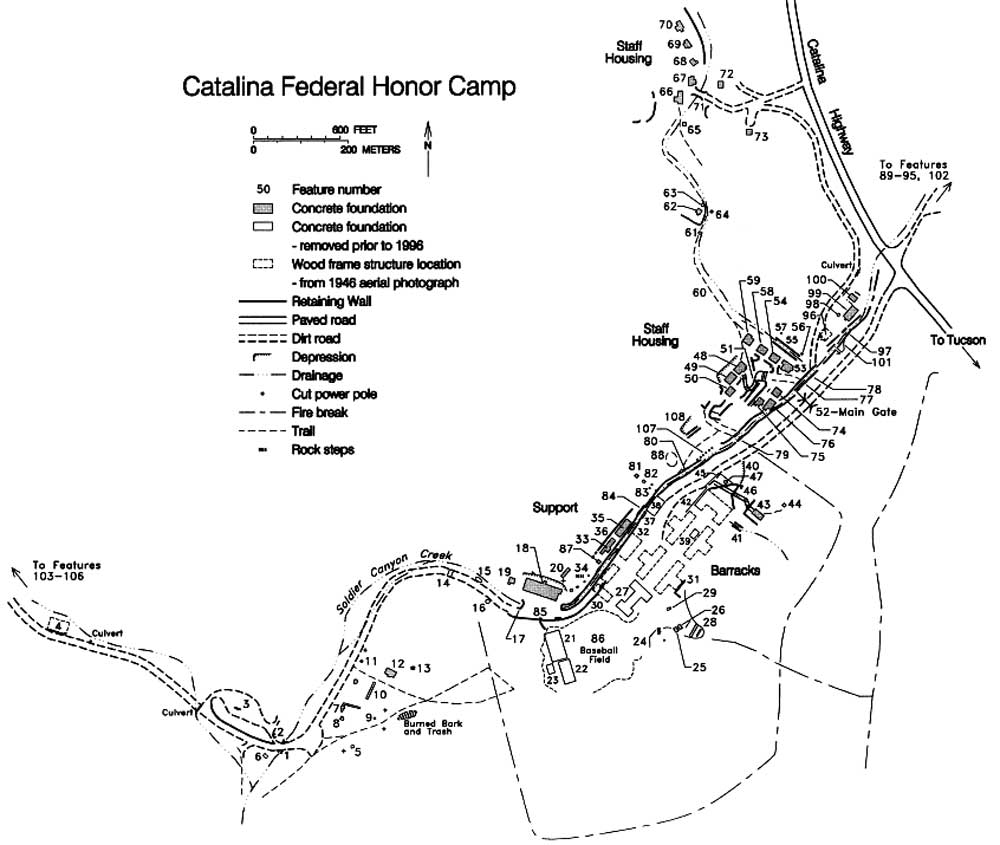
Figure 18.10. Rock walls and steps near the location of the administration building at the site of the Catalina Federal Honor Camp.
Figure 18.11. Basement in the staff housing area at the site of the Catalina Federal Honor Camp.
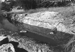
Figure 18.12. Retaining wall along Soldier Canyon Creek, Catalina Federal Honor Camp.
Figure 18.13. Catalina Federal Honor Camp.
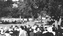
Figure 18.14. Dedication of the Gordon Hirabayashi Recreation Site.
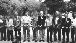
Figure 18.15. Resisters and dignitaries cutting ribbon at the Gordon Hirabayashi Recreation Site dedication.
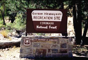
Figure 18.16. Sign at the site of the Catalina Federal Honor Camp.
Figure 18.17. Leavenworth Federal Penitentiary today.
Figure 18.18. McNeil Island Federal Penitentiary in 1937.
Figure 18.19. Cell House #1, McNeil Island Federal Penitentiary.
Figure 18.20. Cell House #2, McNeil Island Federal Penitentiary.
Figure 18.21. Prison buildings at the McNeil Island Federal Penitentiary.

List of Tables
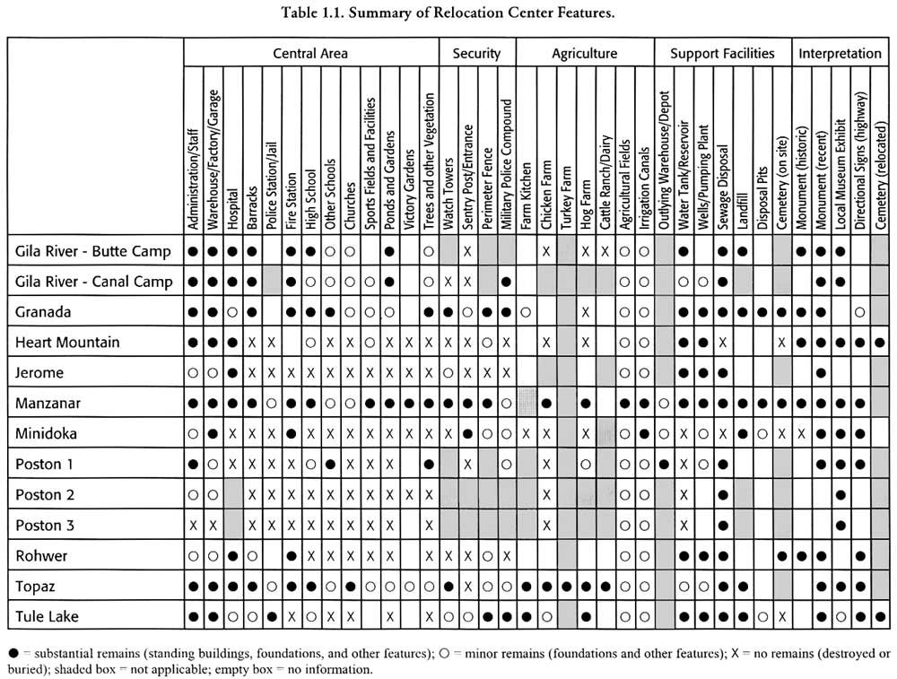
Table 1.1. Summary of Relocation Center Features.
Table 1.2. Standing Buildings and Major Structures at Relocation Centers.
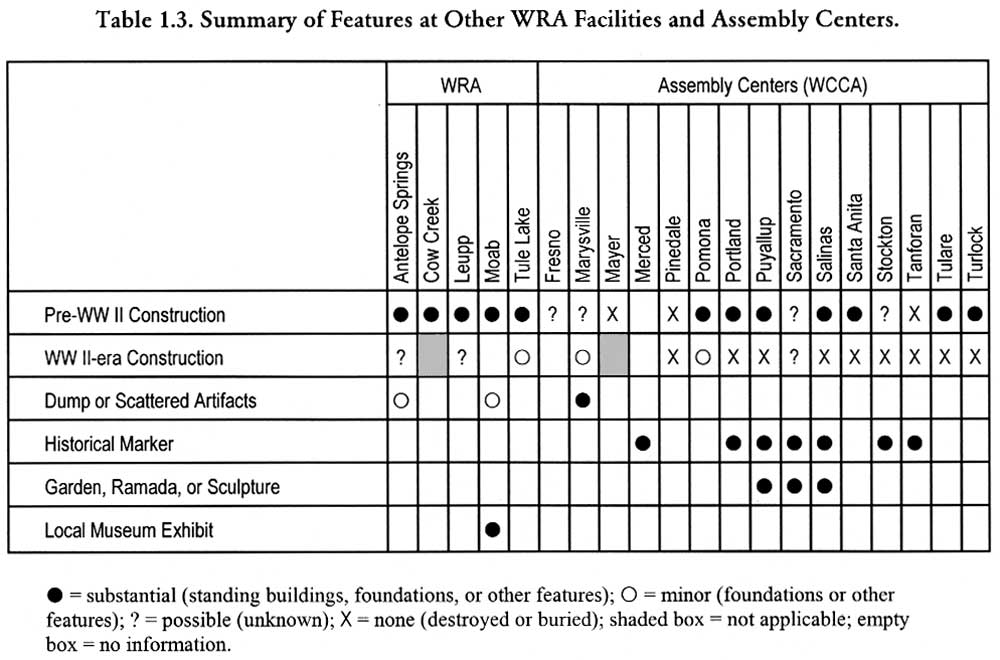
Table 1.3. Summary of Features at Other WRA Facilities and Assembly Centers.
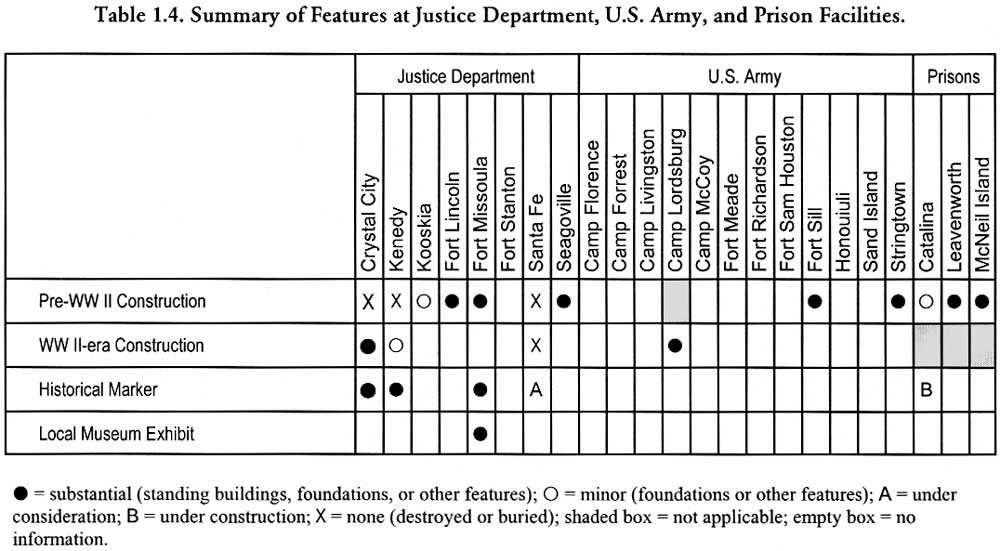
Table 1.4. Summary of Features at Justice Department, U.S. Army, and Prison Facilities.
Table 1.5. Sites Associated with the Relocation of Japanese Americans During World War II Listed on the National Register of Historic Places.
Table 3.1. WCCA Assembly Centers.
Table 3.2. WRA Relocation Centers.
Table 3.3. Disposition of Assembly Centers.
Table 3.4. Relocation Center Agricultural Enterprises, June 1944.
Table 3.5. Relocation Center Statistics.
Table 3.6. Disposition of WRA Centers.
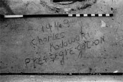
Table 4.1. Inscriptions at Canal Camp.
Table 4.2. Inscriptions at Butte Camp.
Table 8.1. Representative Ponds and Gardens at Manzanar.
Table 13.1. Translation of Japanese Text on the Interior Wall of a Former Warehouse at the Tule Lake Relocation Center.
Table 13.2. Selected Pencilled Inscriptions on the Wall of the Stockade Jail.
Table 13.3. Inscriptions at the Tule Lake Hog Farm.
Table 13.4. World War II-era Inscriptions at Rock Art Site CA-MOD-22.
Table 13.5. Selected Inscriptions at Petroglyph Point, Lava Beds National Monument.
Table 18.1. Archeological Features at the Catalina Federal Honor Camp.
 Top
Top
Last Modified: Fri, Sep 1 2000 07:08:48 pm PDT
http://www.cr.nps.gov/history/online_books/anthropology74/cel.htm
![]()