![]()
Cover Page
MENU
![]() Manzanar
Manzanar
|
| |
Confinement and Ethnicity: An Overview of World War II Japanese American Relocation Sites by J. Burton, M. Farrell, F. Lord, and R. Lord |

|
|
| |
Chapter 8
Manzanar Relocation Center
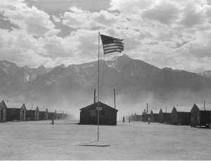 Figure 8.1. Manzanar with Mount Williamson in the background. (Dorothea Lange photograph, National Archives) |
On the western edge of the Basin and Range province, the topography of the area is dramatic, with the steep Sierra Nevada to the west and the White-Inyo Range to the east. Mount Williamson, the second highest peak in the Sierra Nevada at 14,375 feet, is 10 miles southwest. The National Historic Site itself is located where the Sierran bajada meets the valley floor at 3900 feet elevation.
The Owens Valley is in the rainshadow formed by the Sierra Nevada. Independence has a mean annual precipitation of just under 5 inches and Lone Pine approximately 6 inches. However, the valley is well-watered by Sierran streams and the relocation center site is located between two perennial streams which flow east from the Sierra Nevada, Shepherd Creek on the north and George Creek on the south. The stream flow of Bairs Creek, which crosses the southwest corner of the relocation center central area, is intermittent.
Summers are hot and winters cold, and the natural vegetation in the vicinity is desert scrub (for example, rabbitbrush and sagebrush). Non-native trees, mostly black locust, cottonwood, tamarisk, and fruit trees from abandoned ranches, farms, and the relocation center, form a band across the site.
The Manzanar Relocation Center, established as the Owens Valley Reception Center, was first run by the U.S. Army's Wartime Civilian Control Administration (WCCA). It later became the first relocation center to be operated by the War Relocation Authority (WRA). The center was located at the former farm and orchard community of Manzanar. Founded in 1910, the town was abandoned when the city of Los Angeles purchased the land in the late 1920s for its water rights. The Los Angeles aqueduct, which carries Owens Valley water to Los Angeles, is a mile east of Manzanar.
Begun in March of 1942, the relocation center was built by Los Angeles contractor Griffith and Company. Construction proceeded 10 hours a day 7 days a week; major construction was completed within six weeks. On March 21 the first 82 Japanese Americans made the 220-mile trip by bus from Los Angeles. More volunteers soon followed to help build the relocation center: over the next few days 146 more Japanese Americans arrived in 140 cars and trucks under military escort (Figure 8.2). Another 500 Japanese Americans, mostly older men, arrived from Los Angeles by train. By mid April, up to 1,000 Japanese Americans were arriving at Manzanar a day and by mid May Manzanar had a population of over 7,000 (Figure 8.3). By July Manzanar's population was nearly 10,000. Over 90 percent of the evacuees were from the Los Angeles area; others were from Stockton, California, and Bainbridge Island, Washington.
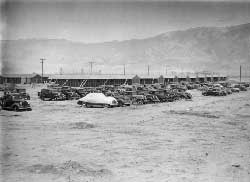 Figure 8.2. Confiscated evacuee automobiles. (Clem Albers photograph, Bancroft Library, University of California, Berkeley) |
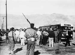 Figure 8.3. Evacuees arriving at Manzanar. (WRA photograph, National Archives) |
The central developed portion of the relocation center covers an area of approximately 540 acres (Figure 8.4). Eight watchtowers were completed on the perimeter by August 1942, and a five-strand barbed wire fence around the central area was completed by the end of the year. A military police compound with 13 buildings was located beyond the southeast quarter of the relocation center central area, south of Bairs Creek and west of U.S. Highway 395.
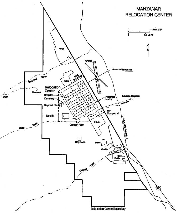 Figure 8.4. Manzanar Relocation Center. (click image for larger size (~60K) ) |
Paved or oiled roads divided the central portion of the relocation center into 67 blocks, including 36 residential blocks, two staff housing blocks, an administrative block, two warehouse blocks, a garage block, and a hospital block (Figure 8.5). The 24 remaining blocks, located throughout the center, served as firebreaks. East-west roads were designated by numbers starting with 1st street at the relocation center entrance and proceeding north. The one road south of 1st Street was named Manzanar Street. North-south roads were designated by letters, starting with "A" street on the east and ending with "I" Street on the west. The evacuee residential blocks were designated 1 through 36; none of the other blocks were designated by number. The relocation center was aligned with U.S. Highway 395, rather than true north.
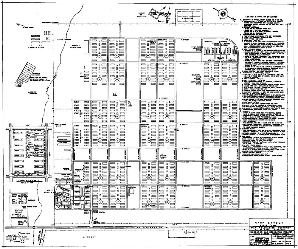 Figure 8.5. Manzanar Relocation Center central area. (National Archives) (click image for larger size (~162K) ) |

 Top
Top
Last Modified: Fri, Sep 1 2000 07:08:48 pm PDT
http://www.cr.nps.gov/history/online_books/anthropology74/ce8.htm
![]()