![]()
Cover Page
MENU
![]() Minidoka
Minidoka
|
| |
Confinement and Ethnicity: An Overview of World War II Japanese American Relocation Sites by J. Burton, M. Farrell, F. Lord, and R. Lord |

|
|
| |
Chapter 9 (continued)
Minidoka Relocation Center
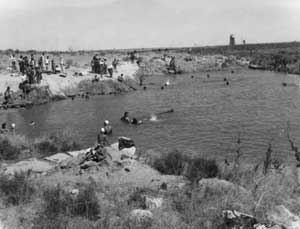 Figure 9.7. Swimming pool located south of warehouses. (WRA photograph, Bancroft Library, University of California, Berkeley) |
Evacuees constructed an irrigation canal to the relocation center from the Milner-Gooding Canal 5 miles east. Because of the topography the North Side canal could not used by the relocation center for irrigation without a costly pumping plant. Both the Milner-Gooding and North Side Canals had their takeout from the Snake River at Milner Dam 20 miles to the southeast. A total of 350 acres were cleared and farmed by the evacuees the first year. In 1943, 420 acres were under cultivation and in 1944 about 740 acres were planted. A variety of garden vegetables were grown in the fields, located mostly north and east of the fenced residential areas (Figure 9.8). Just outside the east side of the fenced residential area was a farm mess hall, a hog and chicken farm, and a landscaped park and picnic grounds watered with water initially hand-carried from a nearby canal.
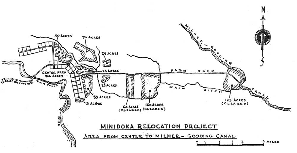 Figure 9.8. Farm fields at Minidoka. (from Minidoka Irrigator 7/21/44) (click image for larger size (~150K) ) |
A small cemetery was northwest of the central fenced portion of the relocation center (Yamaguchi 1989:41). When the relocation center was closed all of the bodies were exhumed and re-buried elsewhere. Some metal coffins remained and have been used for such things as feed and watering troughs.
Sewage lagoons were located about 2 miles southwest of the residential areas, on the other side of the North Side Canal. Also south of the canal, according to the WRA blueprints, there were a warehouse and railroad spur that served the relocation center.
After the relocation center was closed, the area was divided into small farms. Forty-three of these small farms were allotted in 1947 to World War II veterans, whose names were drawn in a lottery. In 1949 another 46 small farms were allotted. Each veteran also received two barracks. The first group of veterans lived in Block 30 of the relocation center until they could move their barracks to their own farms. The veterans and their families had to share the block's common bathroom and "some of the wives were upset to have to use community shower facilities" (Smith 1987), probably echoing the sentiments of the first, involuntary inhabitants.

 Top
Top
Last Modified: Fri, Sep 1 2000 07:08:48 pm PDT
http://www.cr.nps.gov/history/online_books/anthropology74/ce9b.htm
![]()