
CRGIS Contraband Slave Camp Mapping Project
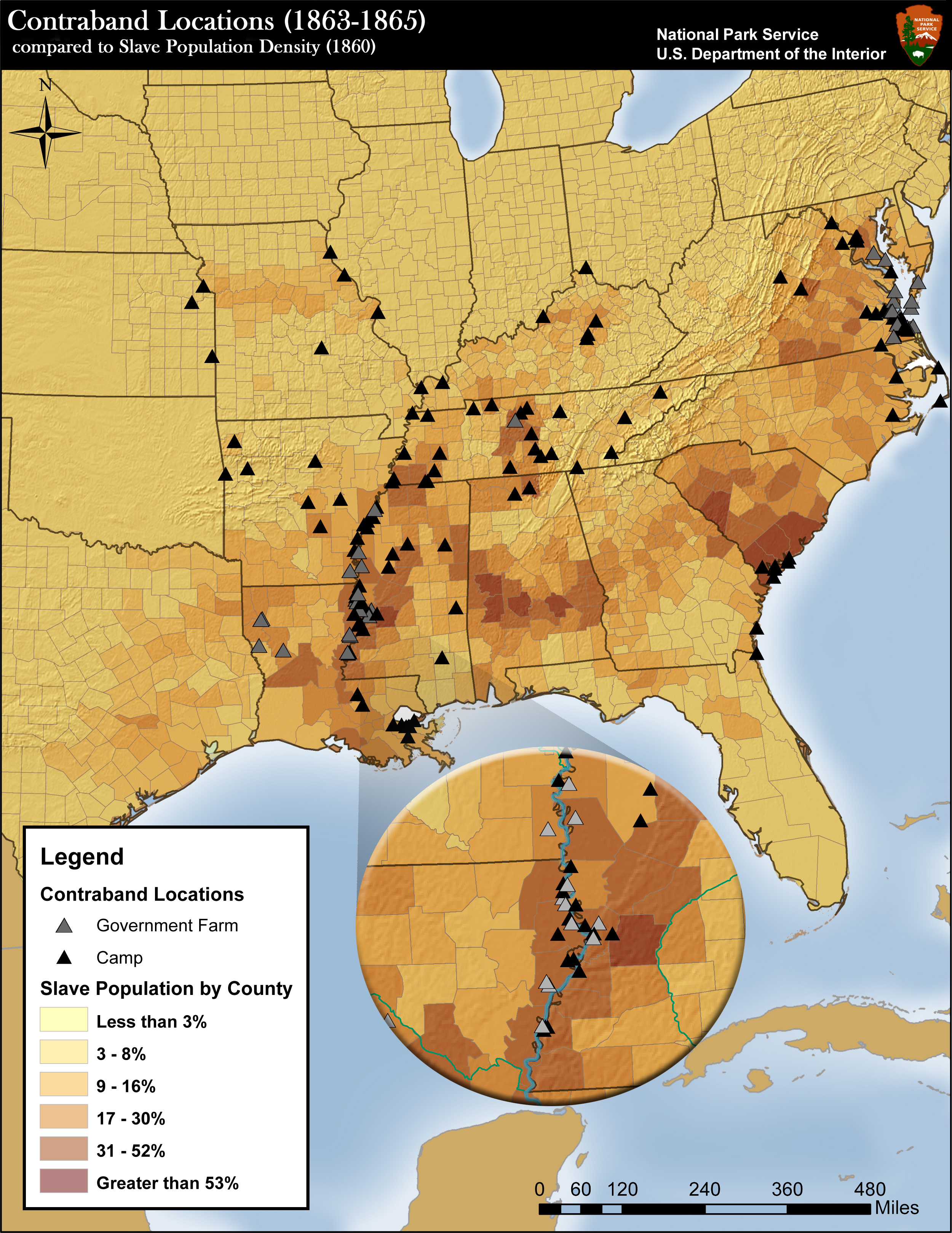
In 1861, General Benjamin Butler defined fugitive slaves of Virginia owners as "contraband of war" that would not be returned, to prevent their use in the Confederate war effort. This led to the formation of hundreds of contraband camps with thousands of fugitive slaves. A cooperative effort with Dr. Amy Taylor of State University of New York, the National Park Service, and the Cultural Resources GIS (CRGIS)of Heritage Documentation Programs has mapped approximately 562 of these camps, plantations, and farms where fugitive slaves lived.
Many of the 180,000 men who served in the United States Colored Troops (USCT) were recruited directly from these contrabands camps. Many of the contraband slaves living in Washington, DC enlisted in the 1st District of Columbia Colored Volunteers, later officially re-designated the 1st United States Colored Troops. This was the first African American regiment formally mustered into Federal service. The 1st United States Colored Troops trained on Mason's Island, the site of a contraband camp, and now known as Theodore Roosevelt Island, a unit of the national park system.
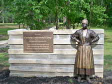
Near the Shiloh National Military Park, a unit of the National Park Service, was the site of another contraband camp at Cornith, Mississippi. The First Alabama Infantry Regiment of African Descent (later renamed the 55th USCT Regiment), stood guard at the contraband camp. Many contraband camps were places where African Americans earned wages as free men and women for the first time. Their labor on confiscated farms and plantations returned badly needed funds to the Union war effort. The 600-acre camp at Corinth was so well organized that it returned a profit to the federal treasurer. The Corinth Contraband Interpretive Center tells the story of the camp at Corinth.

