

Forts of San Juan
San Juan, Puerto Rico
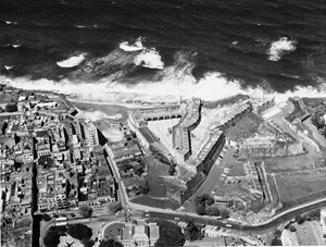
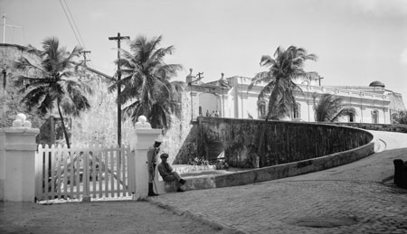
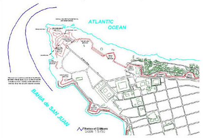
When the Spanish came to the New World, they founded their second city at San Juan, Puerto Rico, building several forts to protect the city and the prosperity it promised: Fort San Felipe del Morro (El Morro), Castle San Cristóbal, and El Palacio de Santa Catalina (La Forteleza). Built in the sixteenth century, the forts are the only European-style battlements on United States territory, and were designated a World Heritage Site by UNESCO in 1983.
Learn More...
- HABS documentation of Castillo de San Cristobal (HABS PR-47)
- HABS & HAER documentation of El Morro (HABS PR-48, HABS PR-48-A, HABS PR-55, and HAER PR-23)
- HABS documentation of El Cañuelo (HABS PR-52)
- HABS documentation of La Fortaleza (HABS PR-54)
- HABS documentation of El Abanico (HABS PR-94 series)
- HABS documentation of las Murallas del Viejo San Juan (HABS PR-135 series)
- National Historic Landmark nomination for Distrito Histórico del Viejo San Juan—Old San Juan Historic District
- UNESCO World Heritage Sites listing of the Forts of San Juan
- Teaching with Historic Places lesson plan on the Forts of Old San Juan
- San Juan National Historic Site
- Federal website for National Hispanic Heritage Month
- National Register of Historic Places celebrates National Hispanic Heritage Month
- HDP Hispanic Heritage Month homepage

