Desert View Drive

 
aerial view above a paved road traveling through a forested plateau on the edge of a mile deep canyon filled with colorful peaks and cliffs.
Open to private vehicles, Desert View Drive travels along the South Rim of the canyon 23 miles (37 km) between Grand Canyon Village and Desert View.
 
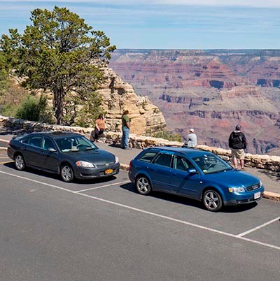
two cars parked by the side of the road at a scenic overlook. Behind a stone guard wall, four people are viewing a colorful canyon landscape of peaks and cliffs.
The 23 mile (37 km) long Desert View Drive features marvelous panoramic views of Grand Canyon and the Colorado River. There is parking at every viewpoint.

Along Desert View Drive

The Desert View Drive portion of SR 64 is a scenic road that begins near Grand Canyon Village. Private vehicles can drive east along the canyon rim for 23 miles (37 km) to the Desert View Services Area, and the East Entrance of Grand Canyon National Park.

What's Along the Desert View Drive portion of SR 64:

  • Six developed canyon viewpoints
  • Four picnic areas
  • Five unmarked pullouts
  • Tusayan Pueblo Site: CLOSED for the Winter.

Desert View Drive begins at Mile Marker 241.5 - at the junction with South Entrance Road.

Note: Yaki Point may only be accessed on foot, bicycle, or by taking the Kaibab Rim (Orange) Route shuttle from the Visitor Center.
Details >

 
Map of Desert View Drive on the S.Rim of Grand Canyon National Park. an overview is shown at the top, showing the entire length of the drive. On the right, an insert of the Desert View developed area. Additional text is on this page.
There is just one scenic drive open to private cars on the South Rim, Desert View Drive. The 23 mile (37 km) long Desert View Drive features marvelous panoramic views of Grand Canyon and the Colorado River. There is parking at every viewpoint. Be sure to bring enough food and water for everyone in your group.
 
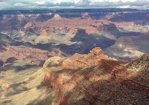
on an overcast day with dramatic shadows, a view down a ridgeline of vermilion colored stratified rock to a lone promontory. In the distance peaks and cliffs are seen rising from the floor of a mile-deep canyon.
The view looking north from Pipe Creek Vista.

Pipe Creek Vista

Mile Marker 242.5

This pullout can be accessed by private vehicle or by using the free Kaibab Rim (Orange Route) Shuttle Bus, departing from Grand Canyon Visitor Center. Since this is the first view of the canyon along Desert View Drive, it can be a congested area with limited parking.

The Canyon Rim Trail may be accessed here, with a 1.3 mile / 2.1 km walk west on a paved footpath to Mather Point, or a 0.8 mile / 1.3 km walk east on a paved footpath to the South Kaibab Trailhead.

 
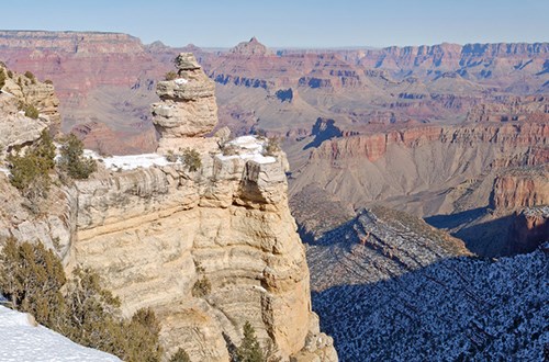
Rounded pale rock formation against Grand Canyon in the background.
Rock formations provide food for thought. What shape do you see?

Duck on a Rock

(Elevation: 7,096 feet / 2,162 meters) Mile Marker 246
Grand Canyon’s seemingly endless rock formations evoke shapes that only our imaginations can bring to life. Early mapmakers saw castles and temples in the rocks. Decade after decade, visitors have come to this spot to look for the “Duck on a Rock.” What do you see?

Duck on a Rock is the next canyon viewpoint beyond Pipe Creek Overlook.

 
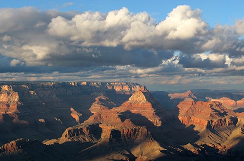
Grand Canyon landscape with clouds overhead.
View from Grandview Point.

Grandview Point

(Elevation: 7399 feet / 2256 meters) Mile Marker 251

This popular viewpoint offers panoramic views of Grand Canyon from east to west, including several bends of the Colorado River to the east.
The historic Grandview Trail begins here. This trail is VERY steep! In the summer much of the trail is in full sun. In the winter ice and snow can make hiking treacherous. Always use caution on the Grandview Trail.

 
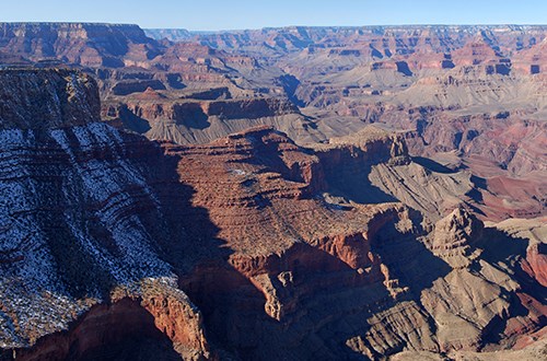
Red cliffs speckled with snow.
Moran Point, named after the painter, Thomas Moran, features a wide pallet of colors.

Moran Point

(Elevation: 7160 feet / 2182 meters) Mile Marker 258

Geology is a prominent feature at any Grand Canyon viewpoint but at Moran Point three main rock groups are clearly visible.
The Layered Paleozoic Rocks represent the sedimentary rocks that make up most of the Grand Canyon's depth. The Grand Canyon Supergroup represents a significant portion of the canyon's geologic record even though it is only in isolated remnants. The Basement Rocks are the oldest at the canyon, consisting of both metamorphic and igneous rock.

 
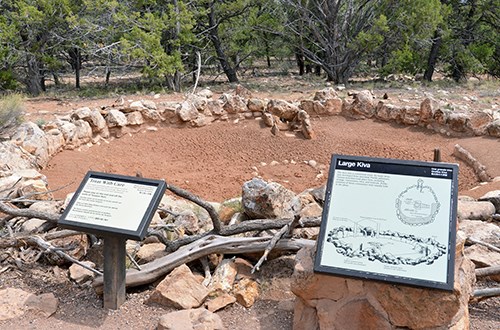
A stone wall circles around bare dirt with pine trees in the background, two informative signs in the foreground.
A outline of a large kiva, or ceremonial room, can be seen within the pueblo

Tusayan Pueblo Site

Mile Marker 262

The Tusayan Pueblo archaeological site and self-guiding trail are CLOSED for the Winter

Drinking water and vault toilets are available when the site is open.


Note: Tusayan Musuem remains closed at this time.

 
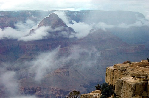
Rock formations surrounded by fog and low clouds.
View from Lipan point with Vishnu Temple breaking through the clouds.

Lipan Point

(Elevation: 7360 feet / 2243 meters) Mile Marker 263.5

From this viewpoint can be seen several points of interest.
  • Hance Rapid is one of the many powerful whitewater rapids along the Colorado River.
  • Unkar Delta was once home to ancestral Puebloan people and is the site of active archeological study.
  • The Grand Canyon Supergroup is a unique rock strata at Grand Canyon, visible to this extent from only a few places on the South Rim.
 
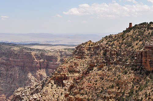
Large cliff goes out into the canyon with a tower at the end.
Desert View Watchtower can be seen from Navajo point.

Navajo Point

(Elevation: 7461 feet / 2275 meters) Mile Marker 264

Just a few minutes west of the Desert View Watchtower, this viewpoint offers a great view of the watchtower as well as panoramic vistas to the west and a view north up the Colorado River.
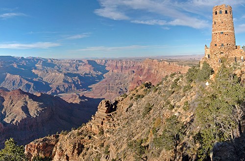
Navajo Point is the highest overlook on the South Rim - unless one is standing on the top observation deck of the watchtower itself. The top of the tower measures slightly higher.

 
Stone tower overlooks the canyon with flat desert to the right.
The Colorado River sweeps through the canyon below Desert View Point.

Desert View

(Elevation: 7438 feet / 2267 meters) Mile Marker 264.5

  • A short ¼-mile (402 m) walk leads from the parking area, past historic buildings, to the canyon rim.
  • From Desert View Point you can see some of the best views of the Colorado River as it makes a big bend to the west.
  • Desert View Campground has closed for the winter.
    • 2024 dates: Campground opens on Saturday, April 13th, the last night to stay is Sunday, October 13th. Campground closes on Monday October 14th. Advanced reservation are required and can be made up to 6 months in advance through www.recreation.gov >

Last updated: November 2, 2023

Park footer

Contact Info

Mailing Address:

PO Box 129
Grand Canyon, AZ 86023

Phone:

928-638-7888

Contact Us