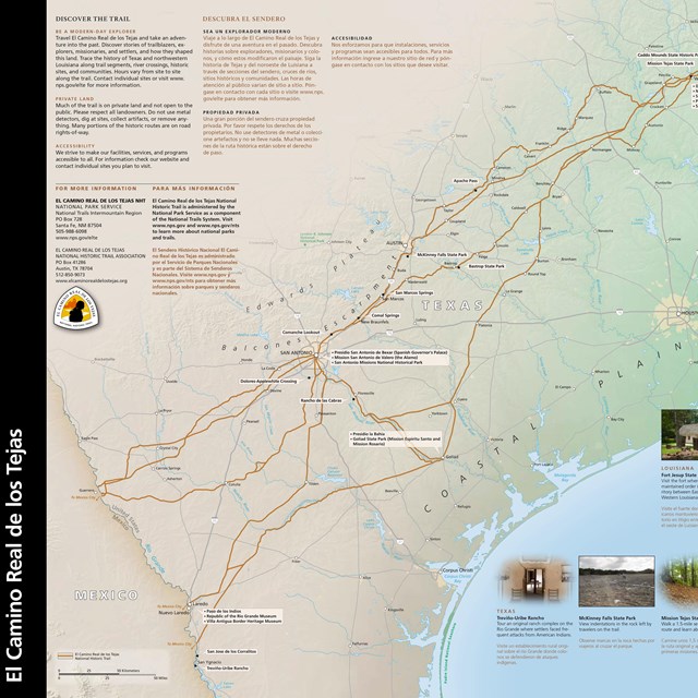
GIS Data and InformationFor Geographic Information System data regarding the El Camino Real de los Tejas National Historic Trail, please visit the Resource Information Management page of the National Trails office website. Trail sites are located across 2,580 miles and 5 states (in the U.S.) and thousands of miles in Mexico. The Trail is administered by the NPS office located at:

Photo/NPS Trail AdministrationEl Camino Real de los Tejas National Historic Trail is administered by the National Park Service as a component of the National Trails System. The National Park Service administers the trail in partnership with El Camino Real de los Tejas Trail Association, American Indian tribes, state, county, and municipal governmental agencies, private landowners, nonprofit heritage conservation groups, and many others. Trail sites are in private, municipal, tribal, federal, or state ownership. Please ask for permission before visiting any trail sites on private lands and check with public sites for visiting hours and regulations. Protect the TrailTo foster trail preservation, do not use metal detectors, dig at sites, collect artifacts, or remove anything. Please respect these historic places. More Trip Planning Information:
|
Last updated: April 23, 2025