An official website of the United States government
Here's how you know
Official websites use .gov A
.gov website belongs to an official government
organization in the United States.
Secure .gov websites use HTTPS A
lock (
) or https:// means you've safely connected to
the .gov website. Share sensitive information only on official,
secure websites.
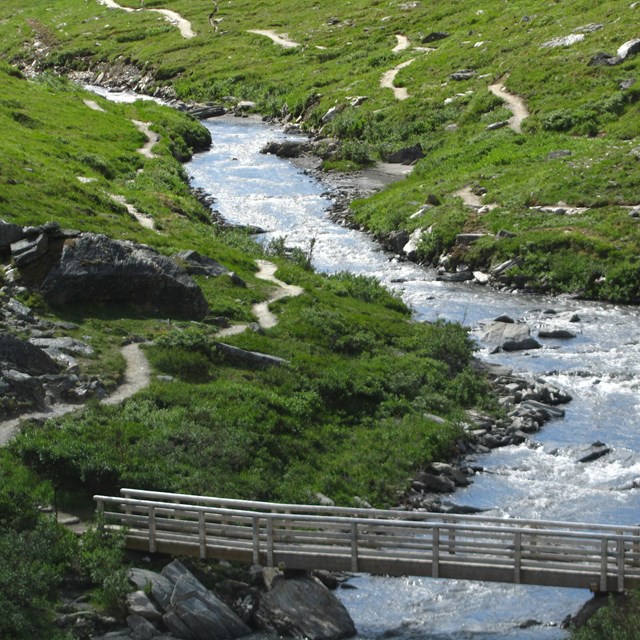
Savage River Canyon, near the mid-way point of the Savage River Loop Trail, where a bridge crosses the river.
NPS Photo / Tim Rains
Hours and Seasons
This part of the park is technically open 24 hours a day, but the road is only open to vehicles from late April until the first snow in fall. When the free Savage River Shuttle is operating (mid-May to mid-September), riding the shuttle is the most reliable way to access the area and to not worry about finding parking. Private vehicles can drive as far as Mile 15 of the Denali Park Road, to Savage River, but parking is extremely limited. Camping in the area is only permitted at Savage River Campground with a reservation or in the backcountry with a backpacking permit.
Access
The Savage River area is located near the end of the paved and publicly-accessible portion of the Denali Park Road. You can use a free bus, called the Savage River Shuttle, to get here.
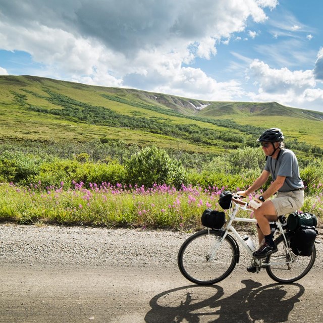
By foot or bike: Year-round
Depending on conditions, you're welcome to ski, bike, or hike out to this part of the park year-round. In winter, this typically means a journey of 12 miles one-way (assuming you start from Park Headquarters, which is typically as far as you can drive a vehicle), so be prepared for a long day if traveling in winter. Be aware this is a road with no bike lanes, so bikers will be constantly passed by traffic.
By bus: Summer
The Savage River Shuttle is a free bus ride out to this area. Bus service is roughly mid-May to mid-September. Using the bus is highly recommended, as parking fills up rapidly at Savage River.
By car: Spring, summer, fall
Parking is extremely limited at Savage River, and often will fill up at the nearby Mountain Vista Rest Area midday, as well. You can avoid worrying about parking in the summer by taking the Savage River Shuttle (described above).
In the fall, the road closes whenever wintry weather sets in. Sometimes this is late September, while in other years it's not until late October. We begin plowing the park road in February. The road is generally open to Mountain Vista (Mile 13) by mid-February and to Teklanika (Mile 30) by late April or early May.
Know Before You Go
The parking area can get full nearly every day in summer. We recommend using the free shuttle when possible, which you can catch at the Denali Visitor Center (or several other buildings near the park entrance). Alternatively, park at Mountain Vista (Mile 13); you can then use the shuttle when available to travel to Savage River, or you can walk the road or hike the strenuous Savage Alpine Trail.
You can ride the free shuttle to, or attempt to find parking at, either the Mountain Vista Rest Stop (Mile 13) or the Savage River Rest Area (Mile 15). Savage River Campground is situated between the two day-use areas. Trails connect the two areas, or you can walk the road.
There is no parking for RVs at Savage River. There is limited parking at Mountain Vista for RVs. The free Savage River Shuttle is the best way to access this area.
The Savage River Shuttle can accommodate up to two bikes at a time.
Savage River can be very windy, so bring layers. It is also several hundred feet higher in elevation than the park entrance, so it can be a bit chillier than conditions at the visitor center.
There is no cell service in the area.
There is no water or food service in the area.
Time Commitment
The answer depends on the time of year.
By bus: The bus makes several stops near the park entrance to pick up passengers, so it takes about an hour for the bus to travel from the entrance of the park to Savage River. It then takes a similar amount of time to return, so that means a minimum of 2 hours, but ideally you'll disembark from the bus to explore Savage River and catch the bus later in the day to travel to the park entrance.
In early and late summer, bus service is less frequent. This might add more time to your journey; review the bus schedule for details.
By car: The speed limit is 35 mph, so it'll take you around half an hour to drive to Savage, assuming you make no stops (you're welcome to pause at pullouts to enjoy the scenery, or pull fully and safely to the shoulder of the road if you spot wildlife). Thus the true minimum amount of time needed is an hour, but hopefully you'll choose to take the shuttle and spend time enjoying the area.
907 683-9532
A ranger is available 9 am to 4 pm daily (except on major holidays). If you reach the voicemail, please leave a message and we'll call you back as soon as we finish with the previous caller.