|
Most people arrive at Arches by car. There is no public transportation inside Arches National Park. You may need to rent a car, ride a bicycle, or take a commercial tour to get around inside the park. The nearest community is Moab, Utah.
Getting to ArchesBy CarThe entrance to Arches National Park is north of the town of Moab, Utah.
By PlaneMost people coming to Arches fly into these airports:
By Train
By Bus
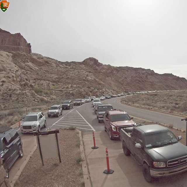
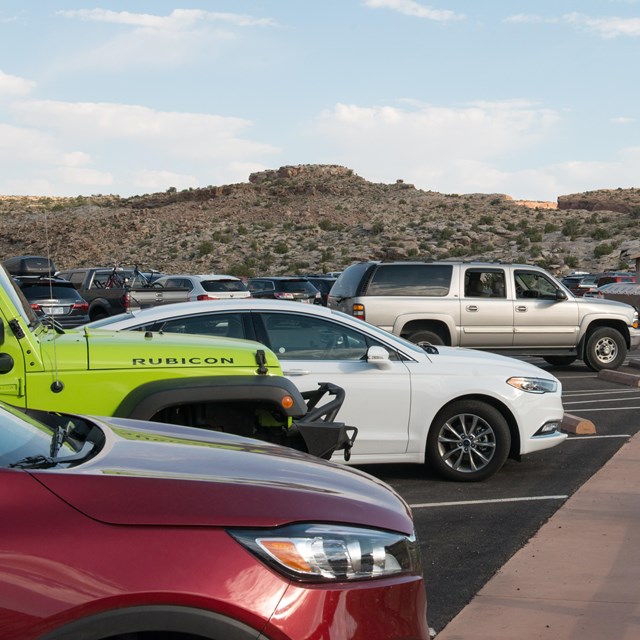
Commercial bus drivers: Please read Tour Bus Information before coming to Arches. By Shuttle or TaxiCommercial van services and taxis operate between Grand Junction, Green River, Moab and other destinations. For a listing of area shuttle and taxi services, visit discovermoab.com. Area Transportation OptionsFor additional information on transportation options in and around Moab, visit discovermoab.com. Getting AroundMost visits to Arches involve traveling by vehicle along the scenic drive, which provides access to many viewpoints and trailheads. Some times of year—or even times of day—are far busier than others. Check the Traffic & Travel Trips page for information on busy times of year. Parking lots can be full for much of the day during busy seasons. Road construction may cause delays or closures during your visit. Mileages from Entrance Station and Visitor Center:
| ||||||||||||||||||
Last updated: April 18, 2025