



News Release
NPS Image
News Release Date: July 21, 2026
Contact:
WRST_Public_Affairs@nps.gov
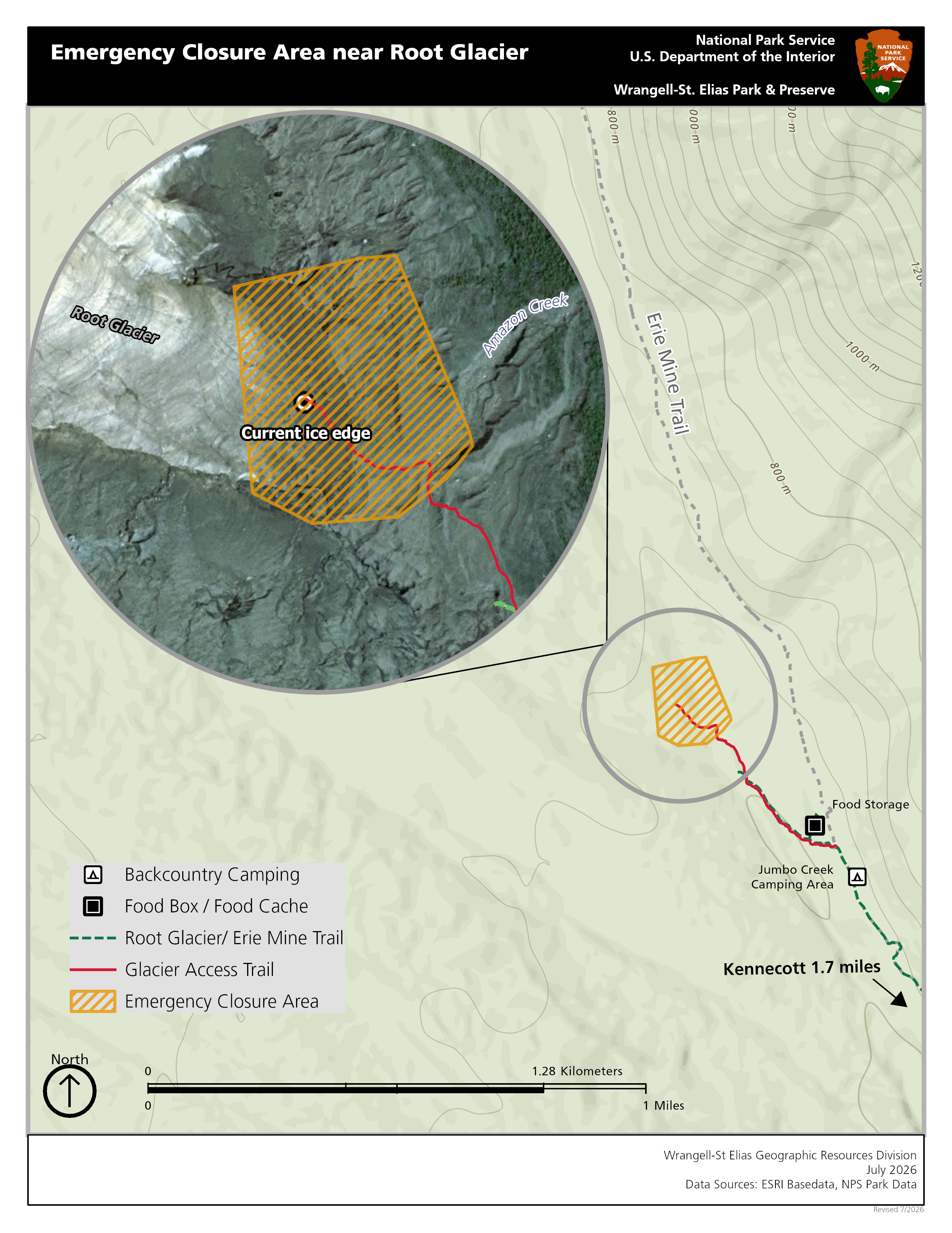
COPPER CENTER, Alaska – In order to reduce hazards on a popular hiking route, Wrangell-St. Elias National Park and Preserve has closed an area beneath an unstable hill on the Root Glacier access trail north of Kennecott Mines National Historic Landmark. Hikers should not enter the closed area and could be injured or buried by falling rock if they do. Seek more information about this evolving situation at visitor centers or from a park ranger if you plan to hike at or near Kennecott.
Background
This July, Wrangell-St. Elias National Park & Preserve geologists observed new areas where the ground is unstable and a landslide is possible on the moraine (rocks next to a glacier) at the northern end of the Root Glacier Trail.
Root Glacier, which is north of Kennecott, is one of the most popular and visited destinations in the park. To help visitors avoid the unstable area, rangers are:
- Installing signs.
- Using new maps at visitor centers.
- Sharing updates on the park website and social media.
- Seeking alternate paths to reroute glacier access in the future.
Glacial landscapes are inherently dynamic, and your safety is your responsibility.
Last updated: July 21, 2026