NPS photo
The Black Hills are a dome-shaped area of crustal uplift, and the rock units exposed at the surface are shaped like a "bullseye" around the center of the Hills. Pre-Cambrian aged granites and gneisses form the interior core of the Hills. Moving outward from the center of the Hills, rock units of limestone, shales and sandstones are expressed at the surface. Wind Cave National Park straddles the older interior Hills rocks younger rocks, covering about 2 billion years of earth history. Due to this, Wind Cave National Park offers prime opportunity to witness a slice of Black Hills geological history. Scroll down to see a geological map of the park.

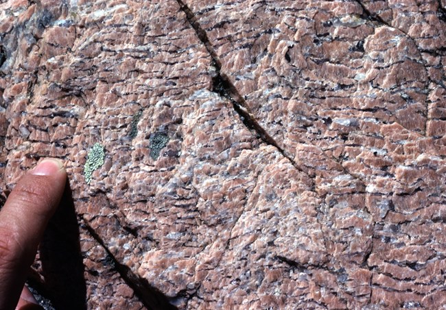
NPS photo The Oldest RocksThe oldest rocks are exposed in the northwest part of the park. These are schists and pegmatites. The schists are metamorphic rocks which formed under heat and intense pressure during an early episode of mountain building, about 2 billion years ago. They have almost parallel bands, or foliation, caused by the growth of mica crystals under pressure. 
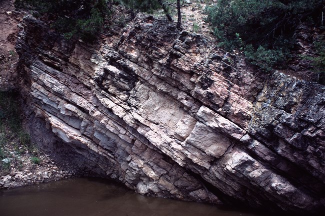
NPS photo Sedimentary RocksTo the southeast of the igneous and metamorphic rocks, progressively younger layers of sedimentary rocks are at the surface. They span a time from the origin of abundant sea life, about 600 million years ago, to the end of the age of dinosaurs, about 60 million years ago. During these years, seas advanced and retreated over this region many times. Periods of deposition of sediments alternated with periods of erosion. About 65 million years ago forces within the earth produced another period of mountain building, raising the "modern" Black Hills.Shaping the LandscapeSince that uplift, weathering, erosion and minor uplifting have been shaping the Black Hills. Sediments produced by the erosion filled some valleys within the park and spilled outside the Hills to the east, forming the layers now visible at Badlands National Park. Rocks more resistant to weathering and erosion, like pegmatite, limestone, and sandstone, form ridges or plateaus. Weaker rocks, like schists and shales, form valleys. Examples of limestone, sandstone and shale are visible in Beaver Creek Canyon, Wind Cave Canyon, and Red Valley. Schists and pegmatites are visible along South Dakota Highway 87.
|
Last updated: September 3, 2023
