Laughlin Park Exhibits

If you had been in Laughlin Park in Waynesville, Missouri the afternoon of December 9, 1837, you would have seen more than 350 Cherokee setting up camp in the fields along Roubidoux Creek. Read the Trail of Tears stories about removal along the northern route.
 
Discover a Hidden History thumbnail

Discover a Hidden History
This orientation panel covers the one-mile walk along Roubidoux Creek in Laughlin Park with a map, a Trail of Tears introduction, and things to do in the park.

 
trees in color, blue sky, Indian territory map, Trail of Tears route map

What is the Trail of Tears?
The Cherokee, or the "Principal People" or Ani'-Yun' wiya, did not willingly leave their homeland in the southern Appalachian Mountains.

 
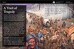
Cherokee Indians walking down a road
This morning word came that a Cherokee woman was dying. I hastened to her tent…She was put in the wagon which carried her family when the detachment started, but soon expired.
Rev. Daniel S. Butrick diary, March 11, 1839

 
A Resting Place for the Weary
halted at Waynesville, MO 4 o'c P.M. encamped and issued corn and fodder, beef and cornmeal. Weather extremely cold. B. B. Cannon's diary, December 9, 1837
 
artwork of trees, a creek, and people by the creek
We travelled about 12 miles to a settlement… on the banks of a beautiful stream, named Rubedoo. Here we had a delightful place, on the bank of the river convenient to wood and water.
Rev Daniel S. Butrick's diary, March 12, 1839

 
A Frigid Crossing

A Frigid Crossing
Traveled 12 miles to Waynesville on Roberdeou Creek, a branch of the Gasconade—clear and present day… Dr. W. I. Morrow's diary, March 5, 1839

 
two bridges and blue sky

A Road Through History
Historic Route 66 followed paths used by American Indians for trade and travel more than 500 years ago.

Last updated: February 21, 2019

Park footer

Contact Info

Mailing Address:

National Trails Office Regions 6|7|8
Trail of Tears National Historic Trail
1100 Old Santa Fe Trail

Santa Fe, NM 87505

Contact Us