Last updated: May 1, 2025
Thing to Do
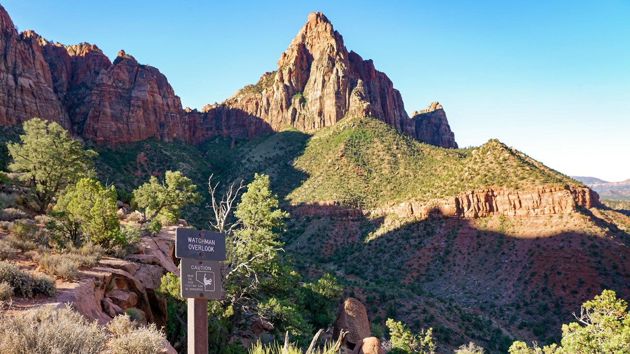
Watchman Trail
NPS/Abi Farish
The Watchman Trail is a moderate out-and-back hike accessed from the Zion Canyon Visitor Center. To reach the trailhead, follow the sidewalk through the Visitor Center plaza and past the shuttle stop to the crosswalk. Stay along the river to begin the trail.
From the relatively flat beginning section of trail by the river, this unpaved trail climbs to a magnificent viewpoint of the Watchman, Temples and Towers, lower Zion Canyon, and the Town of Springdale. The terrain is sandy, rocky, and uneven, with several moderate drop-offs.
Restrooms and water filling stations are available at the Visitor Center.
Bikes are not permitted.
Details
Duration
1-2 Hours
Watchman trail is 3.3 miles (5.3 km) roundtrip. On average, it takes about 2 hours to complete.
Activity
Hiking
Pets Allowed
No
Activity Fee
No
Park entrance fees apply.
Location
Watchman Trailhead
To reach the trailhead from the Zion Canyon Visitor Center, follow the sidewalk through the Visitor Center plaza and past the shuttle stop to the crosswalk. Stay along the river to begin the trail.
Reservations
No
Season
Year Round
This hike is accessible throughout the year. The trail may be muddy or icy during the winter and monsoon season. Limited shade in the summer.
Time of Day
Any Time
Accessibility Information
Watchman Trail to Overlook
- Length (one way) | 1.4 mi (2.3 km)
- Elevation | Gain: 479.4 ft (146.1 m) | Loss: 78.1 ft (23.8 m)
- Grade | Typical: 7.4% | Maximum: 39.4% | 34 % of the trail is at an 8.3% or higher grade.
- Cross Slope | Typical: 4.8% | Maximum: 36.8%
- Tread Width | Typical: 77 in (195.6 cm) | Minimum: 12 in (30.5 cm)
- Surface | 2.2% of the trail is paved, 58.8% is hard rock, 37.4% is firm soil, and 1.6% is soft soil.
- Obstructions | Steps up to 24 in (61 cm) tall, with 0 in of remaining tread | Overhanging rocks 20 ft (6.1 m) long with a minimum vertical clearance of 7 ft (2.1 m). There are 20 in (50.8 cm) of remaining tread,
Loop Trail from Overlook
- Length (one way, counterclockwise) | 0.4 mi (0.7 km)
- Elevation | Gain: 80.4 ft (24.52 m) | Loss: 64.6 ft (19.68 m)
- Grade | Typical: 6.6% | Maximum: 31.5% | 28.8% of the trail is at an 8.3% or higher grade.
- Cross Slope | Typical: 3.6% | Maximum: 18%
- Tread Width | Typical: 34 in (85.9 cm) | Minimum: 12 in (30.5 cm)
- Surface | 73% of the trail is firm soil, and 27% is hard rock.
- Obstructions | Steps up to 12 in (30.5 cm) tall, with 0 in remaining tread.
Last assessed on 01-15-2025. Obstructions less than 4 in (10.2 cm) tall, or outside the tread area of 36 in (91.4 cm) wide by 96 in (243.8 cm) high, were not reported.