Last updated: November 17, 2022
Thing to Do
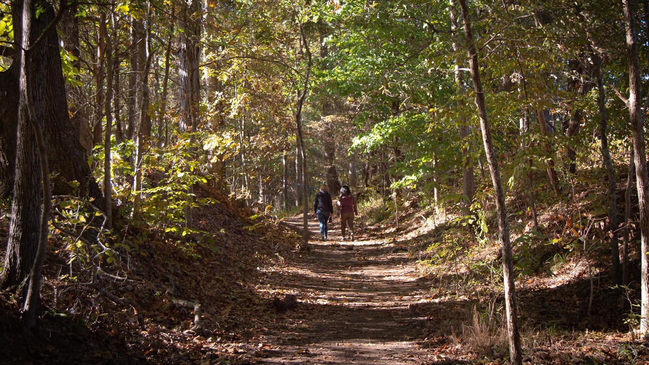
Hike on the Trail of Tears
Photo/NPS
Walk on the Trail
Walk in the footsteps of history. Discover the same landscapes and imagine the hardships of those that have passed before you, as you look through their eyes on the same viewshed. What is different? What is the same? Walking along a hikeable portion of the Trail of Tears is an opportunity to broaden your understanding of the trail. It is a chance to be outside and experience the historical landscape. It is time to remember and commemorate the survival of the Cherokee people, forcefully removed from their homelands, as you walk where they have walked.
Opportunities to walk the trail:
These are only a selection of the sites available. For more information: Places to Go on the Trail of TearsExperiences vary, so please check with individual locations for more details.
Tennesse
- Trail of Tears Hiking Trail (Unicoi Turnpike)
- Roundup Route
- Cherokee National Forest
- Trailhead is on the NC/TN border just off of the Joe Brown Highway, near Tellico Plains
- Trail Info: 2.5 miles; historic route with interpretive panels along the way
- Hiwassee Heritage Center Trail of Tears Interpretive Trail
- Bell Route
- City of Charleston
- Charleston
- Trail Info: ~0.2 miles; paved ADA trail and signed with NHT signs
- David Crockett State Park
- Bell Route
- Tennessee State Parks
- Lawrenceburg
- Trail Info: 2.25 miles; swales are present along this historic route which is signed with NHT signs
- Mountain Goat Trail
- Bell Route
- Mountain Goat Trail Alliance
- Sewanee
- Trail Info: ~4.5 miles; historic route with NHT signs
- Nathan Bedford Forrest State Park
- Benge Route
- Tennessee State Parks
- Benton County
- Trail Info: ~1 mile; trail is signed with NHT signs
- Port Royal State Park
- Northern Route
- Tennessee State Parks
- Trail Info: ~0.1 miles (large swales); trail is signed with NHT signs
- Blythe Ferry
- Northern Route
- Meigs County
- Trail Info: ~0.5 miles; trail is scheduled to be constructed 2021
- Chickamauga Chattanooga National Military Park
- Northern Route
- National Park Service
- Moccasin Bend, Chattanooga
- Trail Info: ~0.5 miles (leads to the historic Brown’s Ferry TN River Crossing site); trail is signed with NHT signs
Kentucky
- Mantle Rock
- Mantle Rock Nature Preserve
- Northern Route
- Nature Conservancy
- Smithland
- Trail Info: 2.75 miles (swales present); trail is signed with NHT signs
Arkansas
- Village Creek State Park
- Bell Route
- Arkansas State Parks
- Trail Info: 1.5 miles; historic route with large swales present
- Pea Ridge National Military Park
- Northern Route
- National Park Service
- Garfield
- Trail Info: ~0.5 miles
- Note: The park is in the process of developing an additional section of hikeable retracement trail near Elk Horn Tavern
- Fort Smith National Historic Site
- Junction of Water Routes
- National Park Service
- Trail Info: ~0.3 miles (along river)
Missouri
- Trail of Tears Greenway
- Northern Route
- Ozark Greenways
- Springfield
- Trail Info: ~1.5 miles; trail is signed with NHT pedestrian signs
Illinois
- Hamburg Hill
- Northern Route
- Shawnee National Forest
- Jonesburg
- Trail Info: ~1 mile (large swales); trail is signed with NHT signs
Alabama
- Decatur Interpretive Trail/Walking Tour
- Junction of Water Routes
- City of Decatur
- Decatur
- Trail Info: ~.05 miles (paved); there is a walking brochure that was produced for the tour
Safety Considerations
For more location information: Places to Go on the Trail of Tears
Details
Activity
Hiking
Experiences vary, so please check with individual locations for more details.
Pets Allowed
Yes
Will vary by location. Please check with individual locations for more details.
Activity Fee
Yes
Will vary by location. Please check with individual locations for more details.
Reservations
No
Accessibility Information
Accessibility information will vary by location. Please check with the individual site for more specific information. Services animals are allowed at all locations.

Photo/NPS
Tennesse
- Trail of Tears Hiking Trail (Unicoi Turnpike)
- Roundup Route
- Cherokee National Forest
- Trailhead is on the NC/TN border just off of the Joe Brown Highway, near Tellico Plains
- Trail Info: 2.5 miles; historic route with interpretive panels along the way
- Hiwassee Heritage Center Trail of Tears Interpretive Trail
- Bell Route
- City of Charleston
- Charleston
- Trail Info: ~0.2 miles; paved ADA trail and signed with NHT signs
- David Crockett State Park
- Bell Route
- Tennessee State Parks
- Lawrenceburg
- Trail Info: 2.25 miles; swales are present along this historic route which is signed with NHT signs
- Mountain Goat Trail
- Bell Route
- Mountain Goat Trail Alliance
- Sewanee
- Trail Info: ~4.5 miles; historic route with NHT signs
- Nathan Bedford Forrest State Park
- Benge Route
- Tennessee State Parks
- Benton County
- Trail Info: ~1 mile; trail is signed with NHT signs
- Port Royal State Park
- Northern Route
- Tennessee State Parks
- Trail Info: ~0.1 miles (large swales); trail is signed with NHT signs
- Blythe Ferry
- Northern Route
- Meigs County
- Trail Info: ~0.5 miles; trail is scheduled to be constructed 2021
- Chickamauga Chattanooga National Military Park
- Northern Route
- National Park Service
- Moccasin Bend, Chattanooga
- Trail Info: ~0.5 miles (leads to the historic Brown’s Ferry TN River Crossing site); trail is signed with NHT signs

Photo/NPS
Kentucky
- Mantle Rock
- Mantle Rock Nature Preserve
- Northern Route
- Nature Conservancy
- Smithland
- Trail Info: 2.75 miles (swales present); trail is signed with NHT signs
Arkansas
- Village Creek State Park
- Bell Route
- Arkansas State Parks
- Trail Info: 1.5 miles; historic route with large swales present
- Pea Ridge National Military Park
- Northern Route
- National Park Service
- Garfield
- Trail Info: ~0.5 miles
- Note: The park is in the process of developing an additional section of hikeable retracement trail near Elk Horn Tavern
- Fort Smith National Historic Site
- Junction of Water Routes
- National Park Service
- Trail Info: ~0.3 miles (along river)
Missouri
- Trail of Tears Greenway
- Northern Route
- Ozark Greenways
- Springfield
- Trail Info: ~1.5 miles; trail is signed with NHT pedestrian signs
Illinois
- Hamburg Hill
- Northern Route
- Shawnee National Forest
- Jonesburg
- Trail Info: ~1 mile (large swales); trail is signed with NHT signs
Alabama
- Decatur Interpretive Trail/Walking Tour
- Junction of Water Routes
- City of Decatur
- Decatur
- Trail Info: ~.05 miles (paved); there is a walking brochure that was produced for the tour