Last updated: August 5, 2021
Thing to Do
Hike Carriage Roads
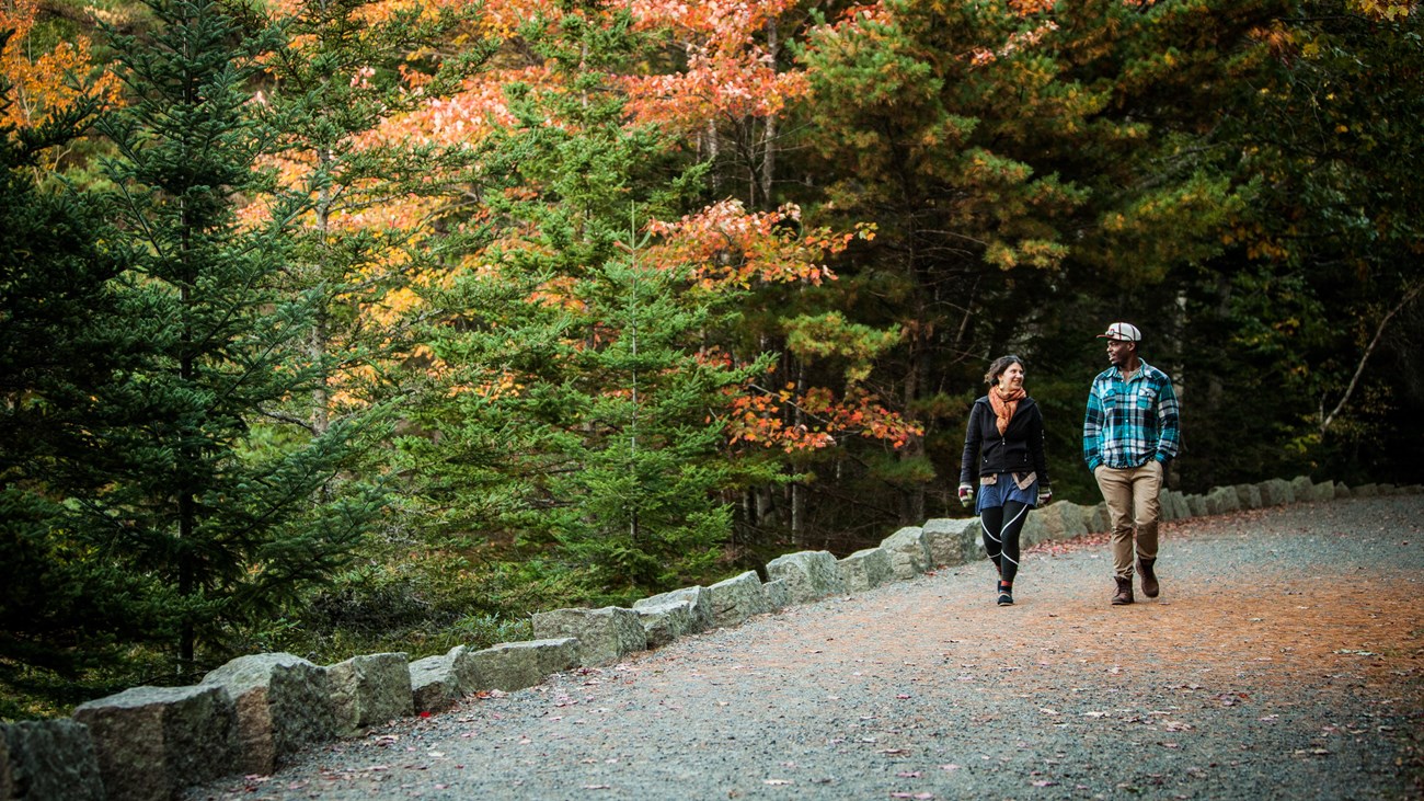
Today, carriage roads have multiple-user groups as they did in the past. Pedestrians, bicyclists, and horse-drawn carriages share in the beauty, access, and safety of these auto-free roads across the park.
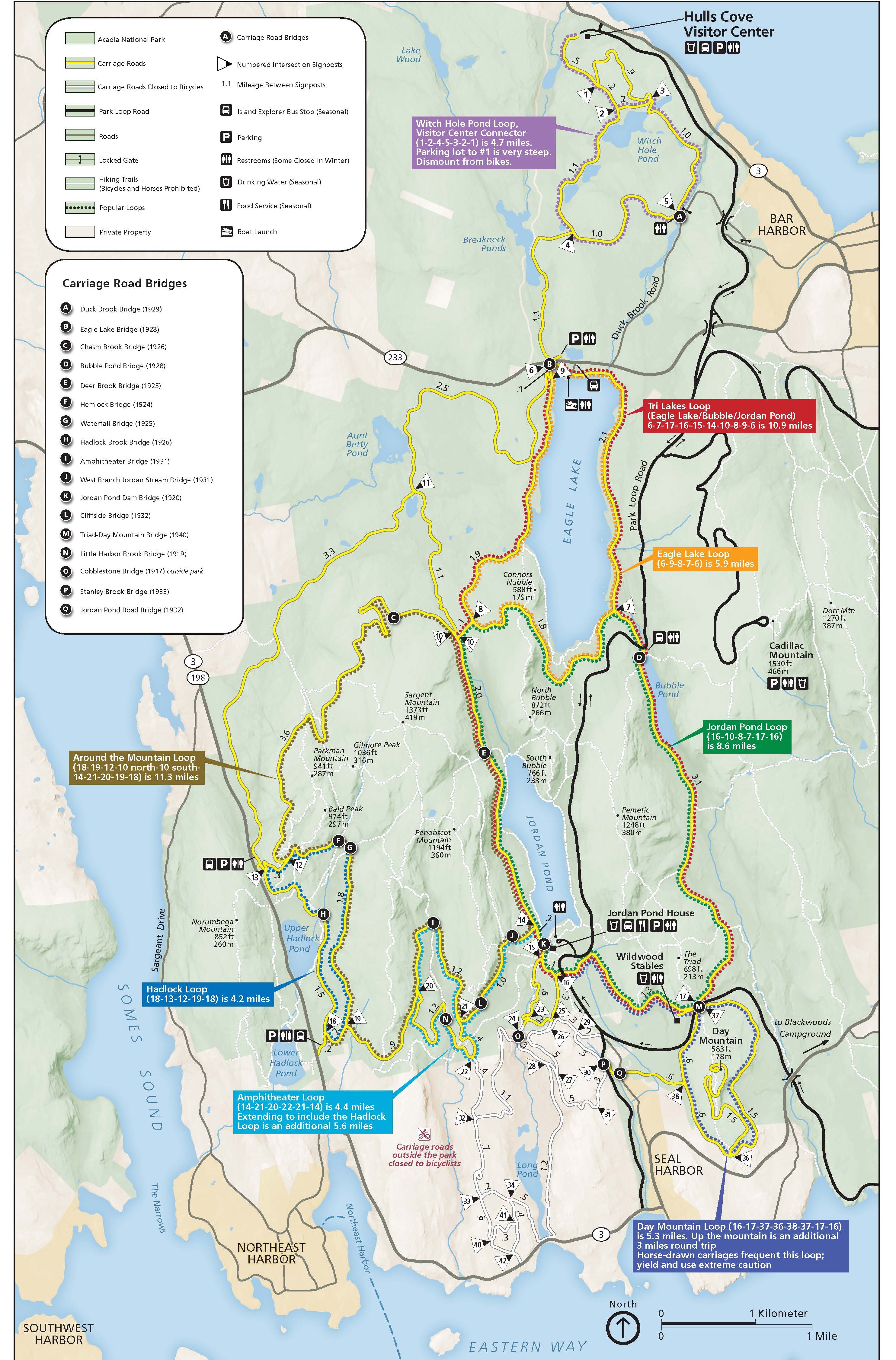
Many carriage roads intersect with hiking trails. They can be incorporated into a hike to create a loop, add distance, or provide opportunities for more even terrain to gain or lose elevation. Carriage roads around Eagle Lake, Jordan Pond, Bubble Pond, Penobscot Mountain, and Sargent Mountain are popular for scenic views and combining with traditional hiking trails.
For opportunities to hike without bicyclists, carriage roads outside park boundaries are for foot traffic only.
Rules and Safety Advisories
When hiking or walking on carriage roads, review the following rules and regulations for safer recreation:
- Use the Carriage Road Map for general orientation and review the rules and safety guidance below.
- If walking or hiking, stay on the right side of carriage roads to allow bicyclists to pass on the left.
-
Carriage roads are closed to motorized vehicles, including Class 2 and 3 E-bikes, Segways, and Hoverboards. Exceptions are provided for individuals with disabilities.
-
Bicyclists yield to all users. Everyone yields to horses, which can be startled by suddent movements.
-
All pets must be on a leash that measures six feet or less.
-
Use caution around heavy machinery and trucks used for carriage road maintenance.
-
Respect closures during spring mud season while underlying gravel remains vulnerable to ruts, potholes, and erosion.
Details
Activity
Hiking
Pets Allowed
Yes with Restrictions
Dogs must be on a leash no longer than 6 feet.
Activity Fee
No
Although this activity is free, a park entrance pass is required for all areas of the park from May 1 through October 31.
Location
Carriage Roads
Reservations
No
Season
Year Round
Respect closures during spring mud season while underlying gravel remains vulnerable to ruts, potholes, and erosion.
See Winter Activities for information on carriage roads during the off season.
Time of Day
Day, Dawn, Dusk
Accessibility Information
We recommend the following carriage roads for visitors using mobility aids like wheelchairs. Other carriage roads may be accessible, but tend to be steeper and slightly uneven, with sections of loose gravel. Extended use of the carriage roads depends on ability and endurance. Carriage roads are shared usage with horses, bicycles, and pedestrians.
Eagle Lake and Witch Hole Pond
The parking area on ME 233 has accessible restrooms and parking. To the north, the carriage road leads toward Witch Hole Pond, 5.3 miles (8.5 km) round-trip. To the south, under the stone bridge, the carriage road loops around Eagle Lake, 6 miles (9.7 km) round-trip. There is a steep hill at the southwest end of the lake.
Bubble Pond
The parking area on Park Loop Road has accessible restrooms and parking. The carriage road near the parking lot goes along the shore of Bubble Pond.
Suggested Routes
Unsure where to start? Check our suggested routes for ideas. These routes are typically for biking, but can be completed as longer hiking loops. Be mindful of the shading where elevation change is indicated. For a better understanding of what areas are more steep or level, always consult a topographic map.
