Last updated: May 21, 2024
Thing to Do
Drive U.S. Highway 50
NPS Photo
U.S. Highway 50 travels west from Gunnison and brings you into Curecanti National Recreation Area. The highway follows along the Gunnison River before reaching Blue Mesa Reservoir. It continues onward along the reservoir edge before it junctions with CO Highway 92 after the Lake City Bridge. The highway goes over two small high elevation passes (Blue Mesa and Cerro Summit) and sharply meanders through Little Blue Creek Canyon.
Follow all posted speed limit signs. Be mindful of wildlife along the roadway, especially at dawn or dusk.
Points of Interest
- Cooper's Ranch
- Neversink
- Beaver Creek
- Lake City Bridge/Iola Basin
- Stevens Creek Campground and boat launch (hand-launched craft only)
- Elk Creek Visitor Center, marina, and campground
- Bay of Chickens
- Cebolla Basin
- Red Creek
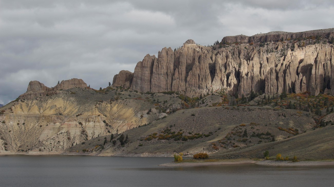
- Dillon Pinnacles
- Lake Fork Marina and campground
- Pine Creek Trailhead
- Cimarron and Morrow Point Dam
Past Cimarron, U.S. Highway 50 heads west to Montrose. Make sure to stop at the south rim of the Black Canyon of the Gunnison National Park, just a 5 mile drive north on CO Highway 347.
Details
Duration
2-4 Hours
This scenic drive can take between 2-4 hours. There are a number of overlooks, picnic areas, and trailheads off U.S. Highway 50. For those wishing to stay overnight, there are seven campgrounds off this scenic drive.
Activity
Scenic Driving
Pets Allowed
Yes with Restrictions
Leashed pets are allowed at overlooks, on trails, and at picnic areas.
Activity Fee
No
Entrance fees may apply, see Fees & Passes information.
Location
U.S. Highway 50
This scenic drive follows U.S. Highway 50 from Gunnison to Montrose. It runs through or along the boundary of Curecanti National Recreation Area.
Reservations
No
Season
Year Round
The road is open year-round. Conditions can become icy or snow-covered during late fall through early spring, especially at higher elevations. Check Colorado Department of Transportation for current road conditions, construction, and closures.
Time of Day
Day, Dawn, Dusk
Accessibility Information
U.S. Highway 50 is a paved state highway. There are multiple wheelchair accessible restrooms along the way.