
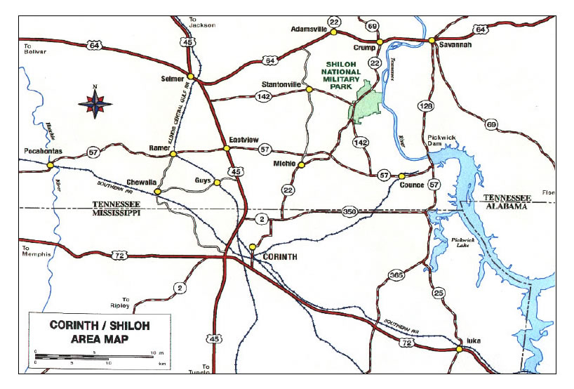
(NPS Photo) Getting There Click here to see an area map From the west (Memphis, Tennessee, area): Take Highway 72 East to Corinth, Mississippi. From the Corinth Civil War Interpretive Center, take Highway 22 North to the Shiloh Battlefield. From the south (Tupelo, Mississippi, area): Take Highway 45 North to Corinth, Mississippi. From the Corinth Civil War Interpretive Center, take Highway 22 North to the Shiloh Battlefield. From the north (Jackson, Tennessee, area): Take Highway 45 South to Selmer, Tennessee. Continue south on Highway 45 to Corinth, Mississippi and the Corinth Civil War Interpretive Center, or take Highway 64 East to Crump, Tennessee, and then Highway 22 South to the Shiloh Battlefield. From the northeast (Nashville, Tennessee, area): Take Interstate 40 West to the Parker's Crossroads Exit. Then take Highway 22 South to Shiloh Battlefield. Continue on Highway 22 South to the Corinth Civil War Interpretive Center. From the east (Chattanooga, Tennessee, area): Take Alternate Highway 72 West through Huntsville, Alabama, to Iuka, Mississippi. Take Highway 25 North (in Mississippi - Highway 57 West in Tennessee) to Counce, Tennessee. From there, take Highway 142 North until it becomes Highway 22 North at the Shiloh Battlefield. To reach the Corinth Civil War Interpretive Center from Iuka, Mississippi, continue on Highway 72 West to Corinth, Mississippi.

Collection of Shiloh National Military Park |
Last updated: August 7, 2021