April 14, 1933. Courtesy of Sequoia National Park Archives 
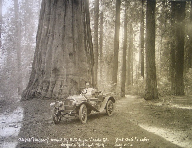
Sequoia National Park archives The main priority for the military administration at Sequoia National Park in the late 19th century was creating access trails and roads to the Big Trees. Under the command of Charles Young, the Buffalo Soldiers constructed the highways in the park. By the early 20th century, the park began to look at the condition of these roadways and the impact the park had on tourism. In addition to fixing and constructing better thoroughfares, a new idea to increase visitation influenced the future of park highways. The Colony Mill Road first opened Sequoia National Park to the public in 1903. Started by the Kaweah Colony, this wagon road wound up the North Fork of the Kaweah River, ending at Colony Mill near Giant Forest. By the late 19th century, this and other park roads were messy, uncomfortable, and all-around treacherous. In 1905, Sequoia National Park began to work on constructing better roads. An agreement with the Mount Whitney Power Company gave the electrical company the right to develop hydroelectric power. In return, they would build a wagon road - called the Middle Fork Road. By 1913, roads extended to Potwisha Camp, Hospital Rock, Buckeye Flat, Moro Creek Corrals, and between Giant Forest and Wolverton Creek (1). With an increase of improved roads and the advent of the automobile, park visitation improved. 
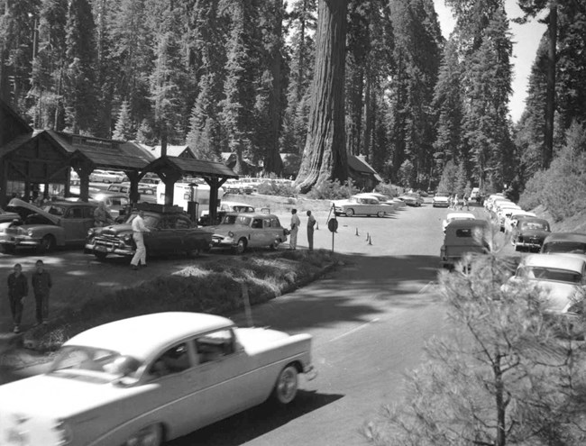
Courtesy of Sequoia National Park Archives The 1920s ushered in a new era filled with greater opportunities and a desire for travel through the introduction of the automobile. Concerns for how road conditions influenced visitation prompted the park to upgrade their highways. Between 1921 and 1926, Tulare County rebuilt the freeway to the park and the National Park Service added onto the Middle Fork and Giant Forest roads. A one-way system of travel up to Giant Forest along the Colony Mill Road created a faster and safer visitor experience (2). As automobile roads in Sequoia improved, the National Park Service was embracing the idea of a nationwide park-to-park highway. The purpose of the park-to-park road was to increase tourism in the United States by connecting all the national parks through one highway. Administrators were exceedingly excited about the possible benefits of a connecting road between Sequoia National Park and General Grant National Park, which became Kings Canyon National Park in in 1940. In 1921 John R. White, then superintendent of General Grant National Park, stated "Most of the 20,000 people who visit Grant Park and the 30,000 who visit Sequoia would enter by one Park and exit by the other were this possible [sic]." 
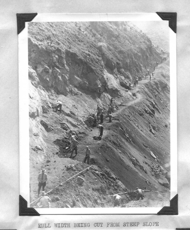
Courtesy of Sequoia National Park Archives The potential effect of the highway had administrators beginning work before they finalized the funding. Built section-by-section, the new highway extended from the newly built Ash Mountain headquarters through the Giant Forest and out to General Grant National Park. The road climbed up the mountain via switchbacks, curved through forests of the biggest trees, and continued over stone bridges and culverts that harmonized with the natural environment. Dedicated on June 23, 1935, at a cost of $2.25 million, the newly named Generals Highway cemented a partnership between Sequoia National Park and General Grant National Park. On the day of the ceremony, 669 cars carried 2,488 people from both the Sequoia and General Grant entrances to create a convoy along the park-to-park highway and meet in the center. By 1940, General Grant National Park was incorporated into the newly-formed Kings Canyon National Park where the highway continued to multiply the visitation between the two parks. A major accomplishment with a beautiful scenic experience, the Generals Highway is a major feature of Sequoia and Kings Canyon National Parks. 
Courtesy of Sequoia National Park Archives (1) W. Joseph Mundy, "The 1895 and 1896 Generals Highway Archeological Survey, Sequoia National Park, California Vol I ,"Publications in Anthropology", No. 10 (July 1990): 55. (2) Superintendent's Annual Report, 1920. Sequoia National Park Archives. |
Last updated: October 16, 2023
